Map of Kennedy town

Map of Kennedy town, Alabama

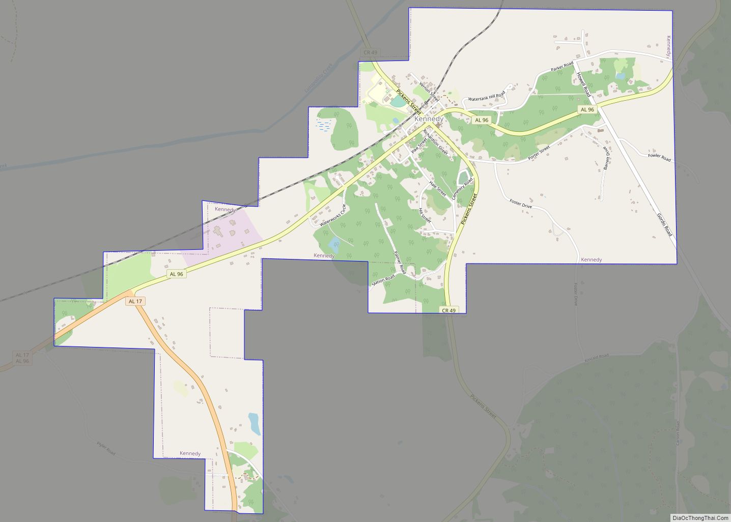
Kennedy is a town in Lamar County, Alabama, United States. It was incorporated by an act of the legislature on February 18, 1895. At the 2010 census the population was 447, down from 541 in 2000. Kennedy town overview: Name: Kennedy town LSAD Code: 43 LSAD Description: town (suffix) State: Alabama County: Lamar County Elevation: … Read more

Map of Kellyton town

Map of Kellyton town

Kellyton is an incorporated town in Coosa County, Alabama, United States. It had a population of 217 as of the 2010 census. The town is part of the Talladega-Sylacauga Micropolitan Statistical Area. Kellyton town overview: Name: Kellyton town LSAD Code: 43 LSAD Description: town (suffix) State: Alabama County: Coosa County Elevation: 761 ft (232 m) Total Area: … Read more

Map of Kansas town

Map of Kansas town, Alabama

Kansas is a town in Walker County, Alabama, United States. It incorporated in 1956. At the 2010 census the population was 226, down from 260 in 2000. Kansas town overview: Name: Kansas town LSAD Code: 43 LSAD Description: town (suffix) State: Alabama County: Walker County Elevation: 459 ft (140 m) Total Area: 1.02 sq mi (2.64 km²) Land Area: 1.02 sq mi … Read more

Map of Kinsey town

Map of Kinsey town

Kinsey is a town in Houston County, Alabama, United States. It was initially located and incorporated in Henry County in February 1893. In 1903, it was redrawn into newly created Houston County and was later reincorporated in August 1957. It is part of the Dothan, Alabama Metropolitan Statistical Area. At the 2010 census the population … Read more

Map of Kimberly city

Map of Kimberly city, Alabama

Kimberly is a city in Jefferson County, Alabama, United States. At the 2020 census, the population was 3,841. Kimberly city overview: Name: Kimberly city LSAD Code: 25 LSAD Description: city (suffix) State: Alabama County: Jefferson County Elevation: 472 ft (144 m) Total Area: 5.86 sq mi (15.18 km²) Land Area: 5.86 sq mi (15.18 km²) Water Area: 0.00 sq mi (0.00 km²) Total Population: 3,841 Population … Read more

Map of Killen town

Map of Killen town

Killen is a town in Lauderdale County, Alabama, United States. It’s part of the Florence – Muscle Shoals Metropolitan Statistical Area known as “The Shoals”. It was incorporated in 1957. As of the 2020 census, the population of the town is 1,034, down from its record high of 1,119 in 2000. Killen town overview: Name: … Read more

Map of Ladonia CDP

Map of Ladonia CDP, Alabama

Ladonia is an unincorporated community and census-designated place (CDP) in Russell County, Alabama, United States. At the 2020 census, the population was 3,074. It is part of the Columbus, Georgia-Alabama, Metropolitan Statistical Area. Ladonia CDP overview: Name: Ladonia CDP LSAD Code: 57 LSAD Description: CDP (suffix) State: Alabama County: Russell County Elevation: 469 ft (143 m) Total … Read more

Map of La Fayette city

Map of La Fayette city, Alabama

La Fayette city overview: Name: La Fayette city LSAD Code: 25 LSAD Description: city (suffix) State: Alabama County: Chambers County FIPS code: 0140672 Online Interactive Map La Fayette online map. Source: Basemap layers from Google Map, Open Street Map (OSM), Arcgisonline, Wmflabs. Boundary Data from Database of Global Administrative Areas. La Fayette location map. Where … Read more

Map of Kinston town

Map of Kinston town, Alabama

Kinston is a town in Coffee County, Alabama, United States. At the 2020 census, the population was 580. It is part of the Enterprise Micropolitan Statistical Area. Kinston town overview: Name: Kinston town LSAD Code: 43 LSAD Description: town (suffix) State: Alabama County: Coffee County Elevation: 269 ft (82 m) Total Area: 4.92 sq mi (12.73 km²) Land Area: 4.89 sq mi … Read more

Map of Lanett city

Map of Lanett city

Lanett is a city in Chambers County, Alabama, United States. At the 2010 census the population was 6,468, down from 7,897 in 2000. Lanett, originally called Bluffton, is located in eastern Alabama, on the Chattahoochee River, southwest of Atlanta. The city’s name is derived from Lafayette Lanier and Theodore Bennett, founders of the West Point … Read more

Map of Lakeview town

Map of Lakeview town, Alabama

Lakeview is a town in DeKalb County, Alabama, United States. At the 2020 census, the population was 161. Lakeview is located atop Sand Mountain. Lakeview town overview: Name: Lakeview town LSAD Code: 43 LSAD Description: town (suffix) State: Alabama County: DeKalb County Elevation: 1,165 ft (355 m) Total Area: 0.65 sq mi (1.68 km²) Land Area: 0.65 sq mi (1.68 km²) Water Area: … Read more

Map of Lake View town

Map of Lake View town, Alabama

Lake View is a city in Tuscaloosa County, Alabama, United States. At the 2010 census the population was 1,943, up from 1,357 in 2000. It is part of the Tuscaloosa, Alabama Metropolitan Statistical Area. It is located approximately halfway between Tuscaloosa and Birmingham via Interstates 20 and 59. Lake View town overview: Name: Lake View … Read more