Kinston is a town in Coffee County, Alabama, United States. At the 2020 census, the population was 580. It is part of the Enterprise Micropolitan Statistical Area.
| Name: | Kinston town |
|---|---|
| LSAD Code: | 43 |
| LSAD Description: | town (suffix) |
| State: | Alabama |
| County: | Coffee County |
| Elevation: | 269 ft (82 m) |
| Total Area: | 4.92 sq mi (12.73 km²) |
| Land Area: | 4.89 sq mi (12.67 km²) |
| Water Area: | 0.02 sq mi (0.06 km²) |
| Total Population: | 580 |
| Population Density: | 118.56/sq mi (45.77/km²) |
| ZIP code: | 36453 |
| Area code: | 334 |
| FIPS code: | 0140096 |
| GNISfeature ID: | 0151962 |
| Website: | www.kinstonal.com |
Online Interactive Map
Click on ![]() to view map in "full screen" mode.
to view map in "full screen" mode.
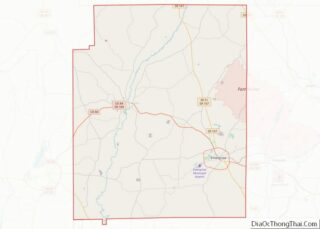
Kinston location map. Where is Kinston town?


History
On March 10, 2009, in the Alabama towns of Kinston, Samson and Geneva, Michael McLendon went on a shooting rampage, killing ten people and wounding six more before committing suicide.
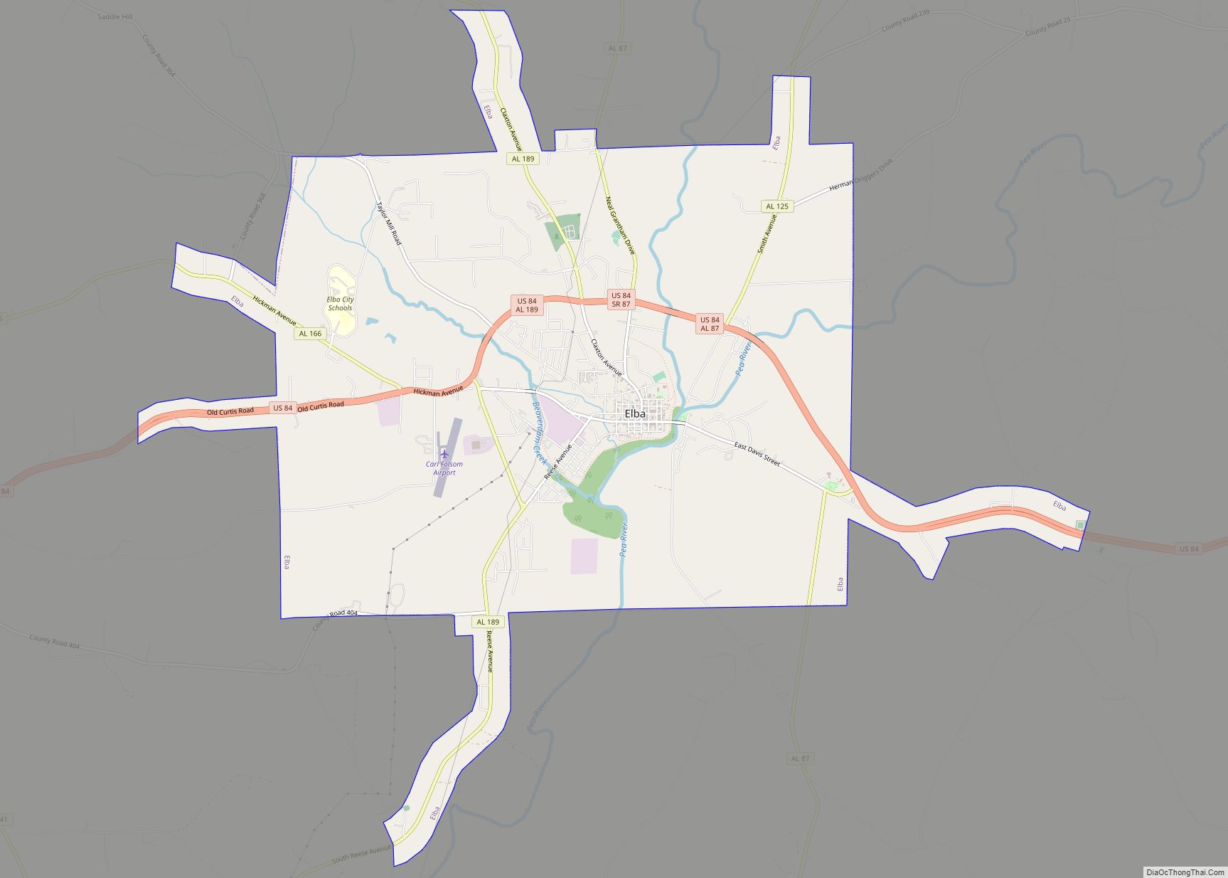
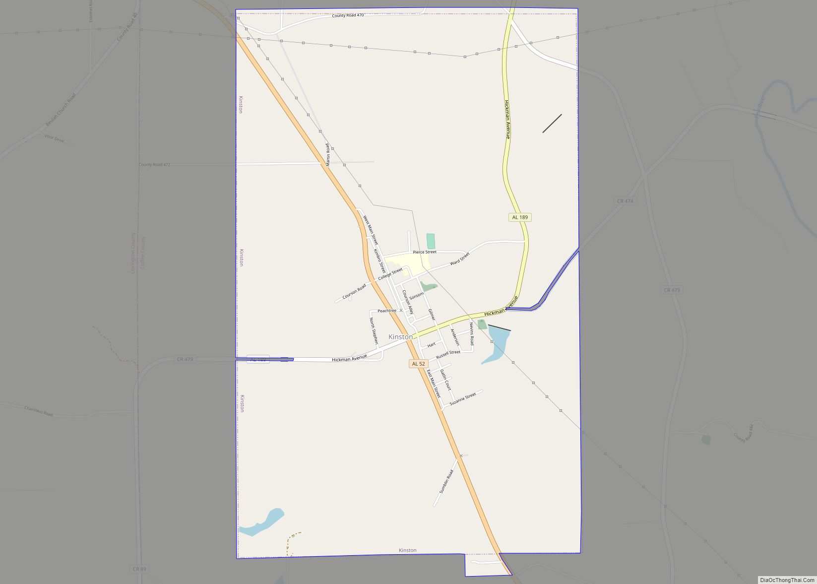
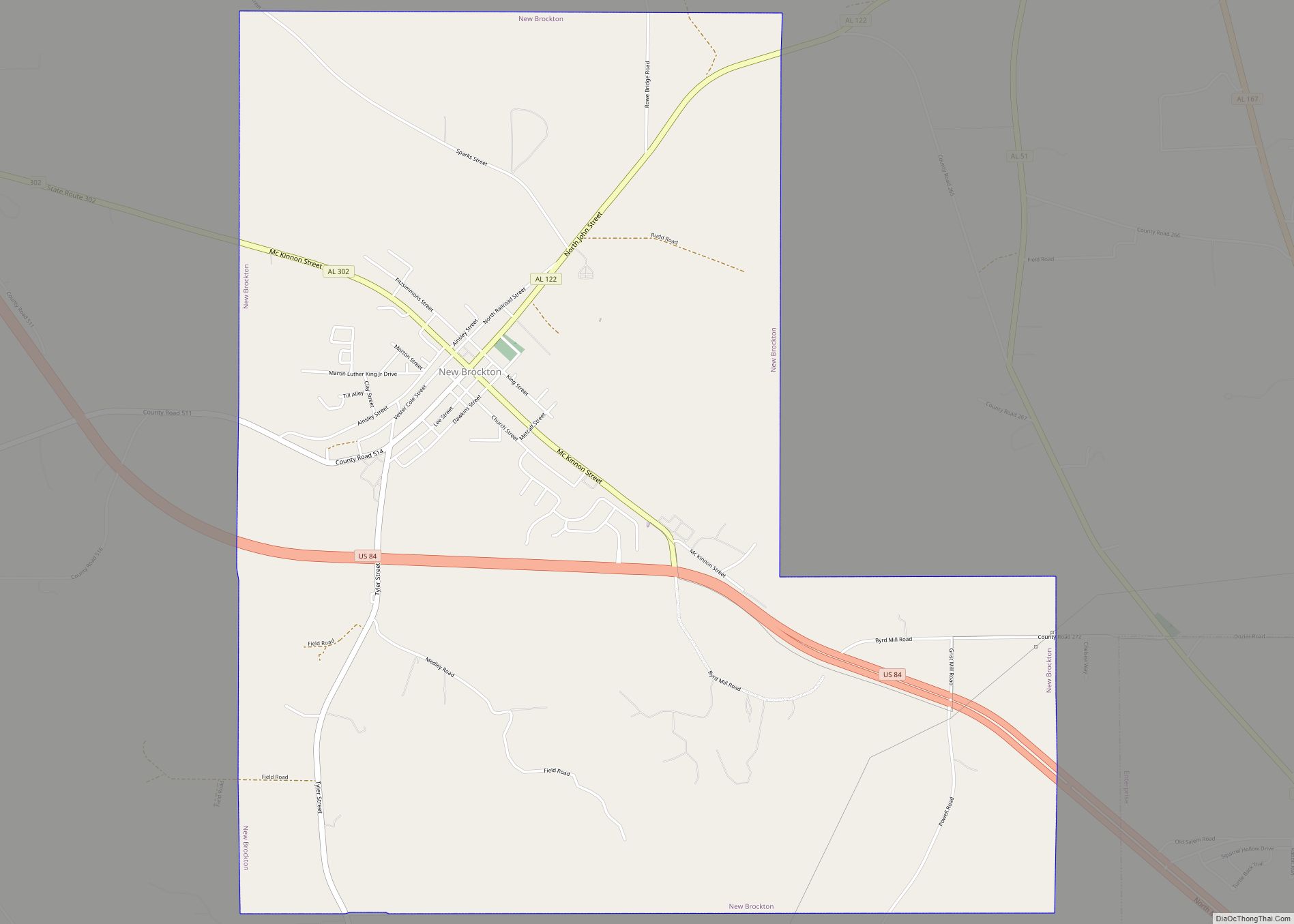
Kinston Road Map

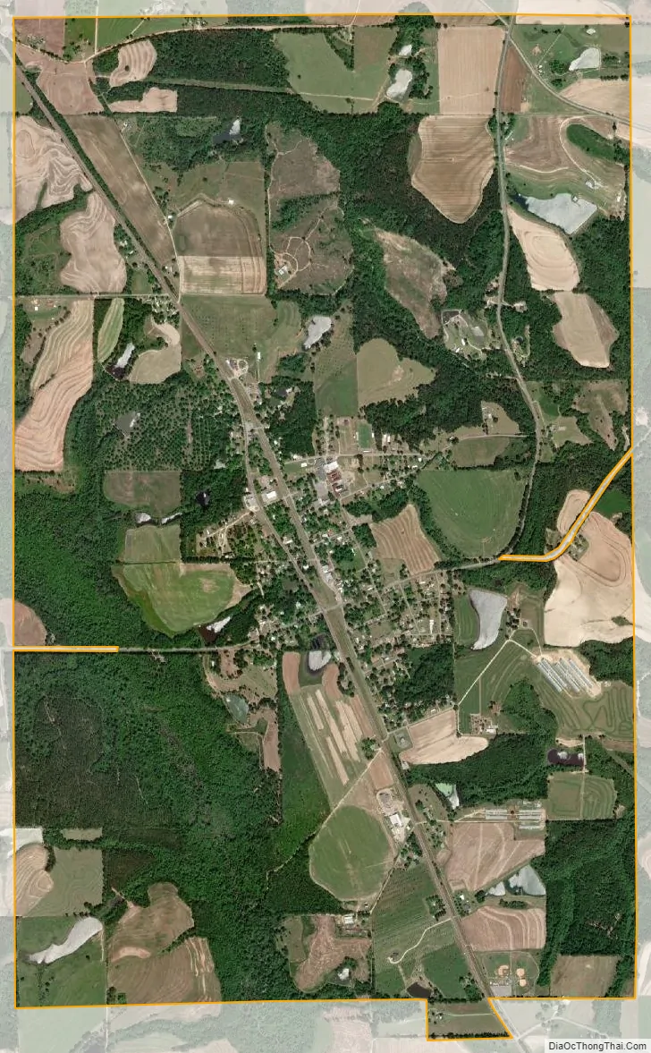
Kinston city Satellite Map
Geography
Kinston is located in the southwest corner of Coffee County at 31°13′14″N 86°10′15″W / 31.22056°N 86.17083°W / 31.22056; -86.17083 (31.220503, -86.170782).
According to the U.S. Census Bureau, the town has a total area of 4.9 square miles (12.7 km), of which 0.02 square miles (0.06 km), or 0.49%, is water.
See also
Map of Alabama State and its subdivision:- Autauga
- Baldwin
- Barbour
- Bibb
- Blount
- Bullock
- Butler
- Calhoun
- Chambers
- Cherokee
- Chilton
- Choctaw
- Clarke
- Clay
- Cleburne
- Coffee
- Colbert
- Conecuh
- Coosa
- Covington
- Crenshaw
- Cullman
- Dale
- Dallas
- De Kalb
- Elmore
- Escambia
- Etowah
- Fayette
- Franklin
- Geneva
- Greene
- Hale
- Henry
- Houston
- Jackson
- Jefferson
- Lamar
- Lauderdale
- Lawrence
- Lee
- Limestone
- Lowndes
- Macon
- Madison
- Marengo
- Marion
- Marshall
- Mobile
- Monroe
- Montgomery
- Morgan
- Perry
- Pickens
- Pike
- Randolph
- Russell
- Saint Clair
- Shelby
- Sumter
- Talladega
- Tallapoosa
- Tuscaloosa
- Walker
- Washington
- Wilcox
- Winston
- Alabama
- Alaska
- Arizona
- Arkansas
- California
- Colorado
- Connecticut
- Delaware
- District of Columbia
- Florida
- Georgia
- Hawaii
- Idaho
- Illinois
- Indiana
- Iowa
- Kansas
- Kentucky
- Louisiana
- Maine
- Maryland
- Massachusetts
- Michigan
- Minnesota
- Mississippi
- Missouri
- Montana
- Nebraska
- Nevada
- New Hampshire
- New Jersey
- New Mexico
- New York
- North Carolina
- North Dakota
- Ohio
- Oklahoma
- Oregon
- Pennsylvania
- Rhode Island
- South Carolina
- South Dakota
- Tennessee
- Texas
- Utah
- Vermont
- Virginia
- Washington
- West Virginia
- Wisconsin
- Wyoming