Map of Pelham city

Map of Pelham city, Alabama

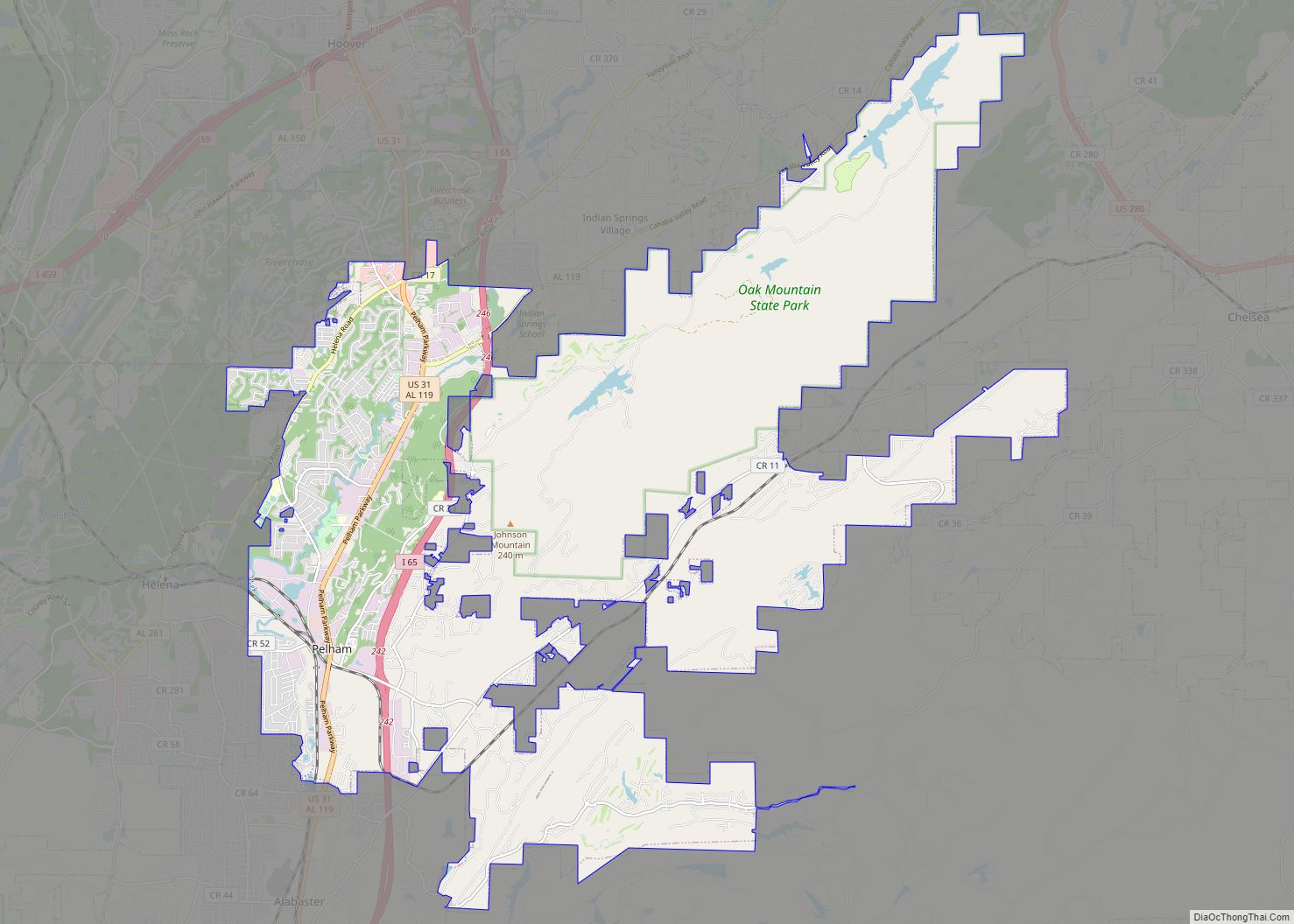
Pelham is a city in Shelby County, Alabama, United States. It incorporated in July 1964 and is a suburb located in the Birmingham metropolitan area, Alabama which was home to over 1.1 million residents as of the 2020 census. At the 2000 census the population was 14,369, and has grown to 24,318 by the 2020 … Read more

Map of Parrish town

Map of Parrish town

Parrish is a town in Walker County, Alabama, United States. It was incorporated in October 1922. At the 2010 census the population was 982, down from 1,268 in 2000. Parrish town overview: Name: Parrish town LSAD Code: 43 LSAD Description: town (suffix) State: Alabama County: Walker County Elevation: 381 ft (116 m) Total Area: 2.09 sq mi (5.42 km²) Land … Read more

Map of Panola CDP

Map of Panola CDP, Alabama

Panola is an unincorporated community and census-designated place in Sumter County, Alabama, United States. As of the 2010 census, its population was 144. Panola is 6 miles (9.7 km) north-northeast of Geiger. Panola has a post office with ZIP code 35477. The community’s name comes from the Choctaw word ponola, which means “cotton”. Panola CDP overview: … Read more

Map of Penton CDP

Map of Penton CDP

Penton is a census-designated place and unincorporated community in Chambers County, Alabama, United States. Its population was 163 as of the 2020 census. Penton CDP overview: Name: Penton CDP LSAD Code: 57 LSAD Description: CDP (suffix) State: Alabama County: Chambers County Elevation: 807 ft (246 m) Total Area: 9.17 sq mi (23.76 km²) Land Area: 9.14 sq mi (23.66 km²) Water Area: 0.04 sq mi … Read more

Map of Pennington town

Map of Pennington town, Alabama

Pennington is a town in Choctaw County, Alabama, United States. At the 2010 census the population was 221, down from 353 in 2000. Pennington town overview: Name: Pennington town LSAD Code: 43 LSAD Description: town (suffix) State: Alabama County: Choctaw County Elevation: 79 ft (24 m) Total Area: 5.26 sq mi (13.62 km²) Land Area: 5.22 sq mi (13.51 km²) Water Area: 0.04 sq mi … Read more

Map of Pell City city

Map of Pell City

Pell City is a city in and one of the county seats of St. Clair County, Alabama, United States, other seat being Ashville. At the 2020 census, the population was 12,939. At the 2010 census, the city-limit population jumped to 12,695. It was home to Avondale Mills and its legacy in the Avondale Mill Historic … Read more

Map of Peterman CDP

Map of Peterman CDP

Peterman is a census-designated place and unincorporated community in Monroe County, Alabama, United States. Its population was 87 as of the 2020 census. Peterman CDP overview: Name: Peterman CDP LSAD Code: 57 LSAD Description: CDP (suffix) State: Alabama County: Monroe County Elevation: 187 ft (57 m) Total Area: 0.42 sq mi (1.09 km²) Land Area: 0.42 sq mi (1.09 km²) Water Area: 0.00 sq mi … Read more

Map of Perdido CDP

Map of Perdido CDP

Perdido, also known as Perdido Station, is an unincorporated community and census-designated place in Baldwin County, Alabama, United States. Perdido is located along County Route 61, 12.2 miles (19.6 km) northeast of Bay Minette. Perdido has a post office with ZIP code 36562. It has an elementary school, Perdido School, which is part of the Baldwin … Read more

Map of Perdido Beach town

Map of Perdido Beach town

Perdido Beach is a town located on the northern shore of Perdido Bay, between the mouths of Soldier Creek and Palmetto Creek in Baldwin County, Alabama, United States. In an April 2009 plebiscite, over 60% of local voters supported incorporation as a town. On June 10, 2009, Baldwin County Probate Judge Adrian Johns issued an … Read more

Map of Petrey town

Map of Petrey town

Petrey is a town in Crenshaw County, Alabama, United States. The population was 58 at the 2010 census. Petrey town overview: Name: Petrey town LSAD Code: 43 LSAD Description: town (suffix) State: Alabama County: Crenshaw County Elevation: 364 ft (111 m) Total Area: 0.75 sq mi (1.94 km²) Land Area: 0.73 sq mi (1.90 km²) Water Area: 0.02 sq mi (0.04 km²) Total Population: 67 Population … Read more

Map of Phil Campbell town

Map of Phil Campbell town

Phil Campbell is a town in Franklin County, Alabama, United States. At the 2020 census, the population was 992. It is one of two towns in Alabama to have the first and last name of an individual; the other is Susan Moore. Phil Campbell town overview: Name: Phil Campbell town LSAD Code: 43 LSAD Description: … Read more

Map of Phenix City city

Map of Phenix City

Phenix City is a city in Lee and Russell counties in the U.S. state of Alabama, and the county seat of Russell County. As of the 2020 Census, the population of the city was 38,817. Phenix City lies immediately west across the Chattahoochee River from Columbus, Georgia and observes Eastern Time on a de facto … Read more