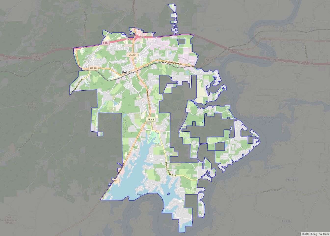
Pell City is a city in and one of the county seats of St. Clair County, Alabama, United States, other seat being Ashville. At the 2020 census, the population was 12,939. At the 2010 census, the city-limit population jumped to 12,695.
It was home to Avondale Mills and its legacy in the Avondale Mill Historic District.
| Name: | Pell City city |
|---|---|
| LSAD Code: | 25 |
| LSAD Description: | city (suffix) |
| State: | Alabama |
| County: | St. Clair County |
| Elevation: | 597 ft (182 m) |
| Total Area: | 27.76 sq mi (71.90 km²) |
| Land Area: | 25.00 sq mi (64.75 km²) |
| Water Area: | 2.76 sq mi (7.14 km²) |
| Total Population: | 12,939 |
| Population Density: | 517.54/sq mi (199.82/km²) |
| ZIP code: | 35125, 35128, 35054 |
| Area code: | 205, 659 |
| FIPS code: | 0158896 |
| GNISfeature ID: | 0164801 |
| Website: | http://pell-city.com/ |
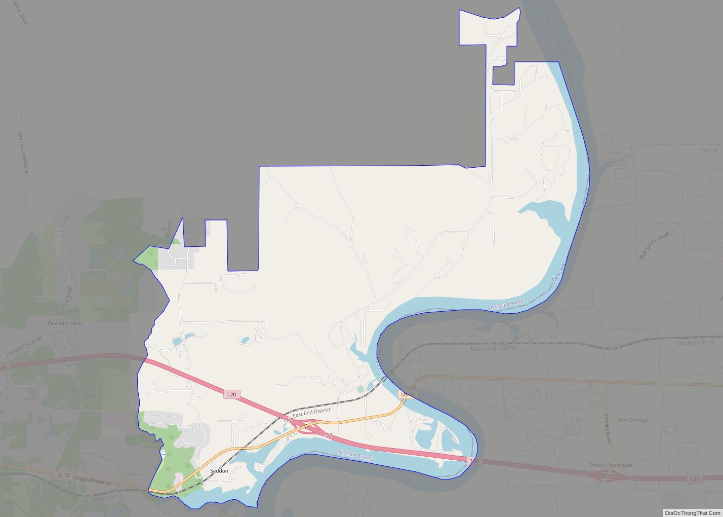
Online Interactive Map
Click on ![]() to view map in "full screen" mode.
to view map in "full screen" mode.
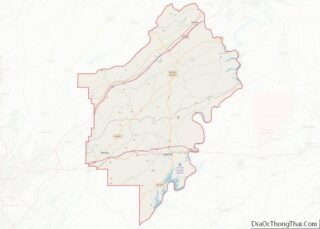
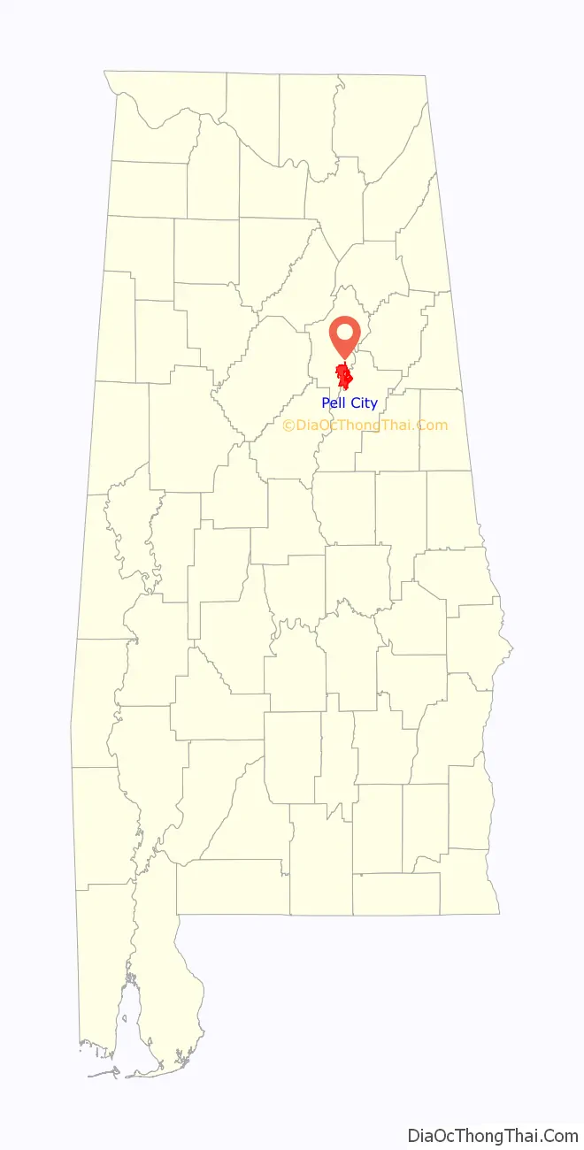
Pell City location map. Where is Pell City city?

History
Pell City was founded in 1890 by railroad investors and named after George Pell of the Pell City Iron and Land Company, one of its financial backers. The city was incorporated on May 6, 1891, but nearly failed during the Panic of 1893.
Pell City was revived in 1902 when Sumter Cogswell built the Pell City Manufacturing Company, which subsequently became Avondale Mills, a major landmark of the town until Thunder Enterprises, a Tennessee company, bought the building and began dismantling the factory in 2008. On February 14, 2008 a fire started at the mill. The fire was so large it could be seen from the Chula Vista/ Springville exit on Interstate 20 (I20). The water tower remains but the smoke stack was destroyed by workers after cracking in the cement made it a hazard.
The mill was the economic and social center of the town during its development and early growth. Besides the textile mill, other economic endeavors included agriculture and mercantile establishments. Large cotton, soybean, and cattle farms were located in the area. Pell City increased its size in 1956 when the nearby towns of Eden and Oak Ridge were merged with the city. The first mayor was Green Evans.
The residences of Sumter Cogswell and Green Evans (Pell City’s first mayor) are two of the earliest structures, dating from the late nineteenth century. The majority of the historic structures date from 1902 to 1905.
Ashville, Alabama, in the northern part of St. Clair County was the county seat from 1821 to 1907. A constitutional amendment in 1907 established Pell City as the second county seat, and for many years St. Clair County was the only county in the country with two full-service county seats. Both county seats remain operational to this day although Pell City has far surpassed Ashville in growth in large part due to I-20 and Logan Martin Lake. The construction of Logan Martin Dam in 1964 created the lake and a large recreational area, which brought new businesses, temporary summer residents and tourists, and hundreds of new permanent residents building new homes along the new lake.
On April 8, 1998, an F2 tornado struck north of the city limits after the F5 tornado expired in western Jefferson County. This windstorm killed two people in a mobile home. It remained for 14 mi (23 km), partially damaging a church, twenty-six homes and mobile homes, and other buildings in Coal City. Ninety other homes and mobile homes suffered minor to major destruction. An additional twelve people were injured. The twister damaged a funeral home and twenty-five homes. The Bethel Baptist Church in Odenville was destroyed a few minutes after its members left an Easter pageant rehearsal that had been cancelled because of the storm.
In 2006 Avondale Mills ceased operations. Two years later, in February 2008, Avondale Mills burned down in an accidental fire. At the time, Thunder Enterprises, a Tennessee firm, had completed almost half of the work in dismantling the building for materials. No employees were harmed in the fire.
In November 2015, Pell City made global news when a video of the Avondale Mills smokestack went viral on the internet. During a demolition of the smokestack, the 133-year-old structure collapsed on top of construction worker, Tim Philfer. Luckily, Philfer walked away unharmed from this accident.
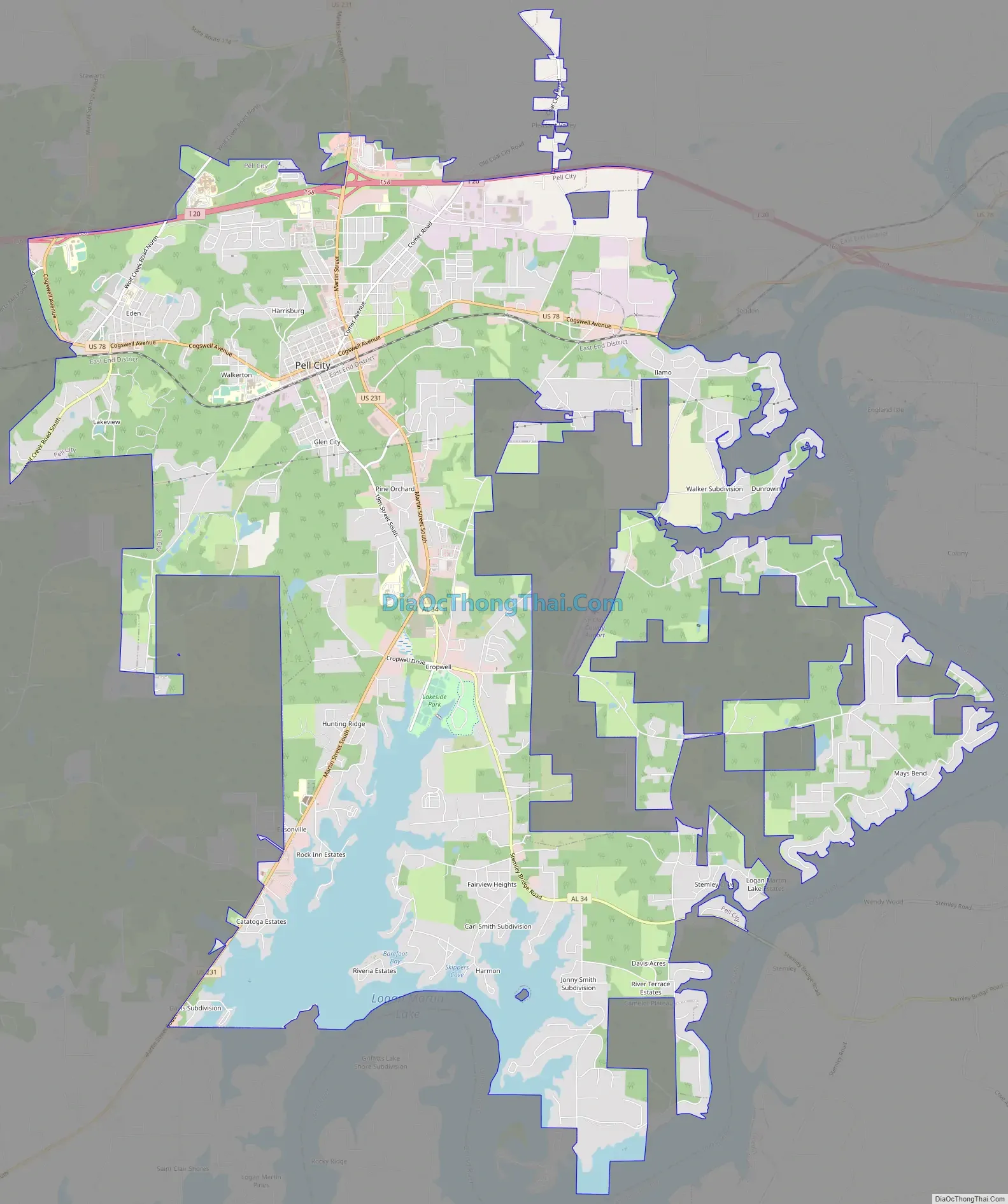
Pell City Road Map
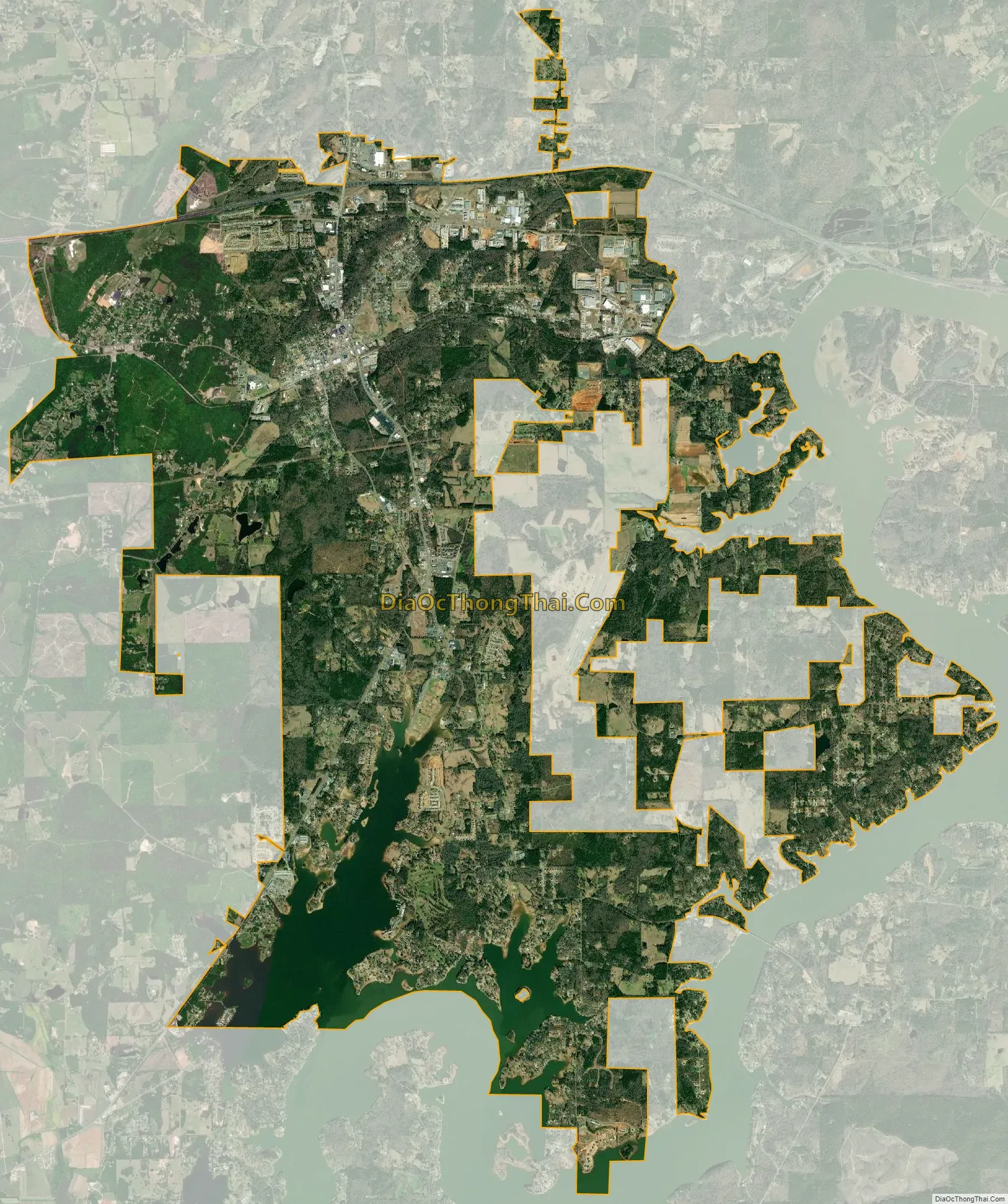
Pell City city Satellite Map
Geography
According to the U.S. Census Bureau, the city has a total area of 27.2 square miles [sq mi] (70 km), of which 24.6 sq mi (64 km) is land and 2.6 sq mi (6.7 km) or 9.57% is water. It is the largest city in St. Clair County. The city is located on the shores of Logan Martin Lake, created by the construction of Logan Martin Dam in 1964 to provide hydro-electric power to the central region of the state. The city is surrounded by the unincorporated communities of Wattsville to the north, Cropwell to the south, Seddon to the east, and Chula Vista to the west.
The city is located along Interstate 20, which runs west to east through the northern part of the city, leading east 114 mi (183 km) to Atlanta and west 35 mi (56 km) to Birmingham. Access to the city can be found from exits 156 and 158. U.S. Route 231 also runs through the city, leading north 19 mi (31 km) to Ashville and southwest 21 mi (34 km) to Harpersville. U.S. Route 78 also runs through the city, paralleling I-20.
See also
Map of Alabama State and its subdivision:- Autauga
- Baldwin
- Barbour
- Bibb
- Blount
- Bullock
- Butler
- Calhoun
- Chambers
- Cherokee
- Chilton
- Choctaw
- Clarke
- Clay
- Cleburne
- Coffee
- Colbert
- Conecuh
- Coosa
- Covington
- Crenshaw
- Cullman
- Dale
- Dallas
- De Kalb
- Elmore
- Escambia
- Etowah
- Fayette
- Franklin
- Geneva
- Greene
- Hale
- Henry
- Houston
- Jackson
- Jefferson
- Lamar
- Lauderdale
- Lawrence
- Lee
- Limestone
- Lowndes
- Macon
- Madison
- Marengo
- Marion
- Marshall
- Mobile
- Monroe
- Montgomery
- Morgan
- Perry
- Pickens
- Pike
- Randolph
- Russell
- Saint Clair
- Shelby
- Sumter
- Talladega
- Tallapoosa
- Tuscaloosa
- Walker
- Washington
- Wilcox
- Winston
- Alabama
- Alaska
- Arizona
- Arkansas
- California
- Colorado
- Connecticut
- Delaware
- District of Columbia
- Florida
- Georgia
- Hawaii
- Idaho
- Illinois
- Indiana
- Iowa
- Kansas
- Kentucky
- Louisiana
- Maine
- Maryland
- Massachusetts
- Michigan
- Minnesota
- Mississippi
- Missouri
- Montana
- Nebraska
- Nevada
- New Hampshire
- New Jersey
- New Mexico
- New York
- North Carolina
- North Dakota
- Ohio
- Oklahoma
- Oregon
- Pennsylvania
- Rhode Island
- South Carolina
- South Dakota
- Tennessee
- Texas
- Utah
- Vermont
- Virginia
- Washington
- West Virginia
- Wisconsin
- Wyoming