Map of Sterrett CDP

Map of Sterrett CDP

Sterrett is a census-designated place and unincorporated community in Shelby County, Alabama, United States. Its population was 712 as of the 2010 census. Sterrett was named in honor of a prominent local family, which included Alphonso A. Sterrett, who served in the Alabama Legislature. At one point in its history, Sterrett was a center of … Read more

Map of Steele town

Map of Steele town, Alabama

Steele is a town in northeastern St. Clair County, Alabama, United States. It was incorporated in 1952. At the 2010 census the population was 1,043, down from 1,093. The town is a part of the Birmingham–Hoover–Cullman Combined Statistical Area. It was initially known as Steel’s Station or Steele’s Depot in the late 19th century. Steele … Read more

Map of Stapleton CDP

Map of Stapleton CDP, Alabama

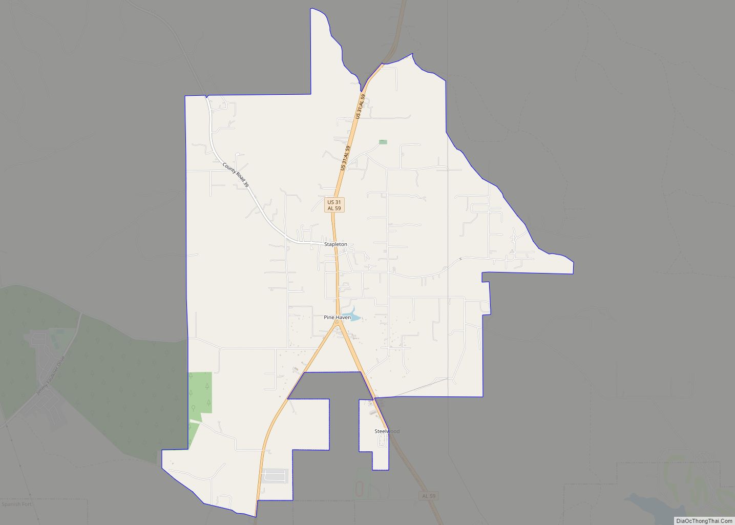
Stapleton is a small unincorporated community in northern Baldwin County, Alabama, United States, with a population of 519.[1]. It is part of the Daphne-Fairhope-Foley metropolitan area. Stapleton lies along U.S. Route 31 and State Route 59 and has been considered for incorporation within the cities of Loxley and Bay Minette. There is a bluegrass music … Read more

Map of Stockton city

Map of Stockton CDP, Alabama

Stockton CDP overview: Name: Stockton CDP LSAD Code: 57 LSAD Description: CDP (suffix) State: Alabama FIPS code: 0173272 Online Interactive Map Stockton online map. Source: Basemap layers from Google Map, Open Street Map (OSM), Arcgisonline, Wmflabs. Boundary Data from Database of Global Administrative Areas. Stockton location map. Where is Stockton CDP? Stockton Road Map Stockton … Read more

Map of Stewartville CDP

Map of Stewartville CDP, Alabama

Stewartville is a census-designated place and unincorporated community in Coosa County, Alabama, United States. Its population was 1,662 as of the 2020 census. Stewartville CDP overview: Name: Stewartville CDP LSAD Code: 57 LSAD Description: CDP (suffix) State: Alabama County: Coosa County Elevation: 722 ft (220 m) Total Area: 24.27 sq mi (62.86 km²) Land Area: 24.14 sq mi (62.52 km²) Water Area: 0.13 sq mi … Read more

Map of Stevenson city

Map of Stevenson city, Alabama

Stevenson is a city in Jackson County, Alabama, United States, and is included in the Chattanooga-Cleveland-Dalton, TN-GA-AL Combined Statistical Area. Sources listed either 1866 or 1867 as the year of incorporation, but that seems to conflict with the dates given for the town being granted a charter. It did not first appear on the U.S. … Read more

Map of Sulligent city

Map of Sulligent city

Sulligent is a city in Lamar County, Alabama, United States. As of the 2010 census, the population of the city was 1,927, down from its record high of 2,151 in 2000. From 1910-1950 and again in 2000, it was the largest community in Lamar County before losing the distinction both times to the county seat … Read more

Map of Summerdale town

Map of Summerdale town

Summerdale is a rural town in south-central Baldwin County, Alabama, United States. It is the site of the Naval Outlying Landing Field Summerdale. At the 2020 census, the population was 1,468. It is part of the Daphne–Fairhope–Foley Metropolitan Statistical Area. Summerdale town overview: Name: Summerdale town LSAD Code: 43 LSAD Description: town (suffix) State: Alabama … Read more

Map of Sumiton city

Map of Sumiton city

Sumiton is a city in Jefferson and Walker counties in the State of Alabama. It incorporated in 1952. At the 2010 census the population was 2,520, down from 2,665 in 2000. Sumiton city overview: Name: Sumiton city LSAD Code: 25 LSAD Description: city (suffix) State: Alabama County: Jefferson County, Walker County Elevation: 515 ft (157 m) Total … Read more

Map of Sylacauga city

Map of Sylacauga city

Sylacauga is a city in Talladega County, Alabama, United States. At the 2020 census, the population was 12,578. Sylacauga is known for its fine white marble bedrock. This was discovered shortly after settlers moved into the area and has been quarried ever since. The marble industry was the first recorded industry in the Sylacauga area. … Read more

Map of Sweet Water town

Map of Sweet Water town

Sweet Water is a town in Marengo County, Alabama, United States. It was founded during the 1840s and named for Sweet Water Creek, which runs through a section of the community. The population was 228 at the 2020 census, down from 258 at the 2010 census. Sweet Water town overview: Name: Sweet Water town LSAD … Read more

Map of Susan Moore town

Map of Susan Moore town

Susan Moore is a town in Blount County, Alabama, United States. At the 2020 census, the population was 787. It is one of two towns in Alabama to have the first and last name of an individual; the other is Phil Campbell. Susan Moore town overview: Name: Susan Moore town LSAD Code: 43 LSAD Description: … Read more