Sulligent is a city in Lamar County, Alabama, United States. As of the 2010 census, the population of the city was 1,927, down from its record high of 2,151 in 2000. From 1910-1950 and again in 2000, it was the largest community in Lamar County before losing the distinction both times to the county seat of Vernon. The name is derived from railroad personnel.
| Name: | Sulligent city |
|---|---|
| LSAD Code: | 25 |
| LSAD Description: | city (suffix) |
| State: | Alabama |
| County: | Lamar County |
| Elevation: | 325 ft (99 m) |
| Total Area: | 7.83 sq mi (20.29 km²) |
| Land Area: | 7.83 sq mi (20.29 km²) |
| Water Area: | 0.00 sq mi (0.00 km²) |
| Total Population: | 1,879 |
| Population Density: | 239.85/sq mi (92.60/km²) |
| ZIP code: | 35586 |
| Area code: | 205, 659 |
| FIPS code: | 0173728 |
| GNISfeature ID: | 153600 |
| Website: | sulligent.org |
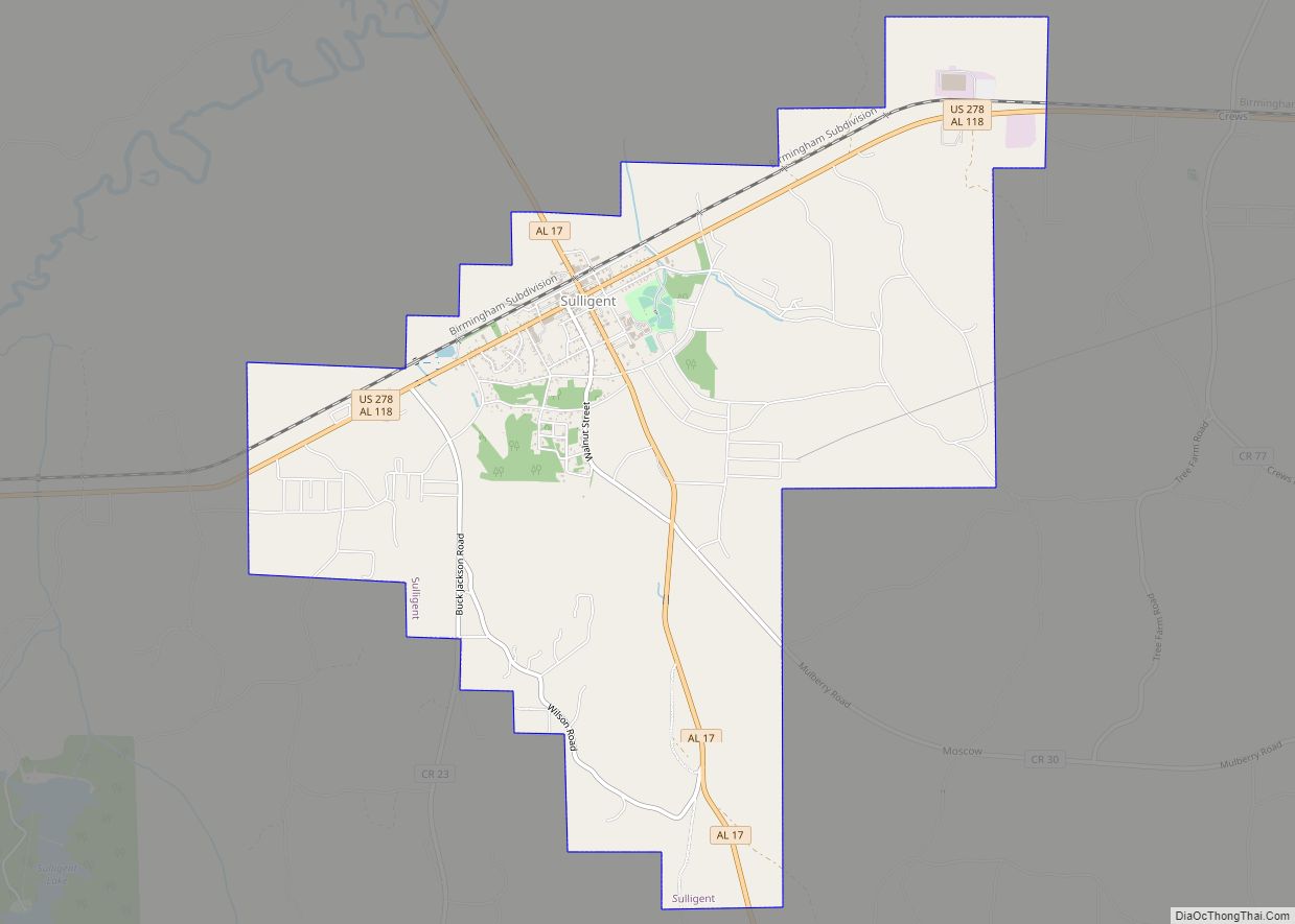
Online Interactive Map
Click on ![]() to view map in "full screen" mode.
to view map in "full screen" mode.
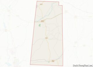
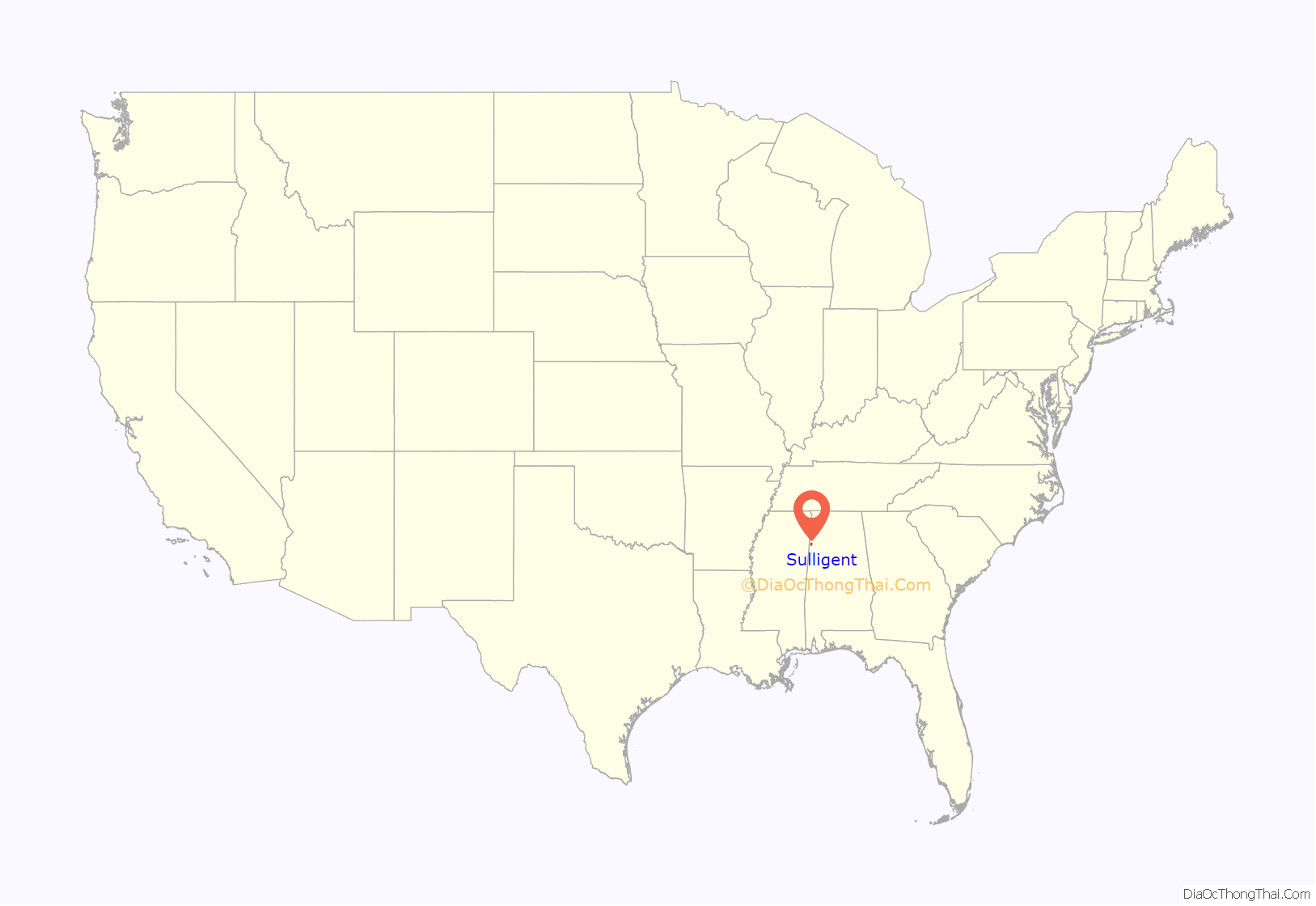
Sulligent location map. Where is Sulligent city?

History
Sulligent was first called Elliott, in honor of the chief engineer of the Kansas City-Memphis-Birmingham Railroad, then renamed one month later with the portmanteau “Sulligent”, in honor of Sullivan, the superintendent of the railroad, and Sargeant, the passenger agent of the railroad. The town was incorporated on February 12, 1897. S. F. Pennington owned the first general store and Dr. R. J. Redden owned the first drug store.
The production and processing of cotton was an important industry. The primary business in Sulligent in the mid-1890s was cotton, with over 2500 bales ginned each year and shipped via the railroad. At one time, Sulligent Cotton Oil Company was known as the largest cotton gin under one roof.
Sulligent is home to Lamar County’s only structure listed on the National Register of Historic Places, the Greer Bankhead House, which antedates the city by almost four decades.
Sulligent Road Map

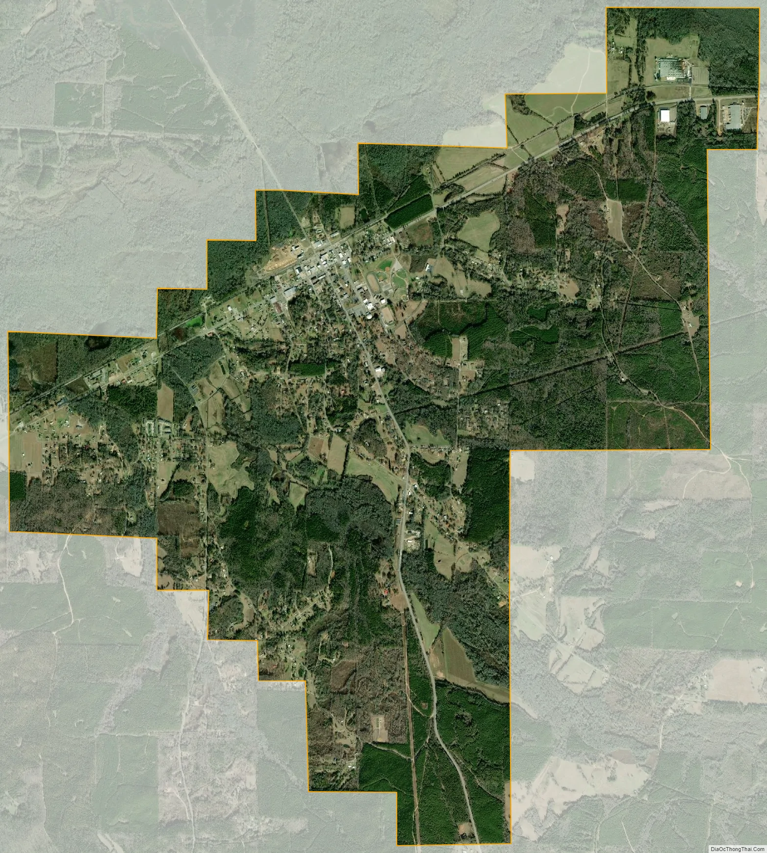
Sulligent city Satellite Map
Geography
Sulligent is located at 33°53′41″N 88°7′55″W / 33.89472°N 88.13194°W / 33.89472; -88.13194 (33.894807, -88.131920).
According to the U.S. Census Bureau, the city has a total area of 7.8 square miles (20 km), all land.
U.S. Route 278 (US 278) passes through Sulligent, intersecting State Route 17 (SR 17) at the center of town.
The BNSF Railway provides railroad service with a line running east–west.
See also
Map of Alabama State and its subdivision:- Autauga
- Baldwin
- Barbour
- Bibb
- Blount
- Bullock
- Butler
- Calhoun
- Chambers
- Cherokee
- Chilton
- Choctaw
- Clarke
- Clay
- Cleburne
- Coffee
- Colbert
- Conecuh
- Coosa
- Covington
- Crenshaw
- Cullman
- Dale
- Dallas
- De Kalb
- Elmore
- Escambia
- Etowah
- Fayette
- Franklin
- Geneva
- Greene
- Hale
- Henry
- Houston
- Jackson
- Jefferson
- Lamar
- Lauderdale
- Lawrence
- Lee
- Limestone
- Lowndes
- Macon
- Madison
- Marengo
- Marion
- Marshall
- Mobile
- Monroe
- Montgomery
- Morgan
- Perry
- Pickens
- Pike
- Randolph
- Russell
- Saint Clair
- Shelby
- Sumter
- Talladega
- Tallapoosa
- Tuscaloosa
- Walker
- Washington
- Wilcox
- Winston
- Alabama
- Alaska
- Arizona
- Arkansas
- California
- Colorado
- Connecticut
- Delaware
- District of Columbia
- Florida
- Georgia
- Hawaii
- Idaho
- Illinois
- Indiana
- Iowa
- Kansas
- Kentucky
- Louisiana
- Maine
- Maryland
- Massachusetts
- Michigan
- Minnesota
- Mississippi
- Missouri
- Montana
- Nebraska
- Nevada
- New Hampshire
- New Jersey
- New Mexico
- New York
- North Carolina
- North Dakota
- Ohio
- Oklahoma
- Oregon
- Pennsylvania
- Rhode Island
- South Carolina
- South Dakota
- Tennessee
- Texas
- Utah
- Vermont
- Virginia
- Washington
- West Virginia
- Wisconsin
- Wyoming