Map of Broomtown CDP

Map of Broomtown CDP

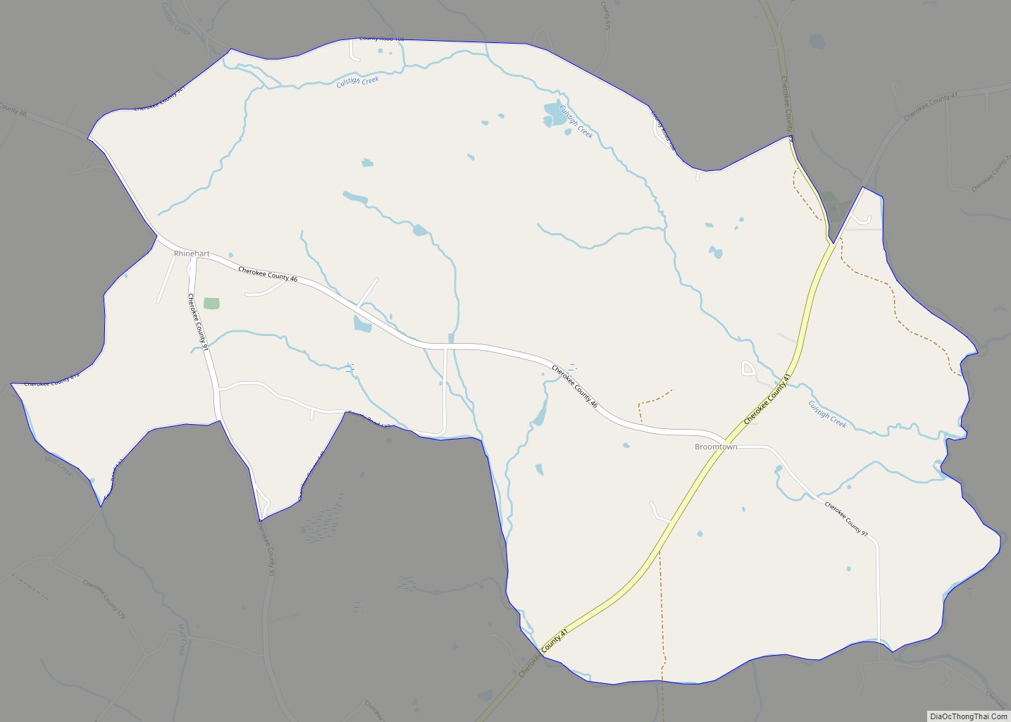
Broomtown is an unincorporated community and census-designated place in Cherokee County, Alabama, United States. As of the 2010 census, its population was 182. It was named for Chief Broom (Broomstown) of the Cherokee Nation, whose people occupied the area from the late eighteenth century into the 1830s. The Cherokee had migrated southwest under pressure from … Read more

Map of Brookwood town

Map of Brookwood town

Brookwood is a city in Tuscaloosa County, Alabama, United States. It incorporated in September 1977. As of the 2020 census, the population of the town is 2,504 . Brookwood town overview: Name: Brookwood town LSAD Code: 43 LSAD Description: town (suffix) State: Alabama County: Tuscaloosa County Elevation: 600 ft (200 m) Total Area: 8.46 sq mi (21.91 km²) Land Area: … Read more

Map of Brookside town

Map of Brookside town, Alabama

Brookside is a town in north-central Jefferson County, Alabama, United States. As of the 2010 census, the population of the town was 1,363. It is a former mining town. Brookside town overview: Name: Brookside town LSAD Code: 43 LSAD Description: town (suffix) State: Alabama County: Jefferson County Elevation: 607 ft (185 m) Total Area: 6.32 sq mi (16.38 km²) Land … Read more

Map of Butler town

Map of Butler town, Alabama

Butler is a town in and the county seat of Choctaw County, Alabama, United States. The population was 1,894 at the 2010 census. Butler town overview: Name: Butler town LSAD Code: 43 LSAD Description: town (suffix) State: Alabama County: Choctaw County Elevation: 151 ft (46 m) Total Area: 6.75 sq mi (17.48 km²) Land Area: 6.75 sq mi (17.48 km²) Water Area: 0.00 sq mi … Read more

Map of Bucks CDP

Map of Bucks CDP

Bucks is an unincorporated community and census-designated place (CDP) in Mobile County, Alabama, United States. As of the 2020 census, its population was 22, down from 32 at the 2010 census. It is located in the northeastern section of the county near the Mobile River, along U.S. Route 43. The James M. Barry Electric Generating … Read more

Map of Brundidge city

Map of Brundidge city

Brundidge is the second-largest city in Pike County, Alabama, United States. The population was 2,076 at the 2010 census, down from 2,341 in 2000. The city was once a major producer of peanut butter. Brundidge holds a Peanut Butter Festival during the last Saturday of each October, which includes live music, a recipe contest, and … Read more

Map of Camden city

Map of Camden city, Alabama

Camden is a city in and the county seat of Wilcox County, Alabama, United States. The population was 2,020 at the 2010 census, down from 2,257 in 2000, at which time it was a town. Camden city overview: Name: Camden city LSAD Code: 25 LSAD Description: city (suffix) State: Alabama County: Wilcox County Elevation: 207 ft … Read more

Map of Calvert CDP

Map of Calvert CDP, Alabama

Calvert is an unincorporated community and census-designated place (CDP) in Mobile and Washington counties, Alabama, United States. It is located in the extreme northeast corner of Mobile County and southeast corner of Washington County near the Tombigbee River, along U.S. Route 43. As of the 2020 census, the population of Calvert was 255. German technology … Read more

Map of Calera city

Map of Calera city, Alabama

Calera is a city in Shelby and Chilton counties in the U.S. state of Alabama. It is the location of the Shelby County Airport. As of the 2010 census Calera had a population of 11,620, more than tripling its total in 2000, making it the fastest-growing city in Alabama. It is within the Birmingham–Hoover, Alabama … Read more

Map of Cardiff town

Map of Cardiff town

Cardiff is a town in Jefferson County, Alabama, United States west of Gardendale. At the 2010 census the population was 55, placing it as the least-populated incorporated area in Jefferson County. It is named after the capital of Wales. It is one of four Jefferson County cities named after cities in Great Britain, the others … Read more

Map of Carbon Hill city

Map of Carbon Hill city, Alabama

Carbon Hill is a city in Walker County, Alabama, United States. It incorporated in February 1891. At the 2010 census the population was 2,021, down from 2,071 in 2000. Carbon Hill city overview: Name: Carbon Hill city LSAD Code: 25 LSAD Description: city (suffix) State: Alabama County: Walker County Elevation: 479 ft (146 m) Total Area: 5.59 sq mi … Read more

Map of Camp Hill town

Map of Camp Hill town, Alabama

Camp Hill is a town in Tallapoosa County, Alabama, United States. It was incorporated in 1895. At the 2010 census the population was 1,014, down from 1,273 in 2000. Camp Hill is the home to Southern Preparatory Academy (formerly known as “Lyman Ward Military Academy”). Camp Hill town overview: Name: Camp Hill town LSAD Code: … Read more