Map of Houston city

Map of Houston city, Alaska

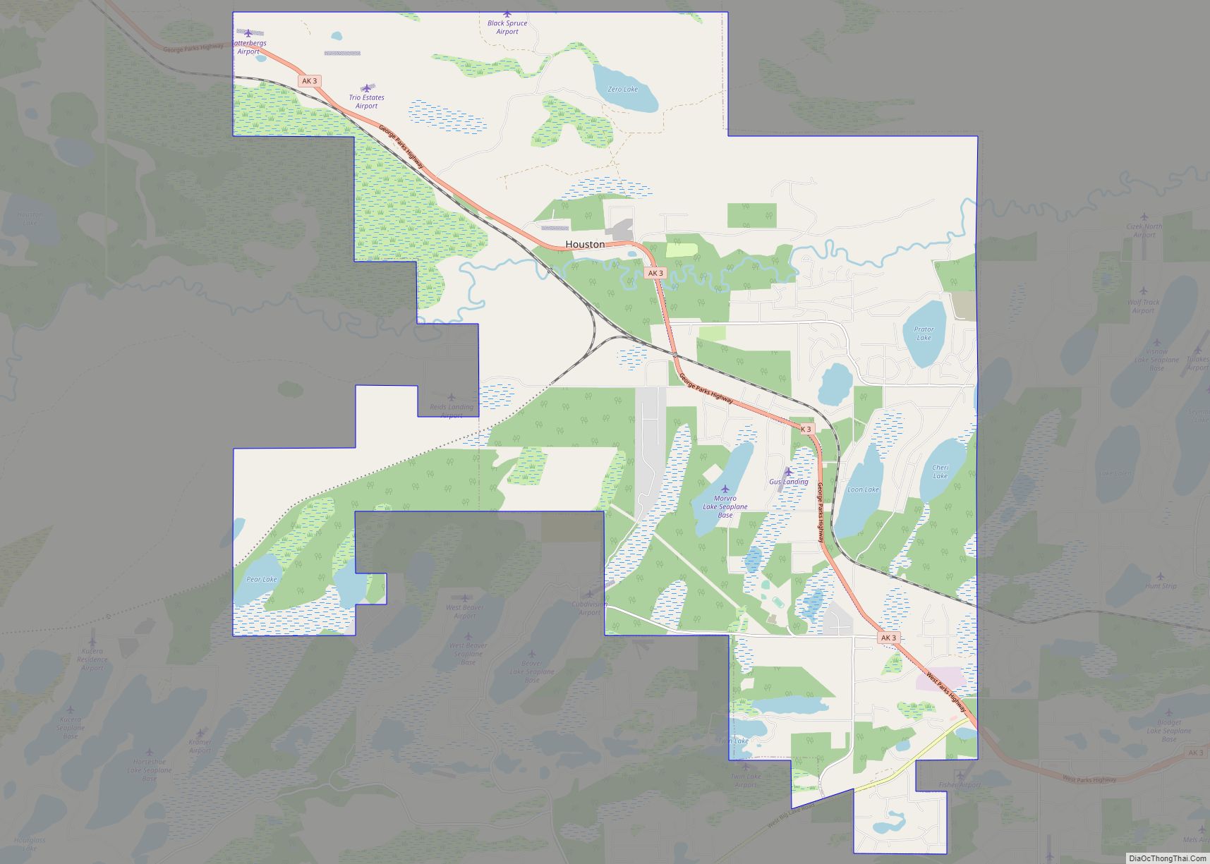
Houston is a city in Matanuska-Susitna Borough, Alaska, United States. It is part of the Anchorage, Alaska Metropolitan Statistical Area. It is located roughly 33 miles from downtown Anchorage, although it is a 58-mile drive by car between the two points. The population was 1,975 at the 2020 census, up from 1,912 in 2000. Houston … Read more

Map of Hope CDP

Map of Hope CDP, Alaska

Hope is a census-designated place (CDP) in Kenai Peninsula Borough in the U.S. state of Alaska. It is eighty-seven miles south from Anchorage. As of the 2010 census the population was 192, up from 137 in 2000. Hope CDP overview: Name: Hope CDP LSAD Code: 57 LSAD Description: CDP (suffix) State: Alaska County: Kenai Peninsula … Read more

Map of Hooper Bay city

Map of Hooper Bay city

Hooper Bay (Central Yupik: Naparyaarmiut) is a city in Kusilvak Census Area, Alaska, United States. At the 2020 census the population was 1,375, up from 1,093 in 2010. On August 3, 2006, a major fire destroyed approximately fifteen acres of the city including thirty-five structures, twelve homes, the elementary school, middle school, high school, teacher … Read more

Map of Hydaburg city

Map of Hydaburg city

Hydaburg (/ˈhaɪdəbɜːrɡ/ HY-də-burg) (Higdáa G̱ándlaay in Haida) is a first-class city in the Prince of Wales-Hyder Census Area, in the U.S. state of Alaska. The population was 382 at the 2000 census and 376 as of the 2010 census. The name “Hydaburg” refers to the Haida people. Hydaburg city overview: Name: Hydaburg city LSAD Code: … Read more

Map of Huslia city

Map of Huslia city

Huslia (/ˈhuːsliə/; Ts’aateyhdenaadekk’onh Denh [t͡sʼæːtʰəj̊tənætəqʼon̥ tən̥] in Koyukon) is a city in Yukon-Koyukuk Census Area, Alaska, United States. Rarely known as Hussliakatna, it is inhabited by Koyukuk-hotana Athabascans. The population was 293 at the 2000 census and 275 as of the 2010 census. Huslia city overview: Name: Huslia city LSAD Code: 25 LSAD Description: city … Read more

Map of Hughes city

Map of Hughes city, Alaska

Hughes (Hut’odlee Kkaakk’et in Koyukon) is a city in Yukon-Koyukuk Census Area, Alaska, United States. The population was 85 at the 2020 census, up from 77 in 2010. Hughes city overview: Name: Hughes city LSAD Code: 25 LSAD Description: city (suffix) State: Alaska County: Yukon-Koyukuk Census Area Incorporated: October 30, 1973 Elevation: 377 ft (115 m) Total … Read more

Map of Iliamna CDP

Map of Iliamna CDP

Iliamna (Dena’ina: Illiamna) is a census-designated place (CDP) in Lake and Peninsula Borough, Alaska, United States. The population was 108 at the 2020 census, slightly down from 109 in 2010. Iliamna CDP overview: Name: Iliamna CDP LSAD Code: 57 LSAD Description: CDP (suffix) State: Alaska County: Lake and Peninsula Borough Elevation: 155 ft (47 m) Total Area: … Read more

Map of Igiugig CDP

Map of Igiugig CDP

Igiugig (Central Yupik: Igyaraq) is a census-designated place (CDP) in Lake and Peninsula Borough, Alaska, United States. The population was 68 at the 2020 census, up from 54 in 2010. The village is at the source of the Kvichak River, at the outlet of Lake Iliamna. Igiugig CDP overview: Name: Igiugig CDP LSAD Code: 57 … Read more

Map of Hyder CDP

Map of Hyder CDP

Hyder is a census-designated place in Prince of Wales-Hyder Census Area, Alaska, United States. The population was 87 at the 2010 census, down from 97 in 2000. Hyder is accessible by road only from Stewart, British Columbia, is popular with motorists wishing to visit Alaska without driving the length of the Alaska Highway, and is … Read more

Map of Kake city

Map of Kake city

Kake (/ˈkeɪk/, like ‘cake’) is a first-class city in Prince of Wales-Hyder Census Area, Alaska, United States. The population was 557 at the 2010 census. The name comes from the Tlingit word Ḵéix̱ʼ (Northern Tlingit) or Ḵéex̱ʼ (Southern Tlingit), which is derived from ḵée ‘dawn, daylight’ and x̱ʼé ‘mouth’, i.e. ‘mouth of dawn’ or ‘opening … Read more

Map of Kachemak city

Map of Kachemak city

Kachemak, locally known as Kachemak City, is a small second-class city in the southern portion of the Kenai Peninsula Borough, Alaska, United States. The city consists of several subdivisions and other miscellaneous properties along an approximately 2-mile (3.2 km) stretch of East End Road, adjoining the northeast corner of the much larger (both in terms of … Read more

Map of Ivanof Bay CDP

Map of Ivanof Bay CDP

Ivanof Bay (Sugpiaq: Kangi’asinaq) is a census-designated place (CDP) in Lake and Peninsula Borough, Alaska, United States. The population was just one at the 2020 census, down from seven in 2010. Ivanof Bay CDP overview: Name: Ivanof Bay CDP LSAD Code: 57 LSAD Description: CDP (suffix) State: Alaska County: Lake and Peninsula Borough Elevation: 20 ft … Read more