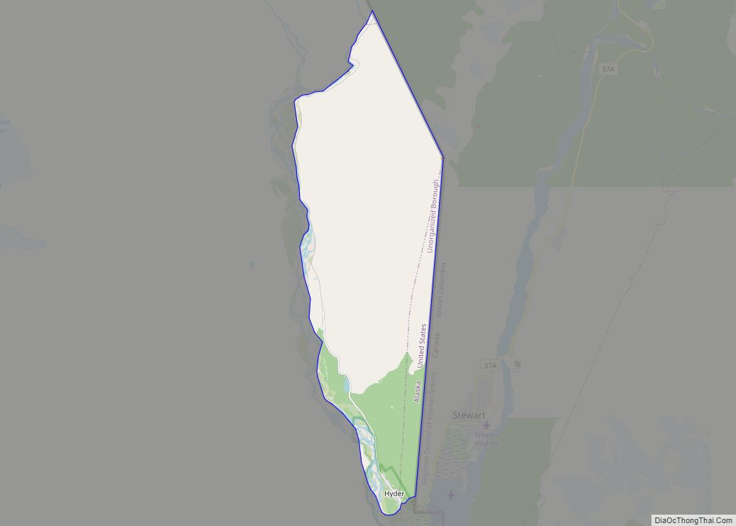
Hyder is a census-designated place in Prince of Wales-Hyder Census Area, Alaska, United States. The population was 87 at the 2010 census, down from 97 in 2000. Hyder is accessible by road only from Stewart, British Columbia, is popular with motorists wishing to visit Alaska without driving the length of the Alaska Highway, and is otherwise landlocked. It is the southernmost community in the state that can be reached via car (others can be reached only by boat or plane). Hyder is Alaska’s easternmost town.
| Name: | Hyder CDP |
|---|---|
| LSAD Code: | 57 |
| LSAD Description: | CDP (suffix) |
| State: | Alaska |
| County: | Prince of Wales-Hyder Census Area |
| Elevation: | 118 ft (36 m) |
| Total Area: | 17.07 sq mi (44.21 km²) |
| Land Area: | 17.07 sq mi (44.21 km²) |
| Water Area: | 0.00 sq mi (0.00 km²) |
| Total Population: | 48 |
| Population Density: | 2.81/sq mi (1.09/km²) |
| ZIP code: | 99923 |
| Area code: | 236, 250, 672, 778 |
| FIPS code: | 0234570 |
| GNISfeature ID: | 1422711 |
Online Interactive Map
Click on ![]() to view map in "full screen" mode.
to view map in "full screen" mode.
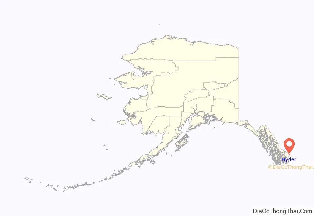
Hyder location map. Where is Hyder CDP?
History
The Nisga’a, who lived around the Nass River, called the head of Portland Canal “Skam-A-Kounst,” meaning safe place, probably because it served them as a retreat from the harassment of the Haidas on the coast. They traveled in the area seasonally to pick berries.
The area around the Portland Canal was explored in 1896 by Captain D.D. Gaillard of the U.S. Army Corps of Engineers.
In 1898, gold and silver lodes were discovered in the region, mainly on the Canadian side, in the upper Salmon River basin. The Stewart brothers, for whom the British Columbia town was named, arrived in 1902.
Hyder was established in 1907 as “Portland City”, after the canal. In 1914, when the US Post Office Department told residents that there were many U.S. communities named Portland, it was renamed Hyder, after Frederick Hyder, a Canadian mining engineer who envisioned a bright future for the area. Hyder was the only practical point of access to the silver mines in Canada; the community became the port, supply point, and post office for miners by 1917. Hyder’s boom years were the 1920s, when the Riverside Mine on the U.S. side extracted gold, silver, copper, lead, zinc, and tungsten. The mine operated from 1924 to 1950.
In 1928, the Hyder business district was consumed by fire. By 1956 all significant mining had ceased, except for the Granduc Mine on the Canadian side, which operated until 1984 and 2010 to present. Westmin Resources Ltd operated a gold and silver mine on the Canadian side in Premier, British Columbia but is not currently active.
Hyder Road Map
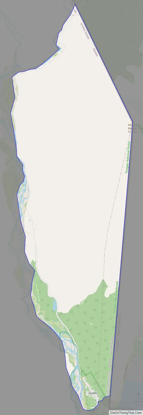
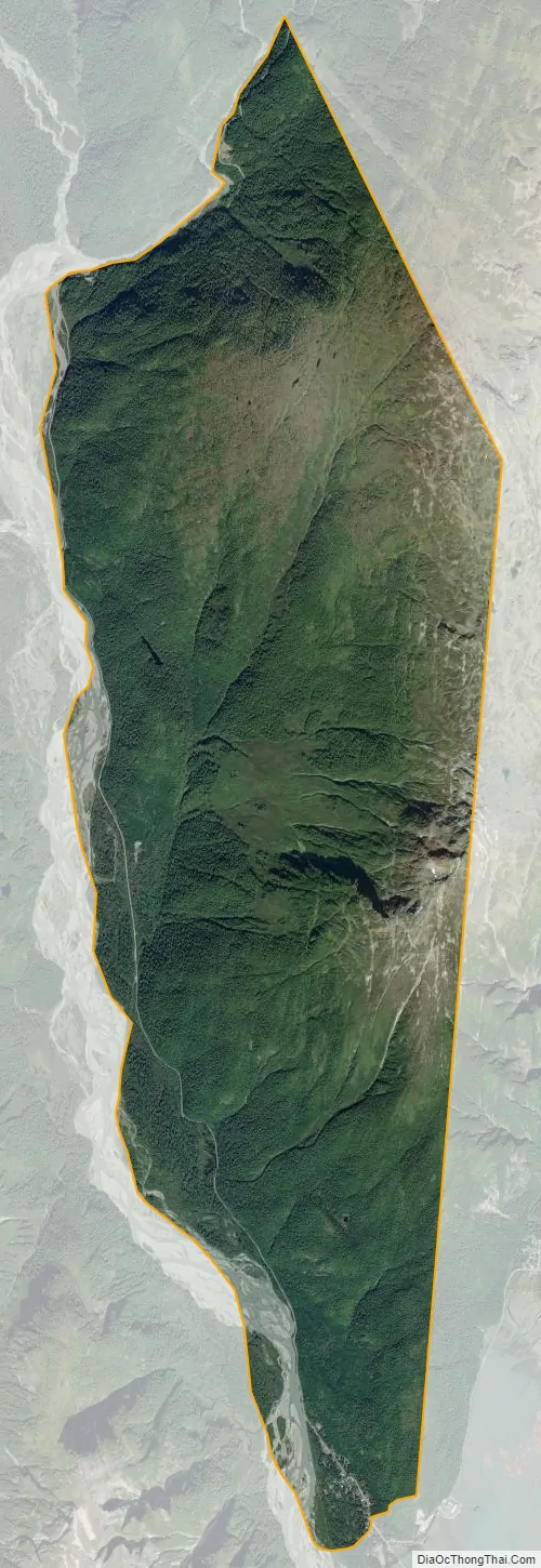
Hyder city Satellite Map
Geography
Hyder is located at 55°56′29″N 130°3′16″W / 55.94139°N 130.05444°W / 55.94139; -130.05444 (55.941442, -130.054504), at the end of the land border between Alaska and British Columbia and at the head of the Portland Canal, a 130-mile (210 km) long fjord which forms a portion of the border at the southeastern edge of the Alaska Panhandle. It sits about 2 miles (3.2 km) from Stewart, British Columbia by road, and 75 miles (121 km) from Ketchikan by air.
According to the U.S. Census Bureau, the CDP has a total area of 14.8 square miles (38 km), all land.
See also
Map of Alaska State and its subdivision:- Aleutians East
- Aleutians West
- Anchorage
- Bethel
- Bristol Bay
- Denali
- Dillingham
- Fairbanks North Star
- Haines
- Juneau
- Kenai Peninsula
- Ketchikan Gateway
- Kodiak Island
- Lake and Peninsula
- Matanuska-Susitna
- Nome
- North Slope
- Northwest Arctic
- Prince of Wales-Outer Ketchi
- Sitka
- Skagway-Yakutat-Angoon
- Southeast Fairbanks
- Valdez-Cordova
- Wade Hampton
- Wrangell-Petersburg
- Yukon-Koyukuk
- Alabama
- Alaska
- Arizona
- Arkansas
- California
- Colorado
- Connecticut
- Delaware
- District of Columbia
- Florida
- Georgia
- Hawaii
- Idaho
- Illinois
- Indiana
- Iowa
- Kansas
- Kentucky
- Louisiana
- Maine
- Maryland
- Massachusetts
- Michigan
- Minnesota
- Mississippi
- Missouri
- Montana
- Nebraska
- Nevada
- New Hampshire
- New Jersey
- New Mexico
- New York
- North Carolina
- North Dakota
- Ohio
- Oklahoma
- Oregon
- Pennsylvania
- Rhode Island
- South Carolina
- South Dakota
- Tennessee
- Texas
- Utah
- Vermont
- Virginia
- Washington
- West Virginia
- Wisconsin
- Wyoming