Map of Kaltag city

Map of Kaltag city

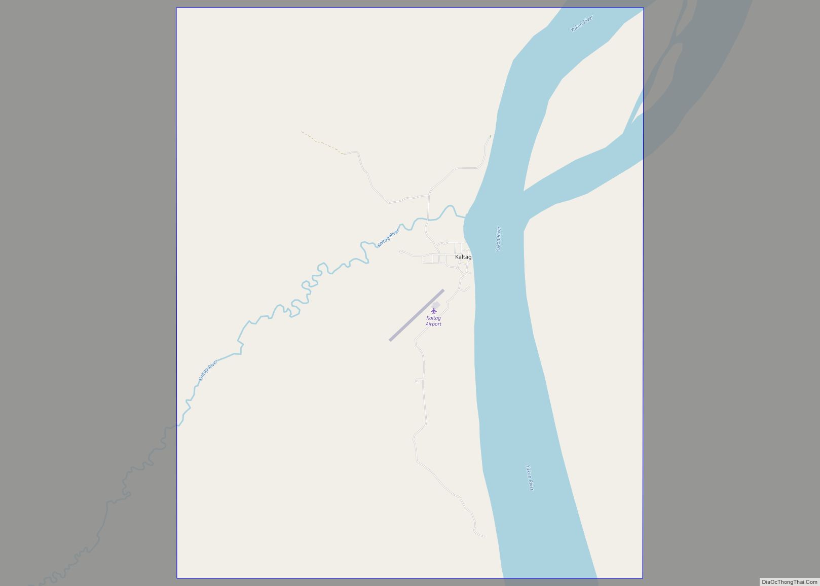
Kaltag (KAL-tag) (Koyukon: Ggaał Doh [qæːɬ toh]; Inupiaq: Qałtaq) is a city and village in Yukon-Koyukuk Census Area, Alaska, United States. At the 2010 census the population was 190, down from 230 in 2000. Kaltag city overview: Name: Kaltag city LSAD Code: 25 LSAD Description: city (suffix) State: Alaska County: Yukon-Koyukuk Census Area Incorporated: June … Read more

Map of Kalifornsky CDP

Map of Kalifornsky CDP

Kalifornsky (Tanaina: Unhghenesditnu) is a census-designated place (CDP) in Kenai Peninsula Borough, Alaska, United States. The population was 8,487 at the 2020 census, up from 7,850 in 2010. It is the most populated locality in the borough. Kalifornsky CDP overview: Name: Kalifornsky CDP LSAD Code: 57 LSAD Description: CDP (suffix) State: Alaska County: Kenai Peninsula … Read more

Map of Kaktovik city

Map of Kaktovik city

Kaktovik (/kækˈtoʊvɪk/; Inupiaq: Qaaktuġvik, IPA: [qaːktoʁvik]) is a city in North Slope Borough, Alaska, United States. The population was 283 at the 2020 census. Kaktovik city overview: Name: Kaktovik city LSAD Code: 25 LSAD Description: city (suffix) State: Alaska County: North Slope Borough Incorporated: March 26, 1971 Elevation: 36 ft (11 m) Total Area: 1.05 sq mi (2.71 km²) Land Area: … Read more

Map of Kasigluk CDP

Map of Kasigluk CDP

Kasigluk /kəˈsɪɡlʊk/ (Central Yupik: Kassigluq) is a census-designated place (CDP) in the Bethel Census Area in the U.S. state of Alaska. At the 2010 census the population was 569, up from 543 in 2000. Kasigluk consists of two smaller villages, called Akiuk and Akula. Kasigluk CDP overview: Name: Kasigluk CDP LSAD Code: 57 LSAD Description: … Read more

Map of Kasaan city

Map of Kasaan city

Kasaan /kəˈsæn/ (Haida: Gasa’áan; Tlingit: Kasa’aan) is a city in the Prince of Wales-Hyder Census Area in the U.S. state of Alaska. The population was 49 at the 2010 census, up from 39 in 2000. The name “Kasaan” comes from Tlingit Kasa’aan, meaning “pretty town”. Kasaan city overview: Name: Kasaan city LSAD Code: 25 LSAD … Read more

Map of Karluk CDP

Map of Karluk CDP

Karluk (Kal’uq or Kal’ut in Alutiiq; Russian: Карлук) is a census-designated place (CDP) in Kodiak Borough, Kodiak Island, Alaska, United States. The population was 37 at the 2010 census, up from 27 in 2000. Karluk CDP overview: Name: Karluk CDP LSAD Code: 57 LSAD Description: CDP (suffix) State: Alaska County: Kodiak Island Borough Total Area: … Read more

Map of Kenny Lake CDP

Map of Kenny Lake CDP

Kenny Lake is a farming community – one of the last to be homesteaded in America. Kenny Lake is a census-designated place (CDP) in the Copper River Census Area, Alaska, United States. At the 2020 census the population was 234, down from 355 in 2010. Kenny Lake CDP overview: Name: Kenny Lake CDP LSAD Code: … Read more

Map of Kenai city

Map of Kenai city

Kenai (/ˈkiːnaɪ/, KEE-ny) (Dena’ina: Shk’ituk’t; Russian: Кенай, Kenay) is a city in the Kenai Peninsula Borough in the U.S. state of Alaska. It is one hundred and fifty-eight miles by road southwest from Anchorage. The population was 7,424 as of the 2020 census, up from 7,100 in 2010, the fifteenth-most populated city in the state. … Read more

Map of Kasilof CDP

Map of Kasilof CDP

Kasilof (/kəˈsiːlɒf/ kə-SEE-lof; Dena’ina: Ggasilat, Russian: Касилов) is a census-designated place (CDP) in Kenai Peninsula Borough, Alaska, United States. At the 2020 census the population was 525, down from 549 in 2010. Kasilof CDP overview: Name: Kasilof CDP LSAD Code: 57 LSAD Description: CDP (suffix) State: Alaska County: Kenai Peninsula Borough Elevation: 125 ft (38 m) Total … Read more

Map of Kiana city

Map of Kiana city

Kiana (Inupiaq: Katyaak or Katyaaq) is a city in Northwest Arctic Borough, Alaska, United States. At the 2010 census the population was 361, down from 388 in 2000. Kiana city overview: Name: Kiana city LSAD Code: 25 LSAD Description: city (suffix) State: Alaska County: Northwest Arctic Borough Incorporated: June 30, 1964 Elevation: 92 ft (28 m) Total … Read more

Map of Ketchikan city

Map of Ketchikan city

Ketchikan (/ˈkɛtʃɪkæn/ KETCH-ih-kan; Tlingit: Kichx̱áan) is a city in and the borough seat of the Ketchikan Gateway Borough of Alaska. It is the state’s southeasternmost major settlement. Downtown Ketchikan is a National Historic District. With a population at the 2020 census of 8,192, up from 8,050 in 2010, it is the sixth-most populous city in … Read more

Map of King Cove city

Map of King Cove city

King Cove (Aleut: Agdaaĝux̂) is a city in Aleutians East Borough, Alaska, United States. As of the 2010 census, its population was 938, up from 792 in 2000, but at the 2020 census this had reduced to 757. King Cove city overview: Name: King Cove city LSAD Code: 25 LSAD Description: city (suffix) State: Alaska … Read more