Map of Denali Park CDP

Map of Denali Park CDP

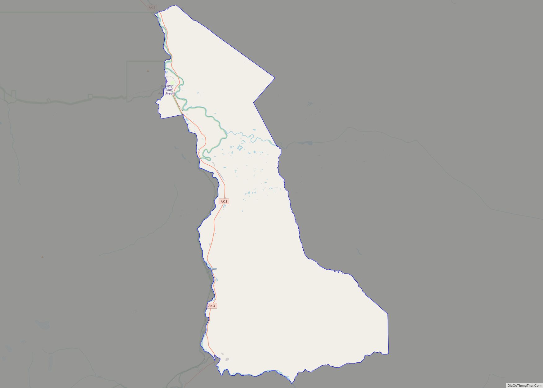
Denali Park, formerly McKinley Park, is a census-designated place (CDP) in Denali Borough, in the U.S. state of Alaska. As of the 2020 census, the population of the CDP was 163, down from 185 at the 2010 census. Denali Park CDP overview: Name: Denali Park CDP LSAD Code: 57 LSAD Description: CDP (suffix) State: Alaska … Read more

Map of Deltana CDP

Map of Deltana CDP

Deltana is a census-designated place (CDP) in Southeast Fairbanks Census Area, Alaska, United States. At the 2020 census the population was 2,359, up from 2,251 in 2010. Native inhabitants are Tanana Athabaskans. Deltana CDP overview: Name: Deltana CDP LSAD Code: 57 LSAD Description: CDP (suffix) State: Alaska County: Southeast Fairbanks Census Area Total Area: 570.14 sq mi … Read more

Map of Delta Junction city

Map of Delta Junction city

Delta Junction (Russian: Делта-Джанкшен; Ukrainian: Делта-Джанкшен, romanized: Delta Dzhankshen) is a city in the Southeast Fairbanks Census Area, Alaska, United States. As of the 2010 census, the population was 958, up from 840 in 2000. The 2018 estimate was down to 931. The city is located a short distance south of the confluence of the Delta … Read more

Map of Diomede city

Map of Diomede city

Diomede (Inupiaq: Iŋaliq, Russian: Диомид) is a city in the Nome Census Area of the Unorganized Borough of the U.S. state of Alaska, legally coterminous with Little Diomede Island. All the buildings are on the west coast of Little Diomede, which is the smaller of the two Diomede Islands located in the middle of the … Read more

Map of Dillingham city

Map of Dillingham city

Dillingham /ˈdɪlɪŋhæm/ (Central Yupik: Curyung; Russian: Диллингхем), also known as Curyung, is a city in Dillingham Census Area, Alaska, United States. Incorporated in 1963, it is an important commercial fishing port on Nushagak Bay. As of the 2020 census, the population of the city was 2,249, down from 2,329 in 2010. Dillingham city overview: Name: … Read more

Map of Diamond Ridge CDP

Map of Diamond Ridge CDP

Diamond Ridge (Dena’ina: Ch’aqiniggech’) is a census-designated place (CDP) just outside Homer in Kenai Peninsula Borough, Alaska, United States. At the 2010 census the population was 1,156, down from 1,802 in 2000. Diamond Ridge CDP overview: Name: Diamond Ridge CDP LSAD Code: 57 LSAD Description: CDP (suffix) State: Alaska County: Kenai Peninsula Borough Elevation: 1,060 ft … Read more

Map of Dry Creek CDP

Map of Dry Creek CDP, Alaska

Dry Creek is a census-designated place (CDP) in Southeast Fairbanks Census Area, Alaska, United States. At the 2010 census the population was 94, down from 128 in 2000. Dry Creek CDP overview: Name: Dry Creek CDP LSAD Code: 57 LSAD Description: CDP (suffix) State: Alaska County: Southeast Fairbanks Census Area Elevation: 1,857 ft (566 m) Total Area: … Read more

Map of Dot Lake CDP

Map of Dot Lake CDP

Dot Lake (Kelt’aaddh Menn’ in Tanacross) is a census-designated place (CDP) in Southeast Fairbanks Census Area, Alaska, United States. It is located on the Alaska Highway between Delta Junction and Tok. The population was 13 at the 2010 census, down from 19 in 2000. Dot Lake CDP overview: Name: Dot Lake CDP LSAD Code: 57 … Read more

Map of Dot Lake Village CDP

Map of Dot Lake Village CDP

Dot Lake Village (Kelt’aaddh Menn’ in Tanacross Athabascan) is a census-designated place (CDP) in Southeast Fairbanks Census Area, Alaska, United States. The population was 62 at the 2010 census, up from 38 in 2000. Dot Lake Village CDP overview: Name: Dot Lake Village CDP LSAD Code: 57 LSAD Description: CDP (suffix) State: Alaska County: Southeast … Read more

Map of Edna Bay city

Map of Edna Bay city

Edna Bay is a city on Kosciusko Island in the Prince of Wales-Hyder Census Area in the U.S. state of Alaska. The community was officially incorporated on October 13, 2014 and has a population of 42 as of the 2010 Census, down from 49 in 2000. Edna Bay is the only populated town on Kosciusko … Read more

Map of Eagle city

Map of Eagle city, Alaska

Eagle (Tthee T’äwdlenn in Hän Athabascan) is a village on the south bank of the Yukon River near the Canada–US border in the Southeast Fairbanks Census Area, Alaska, United States. It includes the Eagle Historic District, a U.S. National Historic Landmark. The population was 86 at the 2010 census. Every February, Eagle hosts a checkpoint … Read more

Map of Eagle Village CDP

Map of Eagle Village CDP

Eagle Village is a census-designated place (CDP) in Southeast Fairbanks Census Area, Alaska, United States. The population was 67 at the 2010 census. The village was destroyed in spring 2009 during severe flooding. Ice dams formed on the river, and the waters flooded behind them, destroying much of the old village. There were no fatalities. … Read more