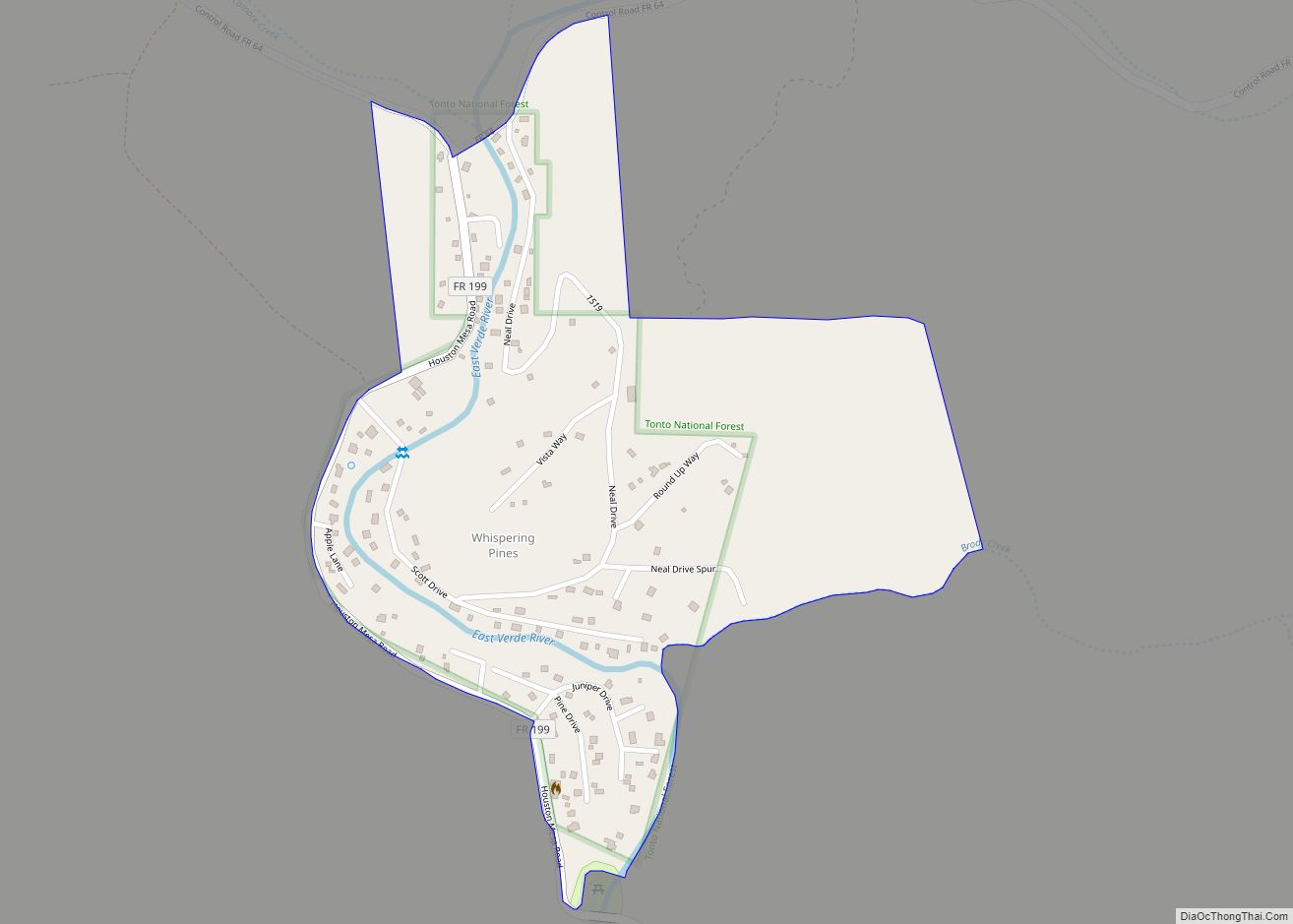
Map of Wheatfields CDP

Map of Wheatfields CDP

Wheatfields is a census-designated place (CDP) in Gila County, Arizona, United States. The population was 785 at the 2010 United States Census. It is one of two places in Arizona with this name, the other being a populated place in Apache County. Wheatfields CDP overview: Name: Wheatfields CDP LSAD Code: 57 LSAD Description: CDP (suffix) … Read more

Map of Whitecone CDP

Map of Whitecone CDP

Whitecone (Navajo: Baaʼoogeedí) is a census-designated place in Navajo County, in the U.S. state of Arizona. The population was 817 at the 2010 census. Whitecone CDP overview: Name: Whitecone CDP LSAD Code: 57 LSAD Description: CDP (suffix) State: Arizona County: Navajo County Total Area: 45.11 sq mi (116.84 km²) Land Area: 45.10 sq mi (116.80 km²) Water Area: 0.01 sq mi (0.04 km²) Total … Read more

Map of White Mountain Lake CDP

Map of White Mountain Lake CDP

White Mountain Lake is an unincorporated community and census-designated place in Navajo County, Arizona, United States. White Mountain Lake is 7.5 miles (12.1 km) north-northeast of Show Low. White Mountain Lake has a post office with ZIP code 85912. White Mountain Lake CDP overview: Name: White Mountain Lake CDP LSAD Code: 57 LSAD Description: CDP (suffix) … Read more

Map of White Hills CDP

Map of White Hills CDP

White Hills is an unincorporated community and census-designated place (CDP) in Mohave County, Arizona, United States. It is 12.5 miles (20.1 km) northwest of Dolan Springs. As of the 2020 census, White Hills had a population of 345. White Hills CDP overview: Name: White Hills CDP LSAD Code: 57 LSAD Description: CDP (suffix) State: Arizona County: … Read more

Map of Wickenburg town

Map of Wickenburg town

Wickenburg is a town in Maricopa and Yavapai counties, Arizona, United States. As of the 2020 census, the population of the town was 7,474, up from 6,363 in 2010. Wickenburg town overview: Name: Wickenburg town LSAD Code: 43 LSAD Description: town (suffix) State: Arizona County: Maricopa County, Yavapai County Elevation: 2,202 ft (671 m) Total Area: 26.52 sq mi … Read more

Map of Why CDP

Map of Why CDP

Why is an unincorporated rural community in Pima County, Arizona, United States. It lies near the western border of the Tohono Oʼodham Indian Reservation and due north of Organ Pipe Cactus National Monument in Southern Arizona. It is approximately 30 miles (48 km) north of the Mexican border where Lukeville, Arizona, and Sonoyta, Sonora, Mexico, border … Read more

Map of Whiteriver CDP

Map of Whiteriver CDP

Whiteriver (Western Apache: Chʼilwózh) is a census-designated place (CDP) located on the Fort Apache Indian Reservation in Navajo County, Arizona, United States. The population was 4,104 at the 2010 census, making it the largest settlement on the Reservation. Whiteriver CDP overview: Name: Whiteriver CDP LSAD Code: 57 LSAD Description: CDP (suffix) State: Arizona County: Navajo … Read more

Map of Wide Ruins CDP

Map of Wide Ruins CDP

Wide Ruins is a chapter of the Navajo Nation and a census-designated place (CDP) in Apache County, Arizona, United States. The population was 176 at the 2010 census. Wide Ruins CDP overview: Name: Wide Ruins CDP LSAD Code: 57 LSAD Description: CDP (suffix) State: Arizona County: Apache County Elevation: 6,263 ft (1,909 m) Total Area: 0.39 sq mi (1.01 km²) … Read more

Map of Wilhoit CDP

Map of Wilhoit CDP

Wilhoit is a census-designated place (CDP) in Yavapai County, Arizona, United States. The population was 664 at the 2000 census. Wilhoit CDP overview: Name: Wilhoit CDP LSAD Code: 57 LSAD Description: CDP (suffix) State: Arizona County: Yavapai County Elevation: 5,075 ft (1,547 m) Total Area: 15.69 sq mi (40.63 km²) Land Area: 15.69 sq mi (40.63 km²) Water Area: 0.00 sq mi (0.00 km²) Total Population: … Read more

Map of Wikieup CDP

Map of Wikieup CDP

Wikieup is an unincorporated community and census-designated place (CDP) located on U.S. Route 93 in Mohave County, Arizona, United States. It is located approximately 139 miles (224 km) northwest of Phoenix and 162 miles (261 km) southeast of Las Vegas. As of the 2020 census, the population of Wikieup was 135. Wikieup CDP overview: Name: Wikieup CDP … Read more

Map of Williamson CDP

Map of Williamson CDP, Arizona

Williamson is a census-designated place (CDP) in Yavapai County, Arizona, United States. The population was 3,776 at the 2000 census and 6,196 at the 2020 census. The name “Wiliamson” is a misnomer, perhaps propagated by federal bureaucratic error; the area has long been known as “Williamson Valley” after the major road through the area, Williamson … Read more

Map of Williams city

Map of Williams city, Arizona

Williams (Havasupai: Wii Gvʼul) is a city in Coconino County, Arizona, United States, located west of Flagstaff. Its population was 3,023 at the 2010 census. It lies on the routes of Historic Route 66 and Interstate 40. It is also the southern terminus of the Grand Canyon Railway, which takes visitors to Grand Canyon Village. … Read more