Map of Damascus town

Map of Damascus town, Arkansas

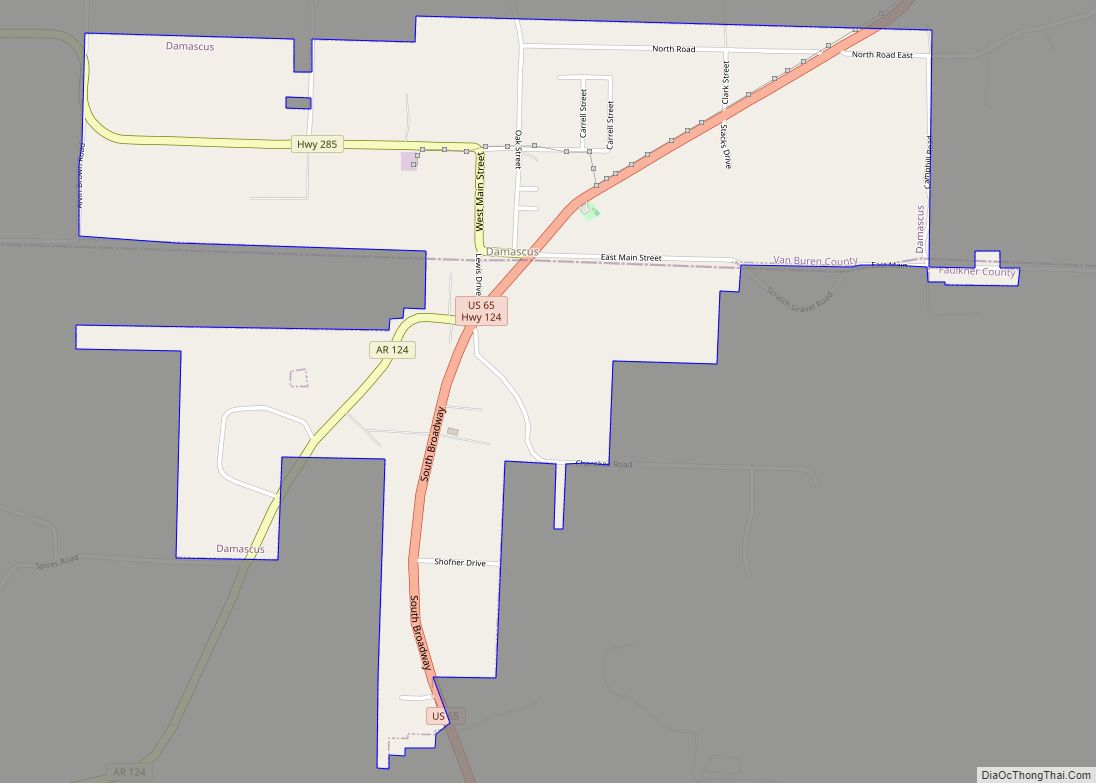
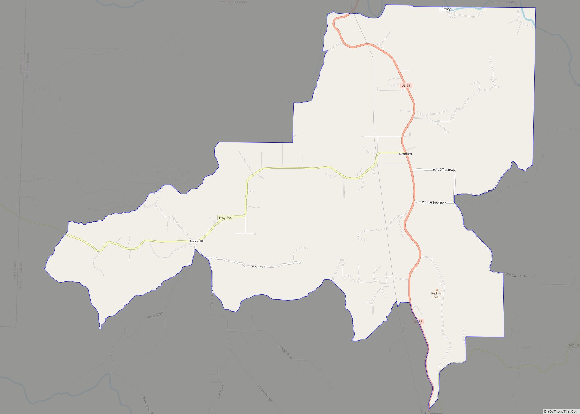
Damascus is a town in Faulkner and Van Buren counties of central Arkansas, United States. The population of Damascus was 382 at the 2010 census. Damascus town overview: Name: Damascus town LSAD Code: 43 LSAD Description: town (suffix) State: Arkansas County: Faulkner County, Van Buren County Incorporated: July 15, 1966 Elevation: 696 ft (212 m) Total Area: … Read more

Map of Daisy town

Map of Daisy town, Arkansas

Daisy is a town in Pike County, Arkansas, United States. Its population is 88 as of the 2020 census. Daisy is also the home of Daisy State Park. Daisy town overview: Name: Daisy town LSAD Code: 43 LSAD Description: town (suffix) State: Arkansas County: Pike County Elevation: 620 ft (189 m) Total Area: 1.45 sq mi (3.76 km²) Land Area: … Read more

Map of De Queen city

Map of De Queen city

De Queen (/diː kwiːn/ DEE-kween) is a city and the county seat of Sevier County, Arkansas, United States. The population was 6,629 at the 2010 census. The placename is the anglicization of the family name of the Dutch merchant and railway financier, Jan de Goeijen (1861–1944). De Goeijen was reportedly rather unhappy with the deformation … Read more

Map of Datto town

Map of Datto town

Datto is a town in Clay County, Arkansas, United States. The population was 100 at the 2010 census. Datto town overview: Name: Datto town LSAD Code: 43 LSAD Description: town (suffix) State: Arkansas County: Clay County Elevation: 289 ft (88 m) Total Area: 0.62 sq mi (1.61 km²) Total Population: 65 Population Density: 104.67/sq mi (40.42/km²) ZIP code: 72424 Area code: … Read more

Map of Dardanelle city

Map of Dardanelle city

Dardanelle is a city in northeast Yell County, Arkansas, United States. The population was 4,745 at the 2010 census. Along with Danville, it serves as a county seat for Yell County. It is located near Lake Dardanelle. Dardanelle is part of the Russellville Micropolitan Statistical Area. Dardanelle city overview: Name: Dardanelle city LSAD Code: 25 … Read more

Map of Delaplaine town

Map of Delaplaine town

Delaplaine is a town in Greene County, Arkansas, United States. The population was 116 at the time of the 2010 census. Delaplaine town overview: Name: Delaplaine town LSAD Code: 43 LSAD Description: town (suffix) State: Arkansas County: Greene County Elevation: 279 ft (85 m) Total Area: 1.11 sq mi (2.86 km²) Land Area: 1.11 sq mi (2.86 km²) Water Area: 0.00 sq mi (0.00 km²) Total … Read more

Map of Decatur city, Arkansas

Map of Decatur city, Arkansas

Decatur is a city, in Benton County, Arkansas, United States. The population was 1,773 at the 2020 census. It is part of the Northwest Arkansas region. This town is named after Commodore Stephen Decatur, Jr. Decatur city overview: Name: Decatur city LSAD Code: 25 LSAD Description: city (suffix) State: Arkansas County: Benton County Elevation: 1,237 ft … Read more

Map of De Valls Bluff city

Map of De Valls Bluff city

DeValls Bluff is a city in and the county seat of the southern district of Prairie County, Arkansas, United States. The population was 619 at the 2010 census. De Valls Bluff city overview: Name: De Valls Bluff city LSAD Code: 25 LSAD Description: city (suffix) State: Arkansas County: Prairie County Incorporated: April 4, 1866 Elevation: … Read more

Map of Dennard CDP

Map of Dennard CDP

Dennard is a census-designated place in Van Buren County, Arkansas, United States. Its population was 496 as of the 2020 census. Dennard CDP overview: Name: Dennard CDP LSAD Code: 57 LSAD Description: CDP (suffix) State: Arkansas County: Van Buren County Elevation: 1,431 ft (436 m) Total Area: 21.93 sq mi (56.80 km²) Land Area: 21.90 sq mi (56.72 km²) Water Area: 0.03 sq mi (0.08 km²) … Read more

Map of Dell town

Map of Dell town

Dell is a town in Mississippi County, Arkansas, United States. The population was 194 at the 2020 census. Dell town overview: Name: Dell town LSAD Code: 43 LSAD Description: town (suffix) State: Arkansas County: Mississippi County Elevation: 240 ft (70 m) Total Area: 0.92 sq mi (2.38 km²) Land Area: 0.92 sq mi (2.38 km²) Water Area: 0.00 sq mi (0.00 km²) Total Population: 194 Population … Read more

Map of Delight city

Map of Delight city

Delight is a town in Pike County, Arkansas, United States. The population was 279 at the 2010 census. Delight city overview: Name: Delight city LSAD Code: 25 LSAD Description: city (suffix) State: Arkansas County: Pike County Elevation: 348 ft (106 m) Total Area: 0.55 sq mi (1.43 km²) Land Area: 0.55 sq mi (1.43 km²) Water Area: 0.00 sq mi (0.01 km²) Total Population: 288 Population … Read more

Map of Des Arc city

Map of Des Arc city, Arkansas

Des Arc /ˈdɛz.ɑːrk/ DEZ-ark is a city on the White River in the Arkansas Delta, United States. It is the largest city in Prairie County, Arkansas, and the county seat for the county’s northern district. Incorporated in 1854, Des Arc’s position on the river has shaped its culture, history, and economy, beginning as a major … Read more