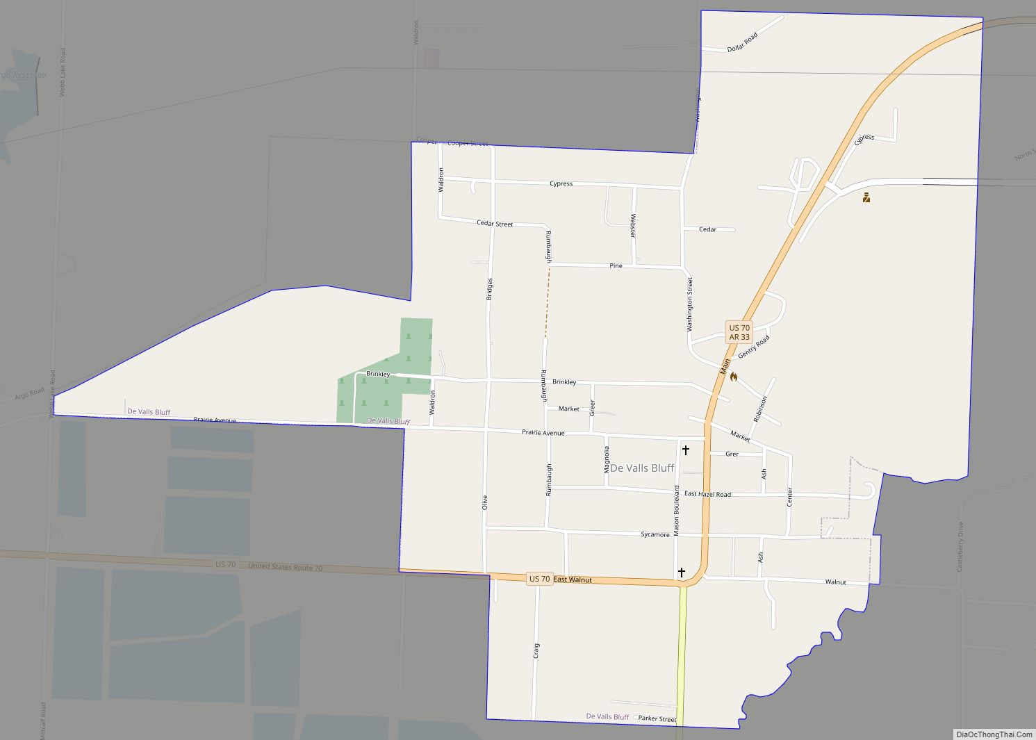
DeValls Bluff is a city in and the county seat of the southern district of Prairie County, Arkansas, United States. The population was 619 at the 2010 census.
| Name: | De Valls Bluff city |
|---|---|
| LSAD Code: | 25 |
| LSAD Description: | city (suffix) |
| State: | Arkansas |
| County: | Prairie County |
| Incorporated: | April 4, 1866 |
| Elevation: | 190 ft (58 m) |
| Total Area: | 1.16 sq mi (3.00 km²) |
| Land Area: | 1.09 sq mi (2.83 km²) |
| Water Area: | 0.07 sq mi (0.17 km²) |
| Total Population: | 520 |
| Population Density: | 476.19/sq mi (183.83/km²) |
| ZIP code: | 72041 |
| Area code: | 870 |
| FIPS code: | 0518640 |
| GNISfeature ID: | 0076762 |
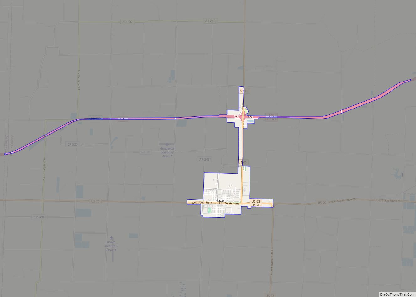
Online Interactive Map
Click on ![]() to view map in "full screen" mode.
to view map in "full screen" mode.
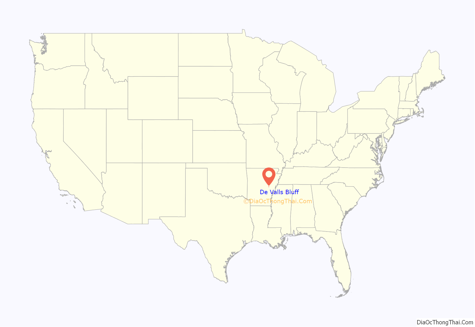
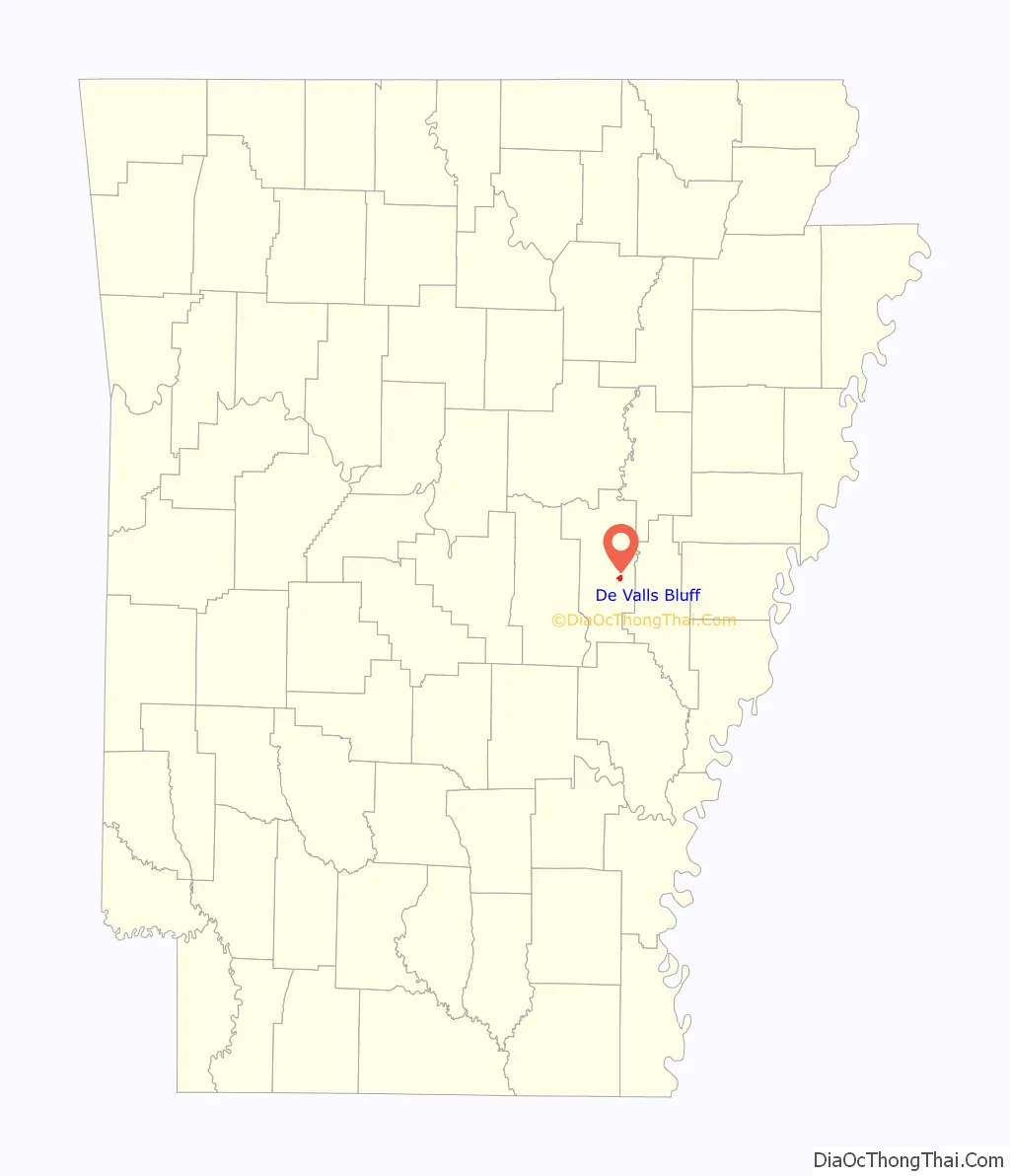
De Valls Bluff location map. Where is De Valls Bluff city?
History
Prairie County has always been important to Arkansas for the transportation of people and goods throughout the state. Initially, it was the White River that gave the agricultural county its importance for transport, since waterways were the primary means of long-distance transportation in the period before the development of railroads. Prairie County was cut from Arkansas, Pulaski, Monroe, St. Francis, and White counties in 1846 and included present-day Lonoke County. European settlement in Prairie County came in the 19th century, with Jacob M. DeVall and his son, Chappel, becoming the first recorded settlers around DeValls Bluff according to 1851 tax records.
During the Civil War, the city was a trading center on the White River, which continued to be the primary shipping corridor when the Arkansas River was innavigable. A railroad connection between North Little Rock and DeValls Bluff gave the city further strategic importance. Union forces traveling up the White from Arkansas Post under the command of Brigadier General Willis Gorman captured DeValls Bluff on January 18, 1863. However, the Union forces eventually returned to Arkansas Post, and the city returned to Confederate control. Following the capture of Little Rock, Union cavalry led by Brigadier General John Wynn Davidson joined with gunboats under the command of Lieutenant George Bache in Clarendon on August 9, 1863 and traveled up the White River to capture DeValls Bluff. Major General Frederick Steele proceeded to DeValls Bluff from Helena, and the city was used to house supplies and injured Union soldiers for the remainder of the war.
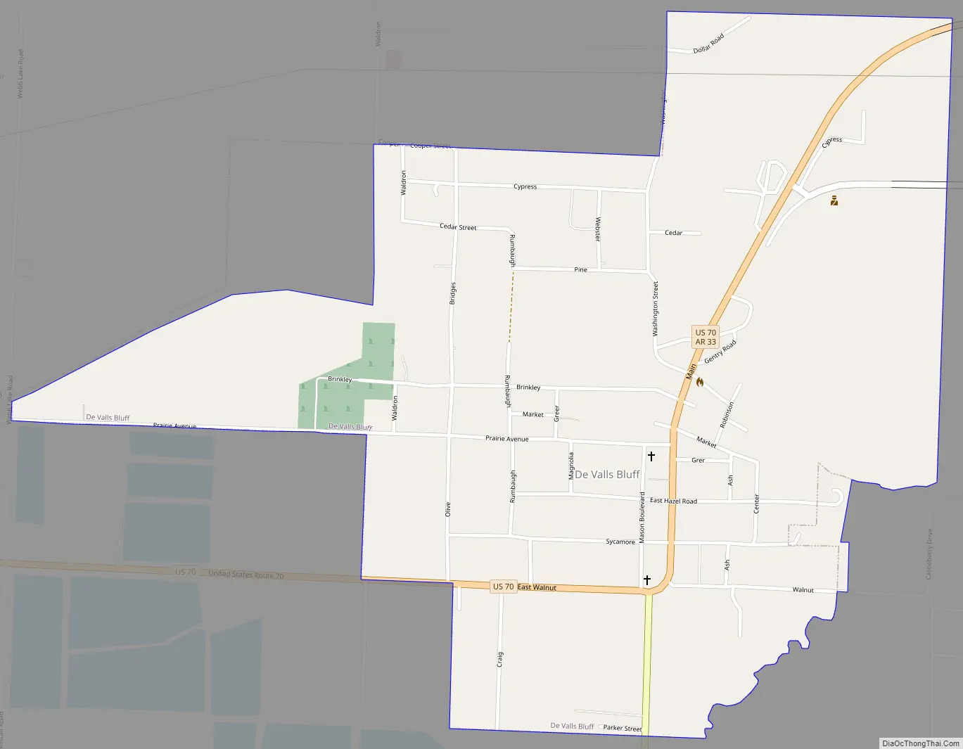
De Valls Bluff Road Map
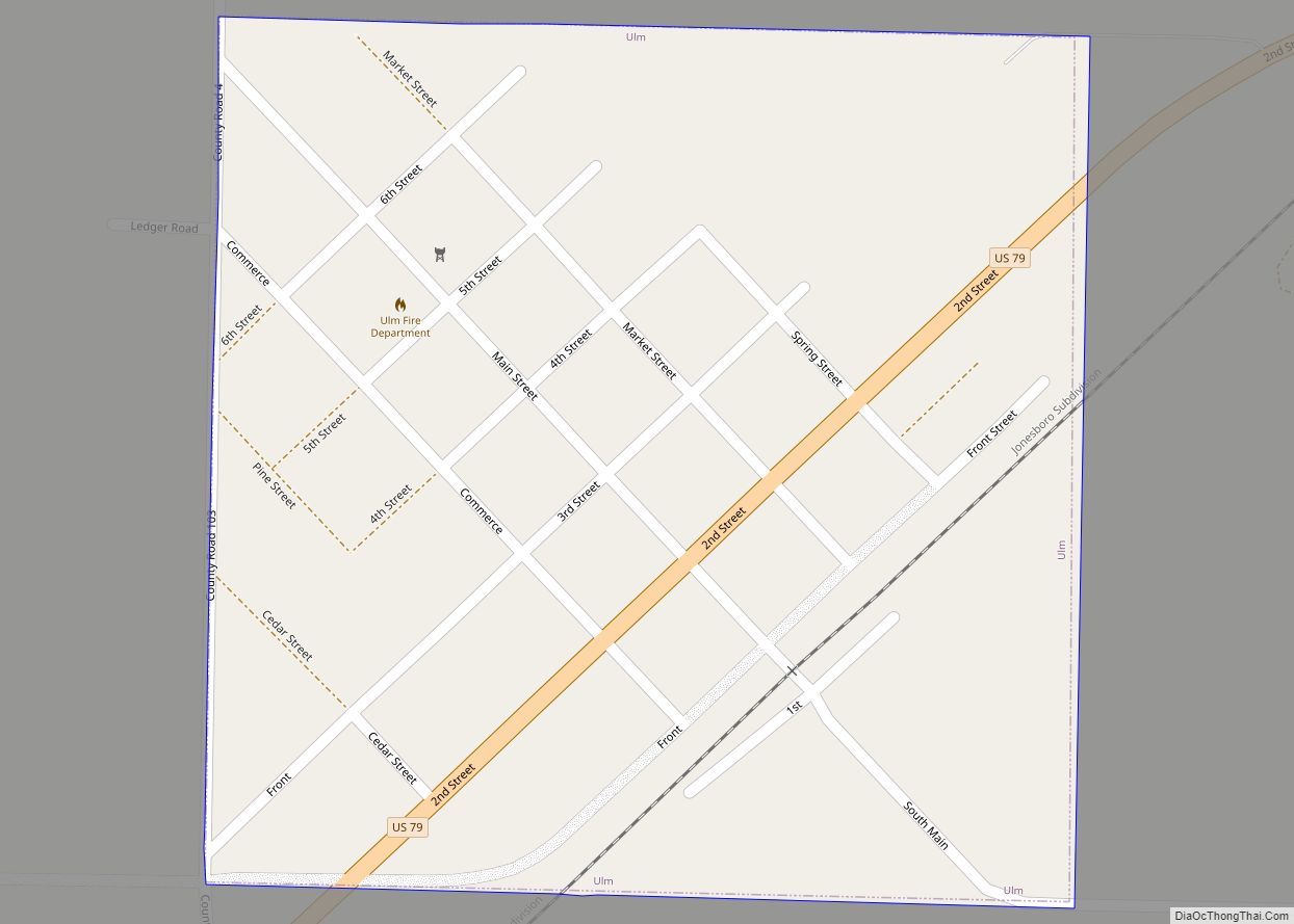
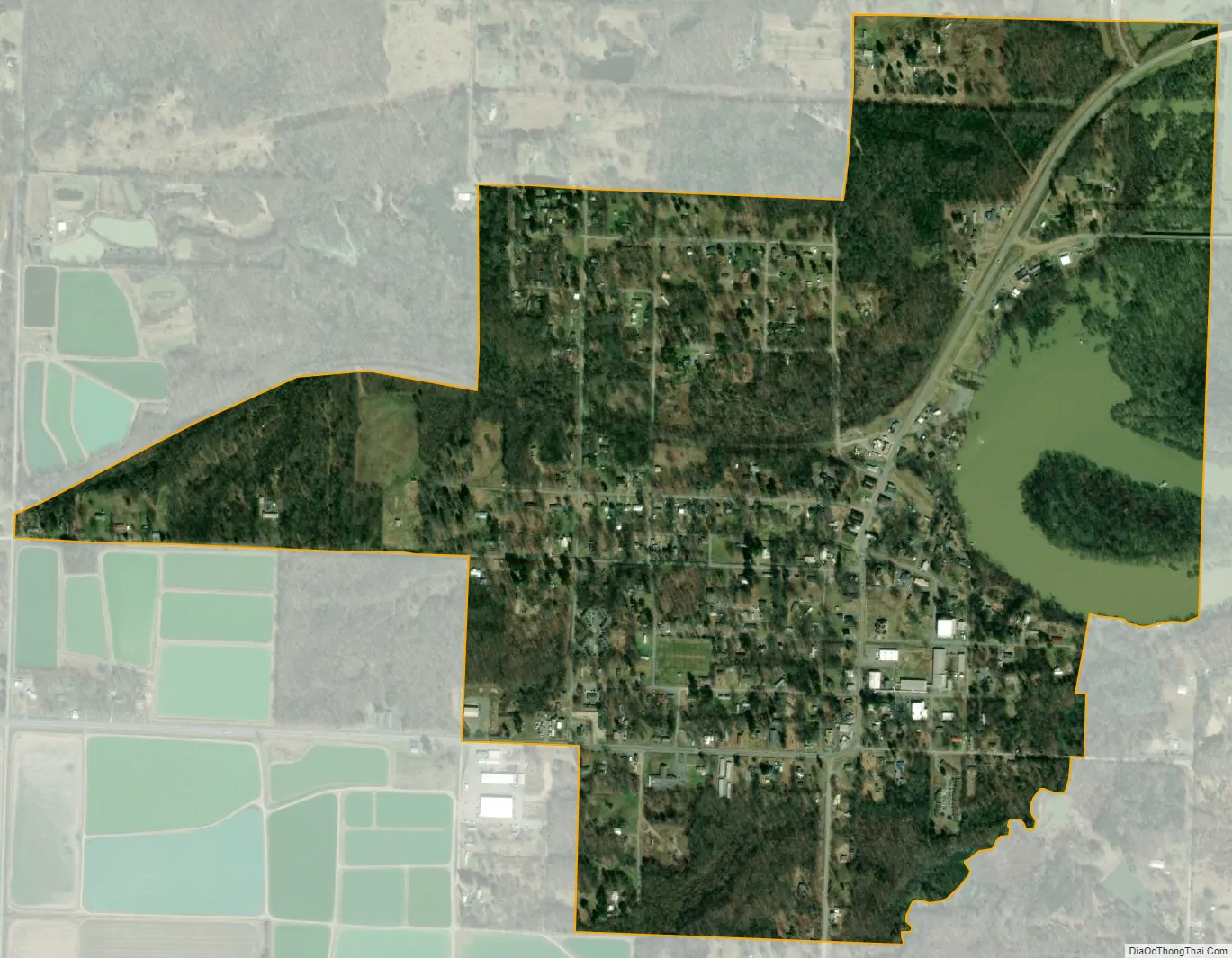
De Valls Bluff city Satellite Map
Geography
DeValls Bluff is located at 34°47′5″N 91°27′37″W / 34.78472°N 91.46028°W / 34.78472; -91.46028 (34.784760, -91.460346). The city is located within the Grand Prairie section of Prairie County, a subdivision of the Mississippi embayment within the Mississippi Alluvial Plain. Historically, the Grand Prairie was a flat grassland between the Arkansas River and the White River. However, the area was subject to clear cutting for row agriculture by early settlers. Today, the area is defined by rice cultivation, aquaculture and duck hunting.
According to the United States Census Bureau, the town has a total area of 2.8 km (1.1 mi), of which 2.7 km (1.0 mi) is land and 0.2 km (0.1 mi) (6.42%) is water.
See also
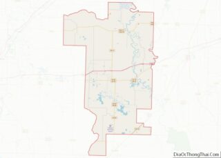
Map of Arkansas State and its subdivision:- Arkansas
- Ashley
- Baxter
- Benton
- Boone
- Bradley
- Calhoun
- Carroll
- Chicot
- Clark
- Clay
- Cleburne
- Cleveland
- Columbia
- Conway
- Craighead
- Crawford
- Crittenden
- Cross
- Dallas
- Desha
- Drew
- Faulkner
- Franklin
- Fulton
- Garland
- Grant
- Greene
- Hempstead
- Hot Spring
- Howard
- Independence
- Izard
- Jackson
- Jefferson
- Johnson
- Lafayette
- Lawrence
- Lee
- Lincoln
- Little River
- Logan
- Lonoke
- Madison
- Marion
- Miller
- Mississippi
- Monroe
- Montgomery
- Nevada
- Newton
- Ouachita
- Perry
- Phillips
- Pike
- Poinsett
- Polk
- Pope
- Prairie
- Pulaski
- Randolph
- Saint Francis
- Saline
- Scott
- Searcy
- Sebastian
- Sevier
- Sharp
- Stone
- Union
- Van Buren
- Washington
- White
- Woodruff
- Yell
- Alabama
- Alaska
- Arizona
- Arkansas
- California
- Colorado
- Connecticut
- Delaware
- District of Columbia
- Florida
- Georgia
- Hawaii
- Idaho
- Illinois
- Indiana
- Iowa
- Kansas
- Kentucky
- Louisiana
- Maine
- Maryland
- Massachusetts
- Michigan
- Minnesota
- Mississippi
- Missouri
- Montana
- Nebraska
- Nevada
- New Hampshire
- New Jersey
- New Mexico
- New York
- North Carolina
- North Dakota
- Ohio
- Oklahoma
- Oregon
- Pennsylvania
- Rhode Island
- South Carolina
- South Dakota
- Tennessee
- Texas
- Utah
- Vermont
- Virginia
- Washington
- West Virginia
- Wisconsin
- Wyoming