Map of East Camden town

Map of East Camden town

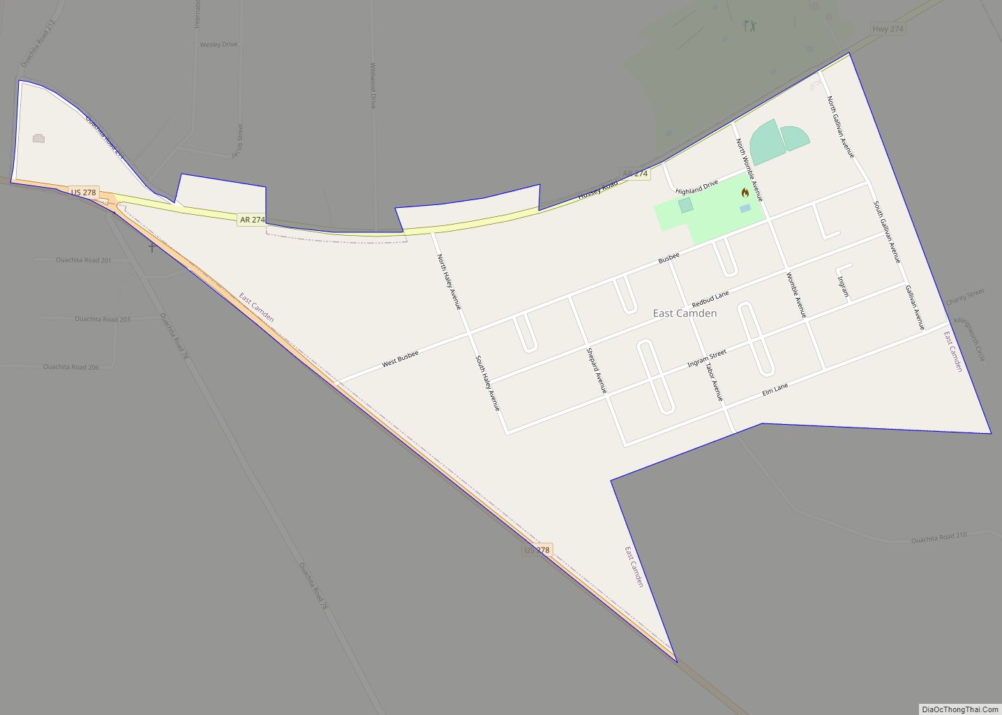
East Camden is a city in Ouachita County, Arkansas, United States. The population was 931 at the 2010 census. It is part of the Camden Micropolitan Statistical Area. East Camden was originally called Billkitts Rental Housing and began as a planned community created to support the nearby Shumaker Naval Ammunition Depot. As he did for … Read more

Map of Earle city

Map of Earle city

Earle is a city in Crittenden County, Arkansas, United States. Per the 2020 census, the population was 1,831. Earle city overview: Name: Earle city LSAD Code: 25 LSAD Description: city (suffix) State: Arkansas County: Crittenden County Elevation: 207 ft (63 m) Total Area: 3.25 sq mi (8.41 km²) Land Area: 3.25 sq mi (8.41 km²) Water Area: 0.00 sq mi (0.00 km²) Total Population: 1,831 Population … Read more

Map of Edmondson town

Map of Edmondson town

Edmondson is a town in Crittenden County, Arkansas, United States. The population was 427 at the 2010 census. Edmondson town overview: Name: Edmondson town LSAD Code: 43 LSAD Description: town (suffix) State: Arkansas County: Crittenden County Elevation: 207 ft (63 m) Total Area: 2.99 sq mi (7.75 km²) Land Area: 2.99 sq mi (7.75 km²) Water Area: 0.00 sq mi (0.00 km²) Total Population: 243 Population … Read more

Map of El Dorado city

Map of El Dorado city, Arkansas

El Dorado, founded by Matthew Rainey, is a city in, and the county seat of, Union County, on the southern border of Arkansas, United States. According to the 2010 census, the population of the city is 18,884. El Dorado is headquarters of the Arkansas Oil and Gas Commission as well as Murphy USA, Deltic Timber … Read more

Map of Egypt town, Arkansas

Map of Egypt town, Arkansas

Egypt is a town in Craighead County, Arkansas, United States. The population was 112 at the 2010 census. It is included in the Jonesboro, Arkansas Metropolitan Statistical Area. Egypt town overview: Name: Egypt town LSAD Code: 43 LSAD Description: town (suffix) State: Arkansas County: Craighead County Elevation: 249 ft (76 m) Total Area: 0.34 sq mi (0.87 km²) Land Area: … Read more

Map of Elm Springs city

Map of Elm Springs city

Elm Springs is a city in Benton and Washington Counties, Arkansas, United States. Located immediately west of Springdale in the Northwest Arkansas metropolitan statistical area, Elm Springs has been gaining population in recent years, including a 47% increase in population between the 2000 and 2010 censuses. Elm Springs city overview: Name: Elm Springs city LSAD … Read more

Map of Elkins city

Map of Elkins city, Arkansas

Elkins is a city in Washington County, Arkansas, United States. The community is located in the Boston Mountains, deep in the Ozark Mountains. A combination of the former unincorporated communities of Harris and Hood, Elkins was established in 1964. Located immediately east of Fayetteville in the Northwest Arkansas metropolitan statistical area, Elkins has been experiencing … Read more

Map of Elaine city

Map of Elaine city

Elaine is a small town in Phillips County, Arkansas, United States, in the Arkansas Delta region of the Mississippi River. The population was 636 at the 2010 census. The city is best known as the location of the Elaine massacre of September 30–October 1, 1919, in which an estimated 237 black people were killed in … Read more

Map of England city

Map of England city

England is a city in southwestern Lonoke County, Arkansas, United States and the county’s fourth most populous city. The population was 2,825 at the 2010 census. It is part of the Little Rock–North Little Rock–Conway Metropolitan Statistical Area. England city overview: Name: England city LSAD Code: 25 LSAD Description: city (suffix) State: Arkansas County: Lonoke … Read more

Map of Emmet city

Map of Emmet city, Arkansas

Emmet is a city in Nevada and Hempstead counties in the U.S. state of Arkansas. It is located at the intersection of U.S. Highway 67 and Arkansas Highway 299 in the Arkansas Timberlands region of southwest Arkansas. It is part of the larger Ark-La-Tex tri-state region. As of the 2010 census, the population of Emmet … Read more

Map of Emerson town

Map of Emerson town, Arkansas

Emerson is a town in Columbia County, Arkansas, United States. The population was 368 at the 2010 census. Emerson town overview: Name: Emerson town LSAD Code: 43 LSAD Description: town (suffix) State: Arkansas County: Columbia County Elevation: 322 ft (98 m) Total Area: 0.99 sq mi (2.57 km²) Land Area: 0.99 sq mi (2.57 km²) Water Area: 0.00 sq mi (0.00 km²) Total Population: 293 Population … Read more

Map of Eudora city

Map of Eudora city, Arkansas

Eudora is a city in Chicot County, Arkansas, United States. The population was 2,269 at the 2010 census, down from 2,819 in 2000. Eudora city overview: Name: Eudora city LSAD Code: 25 LSAD Description: city (suffix) State: Arkansas County: Chicot County Elevation: 135 ft (41 m) Total Area: 3.09 sq mi (8.01 km²) Land Area: 3.09 sq mi (8.01 km²) Water Area: 0.00 sq mi … Read more