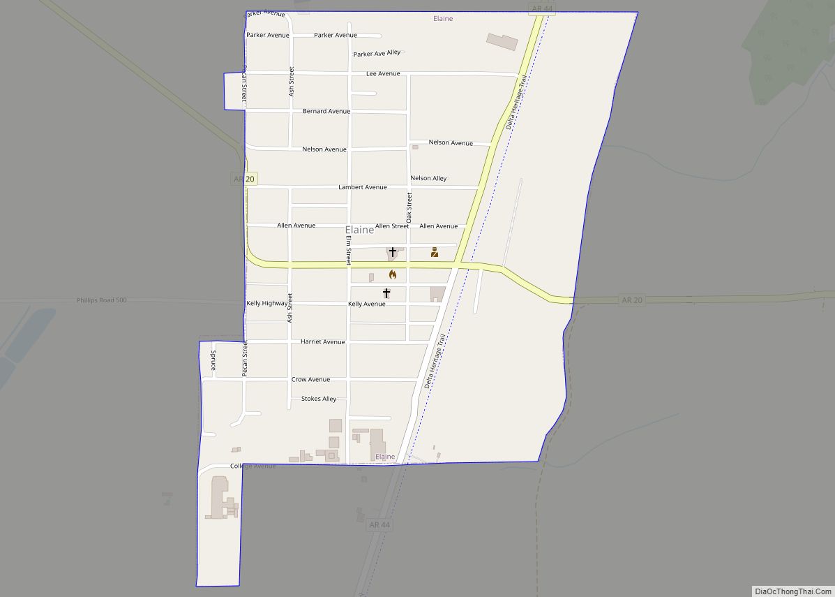
Elaine is a small town in Phillips County, Arkansas, United States, in the Arkansas Delta region of the Mississippi River. The population was 636 at the 2010 census.
The city is best known as the location of the Elaine massacre of September 30–October 1, 1919, in which an estimated 237 black people were killed in the rural county by rampaging white mobs. Five whites died in the events. This was one of the worst incidents of racial and labor violence in American history. Black sharecroppers were attempting to organize a farmers’ union, which the planters resisted.
| Name: | Elaine city |
|---|---|
| LSAD Code: | 25 |
| LSAD Description: | city (suffix) |
| State: | Arkansas |
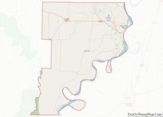
| County: | Phillips County |
| Elevation: | 167 ft (51 m) |
| Total Area: | 0.51 sq mi (1.32 km²) |
| Land Area: | 0.51 sq mi (1.32 km²) |
| Water Area: | 0.00 sq mi (0.00 km²) |
| Total Population: | 509 |
| Population Density: | 994.14/sq mi (384.19/km²) |
| ZIP code: | 72333 |
| Area code: | 870 |
| FIPS code: | 0520950 |
| GNISfeature ID: | 0048832 |
Online Interactive Map
Click on ![]() to view map in "full screen" mode.
to view map in "full screen" mode.
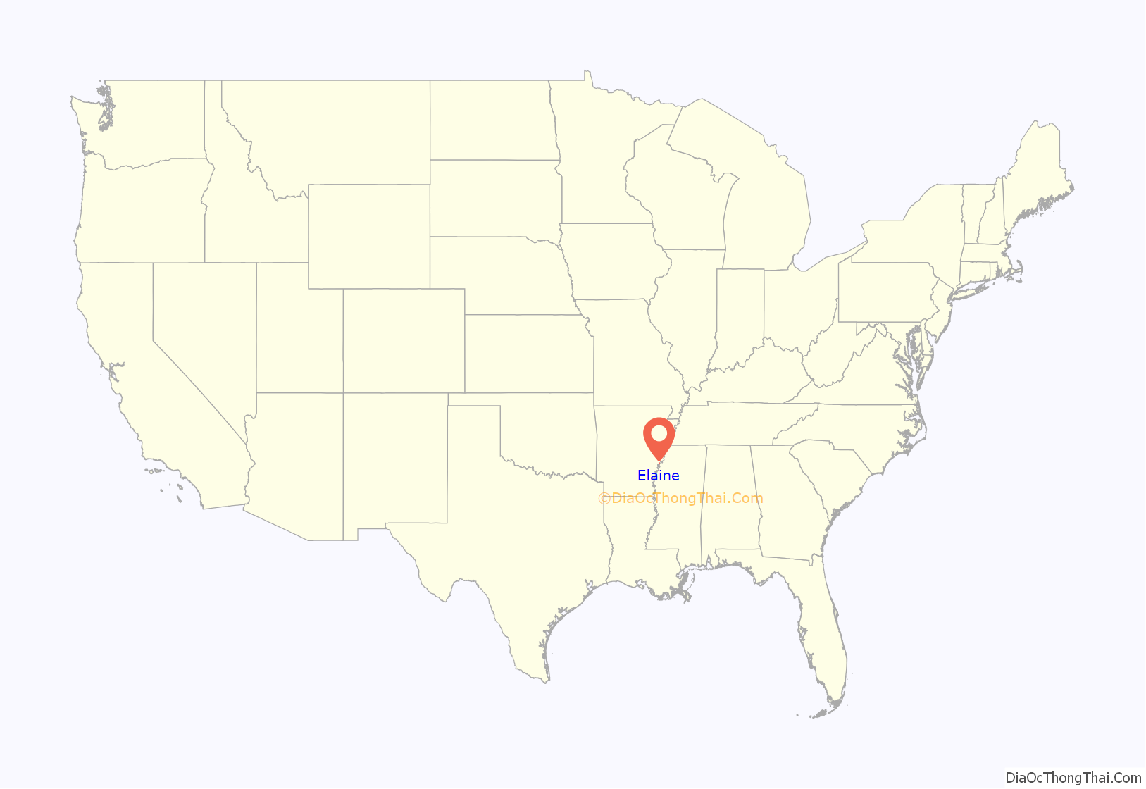
Elaine location map. Where is Elaine city?

History
Phillips County was developed in the antebellum years for cotton plantations, which relied on the labor of enslaved African Americans. Their work produced the wealth of the major large planters. Cotton continued to be the major commodity crop into the 20th century in this area but, after the war, blacks often had to work as sharecroppers or tenant farmers. By the turn of the century, Arkansas and other southern states had disenfranchised most blacks, excluding them from the political system, and imposed Jim Crow laws.
Black sharecroppers began to try to organize a farmers’ union after World War I. They were seeking better payment and accounting from white landowners of the area cotton plantations. Whites resisted any change and often tried to break up their meetings.
On September 30, 1919, two white men, including a local deputy, tried to break up a meeting of black sharecroppers who were trying to organize a farmers’ union. After a white deputy was killed in a confrontation with guards at the meeting, word spread to town and around the area. Hundreds of whites from Phillips and neighboring areas rushed to suppress the blacks, and started attacking blacks at large. Governor Charles Hillman Brough requested federal troops to stop what was called the Elaine massacre. White mobs spread throughout the county, killing an estimated 237 blacks before most of the violence was suppressed after October 1. Five whites also died in the incident. The governor accompanied the troops to the scene; their use had been approved by U.S. President Woodrow Wilson. Sharecroppers generally remained at a disadvantage in dealing with white landowners.
The county continues to rely on agriculture, but mechanization reduced the need for farm labor. Many African Americans left this area in the Great Migration of the early 20th century. In the 21st century, most farms are industrial scale. Some seasonal Hispanic migrant workers have been hired in this area since the late 20th century.
At 6:15 PM, April 26, 2011, a tornado – part of the 2011 Super Outbreak – hit the Elaine area. The tornado was rated EF0, with estimated wind speeds of 75 miles per hour (121 km/h; 65 kn). The tornado’s path of destruction was 200 yards (180 m) wide and the tornado traveled a path of 21.5 miles (34.6 km) along Highway 61 and across the Mississippi state line, ending near Lula, Mississippi. Most of the tornado’s damage was concentrated in Friars Point and Coahoma, Mississippi.
Elaine Road Map
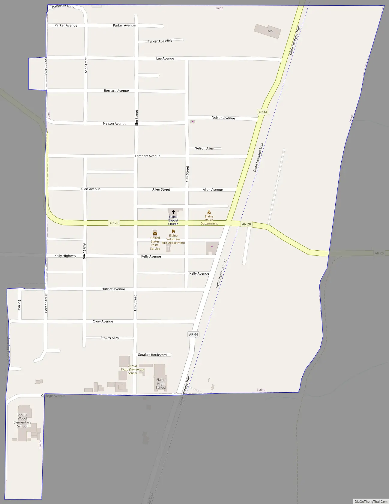
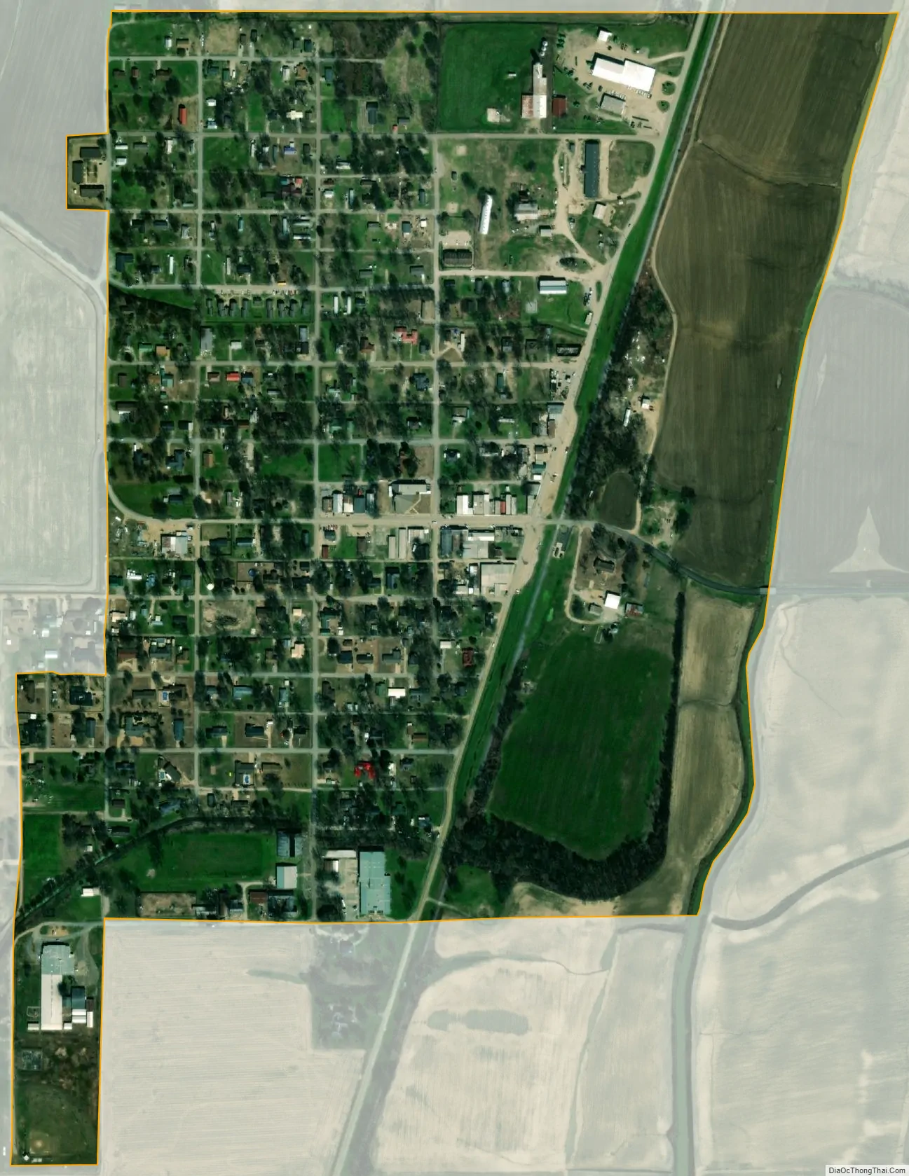
Elaine city Satellite Map
Geography
Elaine is located at 34°18′31″N 90°51′15″W / 34.30861°N 90.85417°W / 34.30861; -90.85417 (34.308595, −90.854201).
According to the United States Census Bureau, the city has a total area of 0.5 square miles (1.3 km), all land.
See also
Map of Arkansas State and its subdivision:- Arkansas
- Ashley
- Baxter
- Benton
- Boone
- Bradley
- Calhoun
- Carroll
- Chicot
- Clark
- Clay
- Cleburne
- Cleveland
- Columbia
- Conway
- Craighead
- Crawford
- Crittenden
- Cross
- Dallas
- Desha
- Drew
- Faulkner
- Franklin
- Fulton
- Garland
- Grant
- Greene
- Hempstead
- Hot Spring
- Howard
- Independence
- Izard
- Jackson
- Jefferson
- Johnson
- Lafayette
- Lawrence
- Lee
- Lincoln
- Little River
- Logan
- Lonoke
- Madison
- Marion
- Miller
- Mississippi
- Monroe
- Montgomery
- Nevada
- Newton
- Ouachita
- Perry
- Phillips
- Pike
- Poinsett
- Polk
- Pope
- Prairie
- Pulaski
- Randolph
- Saint Francis
- Saline
- Scott
- Searcy
- Sebastian
- Sevier
- Sharp
- Stone
- Union
- Van Buren
- Washington
- White
- Woodruff
- Yell
- Alabama
- Alaska
- Arizona
- Arkansas
- California
- Colorado
- Connecticut
- Delaware
- District of Columbia
- Florida
- Georgia
- Hawaii
- Idaho
- Illinois
- Indiana
- Iowa
- Kansas
- Kentucky
- Louisiana
- Maine
- Maryland
- Massachusetts
- Michigan
- Minnesota
- Mississippi
- Missouri
- Montana
- Nebraska
- Nevada
- New Hampshire
- New Jersey
- New Mexico
- New York
- North Carolina
- North Dakota
- Ohio
- Oklahoma
- Oregon
- Pennsylvania
- Rhode Island
- South Carolina
- South Dakota
- Tennessee
- Texas
- Utah
- Vermont
- Virginia
- Washington
- West Virginia
- Wisconsin
- Wyoming