Map of Mountain Home city

Map of Mountain Home city, Arkansas

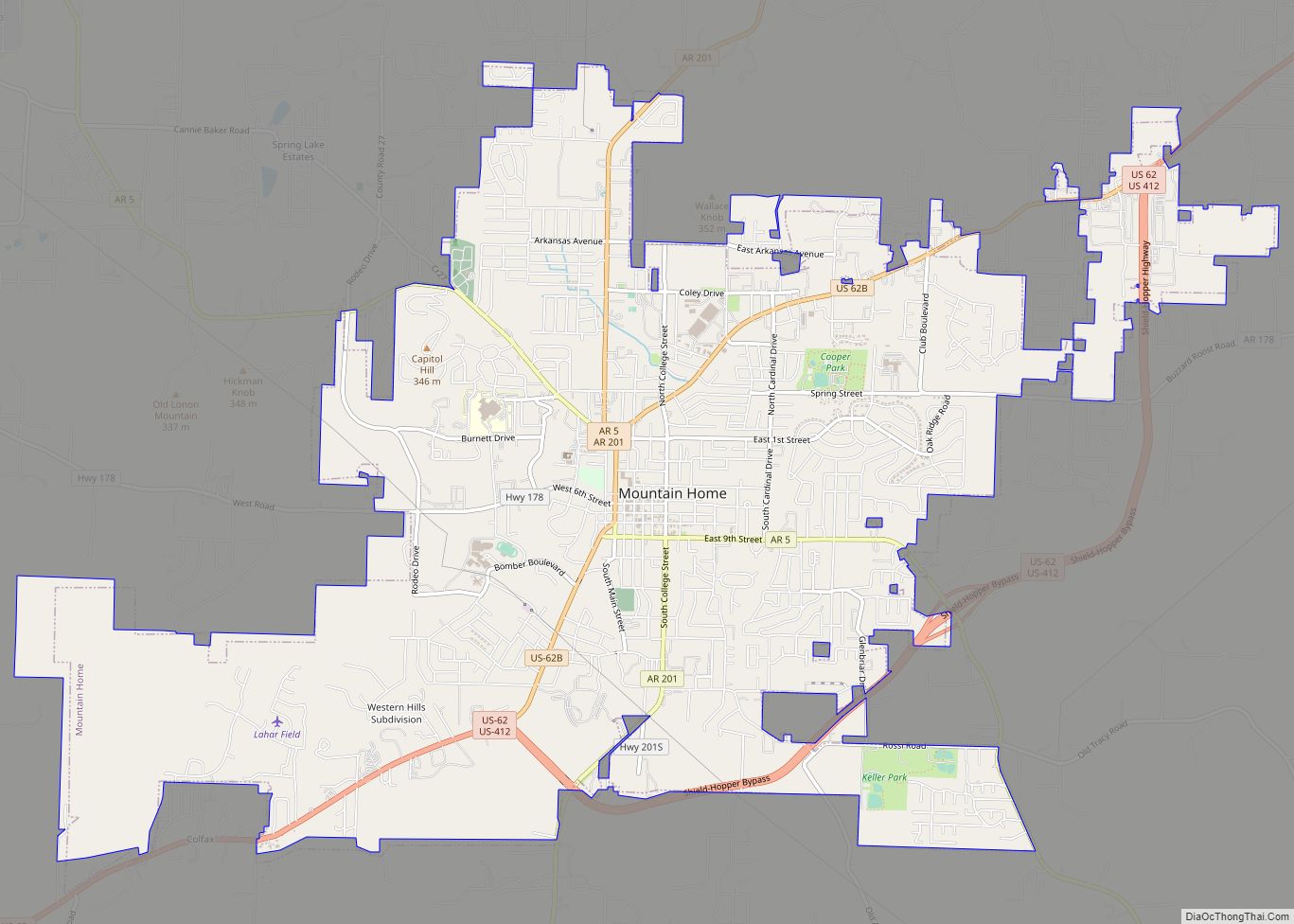
Mountain Home is a city in Arkansas, and the county seat of, Baxter County, Arkansas, United States, in the southern Ozark Mountains near the northern state border with Missouri. As of the 2010 census, the city had a population of 12,448. A total of 41,307 persons lived within the city and micropolitan area combined, which … Read more

Map of Mount Vernon town, Arkansas

Map of Mount Vernon town, Arkansas

Mount Vernon is a town in Faulkner County, Arkansas, United States. The population was 145 at the 2010 census. It is part of the Little Rock–North Little Rock–Conway Metropolitan Statistical Area. Mount Vernon town overview: Name: Mount Vernon town LSAD Code: 43 LSAD Description: town (suffix) State: Arkansas County: Faulkner County Elevation: 423 ft (129 m) Total … Read more

Map of Mulberry city

Map of Mulberry city, Arkansas

Mulberry is a city in Crawford County, Arkansas, United States. It is part of the Fort Smith, Arkansas–Oklahoma Metropolitan Statistical Area. The population was 1,655 as of the 2010 Census, an increase of 1.72% from 1,627 in 2000. Mulberry city overview: Name: Mulberry city LSAD Code: 25 LSAD Description: city (suffix) State: Arkansas County: Crawford … Read more

Map of Mountainburg city

Map of Mountainburg city

Mountainburg is a town in Crawford County, Arkansas, United States. It is part of the Fort Smith, Arkansas–Oklahoma Metropolitan Statistical Area. As of the 2010 census the population was 631. Mountainburg was laid out in 1883 when the St. Louis–San Francisco Railway was extended to that point. Mountainburg city overview: Name: Mountainburg city LSAD Code: … Read more

Map of Mountain View city

Map of Mountain View city, Arkansas

Mountain View is the largest city in and the county seat of Stone County, Arkansas, United States, located in the Ozarks. The city’s economy is largely based on tourism related to its title as the “Folk Music Capital of the World”. The city is also known for outdoors recreation opportunities, including Blanchard Springs Caverns, trout … Read more

Map of Murfreesboro city

Map of Murfreesboro city, Arkansas

Murfreesboro is a city in, and the county seat of, Pike County, Arkansas, United States. Its population was 1,641 at the 2010 census. The city is known for the Crater of Diamonds State Park located south of the city. Murfreesboro city overview: Name: Murfreesboro city LSAD Code: 25 LSAD Description: city (suffix) State: Arkansas County: … Read more

Map of Natural Steps CDP

Map of Natural Steps CDP

Natural Steps is an unincorporated census-designated place in Pulaski County, Arkansas, United States. It is located 18 miles (29 km) northwest of Little Rock along the southern bank of the Arkansas River, on Arkansas Highway 300. Per the 2020 census, the population was 413. Today, it is a small farming community with scattered businesses. Most of … Read more

Map of Nashville city

Map of Nashville city, Arkansas

Nashville is a city in Howard County, Arkansas, United States. The population was 4,627 at the 2010 census. The estimated population in 2018 was 4,425. The city is the county seat of Howard County. Nashville is situated at the base of the Ouachita foothills and was once a major center of the peach trade in … Read more

Map of Newark city

Map of Newark city, Arkansas

Newark is a city in Independence County, Arkansas, United States. The population was 1,180 at the 2020 census. Newark city overview: Name: Newark city LSAD Code: 25 LSAD Description: city (suffix) State: Arkansas County: Independence County Elevation: 299 ft (91 m) Total Area: 1.65 sq mi (4.26 km²) Land Area: 1.65 sq mi (4.26 km²) Water Area: 0.00 sq mi (0.00 km²) Total Population: 1,180 Population … Read more

Map of New Edinburg CDP

Map of New Edinburg CDP

New Edinburg is an unincorporated census-designated place in Cleveland County, Arkansas, United States. Per the 2020 census, the population was 134. New Edinburg CDP overview: Name: New Edinburg CDP LSAD Code: 57 LSAD Description: CDP (suffix) State: Arkansas County: Cleveland County Elevation: 289 ft (88 m) Total Area: 3.20 sq mi (8.30 km²) Land Area: 3.20 sq mi (8.30 km²) Water Area: 0.00 sq mi … Read more

Map of New Blaine CDP

Map of New Blaine CDP

New Blaine is an unincorporated community and census-designated place (CDP) in Logan County, Arkansas, United States. Per the 2020 census, the population was 173. The following sites listed on the National Register of Historic Places are in or near New Blaine: Anhalt Barn, on County Road 68 Old Arkansas Highway 22, part of AR 197, … Read more

Map of Norfork city

Map of Norfork city

Norfork is a city in Baxter County, Arkansas, United States. The population was 550 at the 2010 census. Norfork city overview: Name: Norfork city LSAD Code: 25 LSAD Description: city (suffix) State: Arkansas County: Baxter County Elevation: 479 ft (146 m) Total Area: 2.41 sq mi (6.24 km²) Land Area: 2.23 sq mi (5.76 km²) Water Area: 0.18 sq mi (0.48 km²) Total Population: 465 Population … Read more