Mountain Home is a city in Arkansas, and the county seat of, Baxter County, Arkansas, United States, in the southern Ozark Mountains near the northern state border with Missouri. As of the 2010 census, the city had a population of 12,448. A total of 41,307 persons lived within the city and micropolitan area combined, which encompasses the majority of Baxter County.
| Name: | Mountain Home city |
|---|---|
| LSAD Code: | 25 |
| LSAD Description: | city (suffix) |
| State: | Arkansas |
| County: | Baxter County |
| Elevation: | 814 ft (248 m) |
| Land Area: | 11.97 sq mi (30.99 km²) |
| Water Area: | 0.00 sq mi (0.00 km²) |
| Population Density: | 1,071.79/sq mi (413.81/km²) |
| ZIP code: | 72653-72654 |
| Area code: | 870 |
| FIPS code: | 0547390 |
| GNISfeature ID: | 2404330 |
| Website: | cityofmountainhome.com |
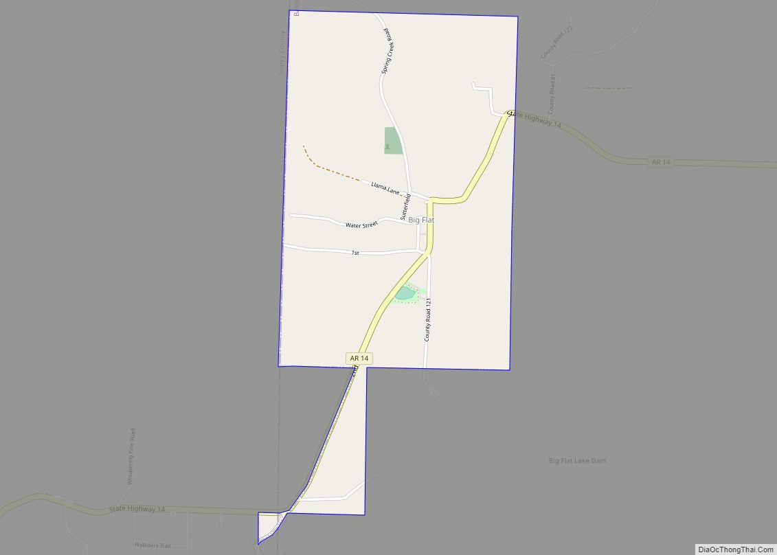
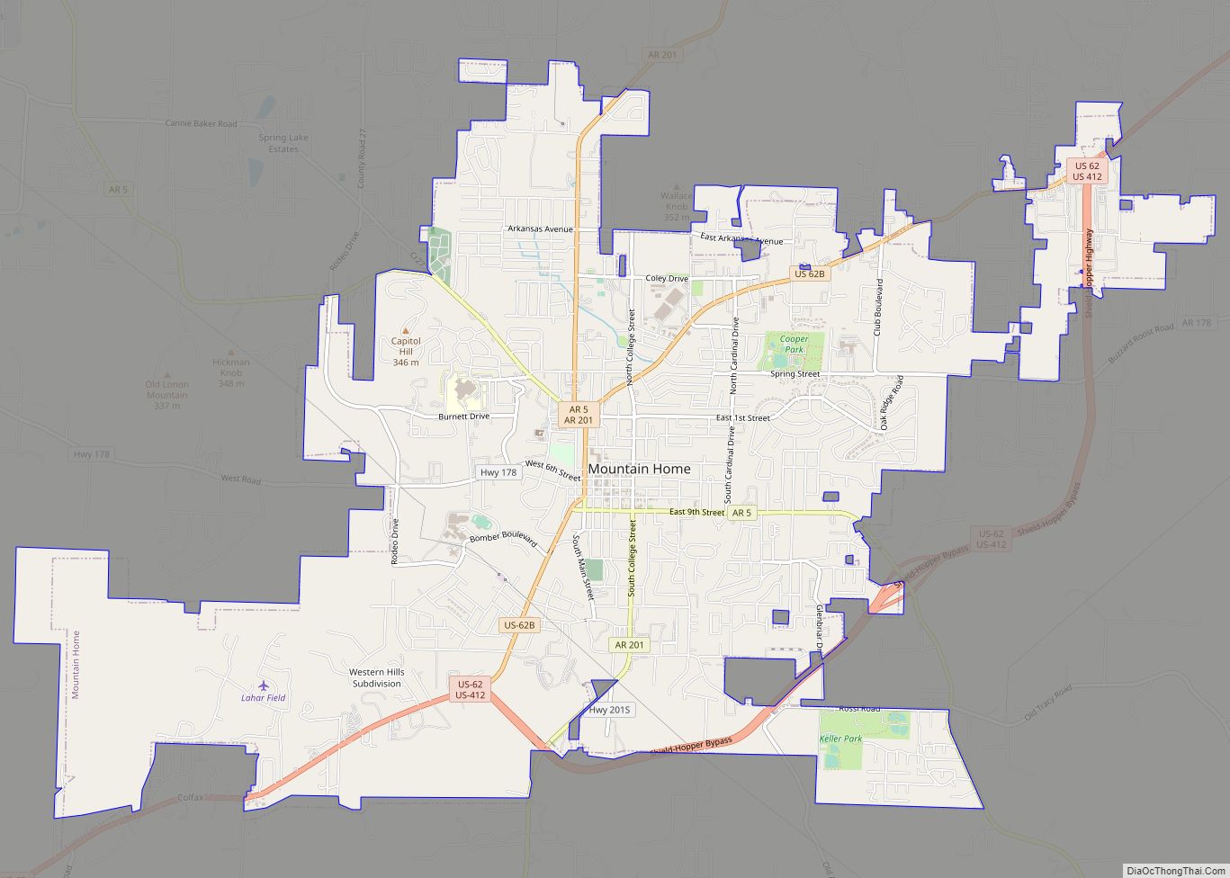
Online Interactive Map
Click on ![]() to view map in "full screen" mode.
to view map in "full screen" mode.
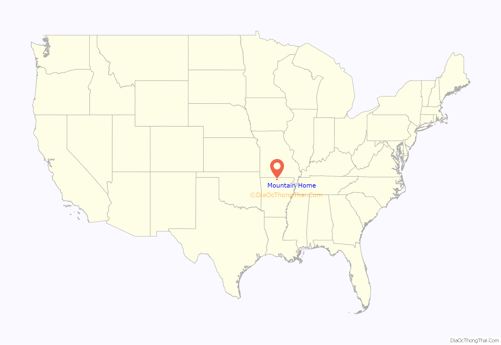
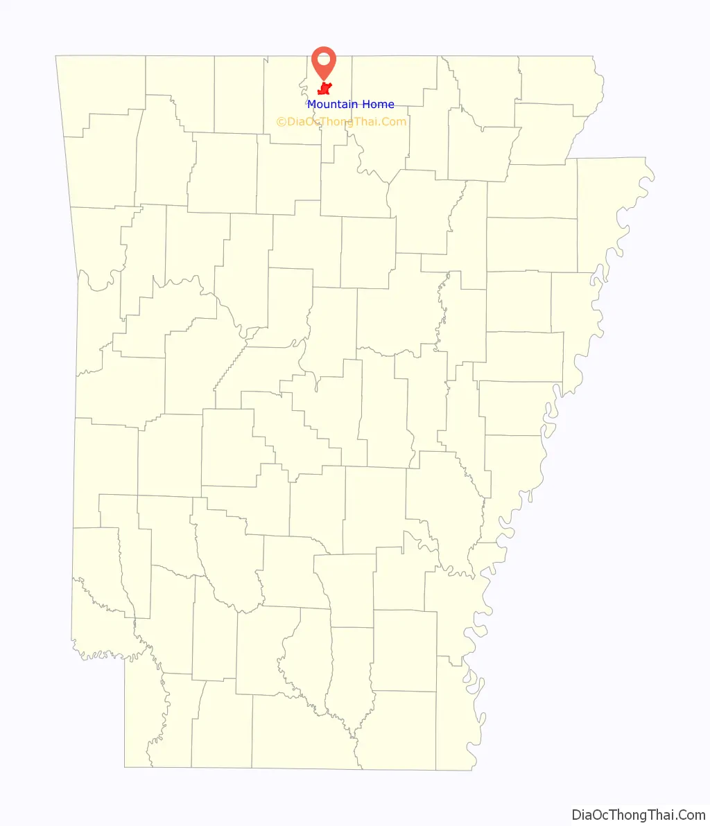
Mountain Home location map. Where is Mountain Home city?
History
Founding and early days
Mountain Home was originally known as Rapp’s Barren. The land was owned by Simeon “Rapp” Talburt, who built the first home in the area in the early 1830s. Rapp and many of his family members are buried in a small cemetery in the Indian Creek subdivision of Mountain Home. The original cabin was found in 1990 and is on display in Cooper Park in Mountain Home with other homes of historic value. The name of the town was changed to Mountain Home in 1856. A post office was established in 1857. The Mountain Home Male and Female Academy was opened in 1853 and provided much needed education in the absence of accessible public schools.
The Courthouse
When Baxter County was incorporated on March 24, 1873, Mountain Home was named as the county seat. Court was held in a local store and prisoners were held in the homes of respected citizens until a proper courthouse could be built. A former boardinghouse was purchased for the purpose, but was deemed unfit for county business during the renovation process, so a new wood-frame building was built on a donated lot in the middle of the town square. This building burned to the ground in the 1890s and was replaced with a stone courthouse. It was suspected that an arsonist set fire to the building due to the location of the start of the fire and the timing. In just a few days, the fireproof safe would have been completed and all county records, including indictments, would have been protected from fire. In 1912, a local town, Cotter, was booming while growth in Mountain Home had slowed, and there was talk of moving the County Seat to the riverfront town. Mountain Home added a third floor to their existing court house due to an Arkansas law that prevented county seats from being moved away from a three-story building. The current court house was completed in 1943 and is still in use today.
Civil War
Mountain Home men participated in the war on the confederate side. No major battles were fought in Mountain Home, but because of its proximity to Missouri, members of the union army would often raid the area for supplies and both sides participated in guerilla warfare. During this time, the Mountain Home Male and Female Academy was closed. In October 1862, the 14th regiment of the Missouri State Militia was ordered to advance to Yellville, Arkansas a town not far away, to attack confederate troops stationed there and to take any supplies they could along the way. When they heard that a larger force of confederate soldiers were also heading for Yellville, and facing the rising waters of the White River, they decided to content themselves with stealing approximately 50 horses and other supplies from local settlers in the Mountain Home area and then retreat. The rear guard was cut off by a battalion of confederate soldiers and a skirmish ensued where the Union Army lost no soldiers and the Confederate Army lost approximately 10.
In April 1864, Mountain Home was again involved with Civil war violence when a group of jayhawkers attacked the town. Much of the town was damaged or destroyed, including the Mountain Home Male and Female Academy.
Post Civil War through the 1920s
In 1893, the Mountain Home Baptist college, known as “The Gem of the Ozarks”, opened. It operated for 40 years, offering education in French, Greek, Shorthand and typing as well as teacher training. Most of the money required to open it was raised locally. It closed occasionally due to lack of funds. In 1901, it became part of the Ouachita Baptist University system. In 1916 it became the flagship of the schools operated in Arkansas by the Southern Baptist Convention. By 1927 there were 265 students and a 7000 volume library. In 1927, funding was withdrawn to support a more centralized school in Conway and by 1933, the school was closed. The library was donated to the local public library and public schools and the dormitories became housing for the Dam builders. In 1901, the Baxter Bulletin was established and continues to operate today.
The Great Depression
The Great Depression hit the area hard, causing many local farmers to lose their land and leave. A series of natural disasters also caused hardship in the area including the Flood of 1927 and the drought of 1930–31. Cotton had been one of the main crops in the area before this, but the drought ended production of cotton in Baxter county and it never truly resumed. Residents received some relief from New Deal programs such as the Federal Emergency Relief Agency (FERA) and the Civilian Conservation Corps. The Works Progress Administration transformed transportation in the area throughout the 1930s and 1940s.
The New Deal
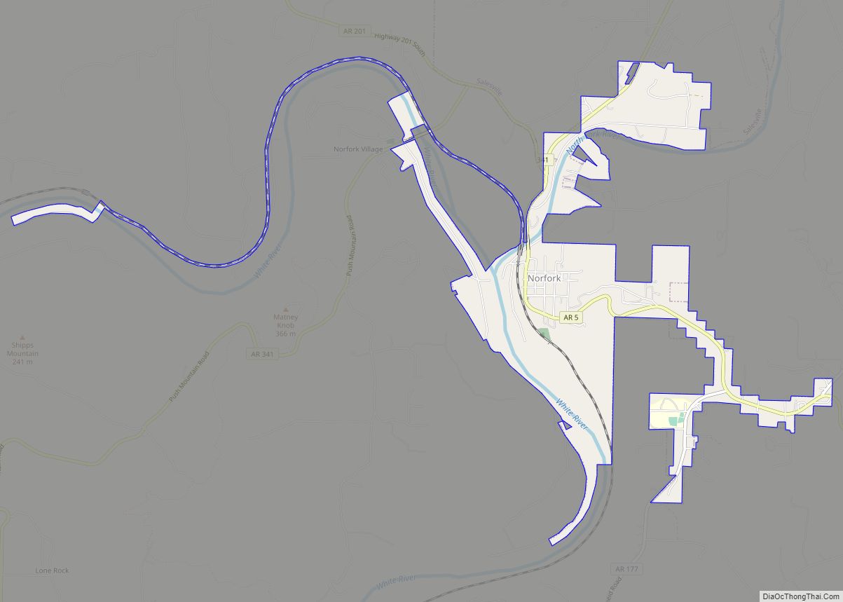
The programs of the New Deal era allowed Mountain Home to modernize its courthouse. The decision to do this was hotly contested and in a vote to decide if the funds should be approved, 731 voted for the new courthouse and 592 voted against. Most of those against the new courthouse were from the Cotter area which had tried several times to move the county seat to their town. The current courthouse was completed and dedicated on August 13, 1943, the old building having been destroyed two years earlier. The WPA also built two dams in the area during this time. The Norfork Dam was built in the town of Norfork about 18 miles south east of Mountain Home. This dam was completed by 1944. An average of 815 were employed building the dam, providing a much needed economic boost to Mountain home and the surrounding area. In addition to flood control, the Norfork Dam boosted tourist interest in Baxter County and made Mountain Home a more attractive destination than Cotter for the first time, and Mountain Home began to surpass its riverfront neighbor in population and industry. A second dam had been built in the town of Bull Shoals in nearby Marion County. This meant Mountain Home was situated between two large lakes and within an easy drive to one of the most famous destinations for fishing in the country at that time. Tourism would shape the economy of Mountain Home moving forward. President Harry Truman was the keynote speaker at the dedication of the dams on July 2, 1952.
The construction of these two dams was a time of tremendous growth for the formerly isolated community of Mountain Home. Streets were paved and Electricity became common in average households. A trout fishery was built at the base of the Norfork Dam, attracting still more tourists.
Mountain Home Road Map
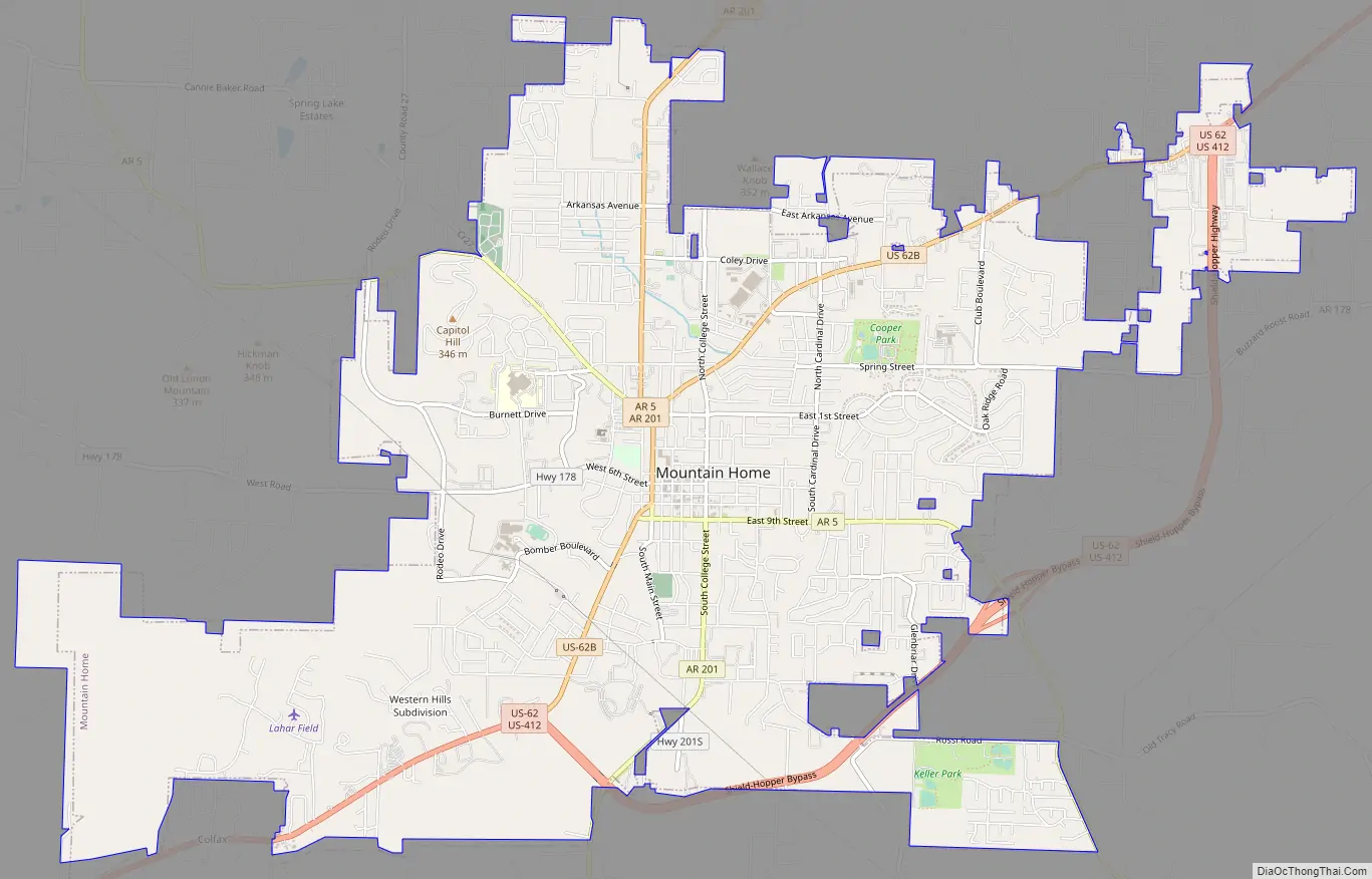
Mountain Home city Satellite Map

Geography
Mountain Home is located in northern Arkansas at 36°20′10″N 92°22′56″W / 36.33611°N 92.38222°W / 36.33611; -92.38222 (36.336248, -92.382279). It is the center of the Twin Lakes area, with Norfork Lake 15 minutes to the east and Bull Shoals Lake 20 minutes to the northwest. It is located within the Ozarks mountain range, in the Salem Plateau region.
The city is located within 15 to 20 minutes of three rivers: the Buffalo National River, the White River and the North Fork River, which features the world-renowned Norfork Tailwater. These make the Mountain Home area one of the nation’s top freshwater fishing destinations. According to the United States Census Bureau, the city has a total area of 11.7 square miles (30.4 km), all land.
Climate
Mountain Home has a humid subtropical climate (Köppen climate classification Cfa), with cool to mild winters and warm, humid summers.
See also
Map of Arkansas State and its subdivision:- Arkansas
- Ashley
- Baxter
- Benton
- Boone
- Bradley
- Calhoun
- Carroll
- Chicot
- Clark
- Clay
- Cleburne
- Cleveland
- Columbia
- Conway
- Craighead
- Crawford
- Crittenden
- Cross
- Dallas
- Desha
- Drew
- Faulkner
- Franklin
- Fulton
- Garland
- Grant
- Greene
- Hempstead
- Hot Spring
- Howard
- Independence
- Izard
- Jackson
- Jefferson
- Johnson
- Lafayette
- Lawrence
- Lee
- Lincoln
- Little River
- Logan
- Lonoke
- Madison
- Marion
- Miller
- Mississippi
- Monroe
- Montgomery
- Nevada
- Newton
- Ouachita
- Perry
- Phillips
- Pike
- Poinsett
- Polk
- Pope
- Prairie
- Pulaski
- Randolph
- Saint Francis
- Saline
- Scott
- Searcy
- Sebastian
- Sevier
- Sharp
- Stone
- Union
- Van Buren
- Washington
- White
- Woodruff
- Yell
- Alabama
- Alaska
- Arizona
- Arkansas
- California
- Colorado
- Connecticut
- Delaware
- District of Columbia
- Florida
- Georgia
- Hawaii
- Idaho
- Illinois
- Indiana
- Iowa
- Kansas
- Kentucky
- Louisiana
- Maine
- Maryland
- Massachusetts
- Michigan
- Minnesota
- Mississippi
- Missouri
- Montana
- Nebraska
- Nevada
- New Hampshire
- New Jersey
- New Mexico
- New York
- North Carolina
- North Dakota
- Ohio
- Oklahoma
- Oregon
- Pennsylvania
- Rhode Island
- South Carolina
- South Dakota
- Tennessee
- Texas
- Utah
- Vermont
- Virginia
- Washington
- West Virginia
- Wisconsin
- Wyoming