Murfreesboro is a city in, and the county seat of, Pike County, Arkansas, United States. Its population was 1,641 at the 2010 census. The city is known for the Crater of Diamonds State Park located south of the city.
| Name: | Murfreesboro city |
|---|---|
| LSAD Code: | 25 |
| LSAD Description: | city (suffix) |
| State: | Arkansas |
| County: | Pike County |
| Elevation: | 367 ft (112 m) |
| Total Area: | 3.71 sq mi (9.61 km²) |
| Land Area: | 3.68 sq mi (9.52 km²) |
| Water Area: | 0.03 sq mi (0.09 km²) |
| Total Population: | 1,495 |
| Population Density: | 406.69/sq mi (157.01/km²) |
| ZIP code: | 71958 |
| Area code: | 870 |
| FIPS code: | 0548290 |
| GNISfeature ID: | 0077783 |
| Website: | mboroarkansas.com |
Online Interactive Map
Click on ![]() to view map in "full screen" mode.
to view map in "full screen" mode.
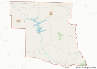
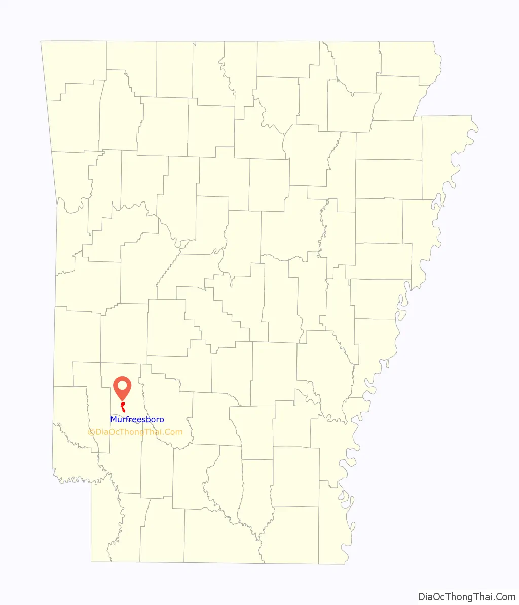
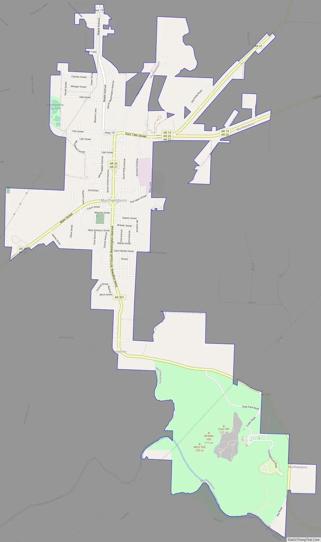
Murfreesboro location map. Where is Murfreesboro city?

History
In 1906, diamonds were found on a local farm. It was determined that an 80-acre (32 ha) volcanic formation was the source of the diamonds. The property was eventually sold to the state of Arkansas, which opened the 37-acre Crater of Diamonds State Park to the public. As a tourist attraction a daily fee ($10 in 2021) is charged to search for diamonds.
Also located in Murfreesboro is the 1,000-year-old Ka-Do-Ha Indian Village and museum dedicated to it, which offers a field that can be excavated for authentic arrowheads.
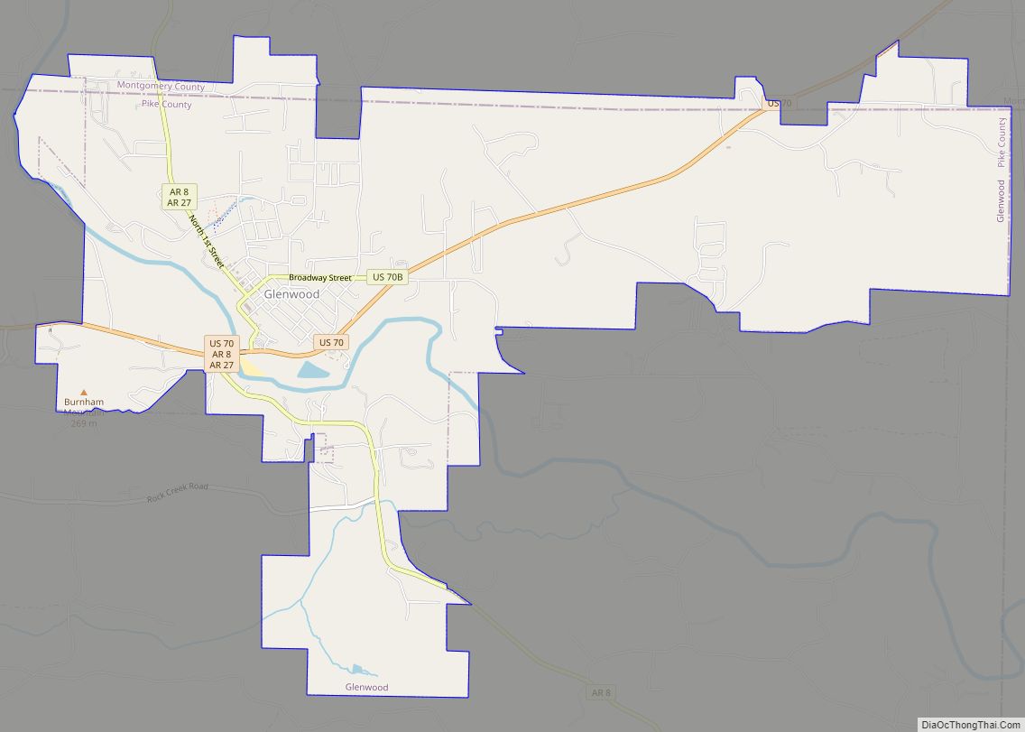
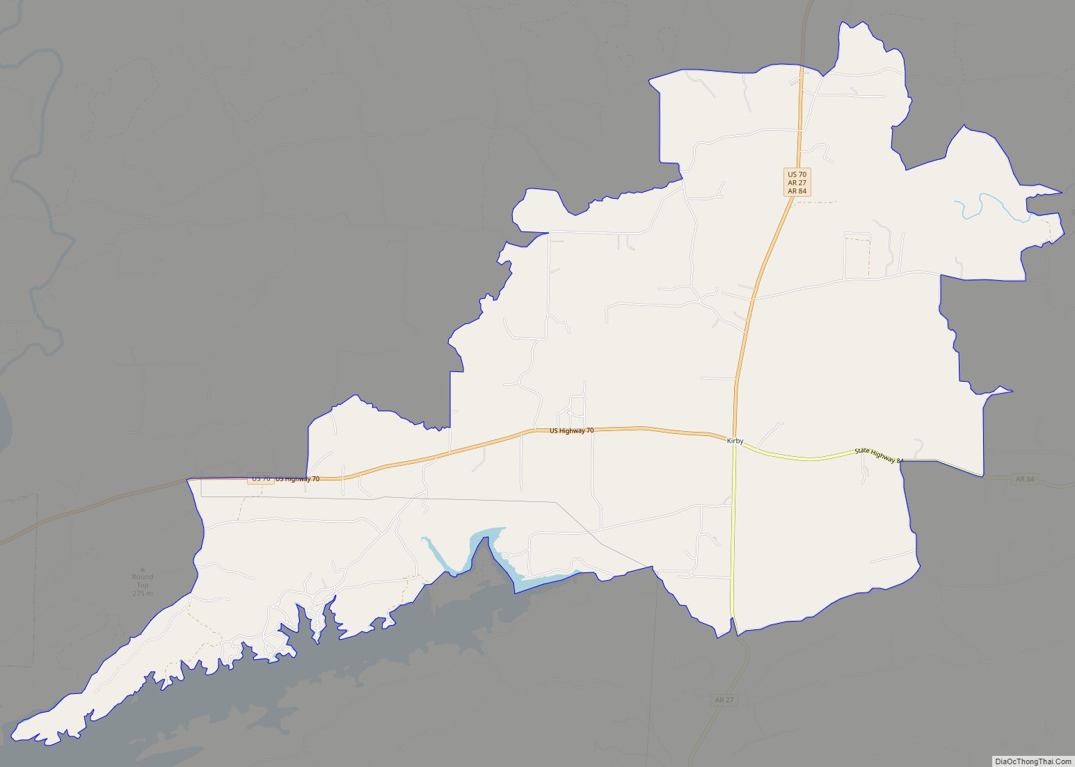
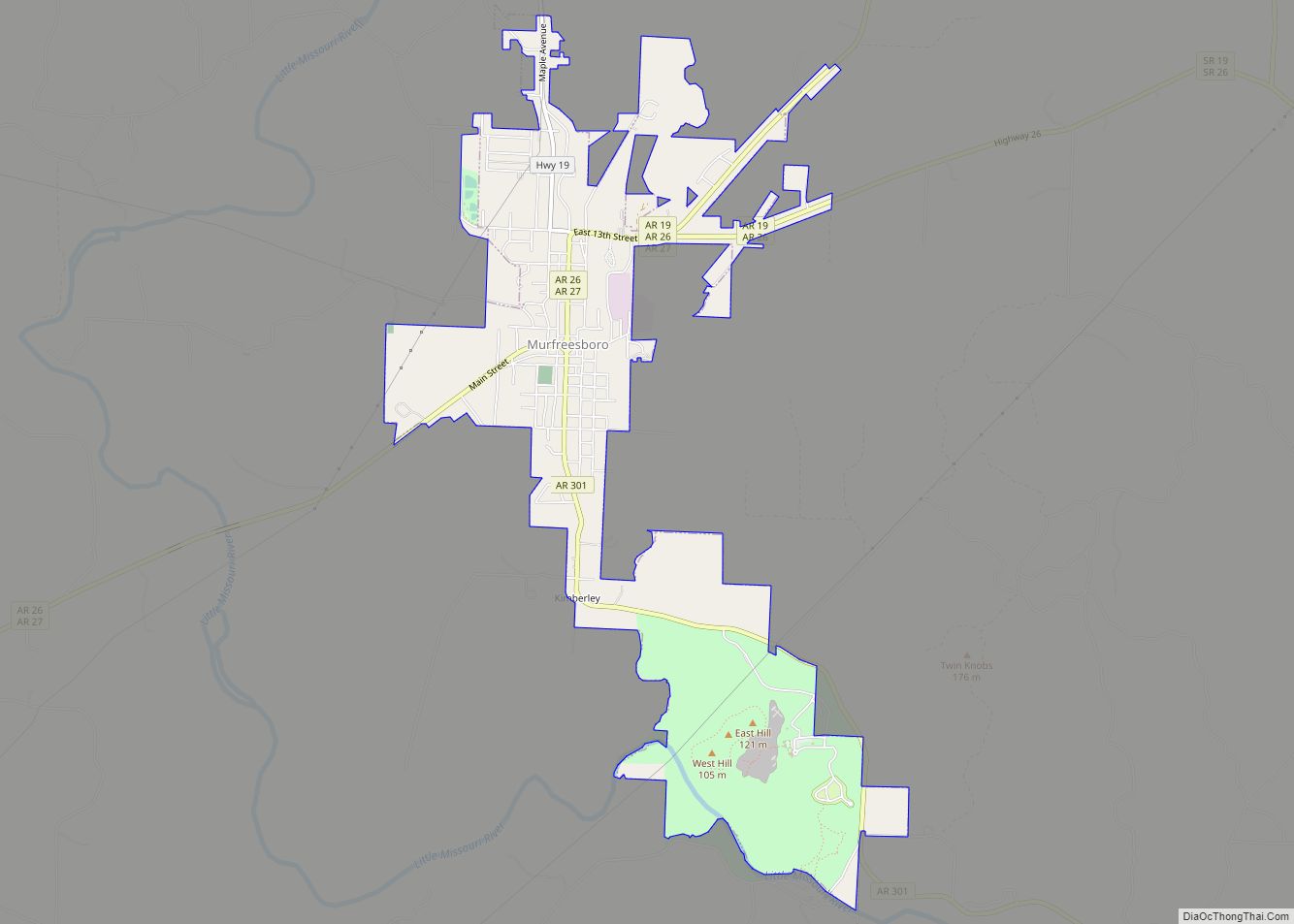
Murfreesboro Road Map
Murfreesboro city Satellite Map

Geography
Murfreesboro is located at 34°3′59″N 93°41′21″W / 34.06639°N 93.68917°W / 34.06639; -93.68917 (34.066255, -93.689256). According to the United States Census Bureau, the city has a total area of 2.0 square miles (5.2 km), all land.
See also
Map of Arkansas State and its subdivision:- Arkansas
- Ashley
- Baxter
- Benton
- Boone
- Bradley
- Calhoun
- Carroll
- Chicot
- Clark
- Clay
- Cleburne
- Cleveland
- Columbia
- Conway
- Craighead
- Crawford
- Crittenden
- Cross
- Dallas
- Desha
- Drew
- Faulkner
- Franklin
- Fulton
- Garland
- Grant
- Greene
- Hempstead
- Hot Spring
- Howard
- Independence
- Izard
- Jackson
- Jefferson
- Johnson
- Lafayette
- Lawrence
- Lee
- Lincoln
- Little River
- Logan
- Lonoke
- Madison
- Marion
- Miller
- Mississippi
- Monroe
- Montgomery
- Nevada
- Newton
- Ouachita
- Perry
- Phillips
- Pike
- Poinsett
- Polk
- Pope
- Prairie
- Pulaski
- Randolph
- Saint Francis
- Saline
- Scott
- Searcy
- Sebastian
- Sevier
- Sharp
- Stone
- Union
- Van Buren
- Washington
- White
- Woodruff
- Yell
- Alabama
- Alaska
- Arizona
- Arkansas
- California
- Colorado
- Connecticut
- Delaware
- District of Columbia
- Florida
- Georgia
- Hawaii
- Idaho
- Illinois
- Indiana
- Iowa
- Kansas
- Kentucky
- Louisiana
- Maine
- Maryland
- Massachusetts
- Michigan
- Minnesota
- Mississippi
- Missouri
- Montana
- Nebraska
- Nevada
- New Hampshire
- New Jersey
- New Mexico
- New York
- North Carolina
- North Dakota
- Ohio
- Oklahoma
- Oregon
- Pennsylvania
- Rhode Island
- South Carolina
- South Dakota
- Tennessee
- Texas
- Utah
- Vermont
- Virginia
- Washington
- West Virginia
- Wisconsin
- Wyoming