Map of Pindall town

Map of Pindall town

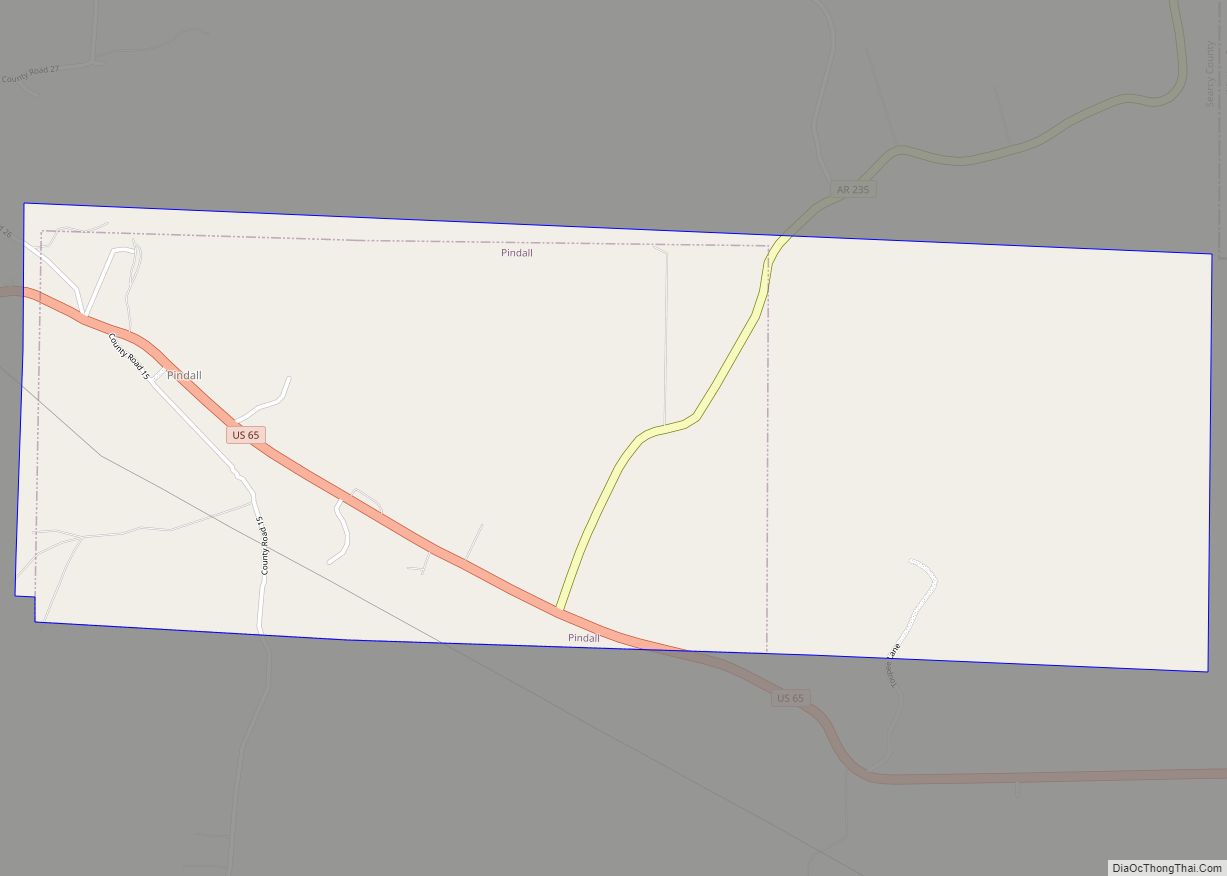
Pindall is a town in Searcy County, Arkansas, United States. The population was 112 at the 2010 census. The town is said to be named for Governor Xenophon Overton Pindall. Pindall town overview: Name: Pindall town LSAD Code: 43 LSAD Description: town (suffix) State: Arkansas County: Searcy County Elevation: 1,194 ft (364 m) Total Area: 2.87 sq mi (7.44 km²) … Read more

Map of Piggott city

Map of Piggott city

Piggott is a city in Clay County, Arkansas, United States. It is one of the two county seats of Clay County, along with Corning. It is the northern terminus of the Arkansas segment of the Crowley’s Ridge Parkway, a National Scenic Byway. As of the 2010 census, Piggott’s population was 3,849. The town was named … Read more

Map of Plainview city

Map of Plainview city, Arkansas

Plainview is a city in Yell County, Arkansas, United States. The population was 608 at the 2010 census. It is part of the Russellville Micropolitan Statistical Area. Plainview city overview: Name: Plainview city LSAD Code: 25 LSAD Description: city (suffix) State: Arkansas County: Yell County Elevation: 423 ft (129 m) Total Area: 1.46 sq mi (3.77 km²) Land Area: 1.46 sq mi … Read more

Map of Piney CDP

Map of Piney CDP, Arkansas

Piney is a census-designated place (CDP) in Garland County, Arkansas, United States. The population was 4,699 at the 2010 census. Piney CDP overview: Name: Piney CDP LSAD Code: 57 LSAD Description: CDP (suffix) State: Arkansas County: Garland County Elevation: 420 ft (130 m) Total Area: 7.11 sq mi (18.42 km²) Land Area: 6.51 sq mi (16.85 km²) Water Area: 0.60 sq mi (1.56 km²) Total Population: … Read more

Map of Pineville town

Map of Pineville town, Arkansas

Pineville is a town in Izard County, Arkansas, United States. The population was 238 at the 2010 census. Pineville town overview: Name: Pineville town LSAD Code: 43 LSAD Description: town (suffix) State: Arkansas County: Izard County Elevation: 689 ft (210 m) Total Area: 1.81 sq mi (4.68 km²) Land Area: 1.81 sq mi (4.68 km²) Water Area: 0.00 sq mi (0.00 km²) Total Population: 154 Population … Read more

Map of Pocahontas city

Map of Pocahontas city, Arkansas

Pocahontas is a city in Randolph County, Arkansas, United States, along the Black River. According to the 2010 Census Bureau, the population of the city was 6,608. The city is the county seat of Randolph County. Pocahontas has a number of historic buildings, including the Old Randolph County Courthouse built in 1871, the St. Mary’s … Read more

Map of Plumerville city

Map of Plumerville city

Plumerville is a city in Conway County, Arkansas, United States. The population was 826 at the 2010 census. Plumerville city overview: Name: Plumerville city LSAD Code: 25 LSAD Description: city (suffix) State: Arkansas County: Conway County Elevation: 315 ft (96 m) Total Area: 1.04 sq mi (2.70 km²) Land Area: 1.03 sq mi (2.67 km²) Water Area: 0.01 sq mi (0.04 km²) Total Population: 734 Population … Read more

Map of Pleasant Plains town

Map of Pleasant Plains town, Arkansas

Pleasant Plains is a town in Independence County, Arkansas, United States. The population was 349 at the 2010 census, up from 267 in 2000. Pleasant Plains town overview: Name: Pleasant Plains town LSAD Code: 43 LSAD Description: town (suffix) State: Arkansas County: Independence County Elevation: 597 ft (182 m) Total Area: 1.01 sq mi (2.61 km²) Land Area: 1.01 sq mi (2.61 km²) … Read more

Map of Portland city

Map of Portland city, Arkansas

Portland is a town in Ashley County, Arkansas, United States. The population was 430 at the 2010 census. Portland was first settled in the 1830s, and named for its early status as a steamboat port. It was incorporated in 1893. Portland city overview: Name: Portland city LSAD Code: 25 LSAD Description: city (suffix) State: Arkansas … Read more

Map of Portia town

Map of Portia town

Portia is a town in Lawrence County, Arkansas, United States. The population was 437 at the 2010 census. Portia town overview: Name: Portia town LSAD Code: 43 LSAD Description: town (suffix) State: Arkansas County: Lawrence County Elevation: 262 ft (80 m) Total Area: 1.29 sq mi (3.35 km²) Land Area: 1.29 sq mi (3.35 km²) Water Area: 0.00 sq mi (0.00 km²) Total Population: 424 Population … Read more

Map of Pollard city, Arkansas

Map of Pollard city, Arkansas

Pollard is a city in Clay County, Arkansas, United States. The population was 222 at the 2010 census. Pollard city overview: Name: Pollard city LSAD Code: 25 LSAD Description: city (suffix) State: Arkansas County: Clay County Elevation: 338 ft (103 m) Total Area: 0.30 sq mi (0.77 km²) Land Area: 0.30 sq mi (0.77 km²) Water Area: 0.00 sq mi (0.00 km²) Total Population: 193 Population … Read more

Map of Pottsville city

Map of Pottsville city, Arkansas

Pottsville is a city in Pope County, Arkansas, United States. As of the 2020 census the population was 3,140. It is part of the Russellville Micropolitan Statistical Area. Pottsville city overview: Name: Pottsville city LSAD Code: 25 LSAD Description: city (suffix) State: Arkansas County: Pope County Elevation: 387 ft (118 m) Total Area: 13.56 sq mi (35.11 km²) Land Area: … Read more