Map of Powhatan town

Map of Powhatan town, Arkansas

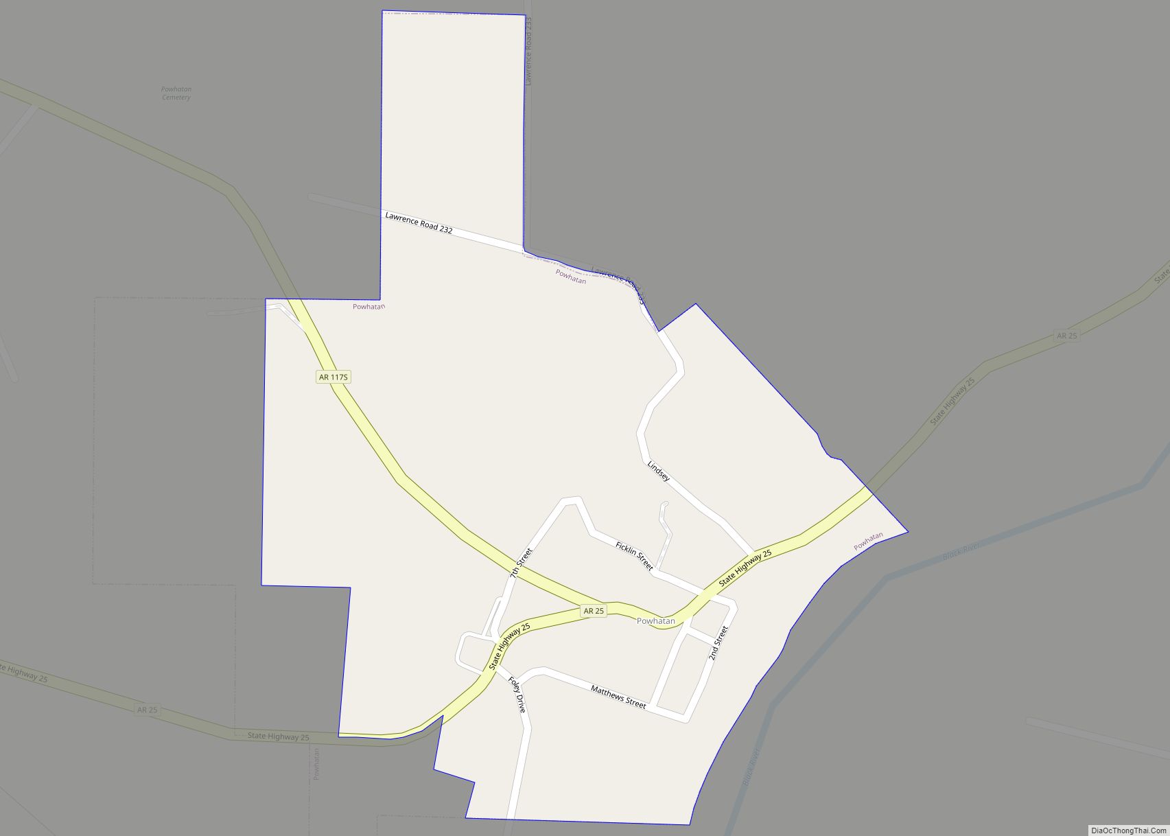
Powhatan is a town in Lawrence County, Arkansas, United States, along the Black River. The population was 72 at the 2010 census, up from 50 at the 2000 census. Powhatan town overview: Name: Powhatan town LSAD Code: 43 LSAD Description: town (suffix) State: Arkansas County: Lawrence County Elevation: 285 ft (87 m) Total Area: 0.55 sq mi (1.42 km²) Land … Read more

Map of Pottsville city

Map of Pottsville city, Arkansas

Pottsville is a city in Pope County, Arkansas, United States. As of the 2020 census the population was 3,140. It is part of the Russellville Micropolitan Statistical Area. Pottsville city overview: Name: Pottsville city LSAD Code: 25 LSAD Description: city (suffix) State: Arkansas County: Pope County Elevation: 387 ft (118 m) Total Area: 13.56 sq mi (35.11 km²) Land Area: … Read more

Map of Prattsville town

Map of Prattsville town, Arkansas

Prattsville is a city in Grant County, Arkansas, United States. The population was 305 at the 2010 census. It is part of the Central Arkansas region. Prattsville town overview: Name: Prattsville town LSAD Code: 43 LSAD Description: town (suffix) State: Arkansas County: Grant County Elevation: 299 ft (91 m) Total Area: 1.62 sq mi (4.21 km²) Land Area: 1.62 sq mi (4.19 km²) … Read more

Map of Prairie Grove city

Map of Prairie Grove city, Arkansas

Prairie Grove is a city in Washington County, Arkansas, United States. The population was 7,045 at the 2020 Census. It is part of the Northwest Arkansas region, and home to Prairie Grove Battlefield State Park. Prairie Grove city overview: Name: Prairie Grove city LSAD Code: 25 LSAD Description: city (suffix) State: Arkansas County: Washington County … Read more

Map of Prairie Creek CDP

Map of Prairie Creek CDP

Prairie Creek is a census-designated place (CDP) in Benton County, Arkansas, United States. Per the 2020 census, the population was 2,217. It is a lakefront community adjacent to Beaver Lake and Rogers within the Northwest Arkansas region. Prairie Creek CDP overview: Name: Prairie Creek CDP LSAD Code: 57 LSAD Description: CDP (suffix) State: Arkansas County: … Read more

Map of Quitman city

Map of Quitman city, Arkansas

Quitman is a city in Cleburne and Faulkner counties in the U.S. state of Arkansas. Its population was 762 at the 2010 census. The portion of the city in Faulkner County is part of the Little Rock–North Little Rock–Conway Metropolitan Statistical Area. Quitman city overview: Name: Quitman city LSAD Code: 25 LSAD Description: city (suffix) … Read more

Map of Pyatt town

Map of Pyatt town

Pyatt is a town in western Marion County, Arkansas, United States. The population was 181 at the 2020 census, down from 221 in 2010. Pyatt town overview: Name: Pyatt town LSAD Code: 43 LSAD Description: town (suffix) State: Arkansas County: Marion County Elevation: 742 ft (226 m) Total Area: 1.28 sq mi (3.33 km²) Land Area: 1.26 sq mi (3.25 km²) Water Area: … Read more

Map of Prescott city

Map of Prescott city, Arkansas

Prescott is a city and the county seat of Nevada County, Arkansas, United States. The community had a population of 3,296 at the 2010 census. Prescott is part of the Hope Micropolitan Statistical Area. Located 100 miles southwest of Little Rock, Prescott was developed on the Prairie D’Âne, named by French colonists before the United … Read more

Map of Ravenden town

Map of Ravenden town

Ravenden is a town in Lawrence County, Arkansas, United States. The population was 470 at the 2010 census. The town is in the valley of the Spring River along U.S. Highway 63 and the Burlington-Northern Railroad. Ravenden town overview: Name: Ravenden town LSAD Code: 43 LSAD Description: town (suffix) State: Arkansas County: Lawrence County Elevation: … Read more

Map of Ravenden Springs town

Map of Ravenden Springs town

Ravenden Springs is a town in Randolph County, Arkansas, United States. The population was 119 at the 2020 census. Ravenden Springs town overview: Name: Ravenden Springs town LSAD Code: 43 LSAD Description: town (suffix) State: Arkansas County: Randolph County Elevation: 417 ft (127 m) Total Area: 1.17 sq mi (3.02 km²) Land Area: 1.17 sq mi (3.02 km²) Water Area: 0.00 sq mi (0.00 km²) Total … Read more

Map of Ratcliff city

Map of Ratcliff city

Ratcliff is a city in Logan County, Arkansas, United States. The population was 202 at the 2010 census. Ratcliff city overview: Name: Ratcliff city LSAD Code: 25 LSAD Description: city (suffix) State: Arkansas County: Logan County Elevation: 400 ft (100 m) Total Area: 1.82 sq mi (4.72 km²) Land Area: 1.81 sq mi (4.70 km²) Water Area: 0.01 sq mi (0.02 km²) Total Population: 167 Population … Read more

Map of Redfield city

Map of Redfield city, Arkansas

Redfield is a small city in the Pine Bluff metropolitan area of northwestern Jefferson County in the U.S. state of Arkansas. It is situated on the Union Pacific Railway (UP) and is approximately 23 miles (37 km) south of Little Rock, the state capital. As of the 2020 census, Redfield has a population of 1,505. Redfield … Read more