Prescott is a city and the county seat of Nevada County, Arkansas, United States. The community had a population of 3,296 at the 2010 census. Prescott is part of the Hope Micropolitan Statistical Area.
Located 100 miles southwest of Little Rock, Prescott was developed on the Prairie D’Âne, named by French colonists before the United States acquired this area. The prairie consisted of approximately 25–30 square miles of rolling open land, surrounded by forest. The area had been a well-known crossroads prior to construction of the Cairo & Fulton Railroad. To the west lies the city of Washington, to the east lies the city of Camden, while to the south lies the Red River, with Shreveport, Texarkana, and Dallas beyond.
As of 2014, Prescott and Nevada County had sixteen properties listed on the National Register of Historic Places. Elkin’s Ferry Battleground and the Prairie D’Ane Battlefield are further recognized as National Historic Landmarks within a National Historic Landmark District.
| Name: | Prescott city |
|---|---|
| LSAD Code: | 25 |
| LSAD Description: | city (suffix) |
| State: | Arkansas |
| County: | Nevada County |
| Elevation: | 325 ft (99 m) |
| Total Area: | 6.46 sq mi (16.74 km²) |
| Land Area: | 6.42 sq mi (16.63 km²) |
| Water Area: | 0.04 sq mi (0.12 km²) |
| Total Population: | 3,101 |
| Population Density: | 483.10/sq mi (186.52/km²) |
| ZIP code: | 71857 |
| Area code: | 870 |
| FIPS code: | 0557260 |
| GNISfeature ID: | 0053784 |
| Website: | www.prescottar.com |
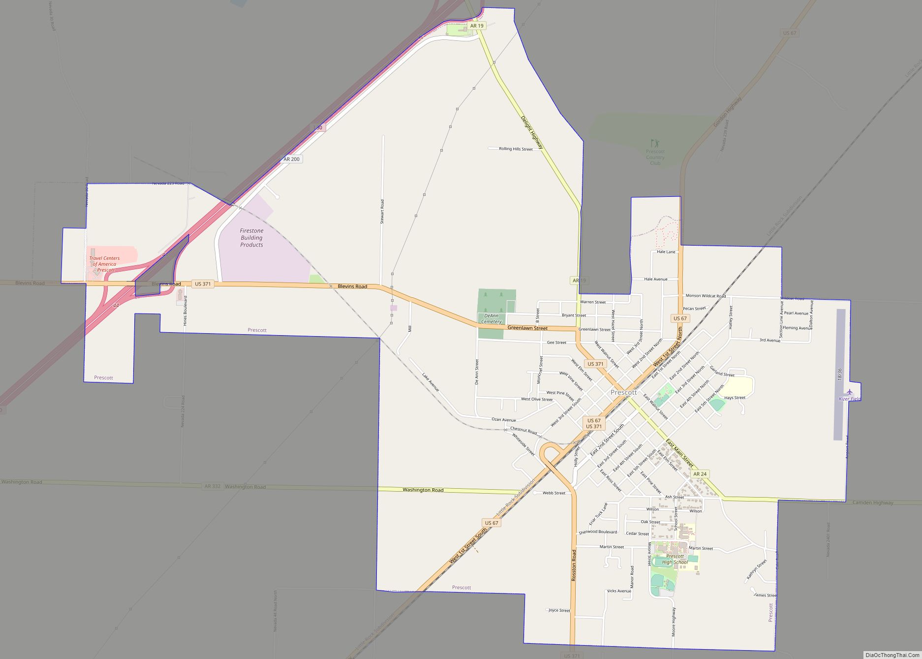
Online Interactive Map
Click on ![]() to view map in "full screen" mode.
to view map in "full screen" mode.
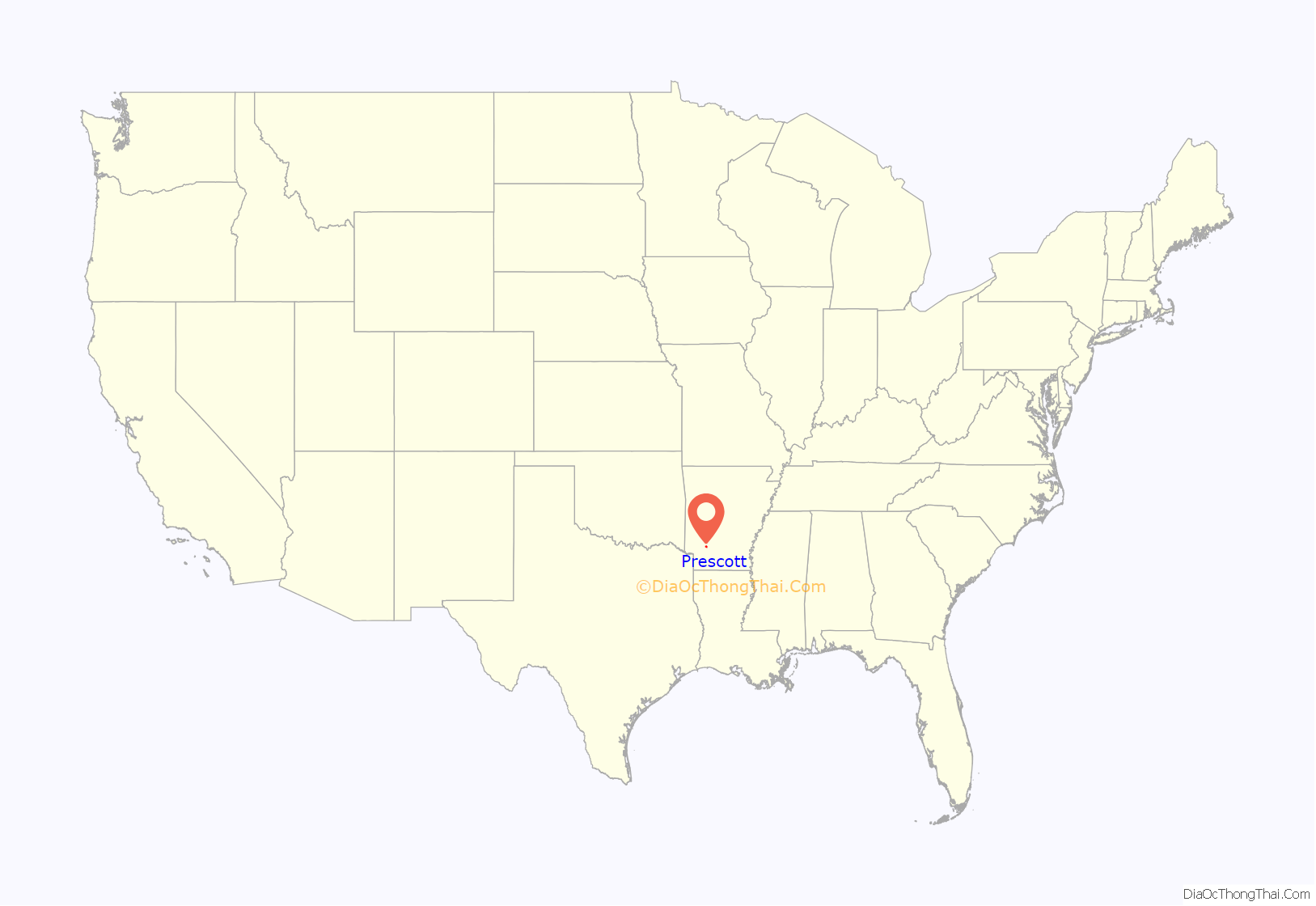
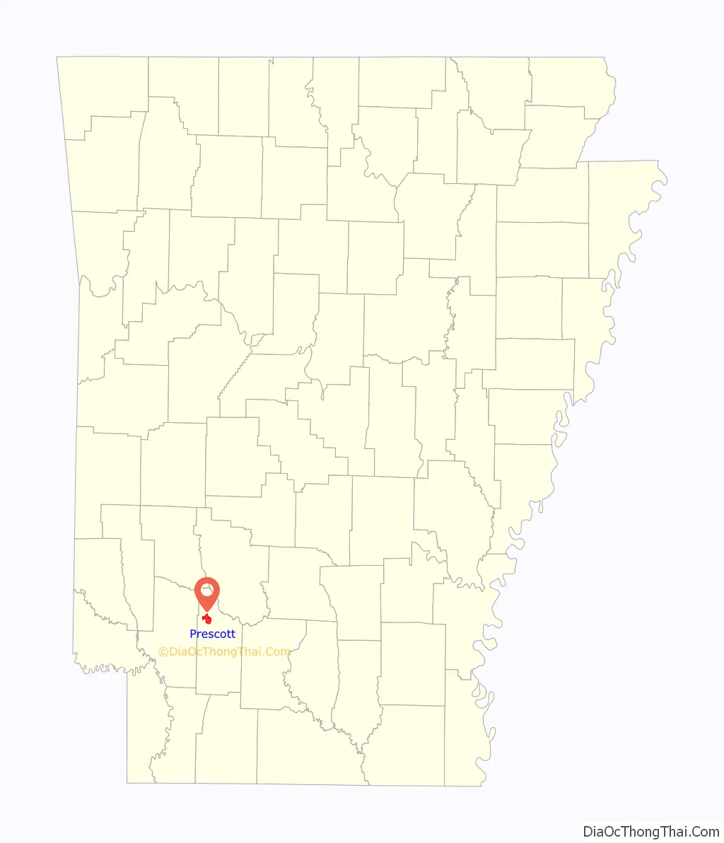
Prescott location map. Where is Prescott city?
History
The city of Prescott was not platted until 1873 during Reconstruction. It was to be a station stop for the Cairo & Fulton Railroad then under construction. The railroad was constructed parallel to the Southwest Trail through northern Nevada County. Prescott was incorporated on October 6, 1874.
The original town site consisted of 48 blocks, 24 on each side of the railroad. The streets were platted in a grid pattern from the railroad line. Streets running east–west use the railroad as a dividing line between their eastern and western halves, and streets running north–south use Main Street as a dividing line between their northern and southern halves.
Prescott grew quickly because the railroad provided a reliable way to transport local products to larger markets. The first post office opened in November 1873, and the first newspaper, The Banner, was established in 1875. The Nevada County seat was moved to Prescott in 1877, which contributed to the town’s commercial importance. It became a center of law and government in the county. By the late 1890s, Prescott had its own telephone system and water and light plant.
The timber industry became important to the region’s early economy when in 1890, James H. Bemis & Benjamin Whitaker built the Ozan Lumber Company plant in Prescott. That same year, Dr. R. L. Powers began constructing the Prescott & Northwestern Railroad. It transported lumber, peaches, cotton and other products. It also provided passenger service, connecting adjacent communities to the Missouri Pacific Railroad Depot in Prescott.
Historians have speculated on the naming of Prescott: whether it was named after William Hickling Prescott, of Salem, Massachusetts, who was a friend of Cairo & Fulton Railroad officials Thomas Allen and Henry Marquand, or where it was named after the County Surveyor, W. H. Prescott.
Prescott Road Map
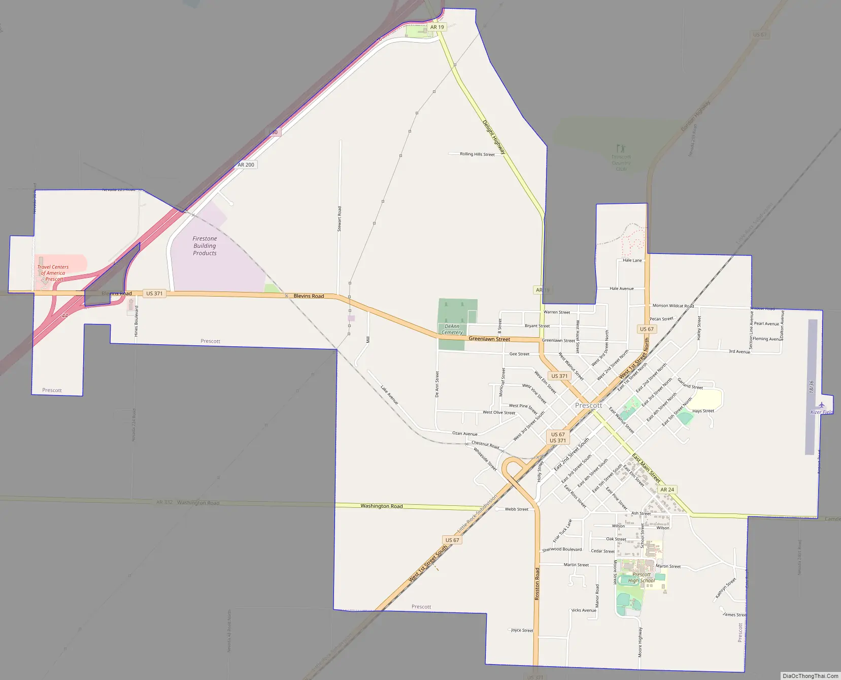
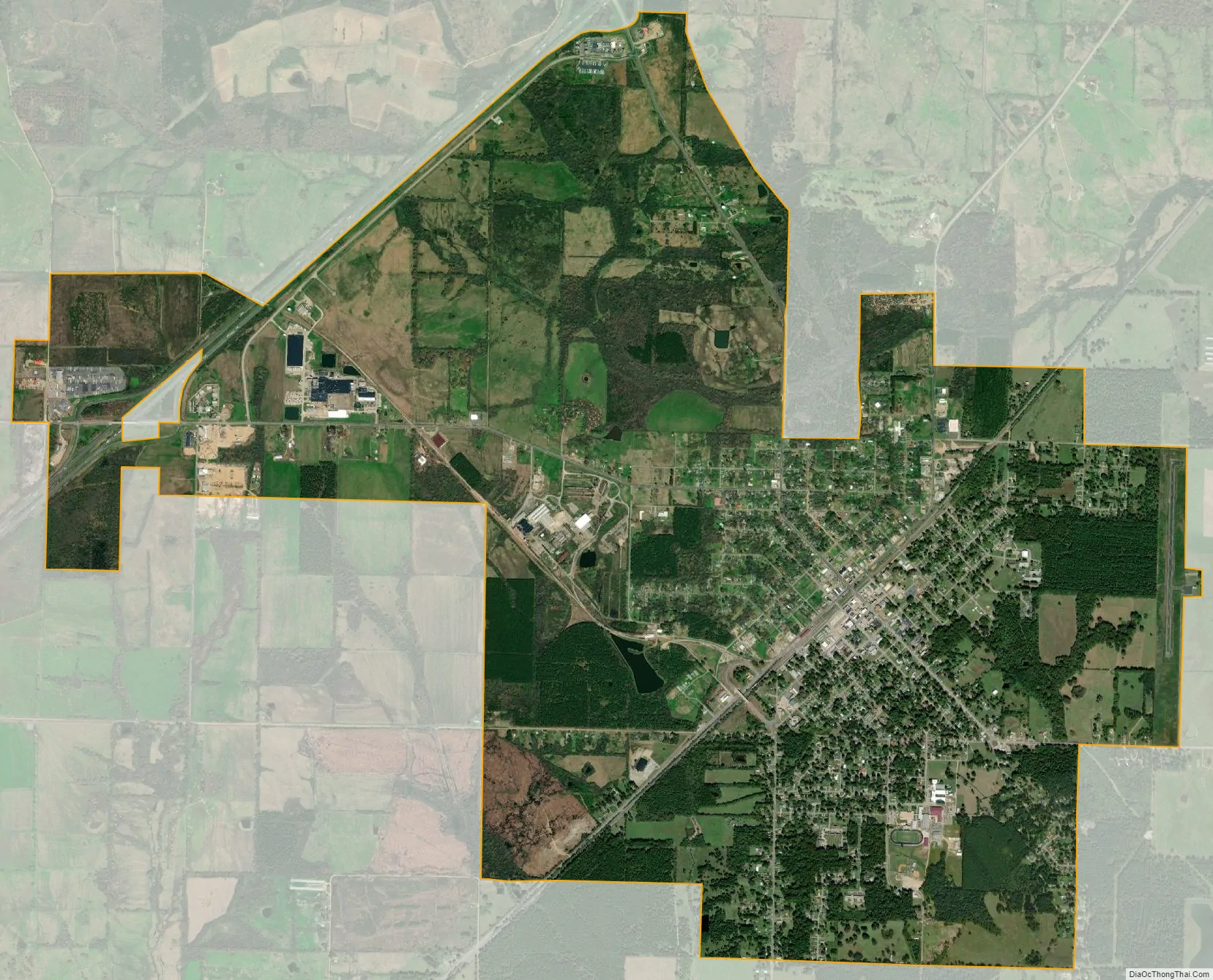
Prescott city Satellite Map
Geography
Prescott is located at 33°48′9″N 93°22′55″W / 33.80250°N 93.38194°W / 33.80250; -93.38194 (33.802614, -93.381884) on south-southwest section of Prairie D’Âne. The large open prairie was named by French colonists and is located in the Arkansas Timberlands region of the Ark-La-Tex. Prescott is situated in the Gulf Coastal Plain, near the Little Missouri River. This waterway provides Prescott with drinking water and recreational opportunities.
According to the United States Census Bureau, the city has a total area of 6.5 square miles (17 km), of which 6.5 square miles (17 km) is land and 0.15% is water.
See also
Map of Arkansas State and its subdivision:- Arkansas
- Ashley
- Baxter
- Benton
- Boone
- Bradley
- Calhoun
- Carroll
- Chicot
- Clark
- Clay
- Cleburne
- Cleveland
- Columbia
- Conway
- Craighead
- Crawford
- Crittenden
- Cross
- Dallas
- Desha
- Drew
- Faulkner
- Franklin
- Fulton
- Garland
- Grant
- Greene
- Hempstead
- Hot Spring
- Howard
- Independence
- Izard
- Jackson
- Jefferson
- Johnson
- Lafayette
- Lawrence
- Lee
- Lincoln
- Little River
- Logan
- Lonoke
- Madison
- Marion
- Miller
- Mississippi
- Monroe
- Montgomery
- Nevada
- Newton
- Ouachita
- Perry
- Phillips
- Pike
- Poinsett
- Polk
- Pope
- Prairie
- Pulaski
- Randolph
- Saint Francis
- Saline
- Scott
- Searcy
- Sebastian
- Sevier
- Sharp
- Stone
- Union
- Van Buren
- Washington
- White
- Woodruff
- Yell
- Alabama
- Alaska
- Arizona
- Arkansas
- California
- Colorado
- Connecticut
- Delaware
- District of Columbia
- Florida
- Georgia
- Hawaii
- Idaho
- Illinois
- Indiana
- Iowa
- Kansas
- Kentucky
- Louisiana
- Maine
- Maryland
- Massachusetts
- Michigan
- Minnesota
- Mississippi
- Missouri
- Montana
- Nebraska
- Nevada
- New Hampshire
- New Jersey
- New Mexico
- New York
- North Carolina
- North Dakota
- Ohio
- Oklahoma
- Oregon
- Pennsylvania
- Rhode Island
- South Carolina
- South Dakota
- Tennessee
- Texas
- Utah
- Vermont
- Virginia
- Washington
- West Virginia
- Wisconsin
- Wyoming