Map of Sheridan city

Map of Sheridan city, Arkansas

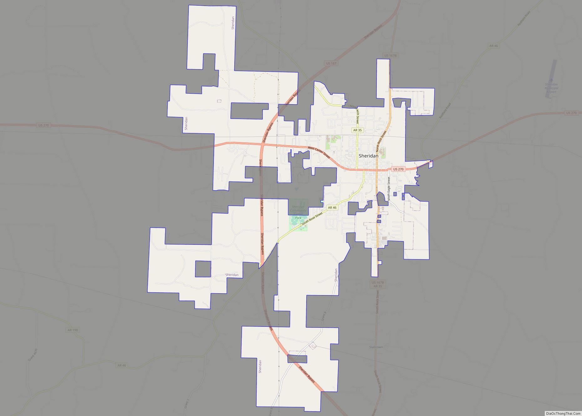
Sheridan is a city and county seat of Grant County, Arkansas, United States. The community is located deep in the forests of the Arkansas Timberlands. It sits at the intersection of US Highways 167 and 270. Early settlers were drawn to the area by the native timber, which is still a very important part of … Read more

Map of Shannon Hills city

Map of Shannon Hills city

Shannon Hills is a city in Saline County, Arkansas, United States. The population was 3,143 at the 2010 census. It is part of the Little Rock–North Little Rock–Conway Metropolitan Statistical Area. Shannon Hills city overview: Name: Shannon Hills city LSAD Code: 25 LSAD Description: city (suffix) State: Arkansas County: Saline County Elevation: 331 ft (101 m) Total … Read more

Map of Sidney town

Map of Sidney town, Arkansas

Sidney is a town in Sharp County, Arkansas, United States. The population was 181 at the 2010 census. Sidney town overview: Name: Sidney town LSAD Code: 43 LSAD Description: town (suffix) State: Arkansas County: Sharp County Elevation: 646 ft (197 m) Total Area: 2.09 sq mi (5.40 km²) Land Area: 2.09 sq mi (5.40 km²) Water Area: 0.00 sq mi (0.00 km²) Total Population: 192 Population … Read more

Map of Shirley town

Map of Shirley town, Arkansas

Shirley is a town in northeast Van Buren County, Arkansas, United States, along the Middle Fork of the Little Red River. A one-time railroad outpost, the community today is oriented toward agriculture and recreational activities due to the river and Greers Ferry Lake. The population was 223 at the 2010 census. Shirley town overview: Name: … Read more

Map of Sherwood city

Map of Sherwood city, Arkansas

Sherwood is a city in Pulaski County, Arkansas, United States. As of the 2020 census, the population of the city was 32,731. It is part of the Little Rock−North Little Rock−Conway Metropolitan Statistical Area with 699,757 people according to the 2010 census. Sherwood city overview: Name: Sherwood city LSAD Code: 25 LSAD Description: city (suffix) … Read more

Map of Smithville town

Map of Smithville town, Arkansas

Smithville is a town in Lawrence County, Arkansas, United States. The population was 78 at the 2010 census. Smithville town overview: Name: Smithville town LSAD Code: 43 LSAD Description: town (suffix) State: Arkansas County: Lawrence County Elevation: 351 ft (107 m) Total Area: 0.67 sq mi (1.73 km²) Land Area: 0.67 sq mi (1.73 km²) Water Area: 0.00 sq mi (0.00 km²) Total Population: 87 Population … Read more

Map of Smackover city

Map of Smackover city

Smackover is a small city in northern Union County, Arkansas, United States. According to the 2010 census, the population was at 1,865. It had a large oil boom in the 1920s, with production continuing for some time. Smackover city overview: Name: Smackover city LSAD Code: 25 LSAD Description: city (suffix) State: Arkansas County: Union County … Read more

Map of Siloam Springs city

Map of Siloam Springs city

Siloam Springs is a city in Benton County, Arkansas, United States, and located on the western edge of the Northwest Arkansas metropolitan area. As of the 2020 census, the population of the city was 17,287. The community was founded in 1882 and was characterized by the purported healing powers of the spring water feeding Sager … Read more

Map of Southside city, Arkansas

Map of Southside city, Arkansas

Southside is an incorporated city located in Independence County, Arkansas, United States. The elevation of Southside is 354 feet (108 m). The spur route of Arkansas Highway 14 connects Southside with Salado. Southside city overview: Name: Southside city LSAD Code: 25 LSAD Description: city (suffix) State: Arkansas County: Independence County Incorporated: 2014 Elevation: 374 ft (114 m) Total Area: … Read more

Map of South Lead Hill town

Map of South Lead Hill town

South Lead Hill is a town in Boone County, Arkansas, United States. The population was 102 at the 2010 census. It is part of the Harrison Micropolitan Statistical Area. South Lead Hill town overview: Name: South Lead Hill town LSAD Code: 43 LSAD Description: town (suffix) State: Arkansas County: Boone County Elevation: 840 ft (256 m) Total … Read more

Map of Sparkman city

Map of Sparkman city

Sparkman is a city in Dallas County, Arkansas, United States. The population was 427 at the 2010 census, down from 586 in 2000. Sparkman city overview: Name: Sparkman city LSAD Code: 25 LSAD Description: city (suffix) State: Arkansas County: Dallas County Elevation: 171 ft (52 m) Total Area: 1.29 sq mi (3.34 km²) Land Area: 1.29 sq mi (3.34 km²) Water Area: 0.00 sq mi … Read more

Map of St. Francis city

Map of St. Francis city, Arkansas

St. Francis is a city in northeastern Clay County, Arkansas, United States, along the St. Francis River. The population was 250 at the 2010 census. St. Francis city overview: Name: St. Francis city LSAD Code: 25 LSAD Description: city (suffix) State: Arkansas County: Clay County Elevation: 299 ft (91 m) Total Area: 0.37 sq mi (0.95 km²) Land Area: 0.35 sq mi … Read more