Siloam Springs is a city in Benton County, Arkansas, United States, and located on the western edge of the Northwest Arkansas metropolitan area. As of the 2020 census, the population of the city was 17,287. The community was founded in 1882 and was characterized by the purported healing powers of the spring water feeding Sager Creek and trading with nearby Native American tribes. The city shares a border on the Arkansas-Oklahoma state line with the city of West Siloam Springs, Oklahoma, which is within the Cherokee Nation territory. It is home of John Brown University.
| Name: | Siloam Springs city |
|---|---|
| LSAD Code: | 25 |
| LSAD Description: | city (suffix) |
| State: | Arkansas |
| County: | Benton County |
| Incorporated: | December 22, 1881 |
| Elevation: | 1,132 ft (345 m) |
| Total Area: | 11.92 sq mi (30.87 km²) |
| Land Area: | 11.75 sq mi (30.43 km²) |
| Water Area: | 0.17 sq mi (0.45 km²) |
| Total Population: | 17,287 |
| Population Density: | 1,471.61/sq mi (568.18/km²) |
| ZIP code: | 72761 |
| Area code: | 479 |
| FIPS code: | 0564370 |
| GNISfeature ID: | 0078364 |
| Website: | siloamsprings.com |
Online Interactive Map
Click on ![]() to view map in "full screen" mode.
to view map in "full screen" mode.
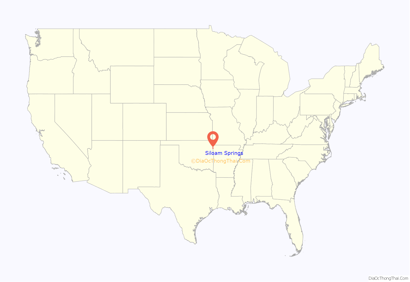
Siloam Springs location map. Where is Siloam Springs city?
History
Osage Indians were the known first inhabitants of the area. Siloam Springs’ first white settlers were of German and Scots-Irish origin. Simon Sager is considered the founder of the town, then known as Hico.
In 2012, the city was named one of the 20 best small towns in America by Smithsonian magazine
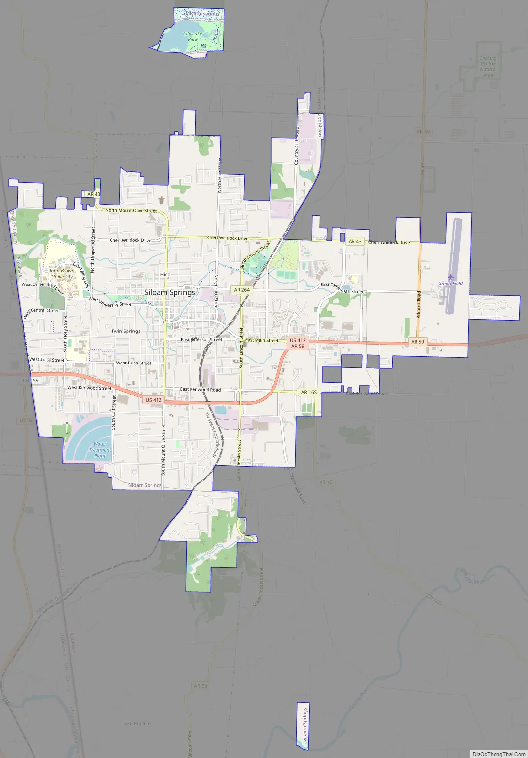
Siloam Springs Road Map
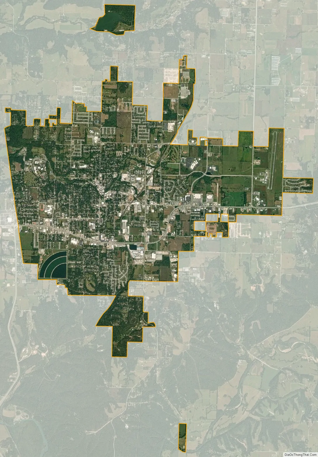
Siloam Springs city Satellite Map
Geography
The area is located in the Mid-South region of the country where the southern plains meet the Ozark Mountains. The city sits atop a plateau with many dogwood trees growing across the landscape.
A perennial creek, named after the founder, Sager Creek, flows through the downtown area.
According to the United States Census Bureau, the city has a total area of 11.2 square miles (28.9 km), of which 11.1 square miles (28.7 km) is land and 0.077 square miles (0.2 km), or 0.71%, is water.
Metropolitan area
The Fayetteville–Springdale–Rogers Metropolitan Area consists of three Arkansas counties: Benton, Madison, and Washington, and McDonald County, Missouri. The area had a population of 347,045 at the 2000 census which had increased to 463,204 by the 2010 Census (an increase of 33.47 percent). Siloam Springs is at the extreme western edge of this area, connected to the principal cities by Highway 412.
Climate
The climate in this area is characterized by hot, humid summers and generally mild to cool winters. According to the Köppen Climate Classification system, Siloam Springs has a humid subtropical climate, abbreviated “Cfa” on climate maps.
July is the hottest month of the year, with an average high of 89.1 °F (31.7 °C) and an average low of 68.6 °F (20.3 °C). Temperatures above 100 °F (37.8 °C) are rare but not uncommon, occurring on average twice a year. January is the coldest month with an average high of 44.3 °F (6.8 °C) and an average low of 24.2 °F (−4.3 °C). Highs below 32 °F (0.0 °C) occur on average thirteen times a year, with 2.2 nights per year dropping below 0 °F (−17.8 °C). The city’s highest temperature was 111 °F (43.9 °C), recorded on July 14, 1954. The lowest temperature recorded was −24 °F (−31.1 °C), on February 12, 1899.
Precipitation is weakly seasonal, with a bimodal pattern: wet seasons in the spring and fall, and relatively drier summers and winters, but some rain in all months. The spring wet season is more pronounced than fall, with the highest rainfall in May. This differs slightly from the climate in central Arkansas, where the fall wet season is more comparable to spring.
See also
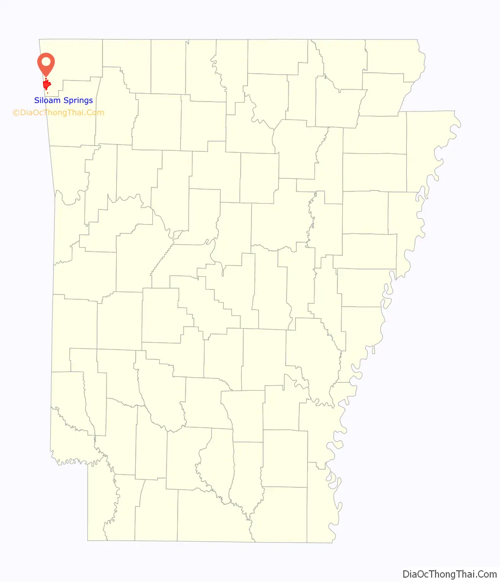
Map of Arkansas State and its subdivision:- Arkansas
- Ashley
- Baxter
- Benton
- Boone
- Bradley
- Calhoun
- Carroll
- Chicot
- Clark
- Clay
- Cleburne
- Cleveland
- Columbia
- Conway
- Craighead
- Crawford
- Crittenden
- Cross
- Dallas
- Desha
- Drew
- Faulkner
- Franklin
- Fulton
- Garland
- Grant
- Greene
- Hempstead
- Hot Spring
- Howard
- Independence
- Izard
- Jackson
- Jefferson
- Johnson
- Lafayette
- Lawrence
- Lee
- Lincoln
- Little River
- Logan
- Lonoke
- Madison
- Marion
- Miller
- Mississippi
- Monroe
- Montgomery
- Nevada
- Newton
- Ouachita
- Perry
- Phillips
- Pike
- Poinsett
- Polk
- Pope
- Prairie
- Pulaski
- Randolph
- Saint Francis
- Saline
- Scott
- Searcy
- Sebastian
- Sevier
- Sharp
- Stone
- Union
- Van Buren
- Washington
- White
- Woodruff
- Yell
- Alabama
- Alaska
- Arizona
- Arkansas
- California
- Colorado
- Connecticut
- Delaware
- District of Columbia
- Florida
- Georgia
- Hawaii
- Idaho
- Illinois
- Indiana
- Iowa
- Kansas
- Kentucky
- Louisiana
- Maine
- Maryland
- Massachusetts
- Michigan
- Minnesota
- Mississippi
- Missouri
- Montana
- Nebraska
- Nevada
- New Hampshire
- New Jersey
- New Mexico
- New York
- North Carolina
- North Dakota
- Ohio
- Oklahoma
- Oregon
- Pennsylvania
- Rhode Island
- South Carolina
- South Dakota
- Tennessee
- Texas
- Utah
- Vermont
- Virginia
- Washington
- West Virginia
- Wisconsin
- Wyoming