Sheridan is a city and county seat of Grant County, Arkansas, United States. The community is located deep in the forests of the Arkansas Timberlands. It sits at the intersection of US Highways 167 and 270. Early settlers were drawn to the area by the native timber, which is still a very important part of Sheridan’s economy, although the city has diversified into several other industries. Sheridan’s history also includes a college, Missionary Baptist College, until its closure in 1934, and a series of conflicts during the Civil Rights Movement. Located at the southern end of the Central Arkansas region, Sheridan has been experiencing a population boom in recent years, as indicated by a 49% growth in population between the 1990 and 2010 censuses. The population as of the 2010 census was 4,603.
| Name: | Sheridan city |
|---|---|
| LSAD Code: | 25 |
| LSAD Description: | city (suffix) |
| State: | Arkansas |
| County: | Grant County |
| Incorporated: | August 26, 1887(135 years ago) (1887-08-26) |
| Elevation: | 278 ft (84 m) |
| Total Area: | 12.20 sq mi (31.59 km²) |
| Land Area: | 12.19 sq mi (31.58 km²) |
| Water Area: | 0.00 sq mi (0.01 km²) |
| Total Population: | 4,920 |
| Population Density: | 403.48/sq mi (155.78/km²) |
| ZIP code: | 72150 |
| Area code: | 870 |
| FIPS code: | 0563710 |
| GNISfeature ID: | 54764 |
| Website: | www.sheridanark.com |
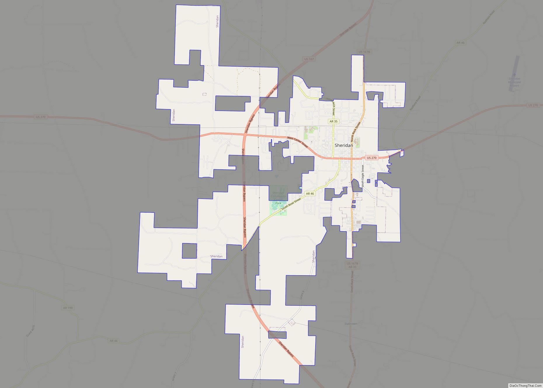
Online Interactive Map
Click on ![]() to view map in "full screen" mode.
to view map in "full screen" mode.
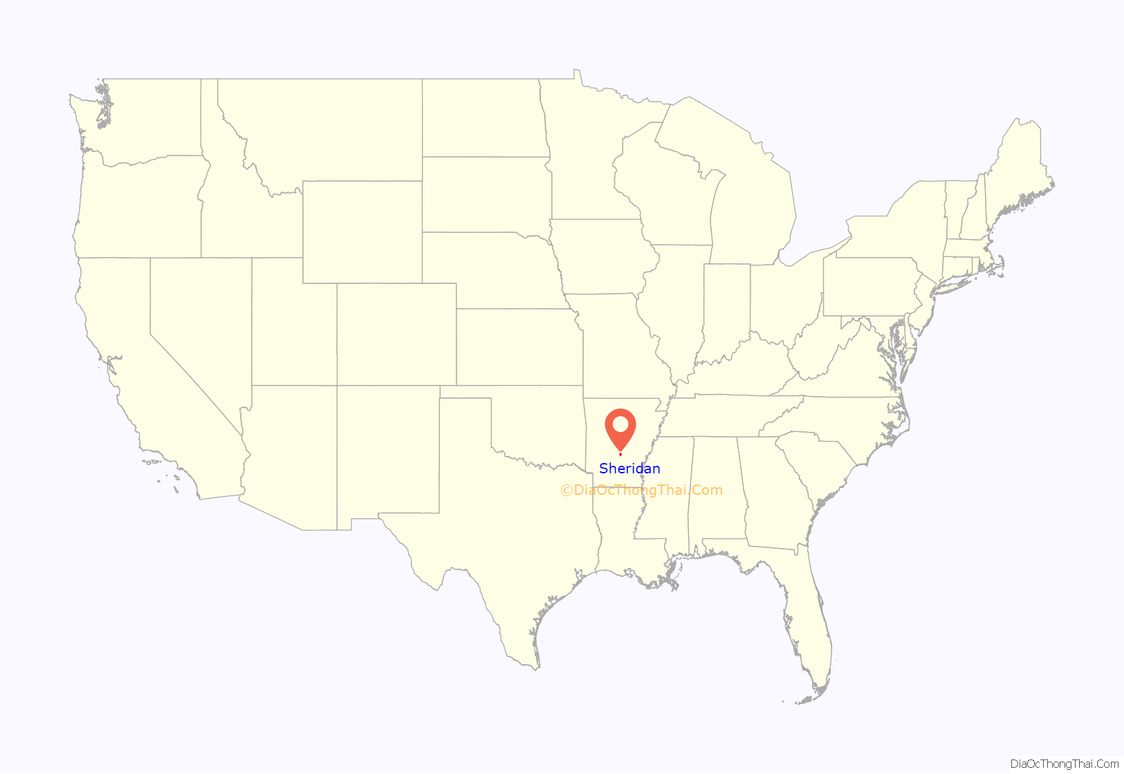
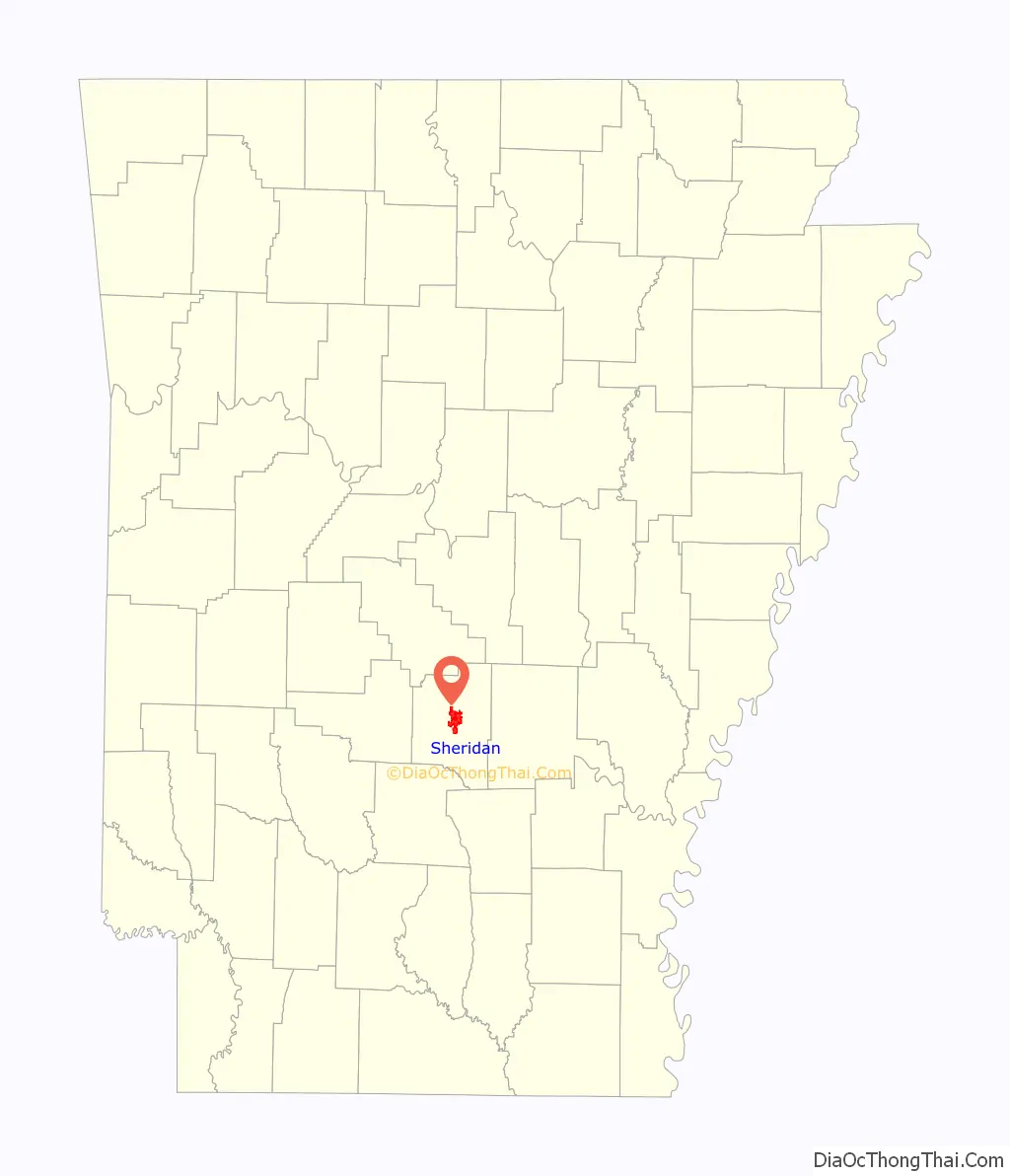
Sheridan location map. Where is Sheridan city?
History
Louisiana Purchase through Early Statehood
In 1818–1824, the land that Sheridan currently occupies was the site of a Quapaw reservation. After the Indian Removal Act of 1830, the Quapaw were removed from the land and pushed further west. By 1833 most of the natives had been moved westward and the land was ceded to the United States.
Eponym
Sheridan was named after Lieutenant-General Philip Sheridan, who served as the 8th Commanding General of the United States Army from 1883 to 1888.
Settlement through the Gilded Age
The first white settler was Dr. Richard C. Rhodes, a native of North Carolina.
At the beginning of the 20th century, a railroad passed through Sheridan south into Dallas County. The railroad, owned by E. S. McCarty, carried freight and passengers for hire.
From 1917 to 1934, Missionary Baptist College operated in Sheridan. The college suffered from financial troubles due to the Great Depression. The college provided local residents with courses, not only in theology, but in Latin, Greek, physiology, ecclesiology, and expression. A 1920 bulletin issued by the college wrote that its goal was “to teach and emphasize the very principles for which the real Baptists of Arkansas stand and for which true Baptists have stood for almost nineteen centuries . . . this is no preacher manufacturing establishment [that] the Lord alone has the prerogative of calling men to preach the gospel.” The revamped Missionary Baptist Seminary thereafter opened in Little Rock.
Mid-twentieth century
In 1943, Jewell Williams, a Jehovah’s Witness, was convicted in the Mayor’s Court for selling Bibles without a permit under Sheridan City Ord. No. 50. and fined $10. On a trial de novo, he obtained the same result. Williams joined other members of his faith and appealed similar convictions occurring across the state to the Arkansas Supreme Court in Berry v. City of Hope, challenging the city ordinance as unconstitutional under the First Amendment. The court agreed and held the ordinances unconstitutional.
The “Mighty 1090” KAAY radio station sponsored the Rebel Springs Rock Festival of 1973 5 miles (8 km) east of Sheridan on Highway 270 that included ZZ Top as a headliner. Tickets were $4 before the show and lasted three days, July 4–6, 1973. The National Guard was sent out to maintain “peace”. Local property owners attempted to get a court-ordered injunction to halt the festival from talking place, on the legal theory of nuisance, but to no avail.
In 1954, Sheridan’s school board voted to comply with the Supreme Court’s decision in Brown vs Board of Education. Sheridan had operated an elementary school for Black children and bused its Black high school students to schools in other counties The protests were so severe that the school board reversed itself the following night. Then, local sawmill owner Jack Williams told his Black employees that they could accept his offer to buy out their homes and give them to the employees, and all move 25 miles west to the town of Malvern. Black residents had no choice, for Williams told them that “if a family refused to move, he would evict them and burn down their home.” This left Sheridan as a sundown town, and instead of becoming “one of the most racially progressive towns in Arkansas if its initial school board decision had stood, instead became one of its most backward.” Loewen’s research describes the fact that “no Sheridan resident lifted a voice to protest the forced buyout of its black community” and a “reputation for bigotry when their high school played interracial teams in athletic contests.”
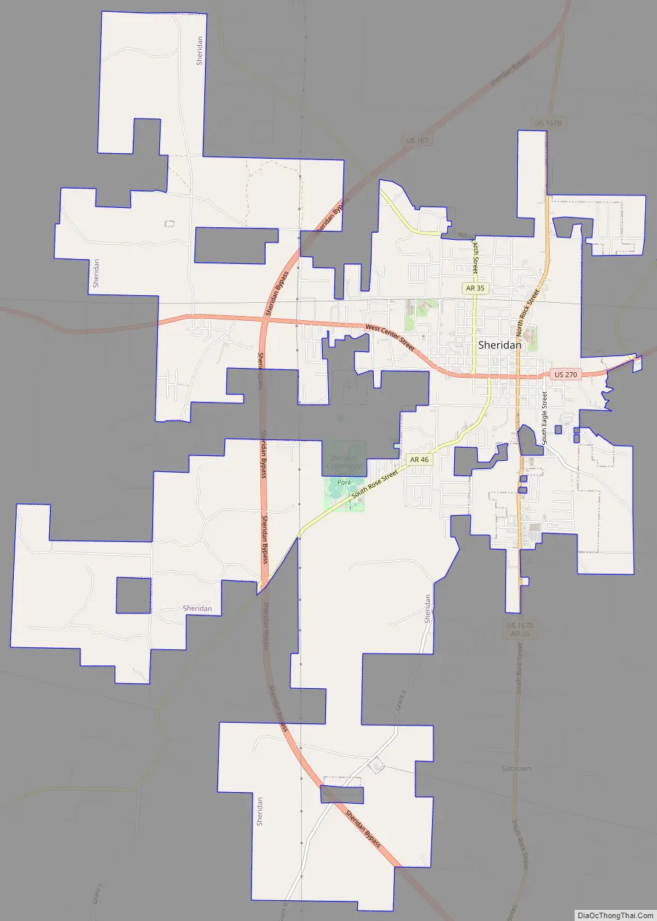
Sheridan Road Map
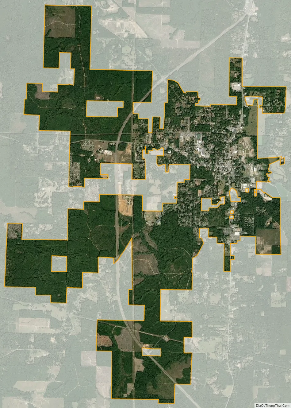
Sheridan city Satellite Map
See also
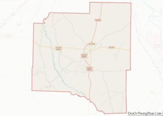
Map of Arkansas State and its subdivision:- Arkansas
- Ashley
- Baxter
- Benton
- Boone
- Bradley
- Calhoun
- Carroll
- Chicot
- Clark
- Clay
- Cleburne
- Cleveland
- Columbia
- Conway
- Craighead
- Crawford
- Crittenden
- Cross
- Dallas
- Desha
- Drew
- Faulkner
- Franklin
- Fulton
- Garland
- Grant
- Greene
- Hempstead
- Hot Spring
- Howard
- Independence
- Izard
- Jackson
- Jefferson
- Johnson
- Lafayette
- Lawrence
- Lee
- Lincoln
- Little River
- Logan
- Lonoke
- Madison
- Marion
- Miller
- Mississippi
- Monroe
- Montgomery
- Nevada
- Newton
- Ouachita
- Perry
- Phillips
- Pike
- Poinsett
- Polk
- Pope
- Prairie
- Pulaski
- Randolph
- Saint Francis
- Saline
- Scott
- Searcy
- Sebastian
- Sevier
- Sharp
- Stone
- Union
- Van Buren
- Washington
- White
- Woodruff
- Yell
- Alabama
- Alaska
- Arizona
- Arkansas
- California
- Colorado
- Connecticut
- Delaware
- District of Columbia
- Florida
- Georgia
- Hawaii
- Idaho
- Illinois
- Indiana
- Iowa
- Kansas
- Kentucky
- Louisiana
- Maine
- Maryland
- Massachusetts
- Michigan
- Minnesota
- Mississippi
- Missouri
- Montana
- Nebraska
- Nevada
- New Hampshire
- New Jersey
- New Mexico
- New York
- North Carolina
- North Dakota
- Ohio
- Oklahoma
- Oregon
- Pennsylvania
- Rhode Island
- South Carolina
- South Dakota
- Tennessee
- Texas
- Utah
- Vermont
- Virginia
- Washington
- West Virginia
- Wisconsin
- Wyoming