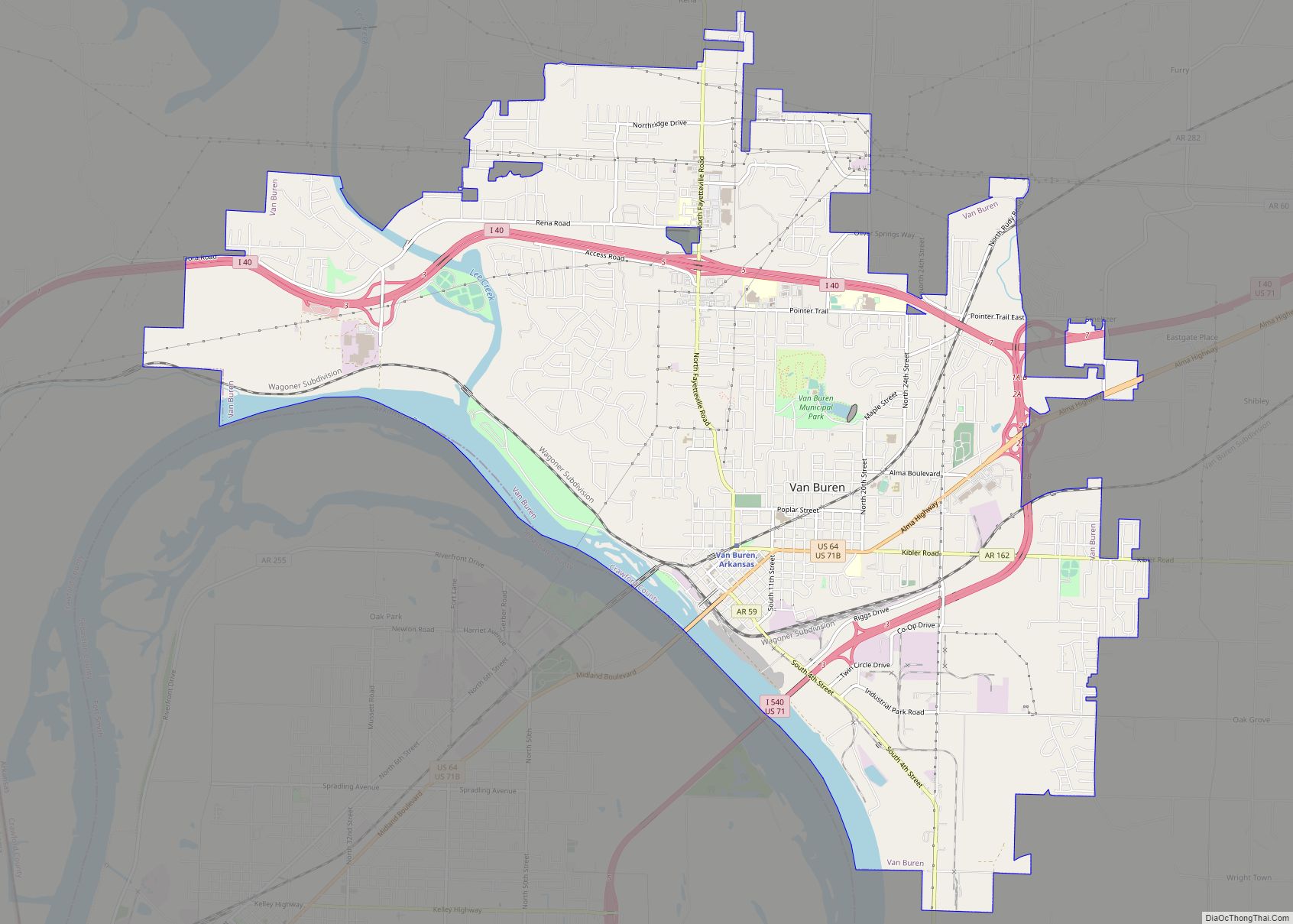
Map of Valley Springs town

Map of Valley Springs town, Arkansas

Valley Springs is a town in Boone County, Arkansas, United States. The population was 175 at the 2010 census. It is part of the Harrison Micropolitan Statistical Area. Valley Springs town overview: Name: Valley Springs town LSAD Code: 43 LSAD Description: town (suffix) State: Arkansas County: Boone County Elevation: 1,086 ft (331 m) Total Area: 0.51 sq mi (1.33 km²) … Read more

Map of Ulm town

Map of Ulm town, Arkansas

Ulm /ˈʊ.ləm/ is a town in Prairie County, Arkansas, United States. The population was 205 at the 2000 census. Ulm town overview: Name: Ulm town LSAD Code: 43 LSAD Description: town (suffix) State: Arkansas County: Prairie County Elevation: 207 ft (63 m) Total Area: 0.26 sq mi (0.68 km²) Land Area: 0.26 sq mi (0.68 km²) Water Area: 0.00 sq mi (0.00 km²) Total Population: 175 … Read more

Map of Vilonia city

Map of Vilonia city

Vilonia is a city in Faulkner County, Arkansas, United States. Its population was 3,815 at the 2010 census, up from 2,106 at the 2000 census. It is part of the Little Rock–North Little Rock–Conway Metropolitan Statistical Area. Its population is now 4,429 as of 2021. Vilonia city overview: Name: Vilonia city LSAD Code: 25 LSAD … Read more

Map of Victoria town

Map of Victoria town, Arkansas

Victoria is a town in Mississippi County, Arkansas, United States. The population was 20 as of the 2020 census, down from 37 in 2010. It is named after a sister of the town’s founder, Robert E. Lee Wilson. Victoria town overview: Name: Victoria town LSAD Code: 43 LSAD Description: town (suffix) State: Arkansas County: Mississippi … Read more

Map of Vandervoort town

Map of Vandervoort town

Vandervoort is a town in Polk County, Arkansas, United States. The population was 120 at the 2000 census. The place is named in honor of the mother of an important early-20th-century railway financier, Jan de Goeijen. Her maiden name was Van der Voort. Vandervoort town overview: Name: Vandervoort town LSAD Code: 43 LSAD Description: town … Read more

Map of Waldenburg town

Map of Waldenburg town

Waldenburg is a town in Poinsett County, Arkansas, United States. The population was 80 at the 2000 census. It is included in the Jonesboro, Arkansas Metropolitan Statistical Area. Waldenburg is home to Zion Lutheran Church. Zion was founded in 1881 and is a member congregation of the Lutheran Church–Missouri Synod. Waldenburg town overview: Name: Waldenburg … Read more

Map of Wabbaseka town

Map of Wabbaseka town

Wabbaseka is a town in Dunnington Township, Jefferson County, Arkansas, United States. Its population was 255 at the 2010 U.S. census. It is included in the Pine Bluff, Arkansas Metropolitan Statistical Area. Wabbaseka town overview: Name: Wabbaseka town LSAD Code: 43 LSAD Description: town (suffix) State: Arkansas County: Jefferson County Incorporated: April 12, 1920; 103 years … Read more

Map of Viola town

Map of Viola town, Arkansas

Viola is a town in Fulton County, Arkansas, United States. The population was 337 at the 2010 census, down from 381 in 2000. Viola town overview: Name: Viola town LSAD Code: 43 LSAD Description: town (suffix) State: Arkansas County: Fulton County Elevation: 879 ft (268 m) Total Area: 1.57 sq mi (4.08 km²) Land Area: 1.57 sq mi (4.07 km²) Water Area: 0.00 sq mi … Read more

Map of Walnut Ridge city

Map of Walnut Ridge city

Walnut Ridge is a city in Lawrence County, Arkansas, United States. The population was 5,098 at the United States Census’s 2019 estimate. The city is the county seat of Lawrence County. Walnut Ridge lies immediately north of Hoxie. The two towns form a contiguous urban area with approximately 8,000 residents. Williams Baptist University is in … Read more

Map of Waldron city

Map of Waldron city, Arkansas

Waldron is a city in Scott County, Arkansas, United States. Its population was 3,386 at the 2020 census. The city is the county seat of Scott County. Waldron city overview: Name: Waldron city LSAD Code: 25 LSAD Description: city (suffix) State: Arkansas County: Scott County Incorporated: December 17, 1852 Elevation: 659 ft (201 m) Total Area: 5.72 sq mi … Read more

Map of Waldo city, Arkansas

Map of Waldo city, Arkansas

Waldo is a town in Columbia County, Arkansas, United States. The population was 1,372 at the 2010 census. Waldo city overview: Name: Waldo city LSAD Code: 25 LSAD Description: city (suffix) State: Arkansas County: Columbia County Elevation: 361 ft (110 m) Total Area: 2.20 sq mi (5.69 km²) Land Area: 2.19 sq mi (5.68 km²) Water Area: 0.00 sq mi (0.00 km²) Total Population: 1,151 Population … Read more

Map of Washington city

Map of Washington city, Arkansas

Washington is a city in Ozan Township, Hempstead County, Arkansas, United States. The population was 180 at the 2010 census, up from 148 in 2000. It is part of the Hope Micropolitan Statistical Area. The city is home to Historic Washington State Park. Washington city overview: Name: Washington city LSAD Code: 25 LSAD Description: city … Read more