Washington is a city in Ozan Township, Hempstead County, Arkansas, United States. The population was 180 at the 2010 census, up from 148 in 2000. It is part of the Hope Micropolitan Statistical Area. The city is home to Historic Washington State Park.
| Name: | Washington city |
|---|---|
| LSAD Code: | 25 |
| LSAD Description: | city (suffix) |
| State: | Arkansas |
| County: | Hempstead County |
| Incorporated: | 1880 |
| Elevation: | 443 ft (135 m) |
| Total Area: | 1.01 sq mi (2.61 km²) |
| Land Area: | 1.01 sq mi (2.61 km²) |
| Water Area: | 0.00 sq mi (0.00 km²) |
| Total Population: | 94 |
| Population Density: | 93.35/sq mi (36.03/km²) |
| ZIP code: | 71862 |
| Area code: | 870 |
| FIPS code: | 0573370 |
| GNISfeature ID: | 78702 |
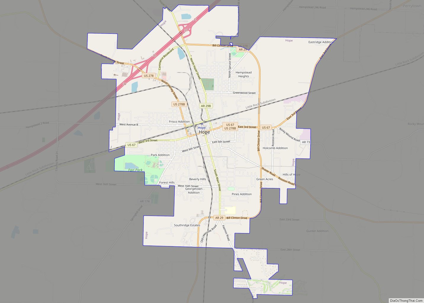
Online Interactive Map
Click on ![]() to view map in "full screen" mode.
to view map in "full screen" mode.
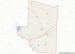
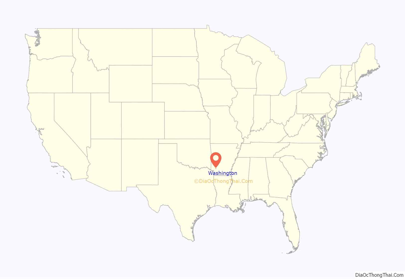
Washington location map. Where is Washington city?

History
From its establishment in 1824, Washington was an important stop on the rugged Southwest Trail for pioneers traveling to Texas. That same year it was established as the “seat of justice” for that area, and in 1825 the Hempstead County Court of Common Pleas was established, located in a building constructed next door to a tavern owned by early resident Elijah Stuart. Between 1832 and 1839 thousands of Choctaw American Indians passed through Washington on their way to Indian Territory. Frontiersmen and national heroes James Bowie, Sam Houston and Davy Crockett all traveled through Washington en route to the Alamo. Houston is believed to have planned parts of the revolt strategy in a tavern in Washington during 1834. James Black, a Washington blacksmith, is credited with creating a knife which became known as the iconic Bowie knife, carried by James Bowie.
During the War with Mexico, beginning in 1846, Washington became a rally point for volunteer troops on their way to serve with the US Army. Later, the town became a major service center for area planters, merchants and professionals. Following the capture of Little Rock by the Union Army in 1863, the pro-Confederate States of America state government moved the state government offices to Hot Springs for a short time, then ultimately based the state government out of Washington, making it the (rebel) state capital until 1865. Albert G. Simms (1882–1964), a United States representative from New Mexico, was born here. Following the construction of the Cairo and Fulton railroad eight miles to the south of Washington, which connected much of the state with Little Rock, the town began a slow decline. Now located on the area’s primary travel route, Hope took on Washington’s formerly important role.
Washington Road Map
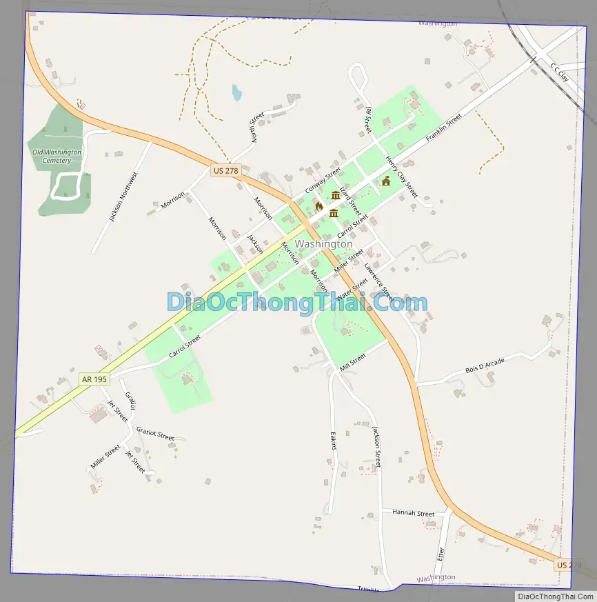
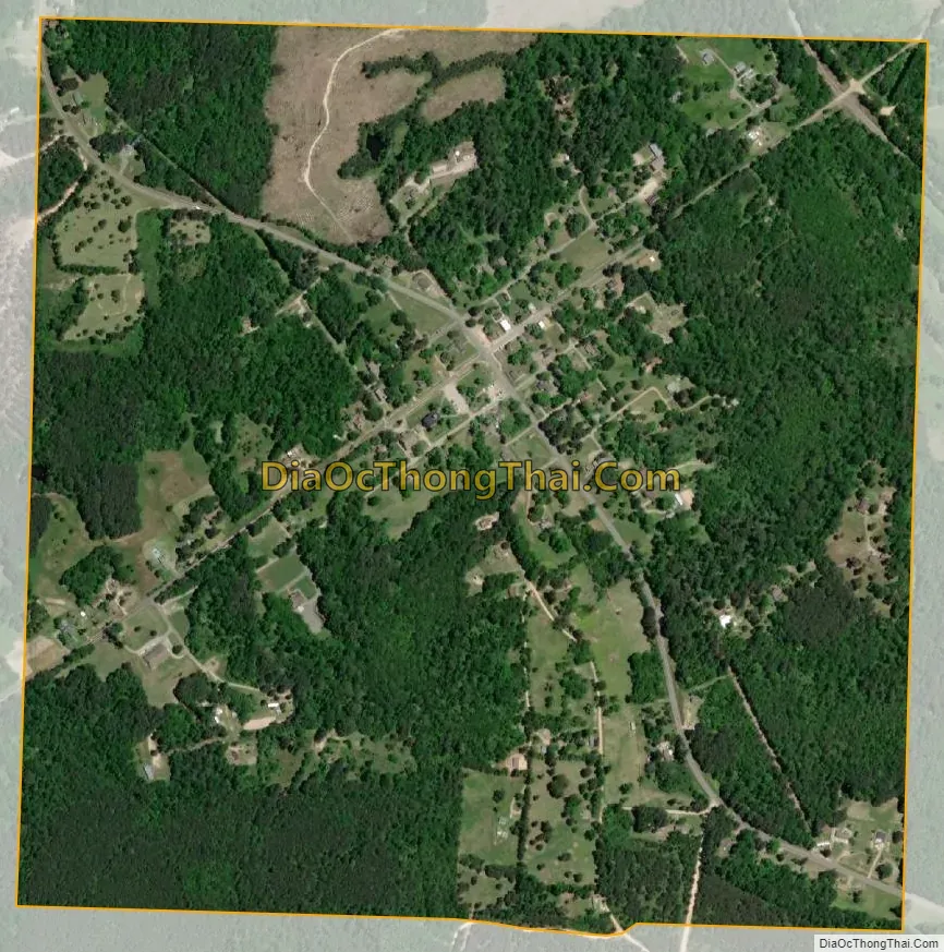
Washington city Satellite Map
Geography
Washington is in north-central Hempstead County, 10 miles (16 km) northwest of Hope, the county seat. U.S. Route 278 passes through Washington as Columbus Street, leading southeast to Hope and northwest 19 miles (31 km) to Nashville. Arkansas Highway 195 has its northern terminus in Washington and leads southwest 14 miles (23 km) to Fulton on the Red River.
According to the United States Census Bureau, Washington has a total area of 1.0 square mile (2.6 km), all land. The climate in this area is characterized by hot, humid summers and generally mild to cool winters. According to the Köppen Climate Classification system, Washington has a humid subtropical climate, abbreviated “Cfa” on climate maps.
See also
Map of Arkansas State and its subdivision:- Arkansas
- Ashley
- Baxter
- Benton
- Boone
- Bradley
- Calhoun
- Carroll
- Chicot
- Clark
- Clay
- Cleburne
- Cleveland
- Columbia
- Conway
- Craighead
- Crawford
- Crittenden
- Cross
- Dallas
- Desha
- Drew
- Faulkner
- Franklin
- Fulton
- Garland
- Grant
- Greene
- Hempstead
- Hot Spring
- Howard
- Independence
- Izard
- Jackson
- Jefferson
- Johnson
- Lafayette
- Lawrence
- Lee
- Lincoln
- Little River
- Logan
- Lonoke
- Madison
- Marion
- Miller
- Mississippi
- Monroe
- Montgomery
- Nevada
- Newton
- Ouachita
- Perry
- Phillips
- Pike
- Poinsett
- Polk
- Pope
- Prairie
- Pulaski
- Randolph
- Saint Francis
- Saline
- Scott
- Searcy
- Sebastian
- Sevier
- Sharp
- Stone
- Union
- Van Buren
- Washington
- White
- Woodruff
- Yell
- Alabama
- Alaska
- Arizona
- Arkansas
- California
- Colorado
- Connecticut
- Delaware
- District of Columbia
- Florida
- Georgia
- Hawaii
- Idaho
- Illinois
- Indiana
- Iowa
- Kansas
- Kentucky
- Louisiana
- Maine
- Maryland
- Massachusetts
- Michigan
- Minnesota
- Mississippi
- Missouri
- Montana
- Nebraska
- Nevada
- New Hampshire
- New Jersey
- New Mexico
- New York
- North Carolina
- North Dakota
- Ohio
- Oklahoma
- Oregon
- Pennsylvania
- Rhode Island
- South Carolina
- South Dakota
- Tennessee
- Texas
- Utah
- Vermont
- Virginia
- Washington
- West Virginia
- Wisconsin
- Wyoming