Map of Bodcaw town

Map of Bodcaw town

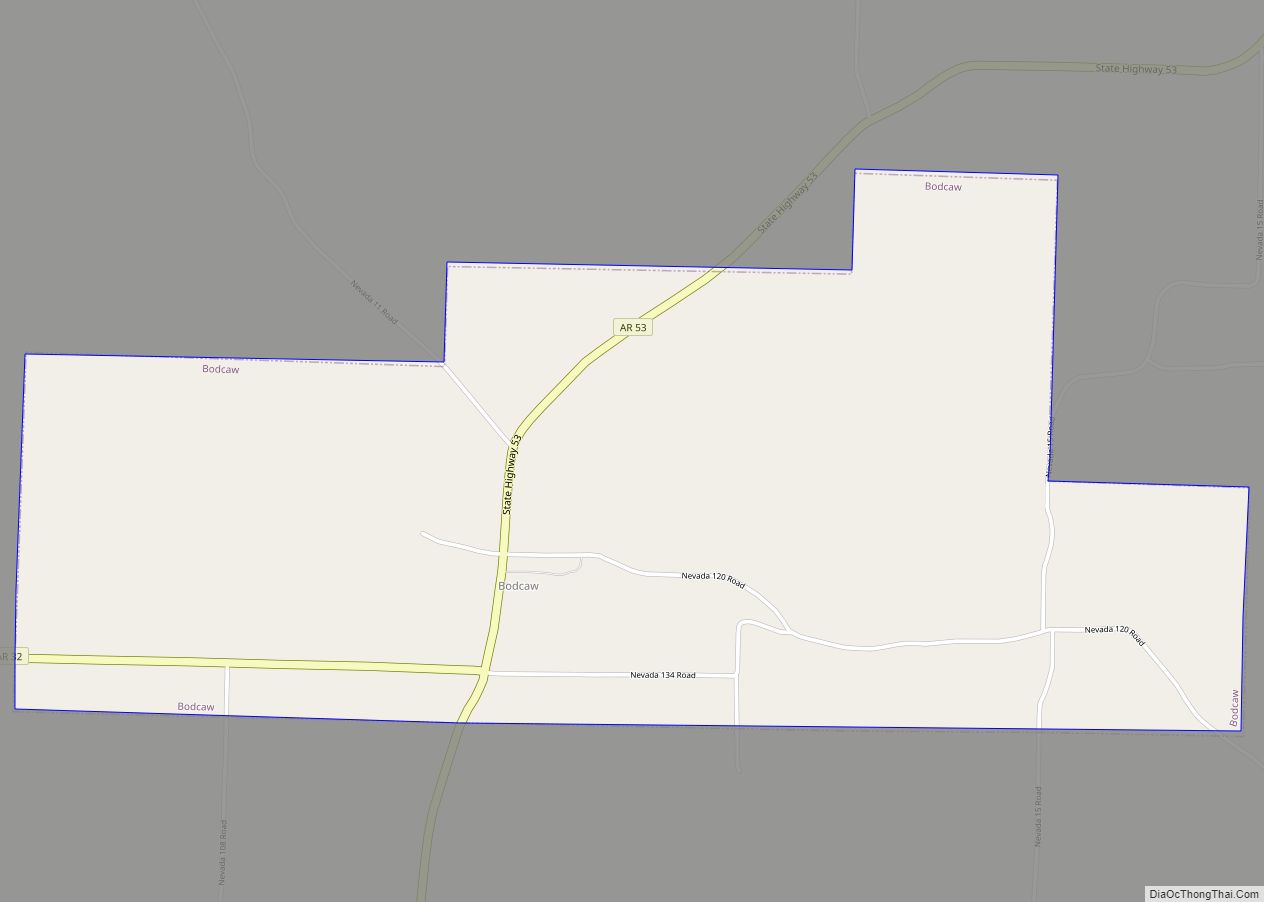
Bodcaw is a town in Nevada County, Arkansas, United States. The population was 121 at the 2020 census. It is part of the Hope Micropolitan Statistical Area. Bodcaw town overview: Name: Bodcaw town LSAD Code: 43 LSAD Description: town (suffix) State: Arkansas County: Nevada County Elevation: 358 ft (109 m) Total Area: 3.04 sq mi (7.87 km²) Land Area: 3.00 sq mi … Read more

Map of Blytheville city

Map of Blytheville city

Blytheville is the county seat and the largest city in Mississippi County, Arkansas, United States. It is approximately 60 miles (100 km) north of West Memphis. The population was 13,406 at the 2020 census, down from 15,620 in 2010. Blytheville city overview: Name: Blytheville city LSAD Code: 25 LSAD Description: city (suffix) State: Arkansas County: Mississippi … Read more

Map of Bradford city

Map of Bradford city, Arkansas

Bradford is a city in White County, Arkansas, United States. The population was 759 at the 2010 census. Bradford city overview: Name: Bradford city LSAD Code: 25 LSAD Description: city (suffix) State: Arkansas County: White County Elevation: 256 ft (78 m) Total Area: 0.87 sq mi (2.24 km²) Land Area: 0.87 sq mi (2.24 km²) Water Area: 0.00 sq mi (0.00 km²) Total Population: 678 Population … Read more

Map of Booneville city

Map of Booneville city, Arkansas

Booneville is a city in Logan County, Arkansas, United States and the county seat of its southern district. Located in the Arkansas River Valley between the Ouachita and Ozark Mountains, the city is one of the oldest in western Arkansas. The city’s economy was first based upon the railroad and Arkansas State Tuberculosis Sanatorium. It … Read more

Map of Bono city

Map of Bono city

Bono is a city in Craighead County, Arkansas, United States. The population was 2,131 at the 2010 census, up from 1,512 in 2000. It is included in the Jonesboro, Arkansas Metropolitan Statistical Area. Bono’s most prominent landmarks are the Bono Bridge and the Bono Cemetery. Bono city overview: Name: Bono city LSAD Code: 25 LSAD … Read more

Map of Briarcliff city

Map of Briarcliff city, Arkansas

Briarcliff is a second-class city in Baxter County, Arkansas, United States. The population was 236 at the 2010 census. Briarcliff city overview: Name: Briarcliff city LSAD Code: 25 LSAD Description: city (suffix) State: Arkansas County: Baxter County Elevation: 709 ft (216 m) Total Area: 2.25 sq mi (5.83 km²) Land Area: 2.25 sq mi (5.83 km²) Water Area: 0.00 sq mi (0.00 km²) Total Population: 236 … Read more

Map of Branch city

Map of Branch city, Arkansas

Branch is a city in Franklin County, Arkansas, United States. It is part of the Fort Smith, Arkansas–Oklahoma Metropolitan Statistical Area. The population was 367 at the 2010 census. Branch city overview: Name: Branch city LSAD Code: 25 LSAD Description: city (suffix) State: Arkansas County: Franklin County Elevation: 469 ft (143 m) Total Area: 3.13 sq mi (8.09 km²) Land … Read more

Map of Bradley city

Map of Bradley city, Arkansas

Bradley is a city in Lafayette County, Arkansas, United States. The population was 628 at the 2010 census. Bradley city overview: Name: Bradley city LSAD Code: 25 LSAD Description: city (suffix) State: Arkansas County: Lafayette County Elevation: 253 ft (77 m) Total Area: 0.91 sq mi (2.36 km²) Land Area: 0.91 sq mi (2.36 km²) Water Area: 0.00 sq mi (0.00 km²) Total Population: 405 Population … Read more

Map of Brookland city

Map of Brookland city

Brookland is a city in Craighead County, Arkansas, United States. The population was 1,642 at the 2010 census. It is included in the Jonesboro, Arkansas Metropolitan Statistical Area. Brookland city overview: Name: Brookland city LSAD Code: 25 LSAD Description: city (suffix) State: Arkansas County: Craighead County Elevation: 262 ft (80 m) Total Area: 7.82 sq mi (20.25 km²) Land Area: … Read more

Map of Brinkley city

Map of Brinkley city

Brinkley is the most populous city in Monroe County, Arkansas, United States. As of the 2020 census, the population was 2,700, down from 3,188 in 2010. Located within the Arkansas Delta, Brinkley was founded as a railroad town in 1872. The city has historically been a transportation and agricultural center in the region, more recently … Read more

Map of Bryant city

Map of Bryant city, Arkansas

Bryant is a city in Saline County, Arkansas, United States and a suburb of Little Rock. According to the 2010 Census, the population of the city was 16,688. It is part of the Central Arkansas region. Bryant city overview: Name: Bryant city LSAD Code: 25 LSAD Description: city (suffix) State: Arkansas County: Saline County Elevation: … Read more

Map of Burdette town

Map of Burdette town

Burdette is a town in Mississippi County, Arkansas, United States. The population was 140 at the 2020 census, down from 191 in 2010. Burdette town overview: Name: Burdette town LSAD Code: 43 LSAD Description: town (suffix) State: Arkansas County: Mississippi County Elevation: 240 ft (70 m) Total Area: 0.74 sq mi (1.91 km²) Land Area: 0.74 sq mi (1.91 km²) Water Area: 0.00 sq mi … Read more