Brinkley is the most populous city in Monroe County, Arkansas, United States. As of the 2020 census, the population was 2,700, down from 3,188 in 2010.
Located within the Arkansas Delta, Brinkley was founded as a railroad town in 1872. The city has historically been a transportation and agricultural center in the region, more recently developing a reputation for outdoors recreation and the ivory-billed woodpecker. Birding has become important to the city and region following the purported discovery of the ivory-billed woodpecker in 2004, a species thought to be extinct 60 years earlier.
Located halfway between Little Rock and Memphis, the city has used the slogan “We’ll Meet You Half-Way” in some of its advertising campaigns.
| Name: | Brinkley city |
|---|---|
| LSAD Code: | 25 |
| LSAD Description: | city (suffix) |
| State: | Arkansas |
| County: | Monroe County |
| Elevation: | 207 ft (63 m) |
| Total Area: | 6.14 sq mi (15.91 km²) |
| Land Area: | 5.69 sq mi (14.73 km²) |
| Water Area: | 0.46 sq mi (1.18 km²) |
| Total Population: | 2,700 |
| Population Density: | 474.85/sq mi (183.35/km²) |
| ZIP code: | 72021 |
| Area code: | 870 |
| FIPS code: | 0508950 |
| GNISfeature ID: | 0057440 |
| Website: | cityofbrinkley.org |
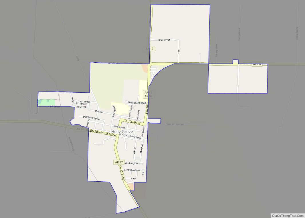
Online Interactive Map
Click on ![]() to view map in "full screen" mode.
to view map in "full screen" mode.
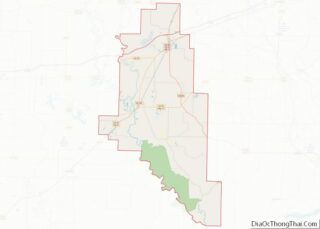
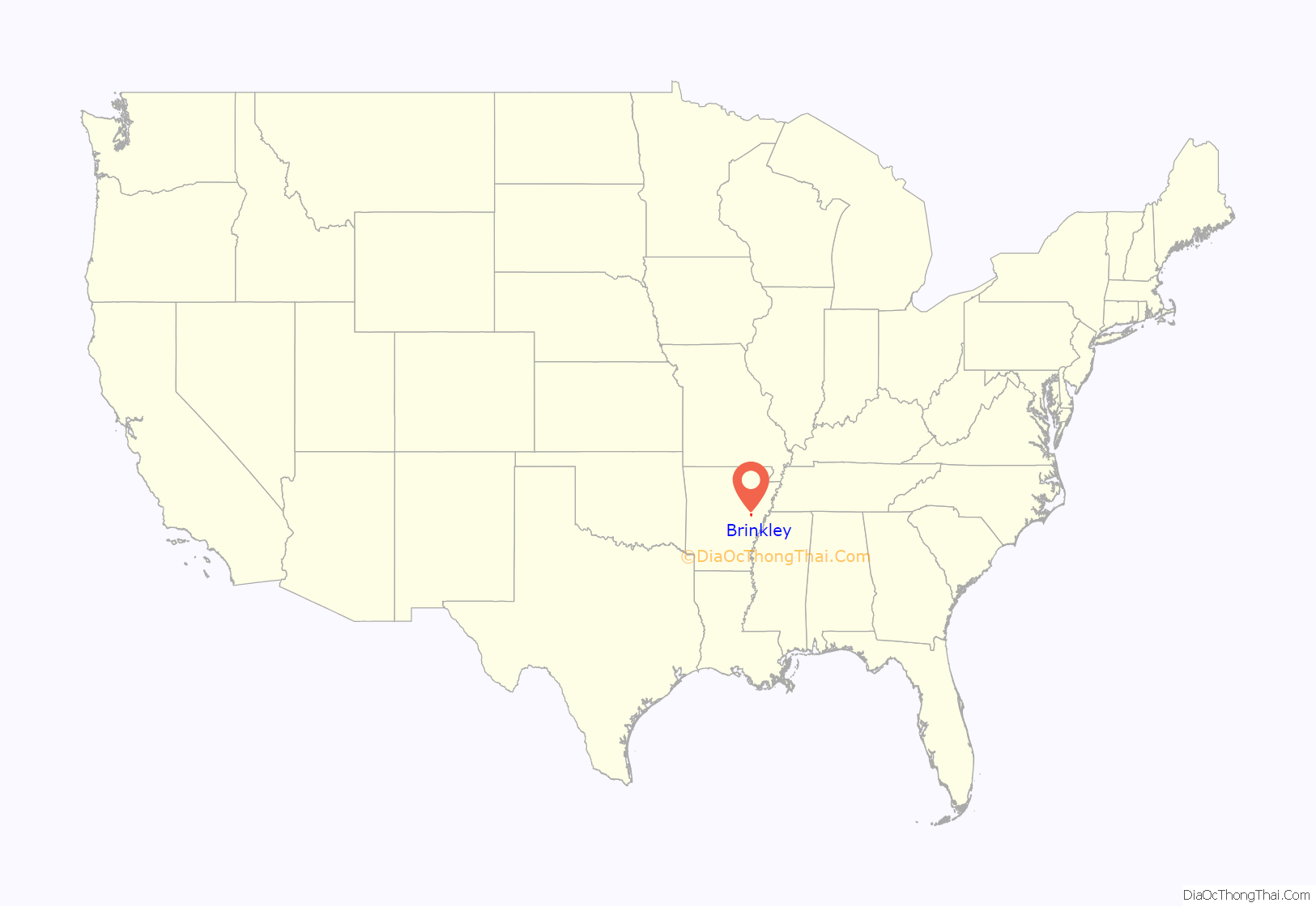
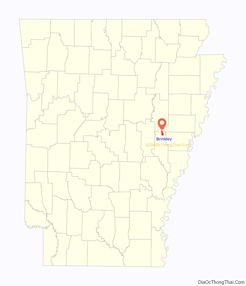
Brinkley location map. Where is Brinkley city?
History
In 1852, a land grant for the construction of rail lines was given to the Little Rock and Memphis Railroad Company, led by its president Robert Campbell Brinkley. Born in North Carolina, Brinkley lived in Memphis, where he served a public career of “noble deeds and generous conduct” and for many years served as president of Planters Bank.
Between 1852 and 1869, the settlement was called “Lick Skillet”. When the day’s work was completed, the railroad construction crew, mostly all immigrants from neighboring towns, cooked their supper over an open fire and returned to their homes when the last “skillet was licked”.
The construction of the rail lines between Little Rock and Memphis brought the city of Brinkley into being. Brinkley is situated in the northern part of Monroe County, the halfway point between the two larger cities. It was laid out in the winter of 1869 on lands belonging to the railroad.
A petition request was granted to incorporate Brinkley on August 6, 1872, at which time the town had 50 qualified voters. The original charter was filed with the Arkansas Secretary of State on August 21, 1872. The Cotton Plant Railroad (later called the Batesville and Brinkley Railroad and the White and Black River Valley Railway) originated from the town in 1879, and the Texas and St. Louis Railway was built through Brinkley in 1883.
On March 8, 1909, much of the town was destroyed by a violent F4 tornado, which resulted in 49 deaths. Entire families were lost to the tornado, and approximately 800 buildings in the community were destroyed. The tornado was 2/3 of a mile wide.
Duck hunting is a major source of income for the city during the months of November, December and January. With many rice fields flooded for the winter, and being located on the Mississippi Flyway, ducks are very prevalent throughout the region. Men and women from around the United States come to Brinkley for guided hunts throughout the season.
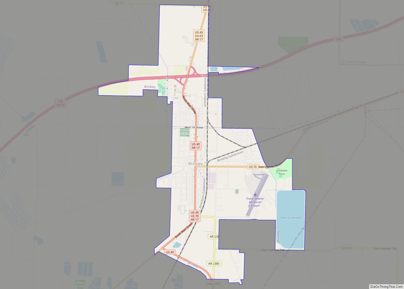
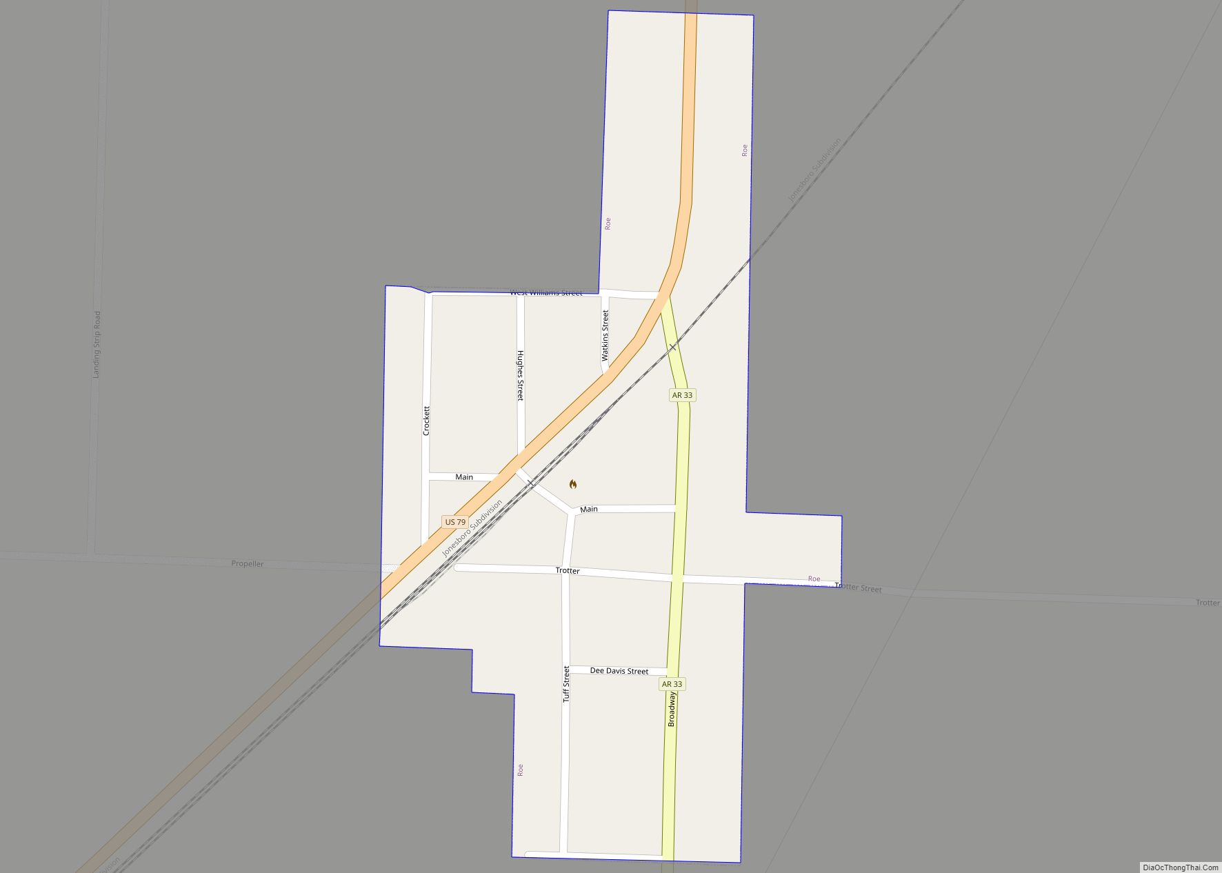
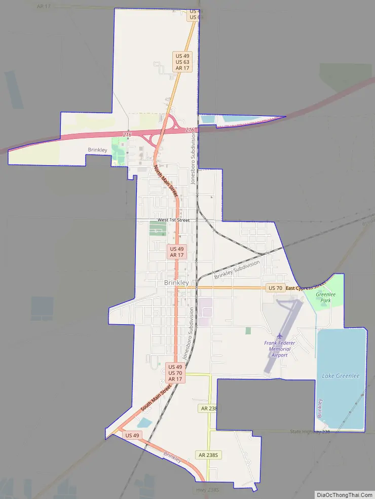
Brinkley Road Map
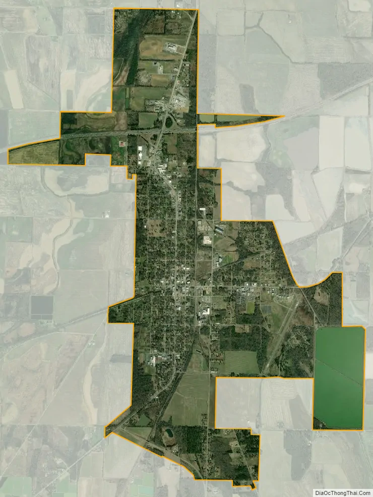
Brinkley city Satellite Map
Geography
Brinkley is in northern Monroe County, 69 miles (111 km) east of Little Rock, the Arkansas capital, and 72 miles (116 km) west-southwest of Memphis, Tennessee. U.S. Routes 70 and 49 join in the city as Main Street, with US 70 turning east on Cypress Street in the center of town. US 70 leads east-northeast 5 miles (8 km) to Wheatley and west-southwest 14 miles (23 km) to Biscoe, while US 49 leads north-northeast 74 miles (119 km) to Jonesboro and southeast 51 miles (82 km) to Helena-West Helena. The Brinkley city limits extend north along US 49 to its interchange with Interstate 40, which connects Memphis and Little Rock.
According to the United States Census Bureau, the city has a total area of 6.14 square miles (15.9 km), of which 5.69 square miles (14.7 km) are land and 0.46 square miles (1.19 km), or 7.41%, are water.
Climate
The climate in this area is characterized by hot, humid summers and generally mild to cool winters. According to the Köppen Climate Classification system, Brinkley has a humid subtropical climate, abbreviated “Cfa” on climate maps.
See also
Map of Arkansas State and its subdivision:- Arkansas
- Ashley
- Baxter
- Benton
- Boone
- Bradley
- Calhoun
- Carroll
- Chicot
- Clark
- Clay
- Cleburne
- Cleveland
- Columbia
- Conway
- Craighead
- Crawford
- Crittenden
- Cross
- Dallas
- Desha
- Drew
- Faulkner
- Franklin
- Fulton
- Garland
- Grant
- Greene
- Hempstead
- Hot Spring
- Howard
- Independence
- Izard
- Jackson
- Jefferson
- Johnson
- Lafayette
- Lawrence
- Lee
- Lincoln
- Little River
- Logan
- Lonoke
- Madison
- Marion
- Miller
- Mississippi
- Monroe
- Montgomery
- Nevada
- Newton
- Ouachita
- Perry
- Phillips
- Pike
- Poinsett
- Polk
- Pope
- Prairie
- Pulaski
- Randolph
- Saint Francis
- Saline
- Scott
- Searcy
- Sebastian
- Sevier
- Sharp
- Stone
- Union
- Van Buren
- Washington
- White
- Woodruff
- Yell
- Alabama
- Alaska
- Arizona
- Arkansas
- California
- Colorado
- Connecticut
- Delaware
- District of Columbia
- Florida
- Georgia
- Hawaii
- Idaho
- Illinois
- Indiana
- Iowa
- Kansas
- Kentucky
- Louisiana
- Maine
- Maryland
- Massachusetts
- Michigan
- Minnesota
- Mississippi
- Missouri
- Montana
- Nebraska
- Nevada
- New Hampshire
- New Jersey
- New Mexico
- New York
- North Carolina
- North Dakota
- Ohio
- Oklahoma
- Oregon
- Pennsylvania
- Rhode Island
- South Carolina
- South Dakota
- Tennessee
- Texas
- Utah
- Vermont
- Virginia
- Washington
- West Virginia
- Wisconsin
- Wyoming