Blytheville is the county seat and the largest city in Mississippi County, Arkansas, United States. It is approximately 60 miles (100 km) north of West Memphis. The population was 13,406 at the 2020 census, down from 15,620 in 2010.
| Name: | Blytheville city |
|---|---|
| LSAD Code: | 25 |
| LSAD Description: | city (suffix) |
| State: | Arkansas |
| County: | Mississippi County |
| Elevation: | 256 ft (78 m) |
| Total Area: | 20.80 sq mi (53.87 km²) |
| Land Area: | 20.74 sq mi (53.71 km²) |
| Water Area: | 0.06 sq mi (0.16 km²) |
| Total Population: | 13,406 |
| Population Density: | 646.45/sq mi (249.60/km²) |
| ZIP code: | 72315, 72316, 72319 |
| Area code: | 870 |
| FIPS code: | 0507330 |
| GNISfeature ID: | 2403885 |
| Website: | www.cityofblytheville.com |
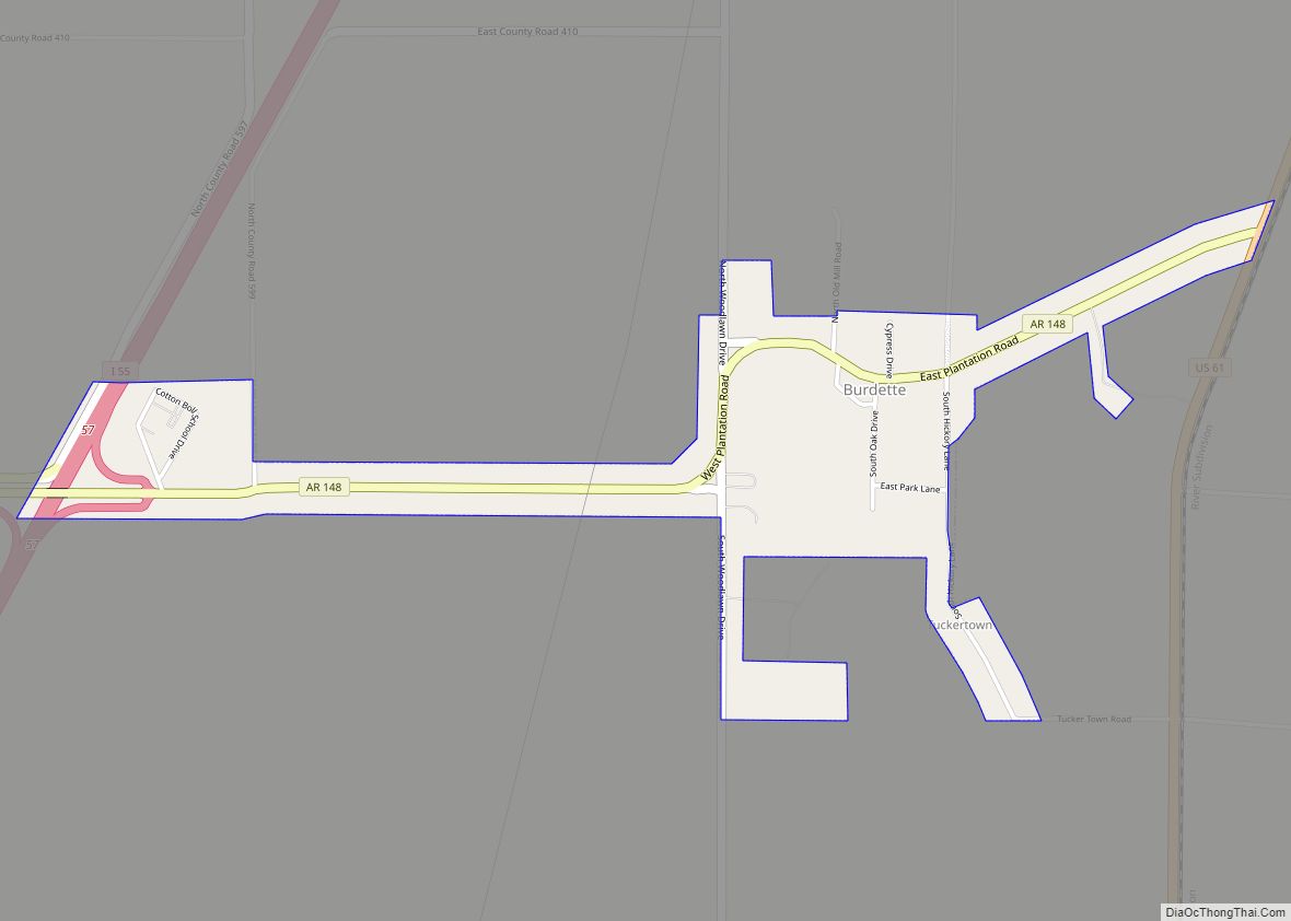
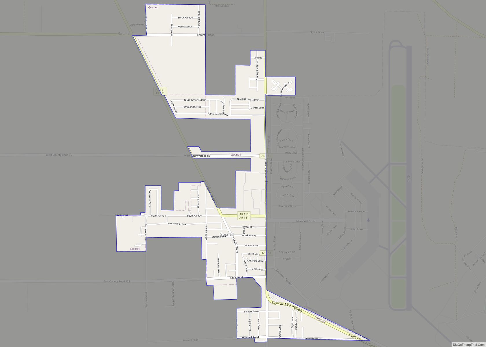
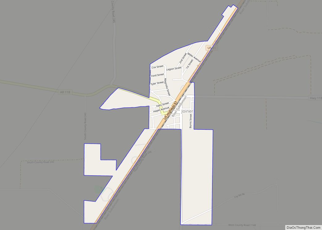
Online Interactive Map
Click on ![]() to view map in "full screen" mode.
to view map in "full screen" mode.
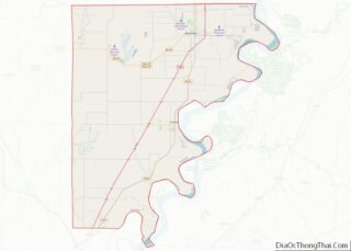
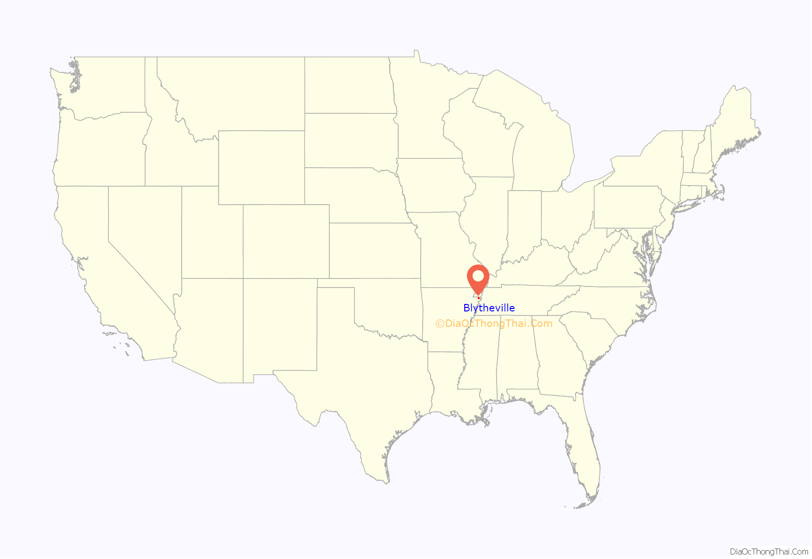
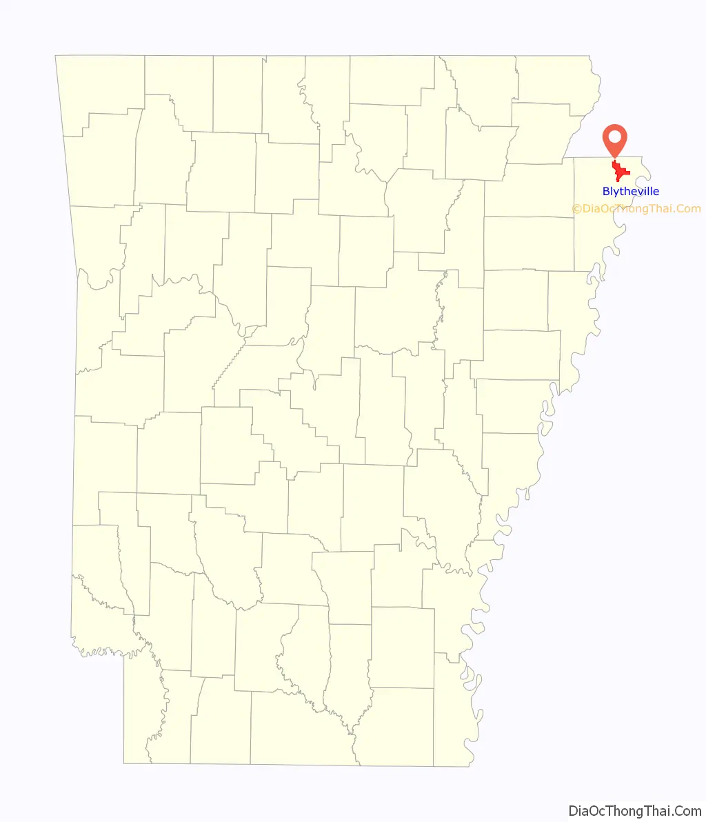
Blytheville location map. Where is Blytheville city?
History
Blytheville was founded by Methodist clergyman Henry T. Blythe in 1879. It received a post office the same year, was incorporated in 1889, and became the county seat for the northern half of Mississippi County (Chickasawba District) in 1901. Blytheville received telephone service and electricity in 1903, and natural gas service in 1950.
Forestry was an early industry, spurred by the massive harvesting of lumber needed to rebuild Chicago following the Great Fire of 1871. The lumber industry brought sawmills and a rowdy crowd, and the area was known for its disreputable saloon culture during the 1880s and 1890s.
The cleared forests enabled cotton farming to take hold, encouraged by ongoing levee building and waterway management; the population grew significantly after 1900. On Blytheville’s western edge lies one of the largest cotton gins in North America. Soybeans and rice have also become important crops.
The area around Blytheville continues to be farmed, though family farms have given way to large factory operations.
In the 1980s, Blytheville began to develop an industrial base, much of which centered on the steel industry.
Until 1992, Blytheville was home to Blytheville Air Force Base (renamed Eaker Air Force Base in 1988), a major airfield that was part of the Strategic Air Command.
James Sanders is Blytheville’s mayor, the first African-American to serve in that position.
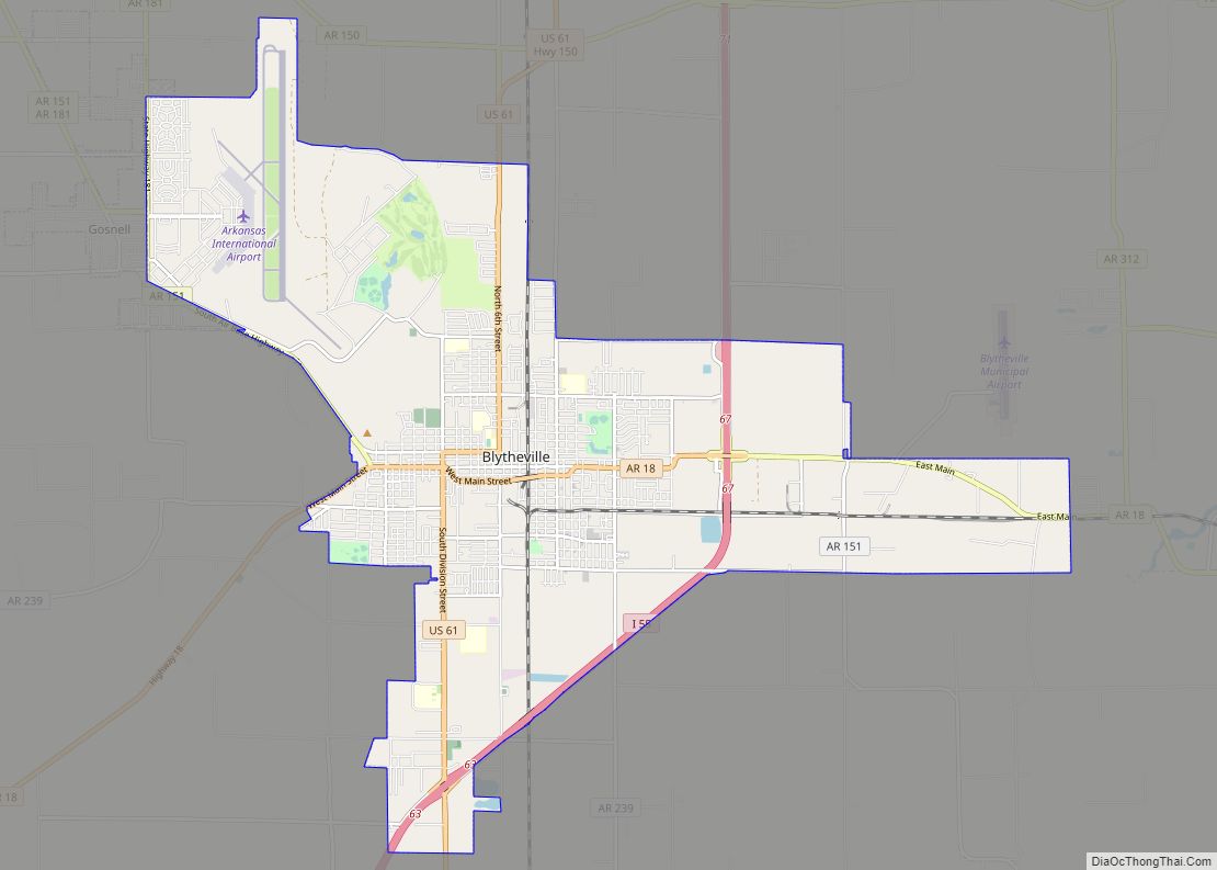
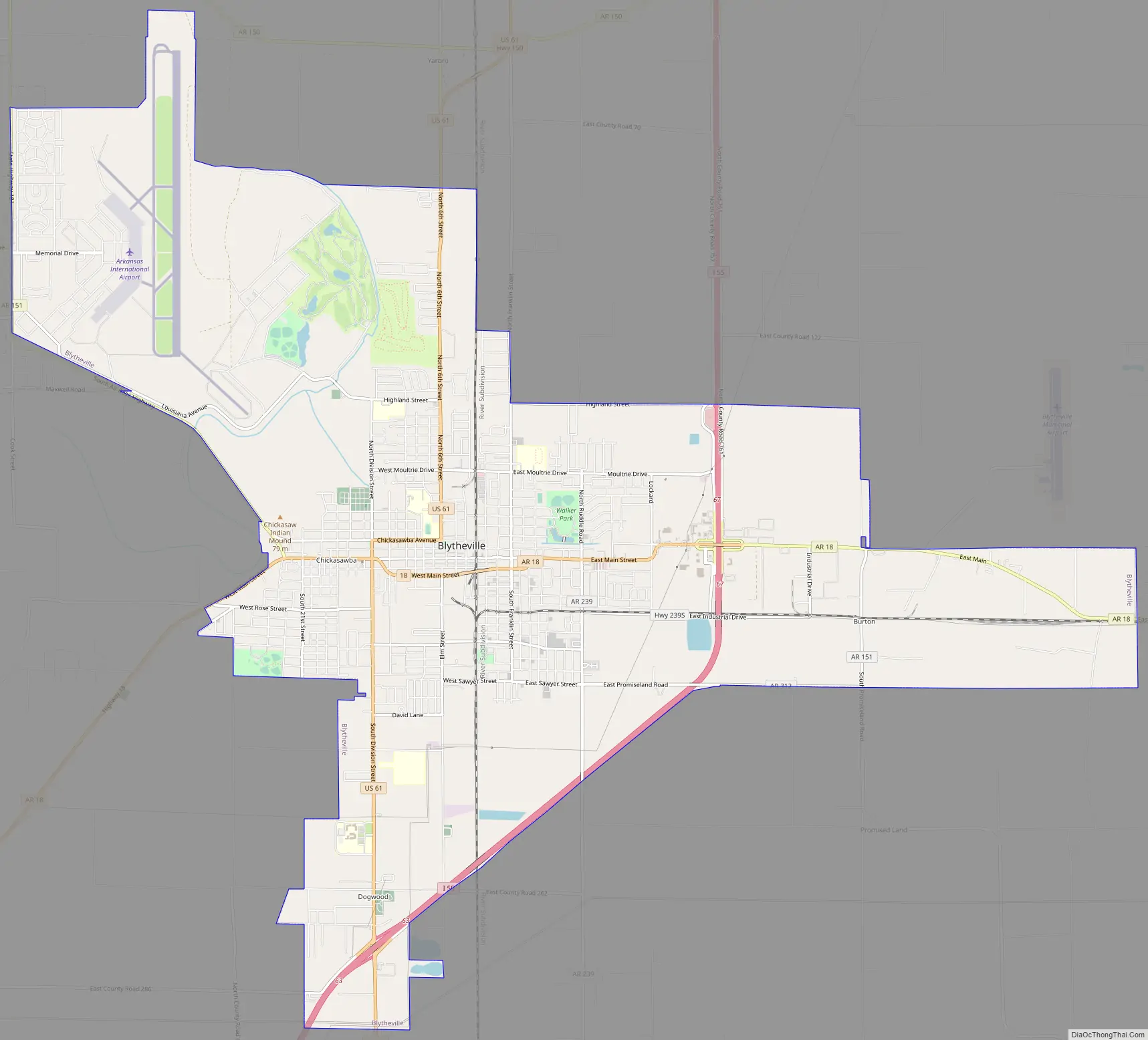
Blytheville Road Map
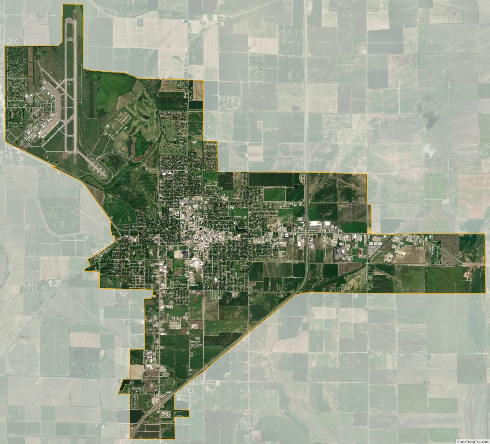
Blytheville city Satellite Map
Geography
Blytheville is located in northeastern Arkansas and northeastern Mississippi County. It is the easternmost incorporated place in Arkansas. The Missouri state line is 5 miles (8 km) north, and the Mississippi River, forming the Tennessee border, is 8 miles (13 km) east.
According to the United States Census Bureau, the city has a total area of 20.8 square miles (54 km), of which 0.06 square miles (0.16 km), or 0.29%, are water.
Climate
The climate in this area is characterized by hot, humid summers and generally mild to cool winters. According to the Köppen Climate Classification system, Blytheville has a humid subtropical climate, abbreviated “Cfa” on climate maps.
See also
Map of Arkansas State and its subdivision:- Arkansas
- Ashley
- Baxter
- Benton
- Boone
- Bradley
- Calhoun
- Carroll
- Chicot
- Clark
- Clay
- Cleburne
- Cleveland
- Columbia
- Conway
- Craighead
- Crawford
- Crittenden
- Cross
- Dallas
- Desha
- Drew
- Faulkner
- Franklin
- Fulton
- Garland
- Grant
- Greene
- Hempstead
- Hot Spring
- Howard
- Independence
- Izard
- Jackson
- Jefferson
- Johnson
- Lafayette
- Lawrence
- Lee
- Lincoln
- Little River
- Logan
- Lonoke
- Madison
- Marion
- Miller
- Mississippi
- Monroe
- Montgomery
- Nevada
- Newton
- Ouachita
- Perry
- Phillips
- Pike
- Poinsett
- Polk
- Pope
- Prairie
- Pulaski
- Randolph
- Saint Francis
- Saline
- Scott
- Searcy
- Sebastian
- Sevier
- Sharp
- Stone
- Union
- Van Buren
- Washington
- White
- Woodruff
- Yell
- Alabama
- Alaska
- Arizona
- Arkansas
- California
- Colorado
- Connecticut
- Delaware
- District of Columbia
- Florida
- Georgia
- Hawaii
- Idaho
- Illinois
- Indiana
- Iowa
- Kansas
- Kentucky
- Louisiana
- Maine
- Maryland
- Massachusetts
- Michigan
- Minnesota
- Mississippi
- Missouri
- Montana
- Nebraska
- Nevada
- New Hampshire
- New Jersey
- New Mexico
- New York
- North Carolina
- North Dakota
- Ohio
- Oklahoma
- Oregon
- Pennsylvania
- Rhode Island
- South Carolina
- South Dakota
- Tennessee
- Texas
- Utah
- Vermont
- Virginia
- Washington
- West Virginia
- Wisconsin
- Wyoming