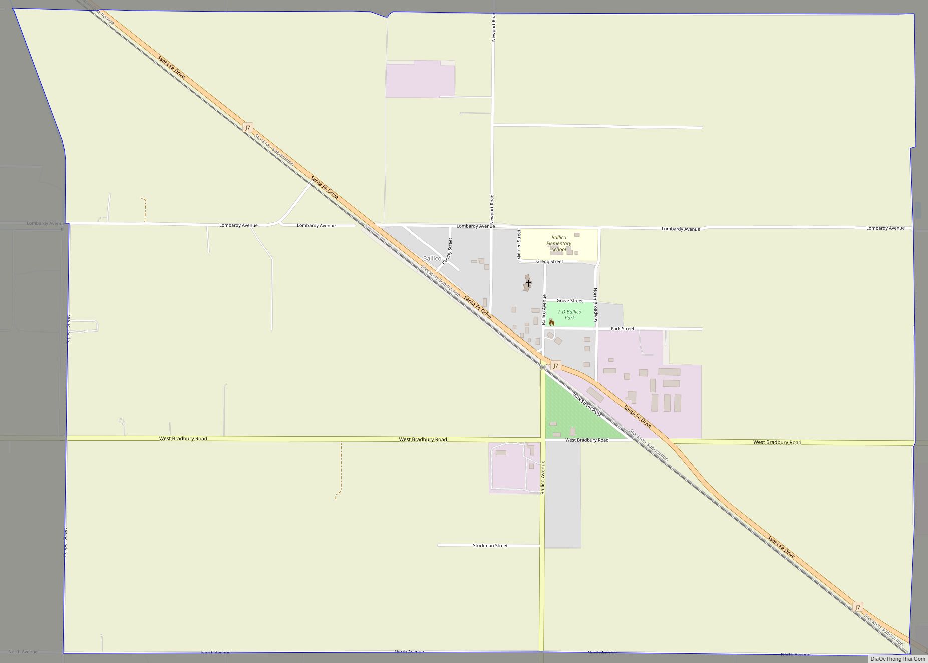
Map of Bay Point CDP

Map of Bay Point CDP

Bay Point, formerly West Pittsburg and originally Bella Vista is a census-designated place located in the East Bay region of the San Francisco Bay Area in Contra Costa County, California. Bay Point is just west of Pittsburg, California, and northeast of Concord, California, on the southern shore of Suisun Bay. The population of Bay Point … Read more

Map of Bass Lake CDP

Map of Bass Lake CDP, California

Bass Lake is a census-designated place in Madera County, California, United States. It is located 4.5 miles (7.2 km) southeast of Yosemite Forks, at an elevation of 3,415 feet (1,041 m). The population was 575 at the 2020 census. Bass Lake is situated in the Sierra National Forest approximately 14 mi (23 km) from the south entrance of Yosemite … Read more

Map of Barstow city

Map of Barstow city, California

Barstow is a city in San Bernardino County, California, in the Mojave Desert of Southern California. Located in the Inland Empire region of California, the population was 25,415 at the 2020 census. Barstow is an important crossroads for the Inland Empire and home to Marine Corps Logistics Base Barstow. Barstow city overview: Name: Barstow city … Read more

Map of Bear Creek CDP, California

Map of Bear Creek CDP, California

Bear Creek is a census-designated place in Merced County, California. It is located 3.5 miles (5.6 km) east of Merced, at an elevation of 190 feet (58 m). The population was 273 at the 2020 United States census, down from 290 at the 2010 census. Bear Creek CDP overview: Name: Bear Creek CDP LSAD Code: 57 … Read more

Map of Beale AFB CDP

Map of Beale AFB CDP

Beale AFB CDP overview: Name: Beale AFB CDP LSAD Code: 57 LSAD Description: CDP (suffix) State: California County: Yuba County FIPS code: 0604576 Online Interactive Map Beale AFB online map. Source: Basemap layers from Google Map, Open Street Map (OSM), Arcgisonline, Wmflabs. Boundary Data from Database of Global Administrative Areas. Beale AFB location map. Where … Read more

Map of Bayview CDP

Map of Bayview CDP, California

Bayview (also, Bay View) is a census-designated place (CDP) located adjacent to the City of Eureka in Humboldt County, California, United States. Its population is 2,619 as of the 2020 census, up from 2,510 from the 2010 census. Many locals consider this area as part of “Pine Hill.” Bayview CDP overview: Name: Bayview CDP LSAD … Read more

Map of Beaumont city

Map of Beaumont city, California

Beaumont is a city in Riverside County, California, United States, located at the summit of the San Gorgonio Pass, between the San Bernardino Mountains and Mount San Gorgonio to the north, and the San Jacinto Mountains and San Jacinto Peak to the south. Early native American inhabitants included the Serrano and Cahuilla people, who still … Read more

Map of Bear Valley CDP

Map of Bear Valley CDP

Bear Valley (formerly Haydenville, Biddle’s Camp, Biddleville, Simpsonville, and Johnsonville) is a census-designated place in Mariposa County, California, United States. It is located 10.5 miles (16.9 km) south-southeast of Coulterville, at an elevation of 2,054 feet (626 m). Bear Valley has been designated California Historical Landmark #331. The population was 156 at the 2020 census. Bear Valley … Read more

Map of Bear Valley Springs CDP

Map of Bear Valley Springs CDP

Bear Valley Springs is a guarded-gate community in Kern County, California, United States. Bear Valley Springs is in the Tehachapi Mountains and is part of the greater Tehachapi area. The elevation ranges from 4,121 feet (1,256 m) to 6,934 feet (2,113 m) (Bear Mountain). The population fluctuates between a low during the winter months when snow is … Read more

Map of Bell Canyon CDP

Map of Bell Canyon CDP

Bell Canyon is an unincorporated community in eastern Ventura County, California, United States. Bell Canyon is a gated community in the Simi Hills with the main access through the Los Angeles community of West Hills and the western San Fernando Valley. Bell Canyon sits at an elevation of 1,368 feet (417 m). The 2010 United States … Read more

Map of Belden CDP

Map of Belden CDP, California

Belden is a census-designated place (CDP) in Plumas County, California, United States. Belden is located on the North Fork Feather River, 7 miles (11.3 km) southwest of Caribou. The population was 22 at the 2010 census, down from 26 in 2000. Belden CDP overview: Name: Belden CDP LSAD Code: 57 LSAD Description: CDP (suffix) State: California … Read more

Map of Beckwourth CDP

Map of Beckwourth CDP

Beckwourth (formerly, Beckwith and Beekwith) is a census-designated place (CDP) in Plumas County, California, United States. Beckwourth is located on the Middle Fork Feather River 5 miles (8.0 km) east of Portola. The population was 432 at the 2010 census, up from 342 at the 2000 census. Beckwourth CDP overview: Name: Beckwourth CDP LSAD Code: 57 … Read more