Barstow is a city in San Bernardino County, California, in the Mojave Desert of Southern California. Located in the Inland Empire region of California, the population was 25,415 at the 2020 census. Barstow is an important crossroads for the Inland Empire and home to Marine Corps Logistics Base Barstow.
| Name: | Barstow city |
|---|---|
| LSAD Code: | 25 |
| LSAD Description: | city (suffix) |
| State: | California |
| County: | San Bernardino County |
| Incorporated: | September 30, 1947 |
| Elevation: | 2,175 ft (663 m) |
| Total Area: | 41.34 sq mi (107.08 km²) |
| Land Area: | 41.30 sq mi (106.96 km²) |
| Water Area: | 0.04 sq mi (0.11 km²) 0.02% |
| Total Population: | 25,415 |
| Population Density: | 615.39/sq mi (237.60/km²) |
| FIPS code: | 0604030 |
Online Interactive Map
Click on ![]() to view map in "full screen" mode.
to view map in "full screen" mode.
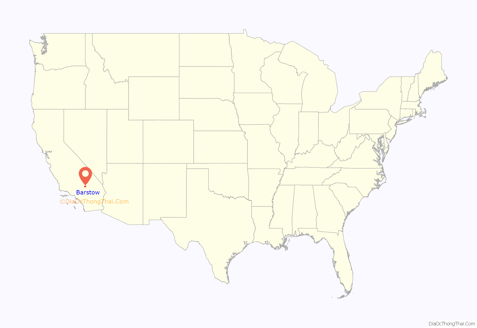
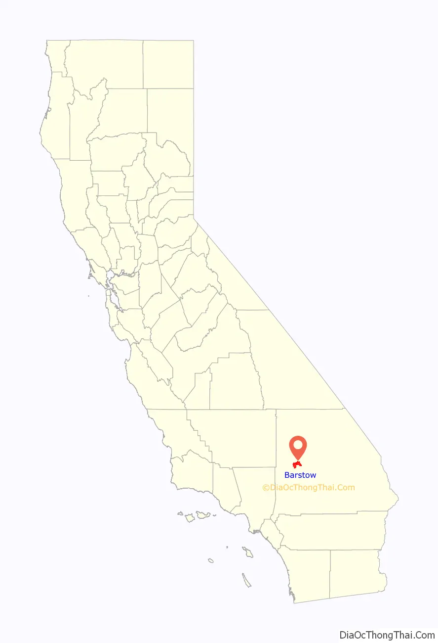
Barstow location map. Where is Barstow city?
History
The settlement of Barstow began in the late 1840s in the Mormon Corridor. Every fall and winter, as the weather cooled, the rain produced new grass growth and replenished the water sources in the Mojave Desert. People, goods, and animal herds would move from New Mexico and later Utah to Los Angeles, along the Old Spanish Trail from Santa Fe, or after 1848, on the Mormon Road from Salt Lake City. Trains of freight wagons traveled back to Salt Lake City and other points in the interior. These travelers followed the course of the Mojave River, watering and camping at Fish Ponds on its south bank (west of Nebo Center) or 3.625 miles up river on the north bank, at a riverside grove of willows and cottonwoods, festooned with wild grapes, called Grapevines (later the site of North Barstow). In 1859, the Mojave Road followed a route that was established from Los Angeles to Fort Mojave through Grapevines that linked eastward with the Beale Wagon Road across northern New Mexico Territory to Santa Fe.
Troubles with the Paiute, Mojave, and Chemehuevi tribes followed, and from 1860 Camp Cady, a U.S. Army post 20 miles (32 km) east of Barstow, was occupied sporadically until 1864, then permanently, by soldiers occupying other posts on the Mojave Road or patrolling in the region until 1871. Trading posts were established at Grapevines and Fish Ponds that supplied travelers on the roads and increasingly the miners that came into the Mojave Desert after the end of hostilities with the native people.
Barstow’s roots also lie in the rich mining history of the Mojave Desert following the discovery of gold and silver in the Owens Valley and in mountains to the east in the 1860s and 1870s. Due to the influx of miners arriving in Calico and Daggett, railroads were constructed to transport goods and people. The Southern Pacific built a line from Mojave, California through Barstow to Needles in 1883. In 1884, ownership of the line from Needles to Mojave was transferred to the Santa Fe Railroad. Paving the major highways through Barstow led to further development of the city. Much of its economy depends on transportation. Before the advent of the interstate highway system, Barstow was an important stop on both Routes 66 and 91. The two routes met in downtown Barstow and continued west together to Los Angeles.
Barstow is named after William Barstow Strong, former president of the Atchison, Topeka and Santa Fe Railway. Some early Barstow names were Camp Sugarloaf, Grapevine, Waterman Junction and Fishpond.
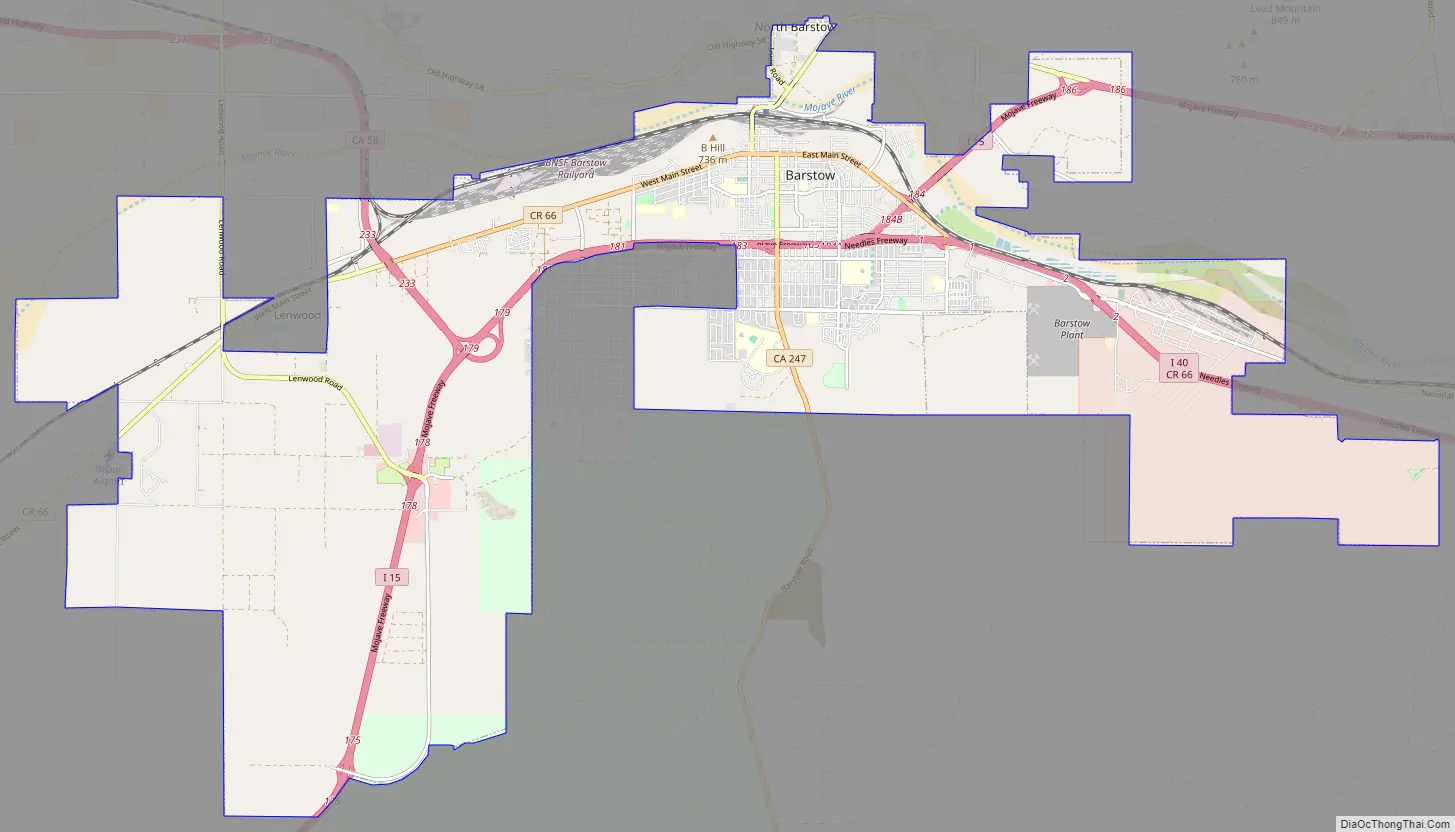
Barstow Road Map
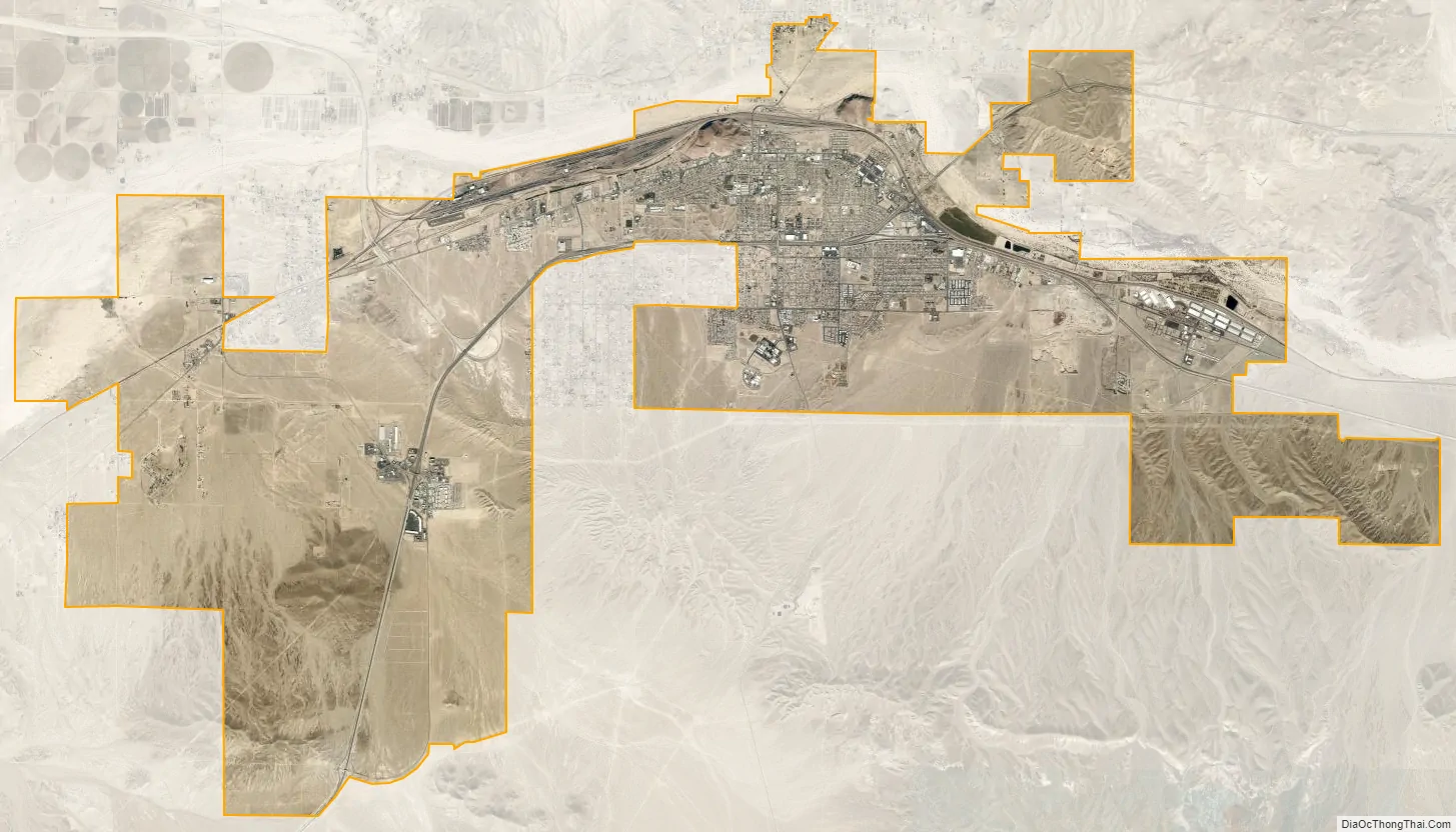
Barstow city Satellite Map
Geography
According to the United States Census Bureau, the city has a total area of 107.2 km (41.4 sq mi), 99.98% land and 0.02% water.
Climate
Barstow experiences an arid climate, and has four seasons. Summer days are very hot, with highs typically exceeding 100 °F (38 °C). Winter, in contrast, is characterized by cold mornings, with lows near 30 °F (−1 °C). Daily temperature ranges are largely a result of the low atmospheric moisture, typically between 25 and 30 °F (14 and 17 °C) difference. There are an average of 133 days with highs of 90 °F (32 °C) or higher, an average of 68 days with highs of 100 °F (38 °C) degrees or higher, and an average of 32 days with lows of 32 °F (0 °C) or lower.
The average annual precipitation is 4.96 inches (12.6 cm), with nearly 80% of rain typically falling during the cooler months (Nov–Apr). Snowfall is uncommon in winter, and many years can go by without any measurable snowfall. There are an average of 24 days annually with measurable precipitation.
The record high was 120 °F (49 °C) on July 23, 1996, and the record low was 3 °F (−16 °C) on January 13, 1963. The wettest year was 1918 with 10.99 inches (27.9 cm) and the driest year was 1904 with 0.80 inches (2.0 cm). The most rainfall in one month was 4.22 inches (10.7 cm) in February 1998. The heaviest rainfall in 24 hours was 2.28 inches (5.8 cm) on September 10, 1976. The most snowfall in one month was 25.0 inches (64 cm) in January 1949, including 7.0 inches (18 cm) January 12; that month was one of the coldest and snowiest in southern California history.
Vegetation
The native vegetation is dominated by high and low desert shrubs such as creosote bush. City residents have introduced many non-native plants, prominent among which are trees such as Aleppo pine, Morus alba, Italian cypress, fan palm, ailanthus, ash, palo verde and redbud.
See also
Map of California State and its subdivision:- Alameda
- Alpine
- Amador
- Butte
- Calaveras
- Colusa
- Contra Costa
- Del Norte
- El Dorado
- Fresno
- Glenn
- Humboldt
- Imperial
- Inyo
- Kern
- Kings
- Lake
- Lassen
- Los Angeles
- Madera
- Marin
- Mariposa
- Mendocino
- Merced
- Modoc
- Mono
- Monterey
- Napa
- Nevada
- Orange
- Placer
- Plumas
- Riverside
- Sacramento
- San Benito
- San Bernardino
- San Diego
- San Francisco
- San Joaquin
- San Luis Obispo
- San Mateo
- Santa Barbara
- Santa Clara
- Santa Cruz
- Shasta
- Sierra
- Siskiyou
- Solano
- Sonoma
- Stanislaus
- Sutter
- Tehama
- Trinity
- Tulare
- Tuolumne
- Ventura
- Yolo
- Yuba
- Alabama
- Alaska
- Arizona
- Arkansas
- California
- Colorado
- Connecticut
- Delaware
- District of Columbia
- Florida
- Georgia
- Hawaii
- Idaho
- Illinois
- Indiana
- Iowa
- Kansas
- Kentucky
- Louisiana
- Maine
- Maryland
- Massachusetts
- Michigan
- Minnesota
- Mississippi
- Missouri
- Montana
- Nebraska
- Nevada
- New Hampshire
- New Jersey
- New Mexico
- New York
- North Carolina
- North Dakota
- Ohio
- Oklahoma
- Oregon
- Pennsylvania
- Rhode Island
- South Carolina
- South Dakota
- Tennessee
- Texas
- Utah
- Vermont
- Virginia
- Washington
- West Virginia
- Wisconsin
- Wyoming


