Bay Point, formerly West Pittsburg and originally Bella Vista is a census-designated place located in the East Bay region of the San Francisco Bay Area in Contra Costa County, California. Bay Point is just west of Pittsburg, California, and northeast of Concord, California, on the southern shore of Suisun Bay. The population of Bay Point was 21,349 as of 2010. The Pittsburg/Bay Point Station of the Bay Area Rapid Transit (BART) rail system is located adjacent to Bay Point in Pittsburg. The community is traversed by a freeway, State Route 4, the California Delta Highway. Being unincorporated, Bay Point does not have its own police department. The community is policed by the California Highway Patrol and the Contra Costa County Sheriff’s Office. The ZIP code is 94565, and the area code is 925.
| Name: | Bay Point CDP |
|---|---|
| LSAD Code: | 57 |
| LSAD Description: | CDP (suffix) |
| State: | California |
| County: | Contra Costa County |
| Elevation: | 89 ft (27 m) |
| Total Area: | 7.44 sq mi (19.28 km²) |
| Land Area: | 6.43 sq mi (16.64 km²) |
| Water Area: | 1.02 sq mi (2.64 km²) 11.7% |
| Total Population: | 23,896 |
| Population Density: | 3,718.64/sq mi (1,435.74/km²) |
| ZIP code: | 94565 |
| Area code: | 925 |
| FIPS code: | 0604415 |
Online Interactive Map
Click on ![]() to view map in "full screen" mode.
to view map in "full screen" mode.
Bay Point location map. Where is Bay Point CDP?


History
Bay Point was previously known by several names, including Bella Vista and, until 1993, West Pittsburg. An election was held in 1993 to vote on renaming the community Bay Point, reviving a historical name used in this area. “West Pittsburg,” the former name, was sometimes confused with the western unincorporated section of Pittsburg, California. Bay Point is similarly unincorporated.
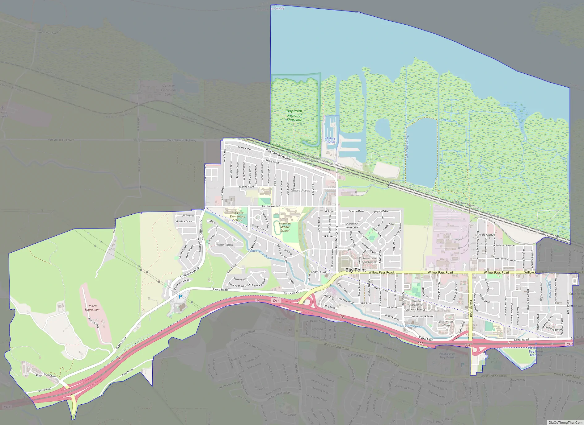
Bay Point Road Map
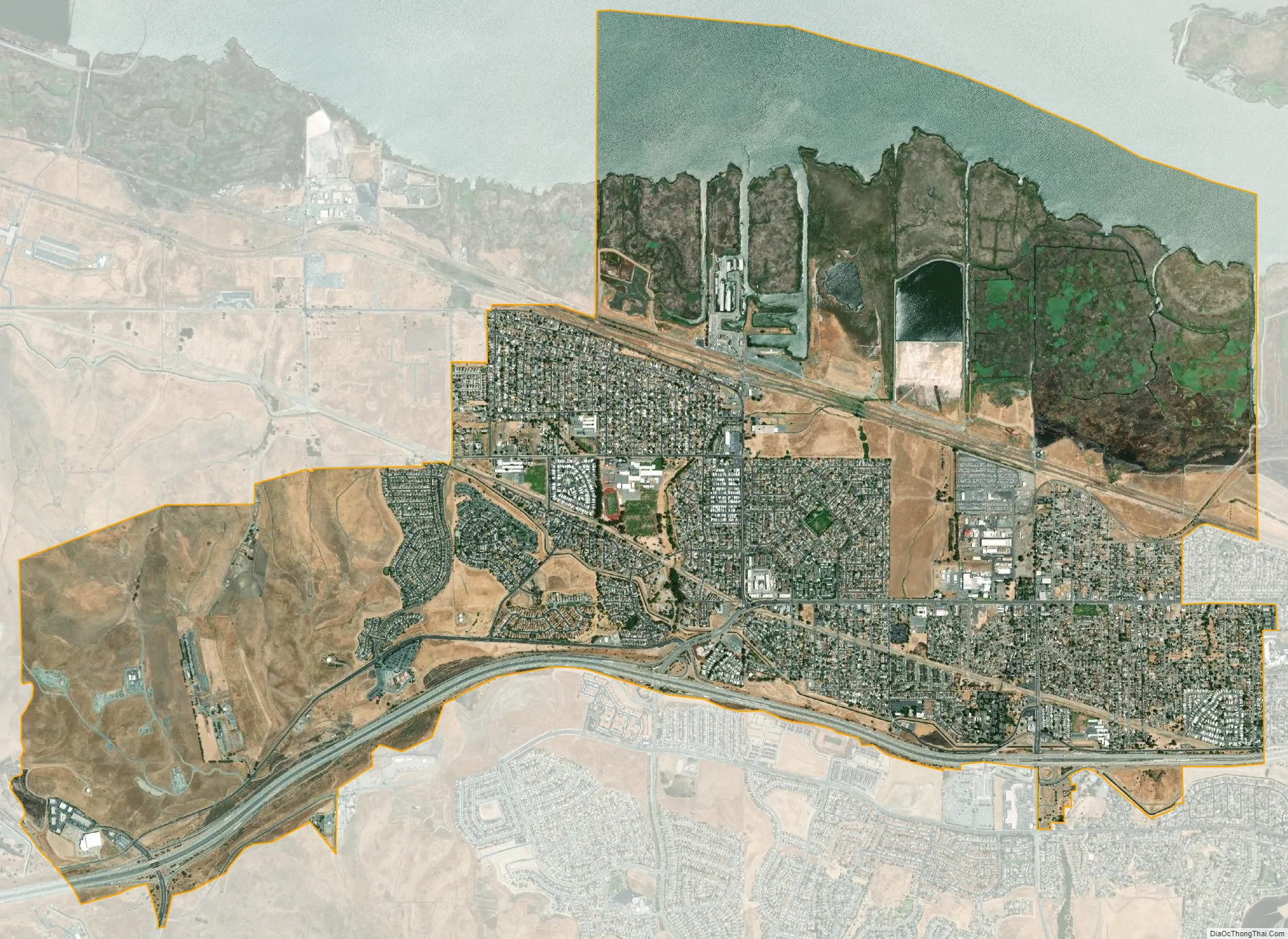
Bay Point city Satellite Map
Geography
According to the United States Census Bureau, the CDP has a total area of 7.4 square miles (19 km), 88.3% land and 11.7% water. Bay Point borders Suisun Bay. The northwest portion is the neighborhood of Shore Acres.
See also
Map of California State and its subdivision:- Alameda
- Alpine
- Amador
- Butte
- Calaveras
- Colusa
- Contra Costa
- Del Norte
- El Dorado
- Fresno
- Glenn
- Humboldt
- Imperial
- Inyo
- Kern
- Kings
- Lake
- Lassen
- Los Angeles
- Madera
- Marin
- Mariposa
- Mendocino
- Merced
- Modoc
- Mono
- Monterey
- Napa
- Nevada
- Orange
- Placer
- Plumas
- Riverside
- Sacramento
- San Benito
- San Bernardino
- San Diego
- San Francisco
- San Joaquin
- San Luis Obispo
- San Mateo
- Santa Barbara
- Santa Clara
- Santa Cruz
- Shasta
- Sierra
- Siskiyou
- Solano
- Sonoma
- Stanislaus
- Sutter
- Tehama
- Trinity
- Tulare
- Tuolumne
- Ventura
- Yolo
- Yuba
- Alabama
- Alaska
- Arizona
- Arkansas
- California
- Colorado
- Connecticut
- Delaware
- District of Columbia
- Florida
- Georgia
- Hawaii
- Idaho
- Illinois
- Indiana
- Iowa
- Kansas
- Kentucky
- Louisiana
- Maine
- Maryland
- Massachusetts
- Michigan
- Minnesota
- Mississippi
- Missouri
- Montana
- Nebraska
- Nevada
- New Hampshire
- New Jersey
- New Mexico
- New York
- North Carolina
- North Dakota
- Ohio
- Oklahoma
- Oregon
- Pennsylvania
- Rhode Island
- South Carolina
- South Dakota
- Tennessee
- Texas
- Utah
- Vermont
- Virginia
- Washington
- West Virginia
- Wisconsin
- Wyoming


