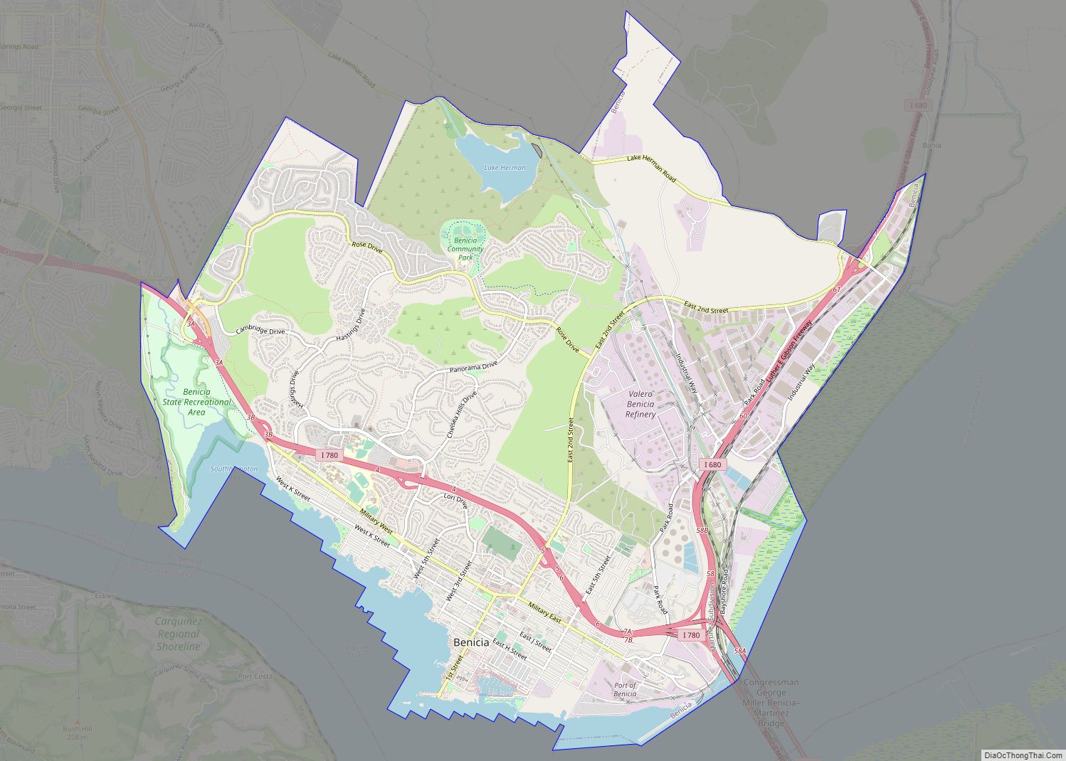
Map of Bethel Island CDP

Map of Bethel Island CDP

Bethel Island is an island in the Sacramento–San Joaquin River Delta of Contra Costa County, California, approximately 10 kilometres (6.2 mi) east of Antioch. The island describes itself as “the heart of the California Delta.” Bethel Island (formerly known as Bethell, Bethell Ranch, Bethel Tract, Sand Mound Ranch, Sand Mound Tract) is also a census-designated place … Read more

Map of Bertsch-Oceanview CDP

Map of Bertsch-Oceanview CDP

Bertsch–Oceanview is a census-designated place (CDP) in Del Norte County, California, United States. The community is located east of Crescent City, at an elevation of 20 feet (6.1 m), Bertsch–Oceanview has a total area of 5.9 square miles (15 km) of which 5.5 square miles (14 km) is land and 0.3 square miles (0.78 km) is water. Its population … Read more

Map of Berry Creek CDP

Map of Berry Creek CDP

Berry Creek (formerly, Berry Valley) is a census-designated place about 25 miles (40 km) northeast of Oroville, California in hilly terrain at 2,000 feet (610 m) above mean sea level. The community is located along the Oroville-Quincy Highway on the shore of Madrone Lake. The community is home to Berry Creek Elementary School (K-8), 2 small mountain … Read more

Map of Big Bear City CDP

Map of Big Bear City CDP

Big Bear City is an unincorporated community in San Bernardino County, California, United States along the east shore of Big Bear Lake and surrounded by the San Bernardino National Forest. It is 27 miles (43 km) northeast of the city of San Bernardino, and immediately east of the incorporated city of Big Bear Lake. For statistical … Read more

Map of Bieber CDP

Map of Bieber CDP

Bieber (formerly Chalk Ford) is a census-designated place (CDP) in Lassen County, California. It is located on the Pit River, 55 miles (89 km) north-northwest of Susanville, at an elevation of 4,124 feet (1,257 m) Its population is 266 as of the 2020 census, down from 312 from the 2010 census. The ZIP Code is 96009. The … Read more

Map of Beverly Hills city

Map of Beverly Hills city, California

Beverly Hills is a city located in Los Angeles County, California. A notable and historic suburb of Los Angeles, it is located immediately southwest of the Hollywood Hills, approximately 12.2 miles (19.6 km) northwest of downtown Los Angeles. Beverly Hills’ land area totals to 5.71 square miles (14.8 km), and along with the smaller city of West … Read more

Map of Big Creek CDP

Map of Big Creek CDP, California

Big Creek (Big Creek Flats in the 1870s; Manzanita Park in 1902; until 1926, Cascada) is a small census-designated place in Fresno County, California, located in the Sierra Nevada on the north bank of Big Creek. It lies at an elevation of 4,984 feet (1,519 m) above sea level. Its last population count was 175. The … Read more

Map of Big Bend CDP

Map of Big Bend CDP, California

Big Bend of the Madesi Valley is a census-designated place (CDP) and the indigenous homeland of Madesi tribe, located in Shasta County, northeastern California. It is named for a major change in course of the Pit River. Its population is 79 as of the 2020 census, down from 102 from the 2010 census. Big Bend … Read more

Map of Big Bear Lake city

Map of Big Bear Lake city

Big Bear Lake is a small city in San Bernardino County, California, located in the San Bernardino Mountains along the south shore of Big Bear Lake, and surrounded by the San Bernardino National Forest. The city is about 25 miles (40 km) northeast of the city of San Bernardino, and immediately west of the unincorporated town … Read more

Map of Big River CDP

Map of Big River CDP

Big River is a census-designated place (CDP) in San Bernardino County, California, United States. The population was 1,327 at the 2010 census, up from 1,266 at the 2000 census. Big River CDP overview: Name: Big River CDP LSAD Code: 57 LSAD Description: CDP (suffix) State: California County: San Bernardino County Elevation: 436 ft (133 m) Total Area: … Read more

Map of Big Pine CDP

Map of Big Pine CDP

Big Pine (formerly, Bigpine) is a census-designated place (CDP) in Inyo County, California, United States. Big Pine is located approximately 15 miles (24 km) south-southeast of Bishop, at an elevation of 3,989 feet (1,216 m). The population was 1,756 at the 2010 census, up from 1,350 at the 2000 census. The Big Pine Band of Owens Valley … Read more

Map of Big Lagoon CDP

Map of Big Lagoon CDP

Big Lagoon is a census-designated place in Humboldt County, California. It is located 7 miles (11 km) north of Trinidad, at an elevation of 56 feet (17 m). Its population is 161 as of the 2020 census, up from 93 from the 2010 census. Big Lagoon CDP overview: Name: Big Lagoon CDP LSAD Code: 57 LSAD Description: … Read more