Big Bear Lake is a small city in San Bernardino County, California, located in the San Bernardino Mountains along the south shore of Big Bear Lake, and surrounded by the San Bernardino National Forest. The city is about 25 miles (40 km) northeast of the city of San Bernardino, and immediately west of the unincorporated town of Big Bear City. The population was approximately 5,019 at the 2010 census, down from 5,438 at the 2000 census. However, since it is a popular year-round resort destination, the actual number of people staying in or visiting the greater Big Bear Valley area regularly surges to over 100,000 during many weekends of the year.
| Name: | Big Bear Lake city |
|---|---|
| LSAD Code: | 25 |
| LSAD Description: | city (suffix) |
| State: | California |
| County: | San Bernardino County |
| Incorporated: | November 28, 1980 |
| Elevation: | 6,752 ft (2,058 m) |
| Total Area: | 6.42 sq mi (16.64 km²) |
| Land Area: | 6.24 sq mi (16.16 km²) |
| Water Area: | 0.18 sq mi (0.47 km²) 2.88% |
| Total Population: | 5,046 |
| Population Density: | 808.52/sq mi (312.17/km²) |
| ZIP code: | 92315 |
| Area code: | 909 |
| FIPS code: | 0606434 |
| GNISfeature ID: | 1652673 |
| Website: | citybigbearlake.com |
Online Interactive Map
Click on ![]() to view map in "full screen" mode.
to view map in "full screen" mode.
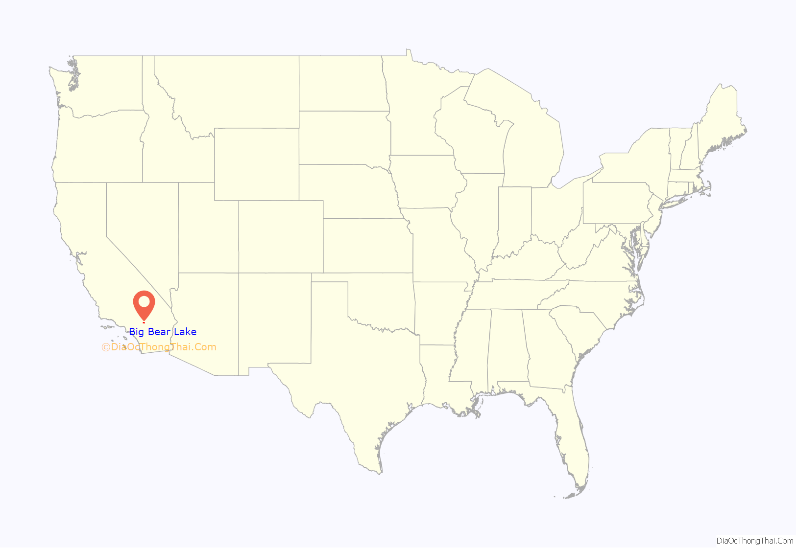
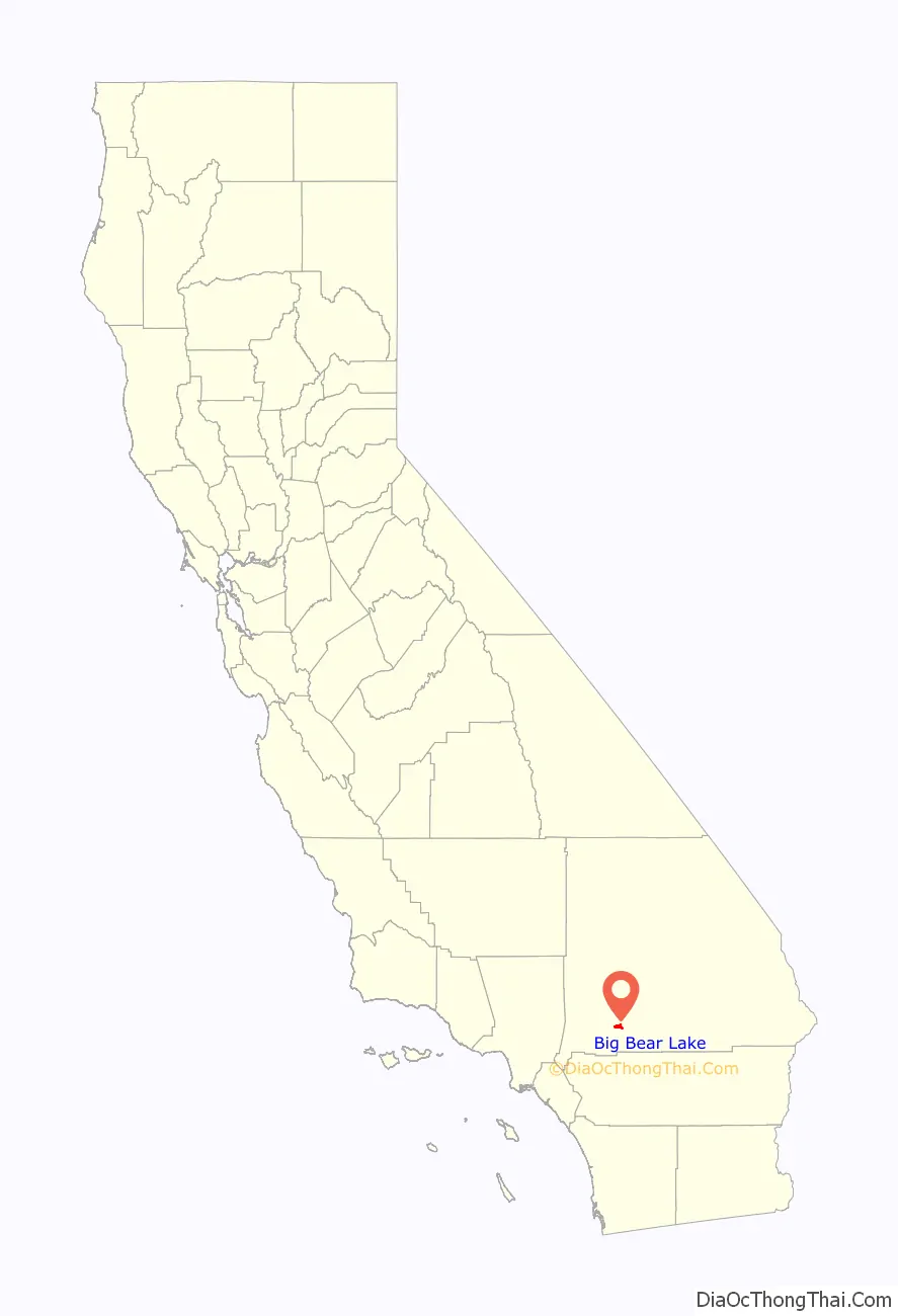
Big Bear Lake location map. Where is Big Bear Lake city?
History
Big Bear Lake was inhabited by the indigenous Serrano people for over 2,000 years before it was explored by Benjamin Wilson and his party. Once populated by only the natives and the grizzly bears, from which the area received its name, the population of the Big Bear Valley grew rapidly during the southern California gold rush from 1861 to 1912. Grizzly bears were not found in the region after 1908. Today, there are black bears in the region since their introduction in 1933, and they are sometimes sighted in residential areas.
A trip to Big Bear Lake from San Bernardino took two days on horse-drawn coaches. Kirk Phillips was a local who took a trip to New York City and saw the world’s first bus line. This inspired him to create the world’s second bus line from San Bernardino to Big Bear Valley using white trucks with several rows of seats. This made it possible for the villages to grow and for Big Bear Lake to become the first mountain recreation area in Southern California.
Many people traveled to enjoy recreation on the lake. However, another major draw was the natural hot spring. Emile Jesserun bought 40 acres (16 ha) of land that included the hot spring and built the first major resort in Big Bear, the Pan Hot Springs Hotel, in 1921. This resort was followed with others that strove to be the best by creating a country club atmosphere, complete with the amenities required to lure the Hollywood celebrities of the time including Cecil B. DeMille, Shirley Temple, and Ginger Rogers. By 1924, Big Bear was populated with 44 resorts and a constant stream of vacationers. The Pan Hot Springs Hotel, like many of the other resorts and hotels in Big Bear, was extensively damaged by fire in 1933.
For Hollywood’s film industry, the area has been a popular place for shooting on location since the silent era. In late November 1915, Universal Studios filmed there for its three-reel production of John o’ the Mountains starring Sydney Ayres and Louella Maxam. The 1920 version of Last of the Mohicans was filmed there as well, as were some scenes for the 1936 film Daniel Boone, Gone with the Wind, 20th Century Fox’s 1960 film North to Alaska, Disney’s Old Yeller, the 1969 musical film Paint Your Wagon, the 1983 movie War Games, and the 1985 “dark comedy” Better Off Dead. Many television series have filmed sequences there too, including opening sequences in 1969 for the NBC children’s program H.R. Pufnstuf.
Winter activities are also popular in Big Bear. The first ski jump in Big Bear was erected in 1929 and quickly claimed a world ski jump record. More jumps were built in Big Bear Lake and the Viking Ski Club of Los Angeles began to use them for competition and events. The move to a winter resort town was solidified in 1952 when Tommy Tyndall opened a resort in Big Bear Lake, now known as Snow Summit. In some winters the area gets little snow, but snow machines keep the resorts in business.
In the summer of 1968, Caltech began construction of Big Bear Solar Observatory (BBSO) located on the north shore of Big Bear Lake. Due to extensive rain and snow, the lake rose several feet and BBSO was surrounded by water at the time construction was completed using makeshift barges in May 1970. BBSO, now operated by the New Jersey Institute of Technology, is still a major Big Bear Lake landmark connected to the north shore by a dirt and rock causeway.
Since 1970, Big Bear Lake has held an annual Oktoberfest. The Big Bear Lake Oktoberfest sports the highest beer garden, by elevation, in the United States. Big Bear Lake was incorporated as a city on November 28, 1980.
During the 1990s, the city became famous as a training spot for boxing champions. Oscar De La Hoya, Mike Tyson, Fernando Vargas, Gennady Golovkin, and Shane Mosley are among the famous boxers who have trained at Big Bear.
In February 2013, a major manhunt occurred in the Big Bear Lake area to find Christopher Dorner, who by that point had killed three people. A standoff ended in nearby Angelus Oaks.
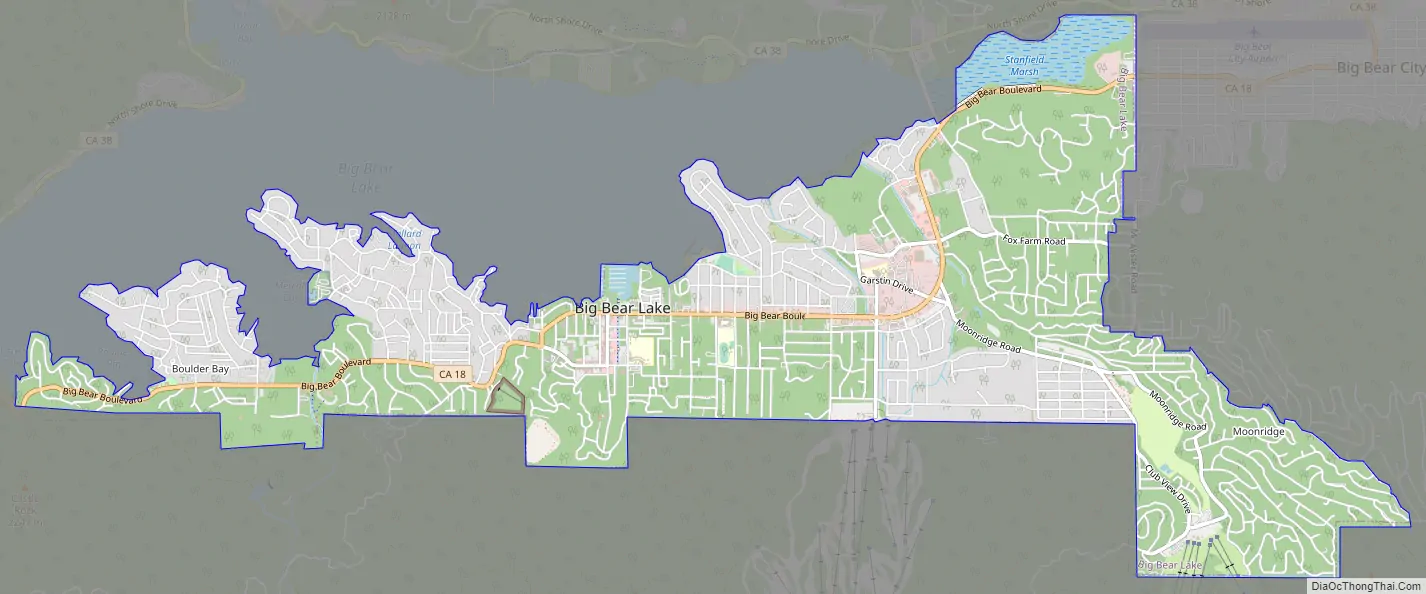
Big Bear Lake Road Map
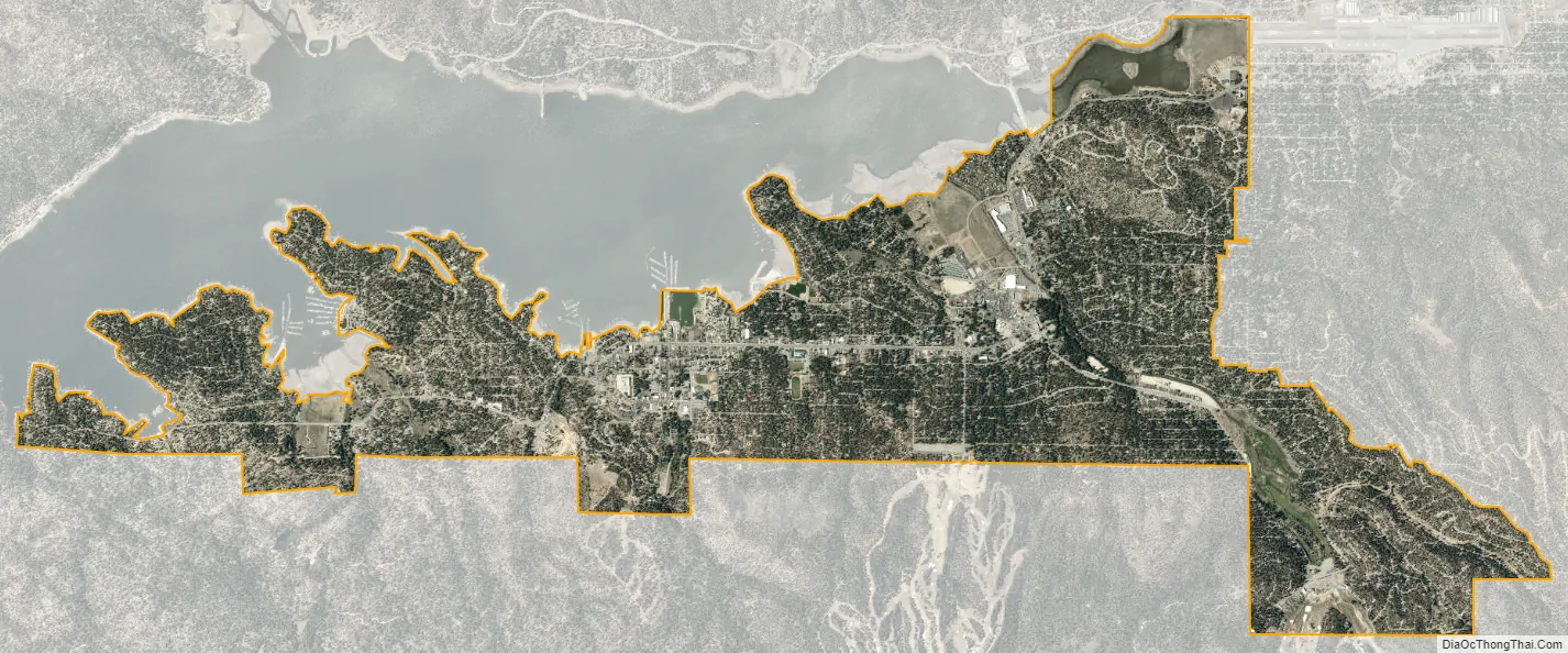
Big Bear Lake city Satellite Map
Geography
According to the United States Census Bureau, the city has a total area of 6.5 square miles (17 km), 6.3 square miles (16 km) of which is land and 0.2 square miles (0.52 km) of which (2.88%) is water. It is located 25 miles (40 km) northeast of the city of San Bernardino, and immediately west of Big Bear City.
Big Bear Lake is officially at an elevation of 6,752 ft (2,058 m) above sea level.
The California Office of Environmental Health Hazard Assessment has issued a safety advisory for any fish caught in Big Bear Lake due to elevated levels of mercury and PCBs.
Climate
According to the National Weather Service, the warmest month at Big Bear is July, with a daily average temperature of 65.1 °F (18.4 °C). The coolest month is February, with a daily average temperature of 34.7 °F (1.5 °C). (January and December are nearly tied, at 34.8 °F (1.6 °C).) There are an average of 1.3 days each year with highs of 90 °F (32 °C) or higher. Freezing temperatures have occurred in every month and occur on an average of 176.2 days each year, on average from September 24 to June 4. With a period of record dating back to only 1960, the highest temperature recorded was 98 °F (37 °C), recorded on June 30, 1994, while the lowest was −15 °F (−26 °C) on November 19, 1964.
Due to the 6,750 feet (2,060 m) elevation of the weather station, precipitation is greater than in the lowlands of southern California, averaging 19.98 in (507 mm) a year. The maximum 24-hour precipitation was 9.43 in (240 mm) on December 6, 1966. Measurable precipitation normally occurs 43.3 days a year. Mountain thunderstorms can produce heavy rainfall, even in midsummer (when most southern California lowland locations are quite dry). Big Bear Lake’s climate is Csb (Warm-summer Mediterranean) under the Köppen climate classification, bordering a humid continental climate (Dsb); it lies within USDA plant hardiness zone 7a. Big Bear Lake is the highest and coldest incorporated city in southern California.
In contrast to most of southern California, the Big Bear Lake region normally receives significant winter snow because of its high elevation. Snowfall, as measured at lake level, averages 58.6 in (149 cm) per season; upwards of 100 in (250 cm) can accumulate on the forested ridges bordering the lake, at elevations above 8,000 ft (2,400 m). In February 1990, 59.5 in (151 cm) of snow were recorded. The most snow in 24 hours was 27.0 in (69 cm) on March 27, 1991. The greatest snow depth was 58 in (150 cm) on February 3, 1979. Snow has fallen in every month except July and August. There are normally 16 days each year with measurable snow of 0.1 in (0.25 cm) or more.
See also
Map of California State and its subdivision:- Alameda
- Alpine
- Amador
- Butte
- Calaveras
- Colusa
- Contra Costa
- Del Norte
- El Dorado
- Fresno
- Glenn
- Humboldt
- Imperial
- Inyo
- Kern
- Kings
- Lake
- Lassen
- Los Angeles
- Madera
- Marin
- Mariposa
- Mendocino
- Merced
- Modoc
- Mono
- Monterey
- Napa
- Nevada
- Orange
- Placer
- Plumas
- Riverside
- Sacramento
- San Benito
- San Bernardino
- San Diego
- San Francisco
- San Joaquin
- San Luis Obispo
- San Mateo
- Santa Barbara
- Santa Clara
- Santa Cruz
- Shasta
- Sierra
- Siskiyou
- Solano
- Sonoma
- Stanislaus
- Sutter
- Tehama
- Trinity
- Tulare
- Tuolumne
- Ventura
- Yolo
- Yuba
- Alabama
- Alaska
- Arizona
- Arkansas
- California
- Colorado
- Connecticut
- Delaware
- District of Columbia
- Florida
- Georgia
- Hawaii
- Idaho
- Illinois
- Indiana
- Iowa
- Kansas
- Kentucky
- Louisiana
- Maine
- Maryland
- Massachusetts
- Michigan
- Minnesota
- Mississippi
- Missouri
- Montana
- Nebraska
- Nevada
- New Hampshire
- New Jersey
- New Mexico
- New York
- North Carolina
- North Dakota
- Ohio
- Oklahoma
- Oregon
- Pennsylvania
- Rhode Island
- South Carolina
- South Dakota
- Tennessee
- Texas
- Utah
- Vermont
- Virginia
- Washington
- West Virginia
- Wisconsin
- Wyoming


