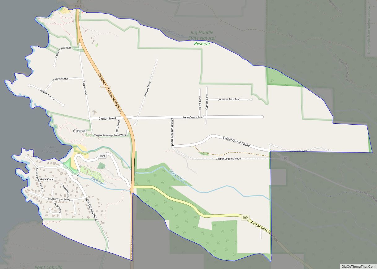
Map of Castroville CDP

Map of Castroville CDP, California

Castroville is an unincorporated town and census-designated place (CDP) in Monterey County, California, United States. At the time of the 2020 census the population was 7,515, up from 6,481 in 2010. Castroville is known for its artichoke crop and for the annual Castroville Artichoke Festival, leading to its nickname as the “Artichoke Center of the … Read more

Map of Castro Valley CDP

Map of Castro Valley CDP

Castro Valley is a census-designated place (CDP) in Alameda County, California, United States. At the 2010 census, it was the fifth most populous unincorporated area in California and the twenty-third most populous in the United States. The population was 66,441 at the 2020 census. Castro Valley is named after Don Guillermo Castro, a noted 19th-century … Read more

Map of Castle Hill CDP

Map of Castle Hill CDP

Castle Hill is a census-designated place in Contra Costa County, California. Castle Hill sits at an elevation of 302 feet (92 m). The 2010 United States census reported Castle Hill’s population was 1,299. Castle Hill CDP overview: Name: Castle Hill CDP LSAD Code: 57 LSAD Description: CDP (suffix) State: California County: Contra Costa County Elevation: 302 ft … Read more

Map of Cayucos CDP

Map of Cayucos CDP

Cayucos (Spanish for “Canoe”) is an unincorporated coastal town in San Luis Obispo County, California, along California State Route 1 between Cambria to the north and Morro Bay to the south. The population was 2,505 at the 2020 census, down from 2,592 at the 2010 census. Cayucos CDP overview: Name: Cayucos CDP LSAD Code: 57 … Read more

Map of Catheys Valley CDP

Map of Catheys Valley CDP

Catheys Valley (formerly, Cathay and Cathey’s Valley) is a census-designated place in Mariposa County, California, United States. It lies in Catheys Valley 22 miles (35 km) northeast of Merced and 8 miles (13 km) southwest of Mariposa, at an elevation of 1,325 feet (404 m). As of the 2020 census, Catheys Valley had a population of 829. Catheys … Read more

Map of Cathedral City city

Map of Cathedral City

Cathedral City, colloquially known as “Cat City“, is a desert resort city in Riverside County, California, United States, within the Colorado Desert’s Coachella Valley. Situated between Palm Springs and Rancho Mirage, the city has the second largest population, after Indio, of the nine cities in the Coachella Valley. Its population was 51,493 at the 2020 … Read more

Map of Cedar Ridge CDP

Map of Cedar Ridge CDP

Cedar Ridge is a census-designated place (CDP) in Tuolumne County, California. Cedar Ridge sits at an elevation of 3,760 feet (1,150 m). The 2010 United States census reported Cedar Ridge’s population was 1,132. Cedar Ridge was created a CDP for the 2010 census, previously it was part of the Phoenix Lake-Cedar Ridge CDP. Cedar Ridge CDP … Read more

Map of Cazadero CDP

Map of Cazadero CDP

Cazadero (Spanish for “hunting ground”) is an unincorporated community and census-designated place (CDP) in western Sonoma County, California, United States with a population of 354 in 2010. The downtown of Cazadero consists of two churches, a general store, a post office, a hardware store, an auto repair garage, private office space, and the Cazadero Volunteer … Read more

Map of Cedar Slope CDP

Map of Cedar Slope CDP

Cedar Slope is a census-designated place (CDP) in Tulare County, California. Cedar Slope sits at an elevation of 5,584 feet (1,702 m). The 2020 United States census reported that Cedar Slope was 10. Cedar Slope can be reached from Porterville by 37 curvy miles on California State Route 190 with an elevation gain of 5,525 feet. … Read more

Map of Ceres city

Map of Ceres city

Ceres is a city in Stanislaus County, California. Its population was 49,302 at the 2020 U.S. Census, up from 45,417 at the 2010 U.S. Census. It is part of the Modesto metropolitan statistical area. Ceres is located in the San Joaquin Valley along State Route 99, south of Modesto and north of Turlock in Stanislaus … Read more

Map of Centerville CDP

Map of Centerville CDP, California

Centerville (formerly, Kings River, King River, Scottsburgh, and Scottsburg) is a census-designated place in Fresno County, California. It is located on the Atchison, Topeka and Santa Fe Railroad 16 miles (26 km) east of Fresno, at an elevation of 394 feet (120 m). At the 2010 census, it had a population of 392. Centerville CDP overview: … Read more

Map of Cedarville CDP, California

Map of Cedarville CDP, California

Cedarville (formerly Surprise Valley and Deep Creek) is a census-designated place located 20 miles (32 km) east of Alturas, at an elevation of 4,652 feet (1,418 m), in Modoc County, California. Its population is 437 as of the 2020 census, down from 514 at the 2010 census. Cedarville CDP overview: Name: Cedarville CDP LSAD Code: 57 LSAD … Read more