Cathedral City, colloquially known as “Cat City“, is a desert resort city in Riverside County, California, United States, within the Colorado Desert’s Coachella Valley. Situated between Palm Springs and Rancho Mirage, the city has the second largest population, after Indio, of the nine cities in the Coachella Valley. Its population was 51,493 at the 2020 census, a slight increase from 51,200 at the 2010 census.
Prior to the arrival of European explorers and settlers, the land was part of the territory inhabited by the Cahuilla Indians. Today every other square mile of the city is part of the Agua Caliente Band of Cahuilla Indians reservation land. Development of a town began when a housing subdivision was built in 1925, although it was not incorporated until 1981.
| Name: | Cathedral City city |
|---|---|
| LSAD Code: | 25 |
| LSAD Description: | city (suffix) |
| State: | California |
| County: | Riverside County |
| Incorporated: | November 16, 1981 |
| Elevation: | 328 ft (100 m) |
| Total Area: | 22.75 sq mi (58.93 km²) |
| Land Area: | 22.49 sq mi (58.26 km²) |
| Water Area: | 0.26 sq mi (0.67 km²) 1.18% |
| Total Population: | 51,493 |
| Population Density: | 2,289.19/sq mi (883.85/km²) |
| ZIP code: | 92234–92235 |
| FIPS code: | 0612048 |
| Website: | www.cathedralcity.gov |
Online Interactive Map
Click on ![]() to view map in "full screen" mode.
to view map in "full screen" mode.
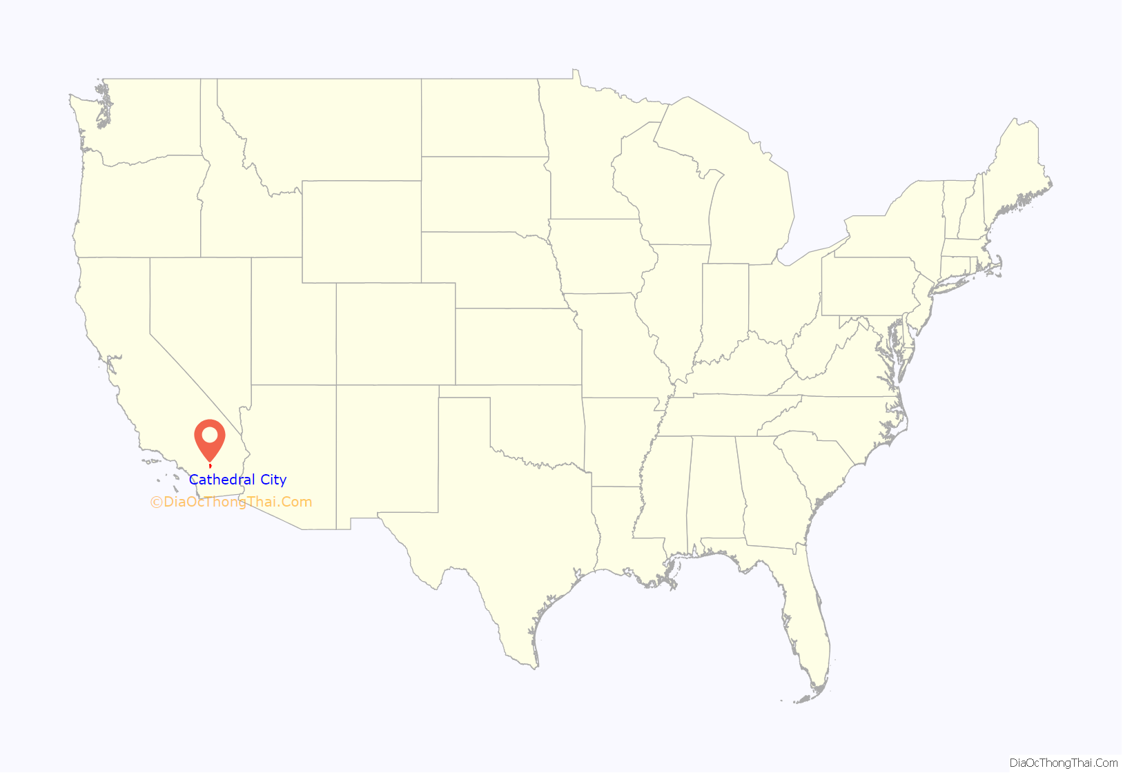
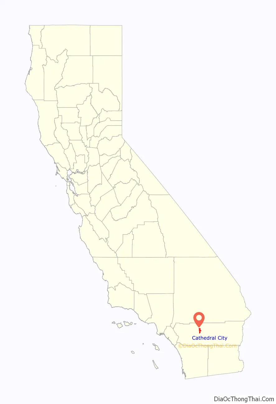
Cathedral City location map. Where is Cathedral City city?
History
Etymology
The city’s name is derived from Cathedral Canyon located to the south of the city in the foothills of the Santa Rosa and San Jacinto Mountains National Monument. The canyon is said to have received its name because certain rock formations in the canyon were reminiscent of a cathedral. A flood in August 1946 significantly altered the cathedral-like features of the canyon.
In the United Kingdom a cathedral city is a town that has achieved “city” status and is typically the location of a cathedral. This prompted Robert Ripley to include the town of Cathedral City in his December 9, 1939, Believe It Or Not column stating, “Believe it or not … there is no church in Cathedral City, Calif. It is named after a canyon”.
Early history: before 1860
Cathedral City sits at the northwestern end of the Coachella Valley between the San Bernardino Mountains to the north, and the San Jacinto Mountains to the south, with the San Gorgonio Pass to the West. The earliest established inhabitants of this region were the Cahuilla Indians. They arrived in the area around 3,000 BCE. The Cahuilla were organized into bands of about 600 to 800 people, and it was the Agua Caliente Band of Cahuilla Indians who inhabited the lands that included what would become Cathedral City, California.
The land was claimed by Spain in 1768 when Spain established Las Californias, a province of the Viceroyalty of New Spain, and then by Mexico in 1821 when Mexico and Spain signed the Treaty of Cordoba. At that time the province had already been renamed and expanded into the larger Alta California province. After the Mexican–American War, and with the signing of the Treaty of Guadalupe Hidalgo in 1848, possession of the land was formally transferred to the United States, and it officially became part of the State of California when the state was formed in 1850.
In 1852 US Army Colonel Henry Washington, a nephew of George Washington, the first President of the United States, was contracted by the government to survey Southern California. On November 7 of that year he established the initial point, in the San Bernardino Mountains, from which all future surveys in Southern California would be based. In 1855 he was contracted to continue his work and survey the Coachella Valley. It was then that he found and named Cathedral Canyon for which Cathedral City would be named.
Besides Colonel Henry Washington, there were occasional explorers, colonizers and soldiers that made their way through the area during the Spanish, Mexican, and early American eras, but none established any permanent structures or residences. The Cahuilla remained the only people known to be living in the area.
Stage and freight lines 1860–1880
Prior to the 1860s the only regularly traveled routes through the Coachella Valley were trading paths used by the Cahuilla and other Native American tribes. One of these paths, on the southwestern side of the valley, followed the base of the San Jacinto and Santa Rosa mountains somewhere near the Whitewater River, and would have passed through the area that would become Cathedral City. Early non-native explorers, surveyors, and military, such as Colonel Washington, made use of these routes, but regular transportation services were not established until 1862.
The Colorado River Gold Rush, which started in the spring of 1862, prompted William D. Bradshaw, a frontiersman, to seek a quicker route from Los Angeles to the Colorado River. Later that year he hired a guide, and with the help of the Cahuilla and Maricopa Indians, mapped a route from San Bernardino, California, through the San Gorgonio Pass and Coachella Valley, past the northern shore of the Salton Sink, through the passes between the Chuckwalla and Chocolate Mountains, and up to the Colorado River across from La Paz in the New Mexico Territory, (now the state of Arizona). Much of the route is thought to have followed the original southwestern trading path used by the Cahuilla.
Shortly after Bradshaw defined the trail from San Bernardino to La Paz, various stagecoach and freight companies began using the route. The stage and freight lines brought miners, supplies, and mail between San Bernardino and La Paz, and the route became known as the Bradshaw Trail or “Gold Road”. The Bradshaw trail, like the original Cahuillian trail, passed through the future Cathedral City, but the nearest scheduled stops were Agua Caliente (now Palms Springs), and Indian Wells (now Indio). The stage and freight lines were eventually supplanted by the railroads, but the trail would later become the basis for Palm Canyon Drive and Highway 111 that run through the city today.
Depression era nightclubs
In 1931, Al and Lou Wertheimer of the reputed Detroit “Purple Gang” opened the Dunes Club just outside Palm Springs’ city limits. This was followed in 1939 by Earl T. Sausser’s 139 Club and the Cove Club in 1941, built by Jake Katelman and Frank Portnoy.
Cathedral City today
Cathedral City began a downtown revitalization program in the late 1990s, which was substantially completed by 2005. A new city hall was built, as well as the IMAX/Mary Pickford movie theater complex, along with a total of 130 acres (0.53 km) of new or remodeled stores and restaurant space.
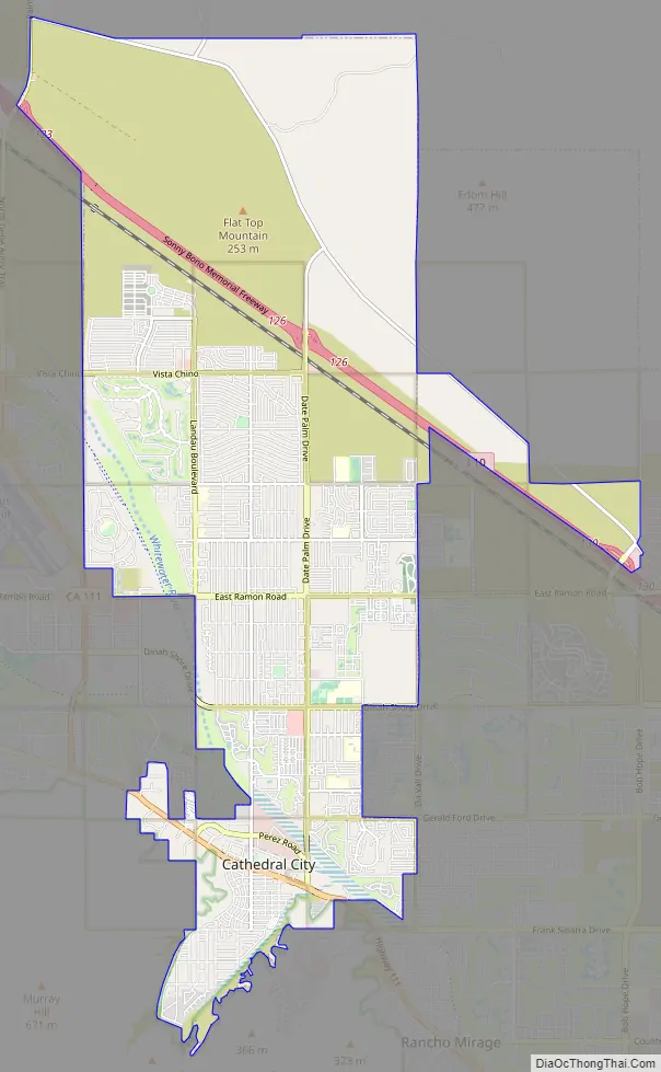
Cathedral City Road Map
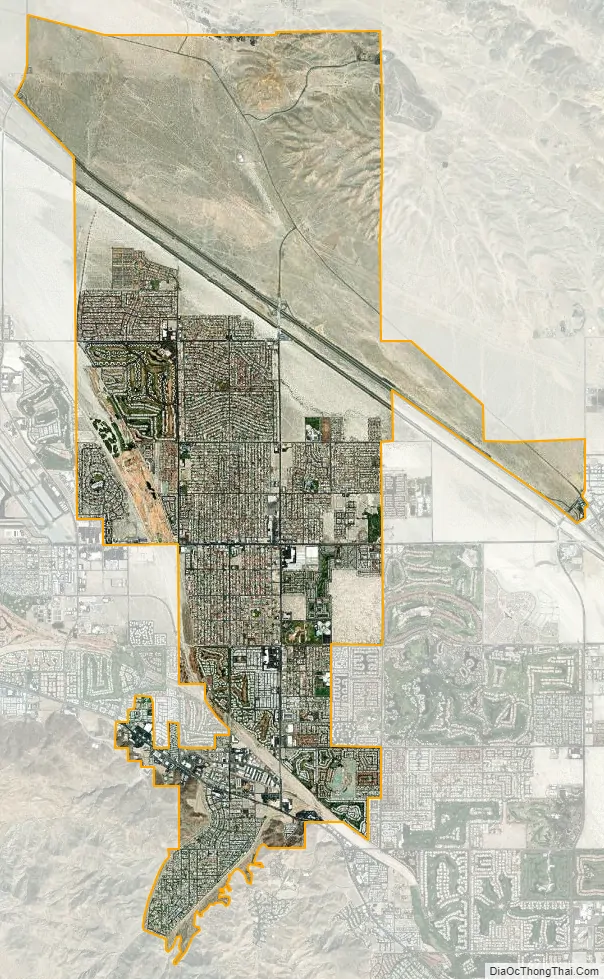
Cathedral City city Satellite Map
Geography
According to the United States Census Bureau, Cathedral City has a total area of 21.8 square miles (56 km), of which 21.5 square miles (56 km) of it is land and 0.3 square miles (0.78 km) of it (1.18%) is water.
See also
Map of California State and its subdivision:- Alameda
- Alpine
- Amador
- Butte
- Calaveras
- Colusa
- Contra Costa
- Del Norte
- El Dorado
- Fresno
- Glenn
- Humboldt
- Imperial
- Inyo
- Kern
- Kings
- Lake
- Lassen
- Los Angeles
- Madera
- Marin
- Mariposa
- Mendocino
- Merced
- Modoc
- Mono
- Monterey
- Napa
- Nevada
- Orange
- Placer
- Plumas
- Riverside
- Sacramento
- San Benito
- San Bernardino
- San Diego
- San Francisco
- San Joaquin
- San Luis Obispo
- San Mateo
- Santa Barbara
- Santa Clara
- Santa Cruz
- Shasta
- Sierra
- Siskiyou
- Solano
- Sonoma
- Stanislaus
- Sutter
- Tehama
- Trinity
- Tulare
- Tuolumne
- Ventura
- Yolo
- Yuba
- Alabama
- Alaska
- Arizona
- Arkansas
- California
- Colorado
- Connecticut
- Delaware
- District of Columbia
- Florida
- Georgia
- Hawaii
- Idaho
- Illinois
- Indiana
- Iowa
- Kansas
- Kentucky
- Louisiana
- Maine
- Maryland
- Massachusetts
- Michigan
- Minnesota
- Mississippi
- Missouri
- Montana
- Nebraska
- Nevada
- New Hampshire
- New Jersey
- New Mexico
- New York
- North Carolina
- North Dakota
- Ohio
- Oklahoma
- Oregon
- Pennsylvania
- Rhode Island
- South Carolina
- South Dakota
- Tennessee
- Texas
- Utah
- Vermont
- Virginia
- Washington
- West Virginia
- Wisconsin
- Wyoming


