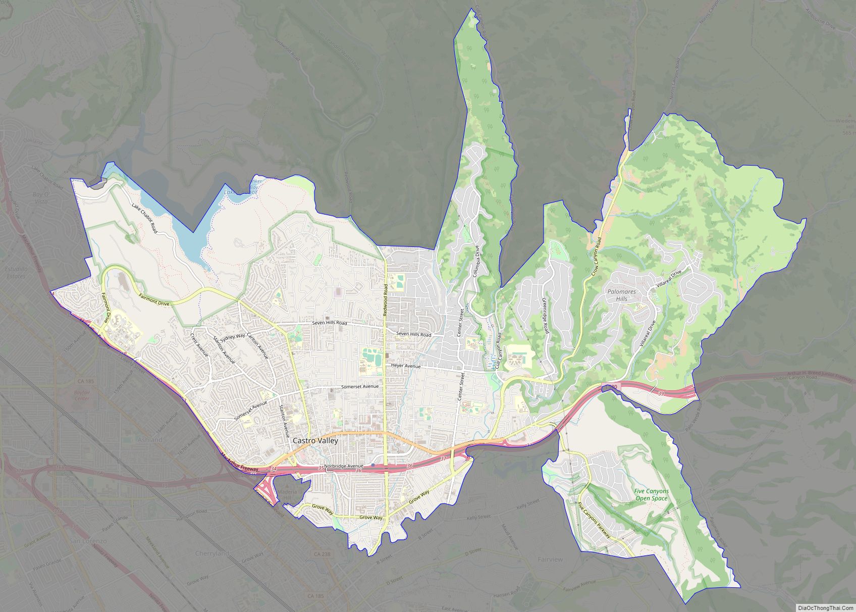
Castro Valley is a census-designated place (CDP) in Alameda County, California, United States. At the 2010 census, it was the fifth most populous unincorporated area in California and the twenty-third most populous in the United States. The population was 66,441 at the 2020 census.
Castro Valley is named after Don Guillermo Castro, a noted 19th-century Californio ranchero who owned the land where the community is located.
| Name: | Castro Valley CDP |
|---|---|
| LSAD Code: | 57 |
| LSAD Description: | CDP (suffix) |
| State: | California |
| County: | Alameda County |
| Elevation: | 161 ft (49 m) |
| Total Area: | 17.07 sq mi (44.21 km²) |
| Land Area: | 16.85 sq mi (43.64 km²) |
| Water Area: | 0.22 sq mi (0.57 km²) 1.68% |
| Total Population: | 66,441 |
| Population Density: | 3,943.55/sq mi (1,522.58/km²) |
| ZIP code: | 94546, 94552 |
| Area code: | 510, 341 |
| FIPS code: | 0611964 |
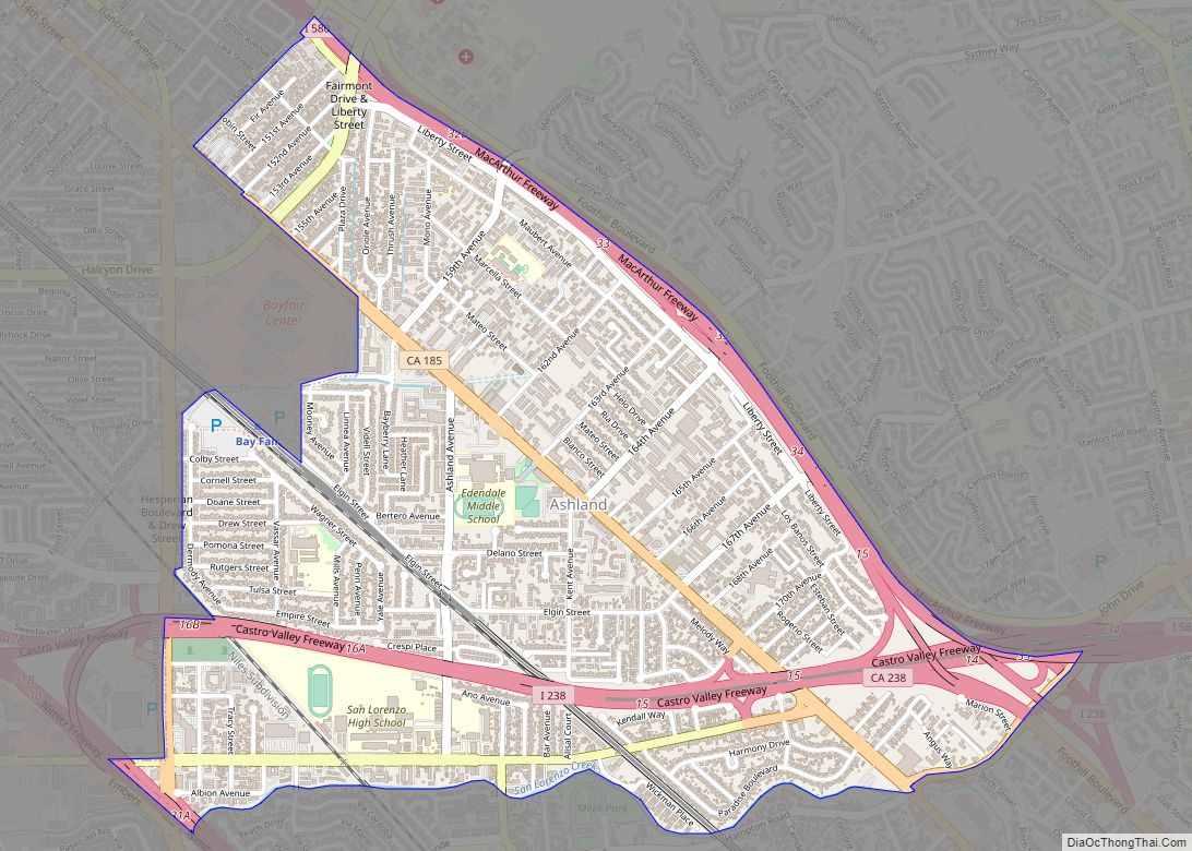
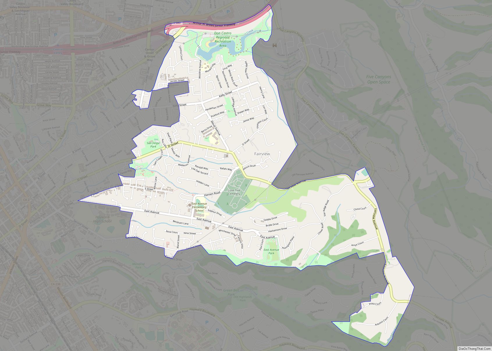
Online Interactive Map
Click on ![]() to view map in "full screen" mode.
to view map in "full screen" mode.
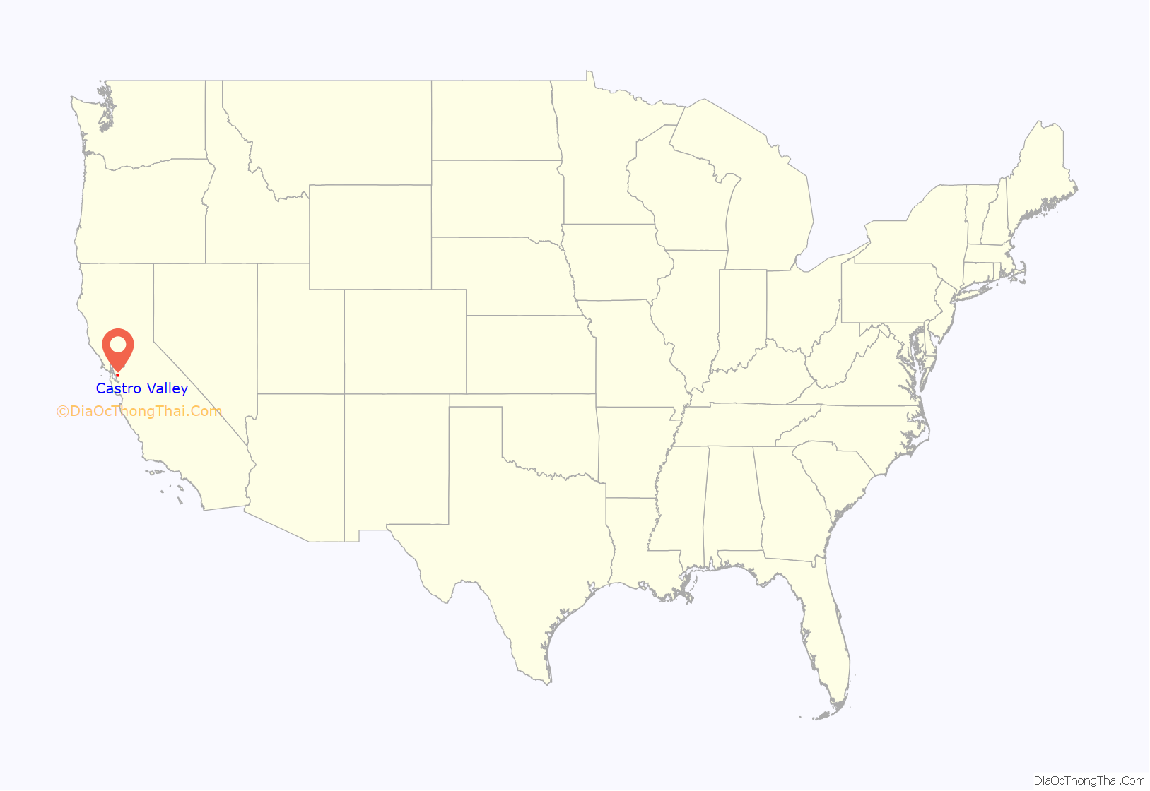
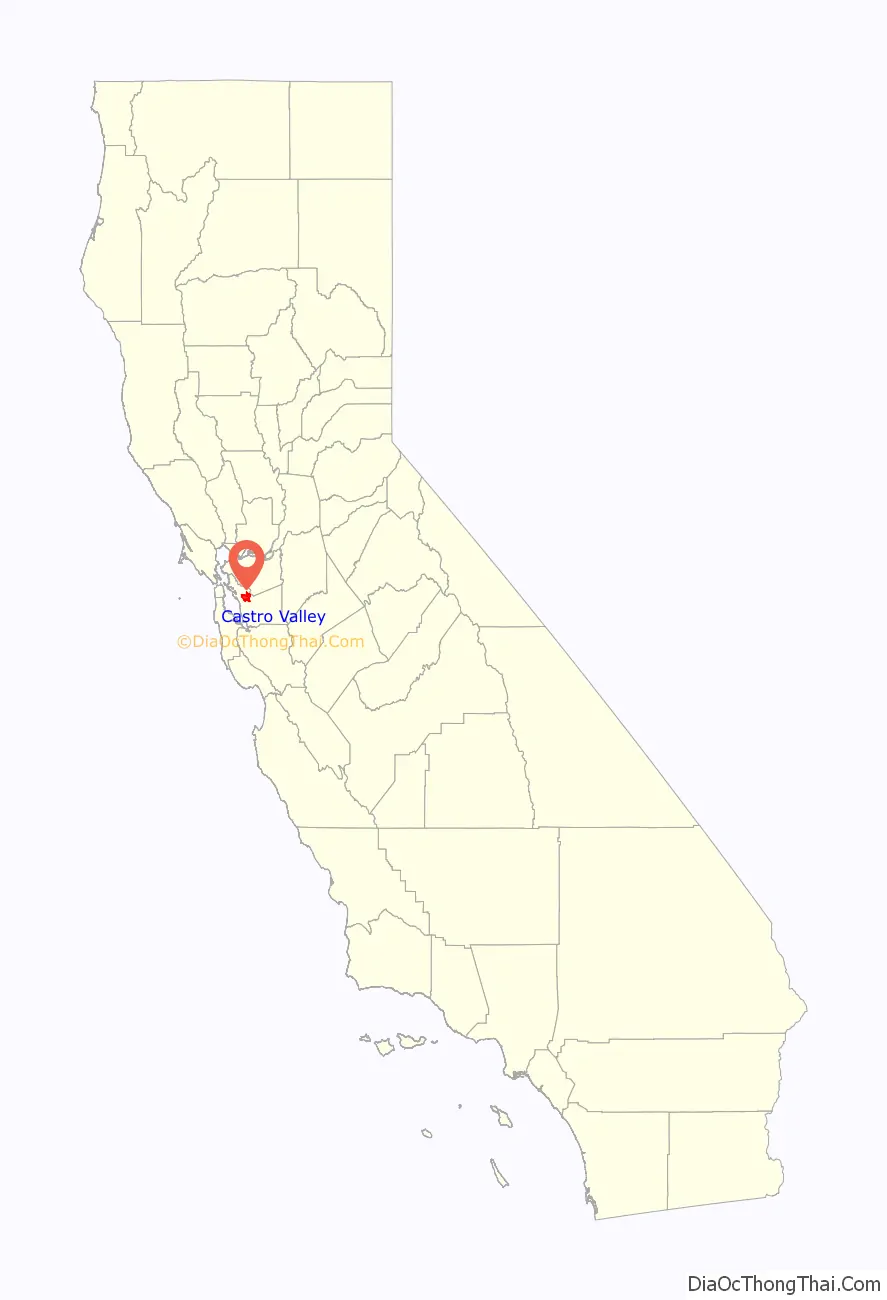
Castro Valley location map. Where is Castro Valley CDP?
History
Before the arrival of European settlers the area was settled by the Chocheño (also spelled Chochenyo or Chocenyo) subdivision of the Ohlone Native Americans.
With the arrival of Europeans, they established Mission San Jose in 1797. The area Castro Valley now occupies was part of the extensive colony of New Spain in what was the province of Alta California.
Castro Valley was part of the original 28,000 acre (110 km) land grant given to Castro in 1840, called Rancho San Lorenzo. This land grant included Hayward, San Lorenzo, and Castro Valley, including Crow Canyon, Cull Canyon, and Palomares Canyons. Castro had a gambling habit and had to sell off portions of his land to pay gambling debts. The last of his holding was sold in a sheriff’s sale in 1864 to Faxon Atherton for $400,000.
Atherton (after whom the city of Atherton is named) in turn began selling off his portion in smaller parcels. Two men named Cull (the namesake of Cull Canyon) and Luce bought some 2,400 acres (10 km) and began running a steam-operated saw mill in Redwood Canyon. The Jensen brothers also bought land from Atherton in 1867.
In 1866, Redwood school was built, the first public school in the area. Many Portuguese families immigrated to the surrounding canyons (especially Palomares Canyon) and farmed large amounts of land, where their descendants remain today. In the 1870s, Lake Chabot, a reservoir and popular park, was built by Chinese laborers living at Camp Yema-Po. During the 1940s and 1950s, Castro Valley was known for its chicken ranches. Later it developed into a bedroom community, where workers live and commute to their jobs in the surrounding communities.
Castro Valley Road Map

Castro Valley city Satellite Map

Geography
Lake Chabot lies in the northwest part of Castro Valley. Directly to the west is San Leandro. Hayward is to the south. Dublin, Pleasanton, and San Ramon are to the east.
The eastern hills of Castro Valley constitute the headwaters of the San Lorenzo Creek watershed and the origin of several creeks that flow into San Lorenzo Creek: Bolinas, Castro Valley, Chabot, Crow, Cull, Eden, Hollis, Kelly Canyon, Norris, and Palomares Creeks.
See also
Map of California State and its subdivision:- Alameda
- Alpine
- Amador
- Butte
- Calaveras
- Colusa
- Contra Costa
- Del Norte
- El Dorado
- Fresno
- Glenn
- Humboldt
- Imperial
- Inyo
- Kern
- Kings
- Lake
- Lassen
- Los Angeles
- Madera
- Marin
- Mariposa
- Mendocino
- Merced
- Modoc
- Mono
- Monterey
- Napa
- Nevada
- Orange
- Placer
- Plumas
- Riverside
- Sacramento
- San Benito
- San Bernardino
- San Diego
- San Francisco
- San Joaquin
- San Luis Obispo
- San Mateo
- Santa Barbara
- Santa Clara
- Santa Cruz
- Shasta
- Sierra
- Siskiyou
- Solano
- Sonoma
- Stanislaus
- Sutter
- Tehama
- Trinity
- Tulare
- Tuolumne
- Ventura
- Yolo
- Yuba
- Alabama
- Alaska
- Arizona
- Arkansas
- California
- Colorado
- Connecticut
- Delaware
- District of Columbia
- Florida
- Georgia
- Hawaii
- Idaho
- Illinois
- Indiana
- Iowa
- Kansas
- Kentucky
- Louisiana
- Maine
- Maryland
- Massachusetts
- Michigan
- Minnesota
- Mississippi
- Missouri
- Montana
- Nebraska
- Nevada
- New Hampshire
- New Jersey
- New Mexico
- New York
- North Carolina
- North Dakota
- Ohio
- Oklahoma
- Oregon
- Pennsylvania
- Rhode Island
- South Carolina
- South Dakota
- Tennessee
- Texas
- Utah
- Vermont
- Virginia
- Washington
- West Virginia
- Wisconsin
- Wyoming