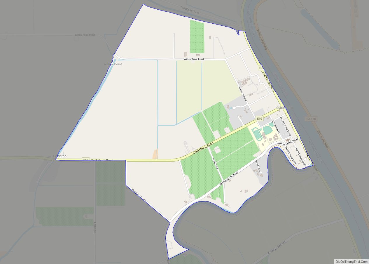
Map of Clear Creek CDP

Map of Clear Creek CDP, California

Clear Creek is a census-designated place (CDP) in Lassen County, California. It is located 2.5 miles (4 km) west-southwest of Westwood, at an elevation of 4970 feet (1515 m). Its population is 175 as of the 2020 census, up from 169 from the 2010 census. Clear Creek CDP overview: Name: Clear Creek CDP LSAD Code: 57 … Read more

Map of Clearlake Riviera CDP

Map of Clearlake Riviera CDP

Clearlake Riviera (formerly Clear Lake Riviera) is a census-designated place in Lake County, California. It lies at an elevation of 1755 feet (535 m). The population was 3,090 at the 2010 census. Clearlake Riviera CDP overview: Name: Clearlake Riviera CDP LSAD Code: 57 LSAD Description: CDP (suffix) State: California County: Lake County Elevation: 1,755 ft (535 m) … Read more

Map of Clearlake Oaks CDP

Map of Clearlake Oaks CDP

Clearlake Oaks is a census-designated place (CDP) in Lake County, California, United States. It is located on the northeast of Clear Lake, 8 miles (13.8 km) northwest of the town of Clearlake, at an elevation of 1,335 feet (407 m). The population was 2,359 at the 2010 census, down from 2,402 at the 2000 census. Clearlake … Read more

Map of Clio CDP, California

Map of Clio CDP, California

Clio (formerly, Wash) is a census-designated place in Plumas County, California, United States. Clio is located 23 miles (37.0 km) southeast of Quincy. The population was 66 at the 2010 census, down from 90 at the 2000 census. Clio CDP overview: Name: Clio CDP LSAD Code: 57 LSAD Description: CDP (suffix) State: California County: Plumas County … Read more

Map of Cleone CDP

Map of Cleone CDP

Cleone (formerly Kanuck) is a census-designated place in Mendocino County, California, United States. It is located 3.25 miles (5.2 km) north-northeast of Fort Bragg on California State Highway 1, at an elevation of 79 feet (24 m). It most likely takes its name from Kelio, a division or village of the Pomo people. The population was 622 … Read more

Map of Clearlake city

Map of Clearlake city

Clearlake is a city in Lake County, California. Clearlake is 4.5 miles (7.2 km) north-northwest of Lower Lake, at an elevation of 1,417 feet (432 m). As of the 2020 census, the city had a total population of 16,685, up from 15,250 in 2010. It takes its name from Clear Lake. Clearlake city overview: Name: Clearlake city … Read more

Map of Clyde CDP

Map of Clyde CDP, California

Clyde is a census-designated place (CDP) in Contra Costa County, California, United States. The population was 678 at the 2010 census. It is located six miles (10 kilometres) east of Martinez. Clyde CDP overview: Name: Clyde CDP LSAD Code: 57 LSAD Description: CDP (suffix) State: California County: Contra Costa County Elevation: 23 ft (7 m) Total Area: … Read more

Map of Cloverdale city

Map of Cloverdale city, California

Cloverdale is a city in Sonoma County, California, United States; it is both the westernmost and the northernmost city in the San Francisco Bay Area. The San Francisco and North Pacific Railroad reached Cloverdale in 1872. The Cloverdale Rancheria of Pomo Indians of California is headquartered there. The population was 8,618 at the 2010 census. … Read more

Map of Clipper Mills CDP

Map of Clipper Mills CDP

Clipper Mills (also, Clipper Mill) is a census-designated place in Butte County, California. It lies at an elevation of 3550 feet (1082 m). Clipper Mills has a post office, first established in 1861 and moved in 1891. Its zip code is 95930. Clipper Mills’s population was 142 at the 2010 census. Clipper Mills’ history and … Read more

Map of Coarsegold CDP

Map of Coarsegold CDP

Coarsegold is a census-designated place in Madera County, California, United States. The population was 4,144 at the 2020 census, up from 1,840 in 2010. The Picayune Rancheria of Chukchansi Indians, a federally recognized tribe, is headquartered in Coarsegold. Coarsegold CDP overview: Name: Coarsegold CDP LSAD Code: 57 LSAD Description: CDP (suffix) State: California County: Madera … Read more

Map of Coalinga city

Map of Coalinga city

Coalinga (/ˌkoʊ.əˈlɪŋɡə/ or /kəˈlɪŋɡə/) is a city in Fresno County and the western San Joaquin Valley, in central California about 80 miles (128 km) southeast of Salinas. It was formerly known as Coaling Station A, Coalingo, and Coalinga Station. The population was 13,380 as of the 2010 census, up from 11,668 at the 2000 census. It … Read more

Map of Coachella city

Map of Coachella city

Coachella (/ˌkoʊəˈtʃɛlə/ KOH-ə-CHEL-ə, commonly /koʊˈtʃɛlə/ koh-CHEL-ə) is a city in Riverside County, California. It is the namesake and easternmost city of the Coachella Valley, in Southern California’s Colorado Desert. Coachella is one of California’s fastest-growing cities; when it incorporated in 1946, it had 1,000 residents. By the 2020 Census, the population had grown to 41,941. … Read more