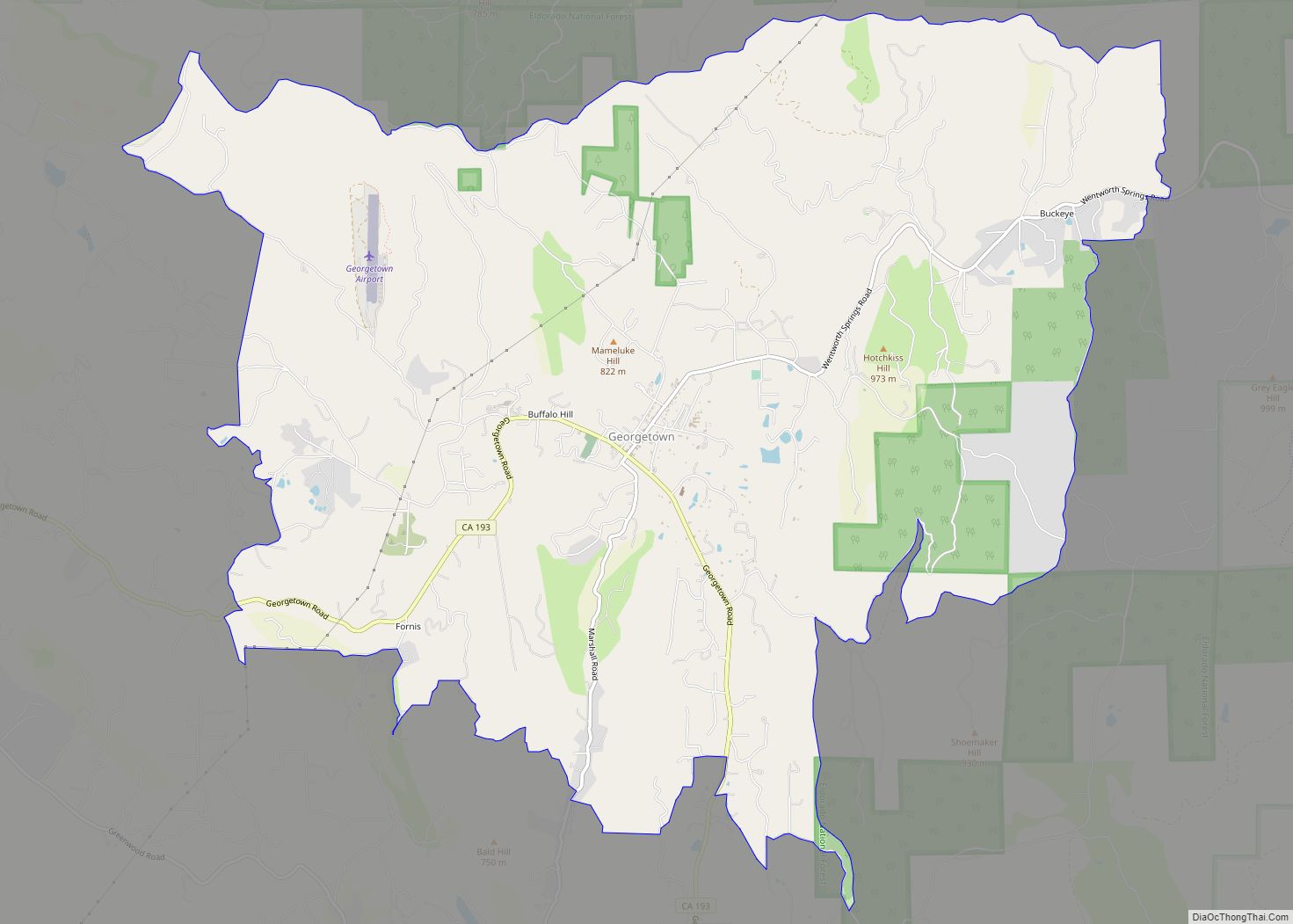
Map of Glendora city

Map of Glendora city, California

Glendora is a city in the San Gabriel Valley in Los Angeles County, California, 26 miles (42 km) east of Los Angeles. As of the 2020 census, the population of Glendora was 52,558. Known as the “Pride of the Foothills”, Glendora is nestled in the foothills of the San Gabriel Mountains. Its downtown area, locally known … Read more

Map of Glen Ellen CDP

Map of Glen Ellen CDP

Glen Ellen is a census-designated place (CDP) in Sonoma Valley, Sonoma County, California, United States. The population was 784 at the 2010 census, down from 992 at the 2000 census. Glen Ellen is the location of Jack London State Historic Park (including the Wolf House), Sonoma Valley Regional Park, and a former home of Hunter … Read more

Map of Gilroy city

Map of Gilroy city

Gilroy is a city in Northern California’s Santa Clara County, south of Morgan Hill and north of San Benito County. Gilroy is the southernmost city in the San Francisco Bay Area, with a population of 59,520 as of the 2020 Census. Gilroy’s origins lie in the village of San Ysidro that grew in the early … Read more

Map of Gold River CDP

Map of Gold River CDP

Gold River is a census-designated place (CDP) in Sacramento County, California. The population was 7,812 at the 2010 census, down from 8,023 at the 2000 census. Gold River is part of the Sacramento–Arden-Arcade–Roseville Metropolitan Statistical Area. With a median family income of $141,399 according to U.S Census Bureau in 2021, Gold River is the highest-income … Read more

Map of Gold Mountain CDP

Map of Gold Mountain CDP

Gold Mountain is an unincorporated community in Plumas County, California. Gold Mountain sits at an elevation of 5,341 feet (1,628 m). The 2010 United States census reported Gold Mountain’s population was 80. For statistical purposes, the United States Census Bureau has defined Gold Mountain as a census-designated place (CDP). Gold Mountain CDP overview: Name: Gold Mountain … Read more

Map of Golden Hills CDP

Map of Golden Hills CDP

Golden Hills is a census-designated place (CDP) in the Tehachapi Mountains, in Kern County, California, United States. The population was 8,656 at the 2010 census, up from 7,434 at the 2000 census. Golden Hills adjoins the city of Tehachapi on the west. Golden Hills CDP overview: Name: Golden Hills CDP LSAD Code: 57 LSAD Description: … Read more

Map of Good Hope CDP, California

Map of Good Hope CDP, California

Good Hope is a census-designated place in Riverside County, California. Good Hope sits at an elevation of 1,624 feet (495 m). The 2010 United States census reported Good Hope’s population was 9,192. Good Hope CDP overview: Name: Good Hope CDP LSAD Code: 57 LSAD Description: CDP (suffix) State: California County: Riverside County Elevation: 1,624 ft (495 m) Total … Read more

Map of Gonzales city

Map of Gonzales city, California

Gonzales is a city in Monterey County, California, United States. Gonzales is located 16 miles (26 km) southeast of Salinas, at an elevation of 135 feet (41 m). The population was 8,647 at the 2020 census, up from 8,187 at the 2010 census. Gonzales is a member of the Association of Monterey Bay Area Governments. Gonzales won … Read more

Map of Goleta city

Map of Goleta city

Goleta (/ɡəˈliːtə/; Spanish: [ɡoˈleta]; Spanish for “Schooner”) is a city in southern Santa Barbara County, California, United States. It was incorporated as a city in 2002, after a long period as the largest unincorporated populated area in the county. As of the 2000 census, the census-designated place had a total population of 55,204. A significant portion … Read more

Map of Graeagle CDP

Map of Graeagle CDP

Graeagle is a town and census-designated place in eastern Plumas County, California, United States, located along the Middle Fork Feather River in the Northern Sierra Nevada. The population was 737 as of 2010. Graeagle CDP overview: Name: Graeagle CDP LSAD Code: 57 LSAD Description: CDP (suffix) State: California County: Plumas County Elevation: 4,373 ft (1,333 m) Total … Read more

Map of Goshen CDP, California

Map of Goshen CDP, California

Goshen is a census-designated place (CDP) near Visalia, in Tulare County, California, United States. The population was 3,006 at the 2010 census, up from 2,394 at the 2000 census. Until the twentieth century, Goshen was an island in a marsh at the edge of Tulare Lake, formerly the largest freshwater lake west of the Great … Read more

Map of Goodyears Bar CDP

Map of Goodyears Bar CDP

Goodyears Bar, known as Slaughter’s Bar before 1851, is a census-designated place (CDP) in Sierra County, California, United States. Goodyears Bar is located along the North Yuba River and California State Route 49 3.25 miles (5.23 km) west-southwest of Downieville. Goodyears Bar has a post office with ZIP code 95944. The post office opened in 1851. … Read more