Goleta (/ɡəˈliːtə/; Spanish: [ɡoˈleta]; Spanish for “Schooner”) is a city in southern Santa Barbara County, California, United States. It was incorporated as a city in 2002, after a long period as the largest unincorporated populated area in the county. As of the 2000 census, the census-designated place had a total population of 55,204. A significant portion of the census territory of 2000 did not incorporate into the new city. The population of Goleta was 32,690 at the 2020 census. It is known for being near the University of California, Santa Barbara, campus.
| Name: | Goleta city |
|---|---|
| LSAD Code: | 25 |
| LSAD Description: | city (suffix) |
| State: | California |
| County: | Santa Barbara County |
| Incorporated: | February 1, 2002 |
| Elevation: | 20 ft (6 m) |
| Total Area: | 7.92 sq mi (20.53 km²) |
| Land Area: | 7.85 sq mi (20.33 km²) |
| Water Area: | 0.07 sq mi (0.19 km²) 0.90% |
| Total Population: | 32,690 |
| Population Density: | 4,100/sq mi (1,600/km²) |
| ZIP code: | 93111, 93116–93118, 93160, 93199 |
| Area code: | 805 |
| FIPS code: | 0630378 |
| GNISfeature ID: | 1660687 |
| Website: | CityofGoleta.org |
Online Interactive Map
Click on ![]() to view map in "full screen" mode.
to view map in "full screen" mode.
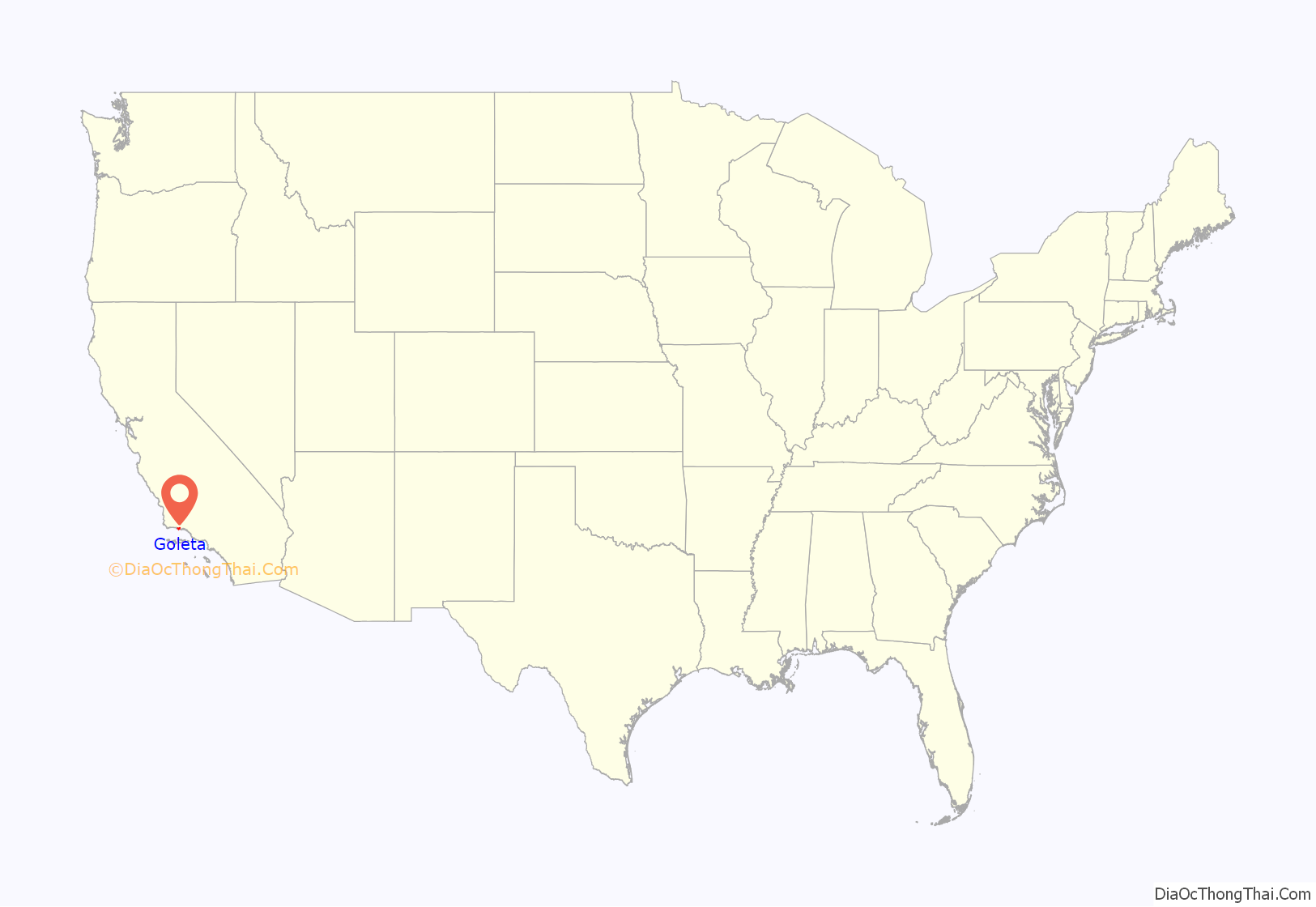
Goleta location map. Where is Goleta city?

History
Early history
The area of present-day Goleta was populated for thousands of years by the native Chumash people. Locally they became known by the Spanish as Canaliños because they lived along the coast adjacent to the Channel Islands. One of the largest villages, S’axpilil, was north of the Goleta Slough, not far from the present-day Santa Barbara Airport.
The first European visitor to the Goleta area was the Spanish mariner Juan Rodríguez Cabrillo, who spent time around the Channel Islands in 1542, and died there in 1543. During the 1980s, discovery of some 16th-century cannon on the beach led to the advancement of a theory that Sir Francis Drake sailed into the Goleta Slough in 1579. Goleta is one of many alternative locations (and the one farthest south) proposed for Drake’s “New Albion”, generally believed to be today’s Drake’s Bay, north of San Francisco.
In 1602, another sailing expedition, led by Sebastian Vizcaino, visited the California Coast. Vizcaino named the channel Santa Barbara. Spanish ships associated with the Manila Galleon trade probably stopped in the area intermittently during the next 167 years, but no permanent settlements were established.
The first land expedition to California, led by Gaspar de Portolà, spent several days in the area in 1769, on its way to Monterey Bay, and spent the night of August 20 near a creek (possibly San Pedro Creek) to the north of the Goleta estuary. At that time, the estuary was a very large open-water lagoon that covered most of what is now the city of Goleta, and extended as far north as Lake Los Carneros (adjacent to Stow House). There were at least five native towns in the area, the largest on an island in the middle of the lagoon. For that reason, expedition engineer Miguel Costanso called the group of towns Pueblos de la Isla. Some of the soldiers called the island town Mescaltitlan, after a similar Aztec island town in Mexico. Franciscan missionary Juan Crespi, who accompanied the expedition, gave the towns the name Santa Margarita de Cortona.
The island retained the name Mescalitan Island (dropping the extra Aztec “t”) until it was bulldozed flat in 1941 to provide fill for the military airfield that is now Santa Barbara airport (SBA). The Wastewater Treatment Plant of the Goleta Sanitary District is located on what used to be the island.
Portola returned to San Diego by the same route in January 1770, and mounted a second expedition to Monterey that year. A second Spanish expedition came to the Santa Barbara area of Alta California in 1774, led by Juan Bautista de Anza. De Anza returned the next year, and the road along the coast of Santa Barbara County (today’s Highway 1) soon became the El Camino Real, connecting the string of Spanish missions.
An expedition in 1782, led by military governor Felipe de Neve, founded the Presidio of Santa Barbara and, soon thereafter, the Santa Barbara Mission. The Goleta area, along with most of the coastal areas of today’s Santa Barbara County, was placed in the jurisdiction of the presidio and mission.
Sometime after the De Anza expeditions, a sailing ship (“goleta”) was wrecked at the mouth of the lagoon, and remained visible for many years, giving the area its current name. After Mexico became independent of Spain in 1821, most of the former mission ranch lands were divided up into large grants. The Goleta area became part of two adjacent ranchos. To the east of today’s Fairview Avenue was Rancho La Goleta, named for the shipwreck and granted to Daniel A. Hill, the first American resident of Santa Barbara. An 1840s diseño (claim map) of the rancho shows the wrecked ship.
The parts of Goleta to the west of Fairview Avenue were in Rancho Dos Pueblos, granted in 1842 to Irish immigrant Nicholas Den, son-in-law of Daniel Hill. Rancho Dos Pueblos included the lagoon, airport, UCSB and Isla Vista, extending to the west as far as the eastern boundary of today’s El Capitan State Beach.
19th and 20th centuries
The Goleta Valley was a prominent lemon-growing region during the late 19th and early 20th centuries, and was largely agricultural. Several areas, especially the Ellwood Mesa, were developed for oil and natural gas extraction. In the 1920s, aviation pioneers started using portions of the Goleta Slough that had silted-in due to agriculture to land and takeoff. As former tidelands, the title to these lands was unclear. Starting in 1940, boosters from the city of Santa Barbara lobbied and obtained federal funding and passed a bond measure to formally develop an airport on the Goleta Slough. The necessity for an airport – or at least a military airfield – became more apparent after a Japanese submarine shelled the Ellwood Oil Field in 1942. This was one of the few direct-fire attacks on the U.S. continent during WWII. The Marine Corps undertook completion of the airport and established Marine Corps Air Station Santa Barbara on the site of the current airport and University of California, Santa Barbara campus.
After the war, Goleta Valley residents supported the construction of Lake Cachuma, which provided water, enabling a housing boom and the establishment of research and aerospace firms in the area. In 1954, the University of California, Santa Barbara moved to part of the former Marine base. Along with the boom in aerospace, the character changed from rural-agricultural to high-tech. Goleta remains a center for high-tech firms, and a bedroom community for neighboring Santa Barbara.
Incorporation
Goleta was incorporated as a city in 2002 after several unsuccessful attempts. A significant urbanized area remains unincorporated between the cities of Goleta and Santa Barbara, largely consisting of the area which polled against incorporation prior to the 2002 election (this area was excluded from the city boundaries to facilitate approval of incorporation). There has been some discussion of annexation of this area (sometimes dubbed “Noleta”) by the city of Santa Barbara.
In addition, the student community of Isla Vista directly to the south was excluded from the new city of Goleta. Whether or not to include Isla Vista was a subject of debate during incorporation planning, including Goleta residents concerned about impacts on tax revenue and the voting patterns of students. A Local Agency Formation Commission report supported excluding Isla Vista because of differences in “community identity”, but considered both including and excluding Isla Vista to be viable choices.
Postal shooting
On January 30, 2006, Jennifer San Marco shot and killed seven people, including six postal workers, before committing suicide at the postal processing facility where she had been previously employed. The dead included Charlotte Colton, 44, Beverly Graham, 54, Ze Fairchild, 37, Maleka Higgins, 28, Nicola Grant, 42, Guadalupe Swartz, 52, and Dexter Shannon, 57. This incident is believed to be the deadliest workplace shooting ever carried out in the United States by a woman.
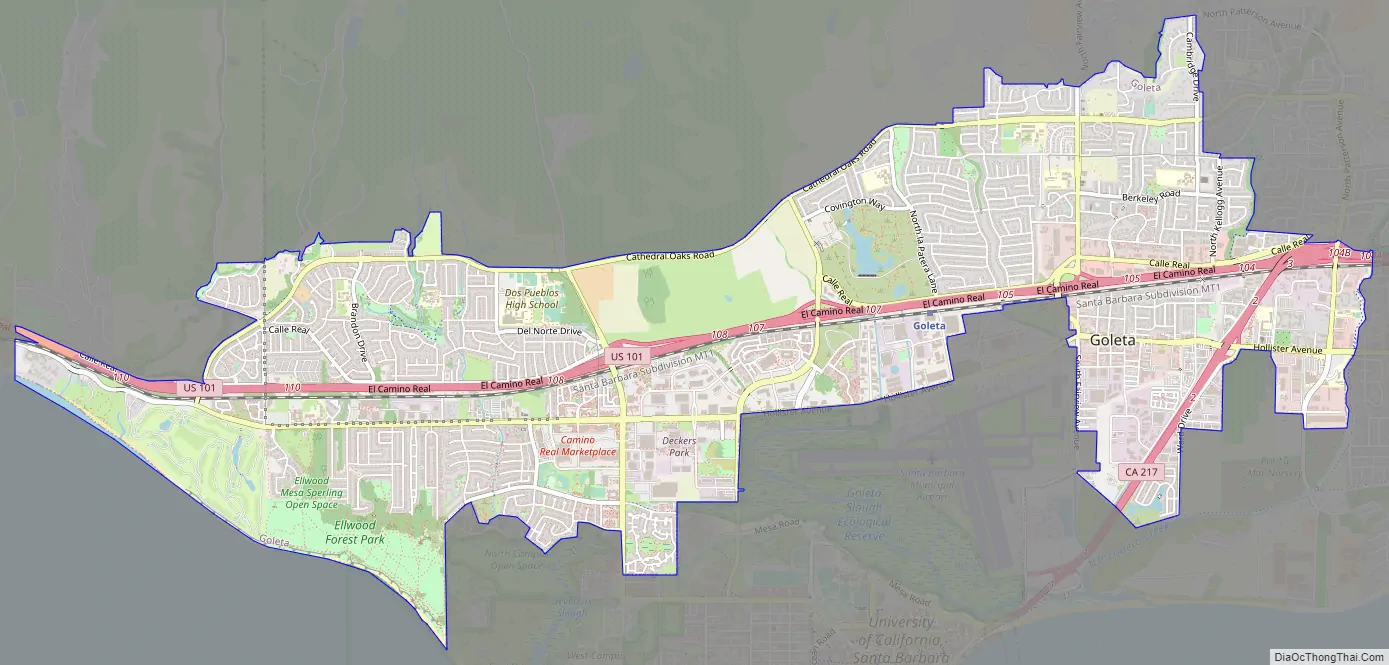
Goleta Road Map
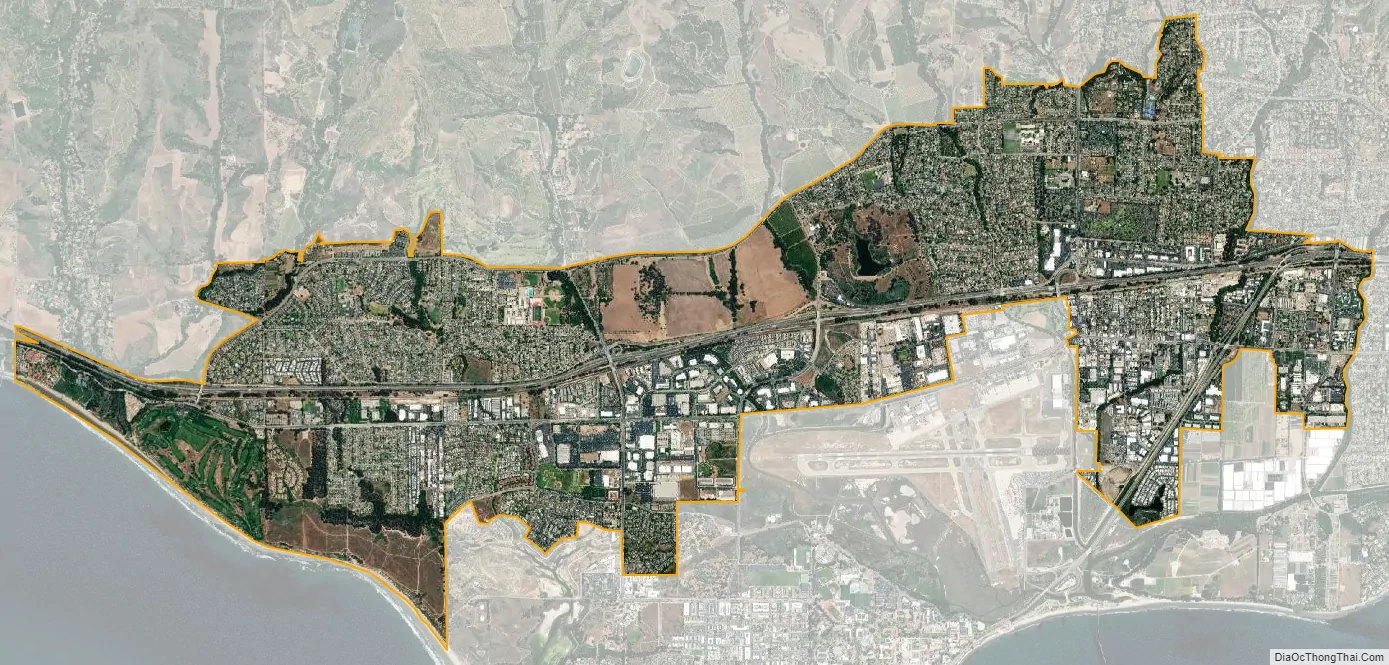
Goleta city Satellite Map
Geography
Goleta is about 8 miles (13 km) west of the city of Santa Barbara, along the coast (the coast runs east to west in this portion of southern California). Nearby is the Santa Barbara campus of the University of California and the student community of Isla Vista.
According to the United States Census Bureau, the CDP has a total area of 26.4 square miles (68 km), of which 26.3 square miles (68 km) are land and 0.1 square miles (0.26 km) (0.38%) is water.
Geology
The Goleta Valley is a coastal plain, approximately three miles (4.8 km) across, between the Santa Ynez Mountains, the principal mountain range of southern Santa Barbara County, and the Pacific Ocean. It consists of Holocene and Pleistocene alluvium, colluvium, estuarine deposits, as well as marine terraces created during interglacial high sea level episodes. The area has been subject to rapid geologic uplift, as evidenced by its coastal bluffs and narrow beaches. Between the flattest part of the Goleta Valley and the ocean is an area of uplift paralleling the shore which includes, from west to east, Isla Vista, Mescalitan Island, More Mesa, and the Hope Ranch Hills. The elevation of this block of land relative to Goleta Valley increases from 40 to 300 feet along this length. The uplift was caused by motion along the More Ranch Fault, one of the most geologically active faults in the area. The More Ranch Fault roughly follows a line along El Colegio Road, through the southern part of the airport, along Atascadero Creek, and then continues east into Santa Barbara as the Mission Ridge Fault Zone. Soils in Goleta are mostly well drained brown fine sandy loam of the Milpitas series.
Underneath the alluvial units of the coastal plain are three prominent bedrock units: the Monterey Formation, the Sisquoc Formation, and the Santa Barbara Formation. This latter unit is the principal groundwater aquifer for the region, and its freshwater wells are protected from seawater intrusion by the uplift along the More Ranch Fault, which has placed relatively impermeable rock units between it and the ocean.
Some of the underlying sedimentary units contain economically recoverable quantities of oil and gas. The Ellwood Oil Field was worked beginning in the 1920s, with its onshore portions only being dismantled in the 1970s. The La Goleta Gas Field was formerly productive on the bluffs west of More Mesa, and is now used for gas storage by the Southern California Gas Company.
The Santa Ynez Mountains form a scenic backdrop to Goleta. They consist of multiple layers of sandstone and conglomerate units dating from the Jurassic Age to the present, uplifted rapidly since the Pliocene. Rapid uplift has given them their craggy, scenic character, and numerous landslides and debris flows, which form some of the urban and suburban lowland area, are testament to their geologically active nature. Covered by chaparral, the range exceeds 4,000 feet (1,200 m) in height to the northwest of Goleta, at Broadcast and Santa Ynez Peaks. Sundowner winds occur in both Goleta and Santa Barbara.
Wildlife
Bobcats can also be seen in the area. Coyotes sometimes prey on small domestic pets. Skunks sometimes spray, and often fall prey to cars, owls, dogs, and coyotes. Raccoons can become neighborhood pests. Opossums commonly inhabit neighborhoods. Dogs and cats sometimes kill small animals. Monarch butterflies spend the winter in several eucalyptus groves on the Ellwood Mesa. Bears and mountain lions live in the foothills and mountains around the town, but are rarely seen by residents.
Climate
Goleta has a mediterranean climate influenced by maritime winds from the Pacific Ocean with moderate average temperatures. Due to brief spells of winds from the interior, the warmest temperature on record is 109 °F (43 °C) and the coldest is 20 °F (−7 °C). That is a relatively large thermal span for a shoreline town.
Chilly days and warm nights are rare. The coldest maximum temperature on record is 45 °F (7 °C) in 1949 with the annual average between 1991 and 2020 being 54 °F (12 °C). The warmest night measured is a freak event of 81 °F (27 °C) during a heat snap in 1979, a full 10 °F (5.6 °C) warmer than the second warmest night on record. During a regular year, the warmest night is at a mild 65 °F (18 °C).
See also
Map of California State and its subdivision:- Alameda
- Alpine
- Amador
- Butte
- Calaveras
- Colusa
- Contra Costa
- Del Norte
- El Dorado
- Fresno
- Glenn
- Humboldt
- Imperial
- Inyo
- Kern
- Kings
- Lake
- Lassen
- Los Angeles
- Madera
- Marin
- Mariposa
- Mendocino
- Merced
- Modoc
- Mono
- Monterey
- Napa
- Nevada
- Orange
- Placer
- Plumas
- Riverside
- Sacramento
- San Benito
- San Bernardino
- San Diego
- San Francisco
- San Joaquin
- San Luis Obispo
- San Mateo
- Santa Barbara
- Santa Clara
- Santa Cruz
- Shasta
- Sierra
- Siskiyou
- Solano
- Sonoma
- Stanislaus
- Sutter
- Tehama
- Trinity
- Tulare
- Tuolumne
- Ventura
- Yolo
- Yuba
- Alabama
- Alaska
- Arizona
- Arkansas
- California
- Colorado
- Connecticut
- Delaware
- District of Columbia
- Florida
- Georgia
- Hawaii
- Idaho
- Illinois
- Indiana
- Iowa
- Kansas
- Kentucky
- Louisiana
- Maine
- Maryland
- Massachusetts
- Michigan
- Minnesota
- Mississippi
- Missouri
- Montana
- Nebraska
- Nevada
- New Hampshire
- New Jersey
- New Mexico
- New York
- North Carolina
- North Dakota
- Ohio
- Oklahoma
- Oregon
- Pennsylvania
- Rhode Island
- South Carolina
- South Dakota
- Tennessee
- Texas
- Utah
- Vermont
- Virginia
- Washington
- West Virginia
- Wisconsin
- Wyoming


