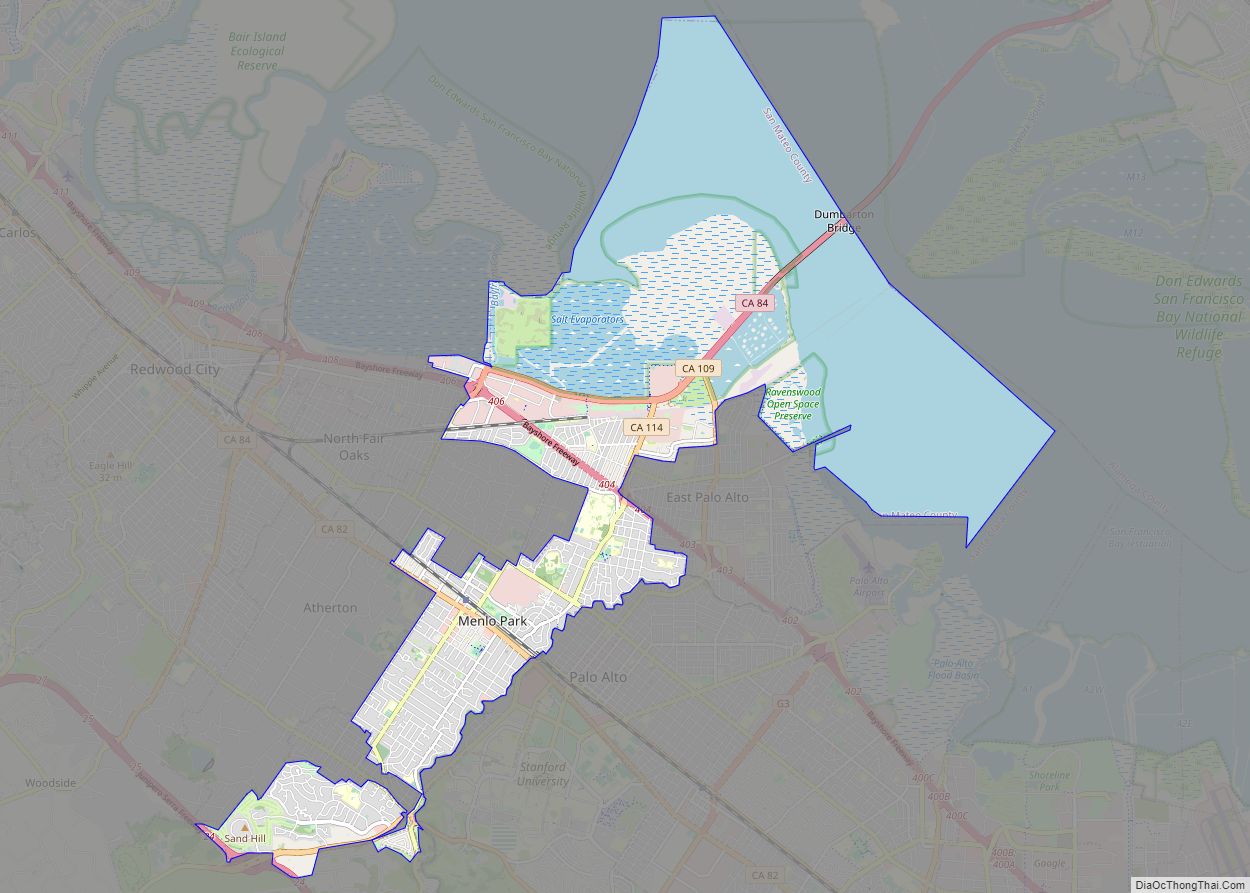
Map of Meridian city

Map of Meridian CDP, California

Meridian is a census-designated place (CDP) in Sutter County, California. Meridian sits at an elevation of 43 feet (13 m). It is in the Yuba City Metropolitan Statistical Area. The ZIP Code is 95957. The community is inside area code 530. The 2010 United States Census reported Meridian’s population was 358. Meridian CDP overview: Name: Meridian … Read more

Map of Merced city

Map of Merced city

Merced (/mɜːrˈsɛd/; Spanish for “Mercy”) is a city in, and the county seat of, Merced County, California, United States, in the San Joaquin Valley. As of the 2020 Census, the city had a population of 86,333, up from 78,958 in 2010. Incorporated on April 1, 1889, Merced is a charter city that operates under a … Read more

Map of Mentone CDP, California

Map of Mentone CDP, California

Mentone is a census-designated place in San Bernardino County, California, United States. The population was 7,803 at the 2000 census and 8,720 at the 2010 census. It is located at 34°3′53″N 117°7′13″W / 34.06472°N 117.12028°W / 34.06472; -117.12028. According to the United States Census Bureau, it has a total area of 6.2 square miles (16 km); … Read more

Map of Mesa CDP, California

Map of Mesa CDP, California

Mesa (Spanish for “Table”) is a census-designated place (CDP) in Inyo County, California, United States. The population was 251 at the 2010 census, up from 214 at the 2000 census. Mesa CDP overview: Name: Mesa CDP LSAD Code: 57 LSAD Description: CDP (suffix) State: California County: Inyo County Elevation: 4,626 ft (1,410 m) Total Area: 3.656 sq mi (9.467 km²) … Read more

Map of Mesa Vista CDP

Map of Mesa Vista CDP

Mesa Vista (corruption of Vista de la Mesa, Spanish for “View of Table”) is a census-designated place (CDP) in Alpine County, California, United States. The population was 200 at the 2010 census, up from 182 at the 2000 census. Mesa Vista CDP overview: Name: Mesa Vista CDP LSAD Code: 57 LSAD Description: CDP (suffix) State: … Read more

Map of Mesa Verde CDP

Map of Mesa Verde CDP

Mesa Verde (Spanish for “Green Table”) is a census-designated place in Riverside County, California. Mesa Verde sits at an elevation of 390 feet (120 m). The 2010 United States census reported Mesa Verde’s population was 1,023. Mesa Verde CDP overview: Name: Mesa Verde CDP LSAD Code: 57 LSAD Description: CDP (suffix) State: California County: Riverside County … Read more

Map of Mi-Wuk Village CDP

Map of Mi-Wuk Village CDP

Mi-Wuk Village is a census-designated place (CDP) in Tuolumne County, California, United States. The population was 941 at the 2010 census, down from 1,485 at the 2000 census. It was named after the Miwok Indians by the real estate developer and promoter Harry Hoeffler in 1955. Mi-Wuk Village CDP overview: Name: Mi-Wuk Village CDP LSAD … Read more

Map of Mexican Colony CDP

Map of Mexican Colony CDP

Mexican Colony (Spanish: La Colonia Mexicana de Shafter or simply Colonia Mexicana) is a census-designated place in Kern County, California. It is located 2 miles (3.2 km) south of Shafter, at an elevation of 331 feet (101 m). The population was 283 at the 2020 census. Mexican Colony CDP overview: Name: Mexican Colony CDP LSAD Code: 57 … Read more

Map of Mettler CDP

Map of Mettler CDP

Mettler, or Mettler Station, is a heavily Hispanic, low-income unincorporated area and census-designated place in Kern County, California. The population was 90 at the 2020 census, down from 136 at the 2010 census. It is the place where motion picture actor James Dean received a traffic ticket on the last day of his life. Mettler … Read more

Map of Midway City CDP

Map of Midway City CDP

Midway City is a census-designated place in the United States that forms part of the county land controlled by Orange County, California. The only area in Orange County that incorporates its chamber of commerce and homeowners association to act in concert like a city council, the area mostly is surrounded by Westminster with Huntington Beach … Read more

Map of Midpines CDP

Map of Midpines CDP

Midpines is a census-designated place in Mariposa County, California. It lies among the Sierra Nevada foothills of the central part of the state at an elevation of 2,585 feet (788 m), 5 miles (8 km) northeast of Mariposa, the county seat, and 22 miles (35 km) by road southwest of El Portal. It is composed of scattered residential … Read more

Map of Middletown town

Map of Middletown CDP, California

Middletown is a census-designated place (CDP) in Lake County, California, United States. Its population was 725 at the 2020 census down from 1,323 at the 2010 census, which was up slightly from 1,020 at the 2000 census. Middletown was given its name because it is halfway between Lower Lake and Calistoga, which is 17 miles … Read more