Menlo Park is a city at the eastern edge of San Mateo County within the San Francisco Bay Area of California in the United States. It is bordered by San Francisco Bay on the north and east; East Palo Alto, Palo Alto, and Stanford to the south; and Atherton, North Fair Oaks, and Redwood City to the west. It had 33,780 residents at the 2020 United States census. It is home to the corporate headquarters of Meta, and is where Google, Roblox Corporation and Round Table Pizza were founded. The train station holds the record as the oldest continually operating train station in California. It is one of the most educated cities in California and the United States; nearly 70% of residents over 25 have earned a bachelor’s degree or higher.
| Name: | Menlo Park city |
|---|---|
| LSAD Code: | 25 |
| LSAD Description: | city (suffix) |
| State: | California |
| County: | San Mateo County |
| Incorporated: | November 23, 1927 |
| Elevation: | 72 ft (22 m) |
| Total Area: | 17.38 sq mi (45.03 km²) |
| Land Area: | 9.99 sq mi (25.87 km²) |
| Water Area: | 7.39 sq mi (19.15 km²) 43.79% |
| Total Population: | 33,780 |
| Population Density: | 3,473.3/sq mi (1,341.04/km²) |
| Area code: | 650 |
| FIPS code: | 0646870 |
| Website: | menlopark.gov |
Online Interactive Map
Click on ![]() to view map in "full screen" mode.
to view map in "full screen" mode.
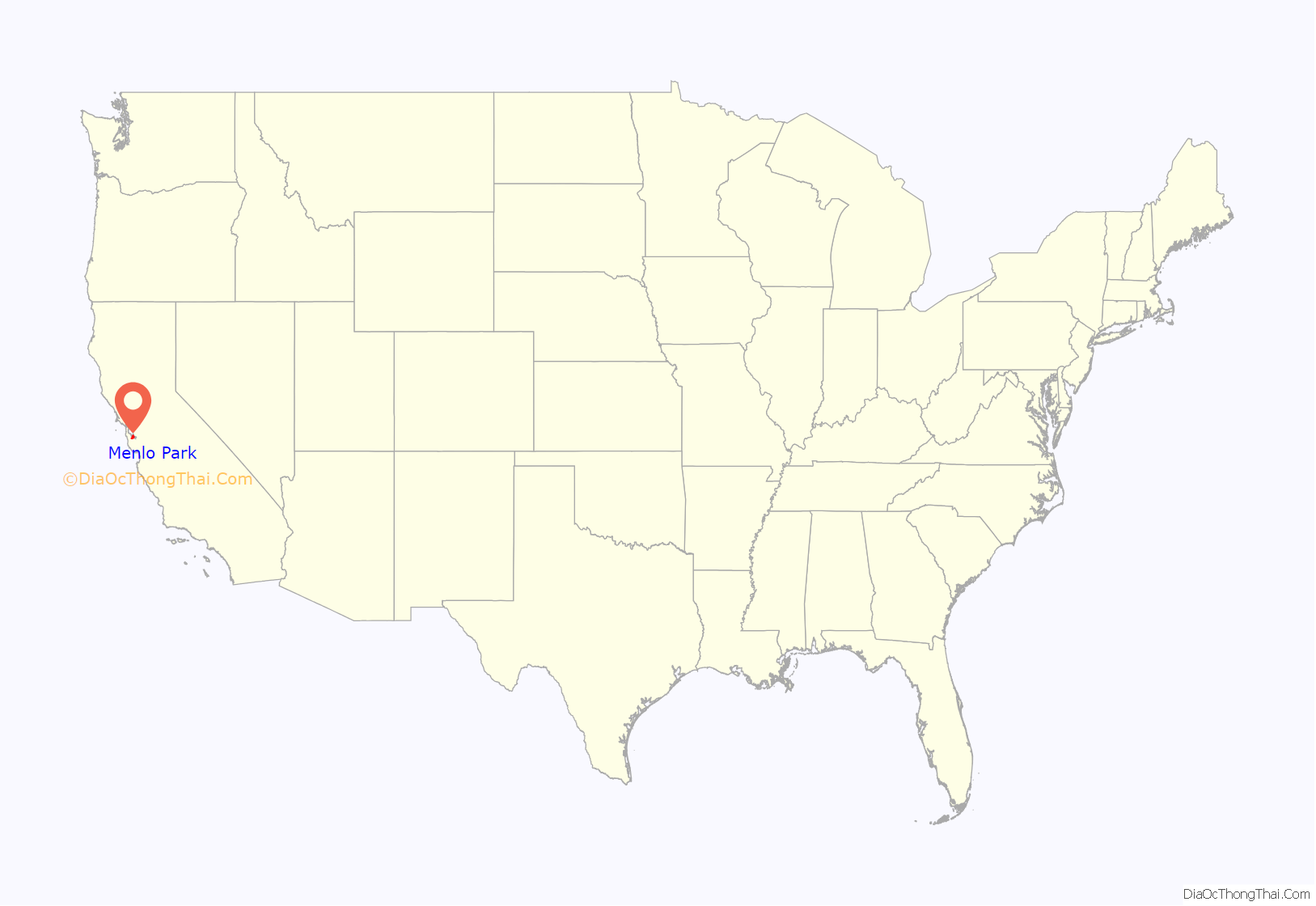
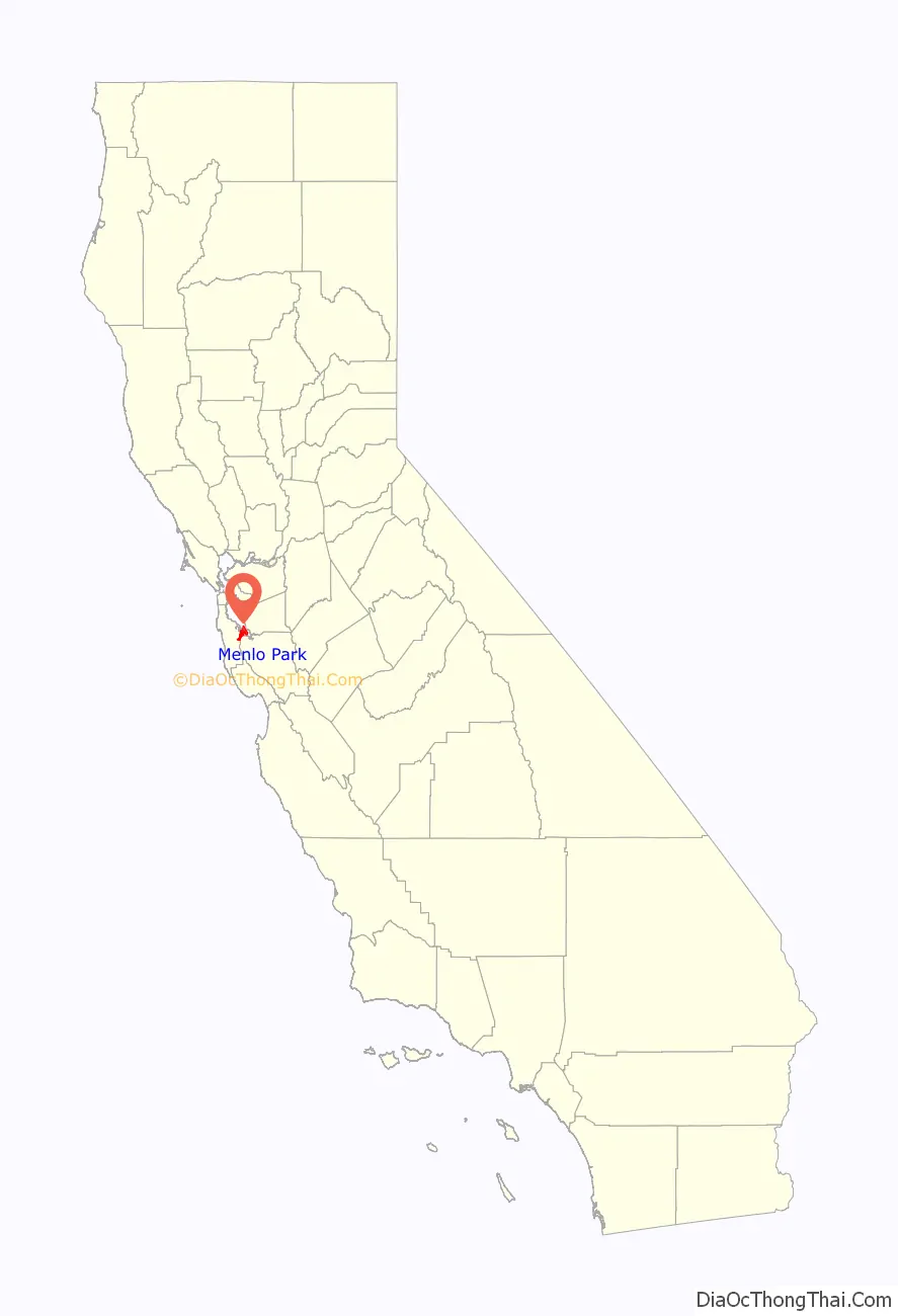
Menlo Park location map. Where is Menlo Park city?
History
The area of Menlo Park was inhabited by the Ohlone people when the Portolá expedition arrived in 1769.
In 1795, the Rancho de las Pulgas Spanish land grant was made that included the area of the current city.
In 1851, two Irish immigrants, Dennis J. Oliver and his brother-in-law, D.C. McGlynn, purchased a 1,700-acre (690 ha) tract of land on the former Rancho de las Pulgas. In 1854, they erected a gate with a wooden arch bearing the inscription “Menlo Park” and the date “August 1854” at the entrance to their property (now the intersection of Middle Ave and El Camino Real). The word “Menlo” derived from the owners’ former home of Menlo (or Menlough) in County Galway, Ireland, and is an anglicized version of the original Irish name of the place, Mionloch, meaning “middle lake”.
In 1863, the San Francisco and San Jose Rail Road had built the railroad from San Francisco to as far as Mayfield (now California Avenue station in Palo Alto) and started running trains to the area. They named a nearby station “Menlo Park” after the sign. The 1867 station building still stands on the platform of the current Caltrain station, used by the local Chamber of Commerce. It holds the record as the oldest, continually operating train station in California. The town of Menlo Park grew up around this station, becoming a popular home for San Francisco businessmen. A post office was established in 1870, and the city was incorporated in 1874 (it dissolved after two years, but later was permanently incorporated in 1927). The original arch, which gave its name to the stations and ultimately, the city, survived until 1922, when it was destroyed in an automobile accident. The origin of the name of Menlo Park, California (circa 1850) antedates any work done by Thomas Edison (circa 1876) in Menlo Park, New Jersey; Menlo Park, New Jersey, was named after Menlo Park, California, as was Menlo, Washington.
In 1917–18, a large portion of Menlo Park was the site of Camp Fremont, a training camp for, at its height, 27,000 men being sent to fight in World War I. It did not last long (the camp was dismantled after the war), but army engineers paved the first streets in Menlo Park and laid the first water and gas lines. The army did retain the camp hospital, and it is now the site of a Veterans Administration Hospital off of Willow Road in Menlo Park. In the autumn of 1918, a flu pandemic hit Camp Fremont and killed 147.
At the start of World War II, the US government bought the 260-acre (110 ha) estate of Timothy Hopkins from his widow and created the Palo Alto General Hospital, later renamed the Dibble General Hospital (after Colonel John Dibble, who was killed in 1943). After the war ended, some of the land was sold to the city and became the sites of the main library and city hall. More of the land was bought by Stanford University to house the increase in students due to the G.I. Bill; the area was known as the “Stanford Village”, which existed as student housing until the mid-1960s. This land also was the site of the Stanford Research Institute (now SRI International) starting in 1947; between 1955 and 1968, SRI bought the rest of the Stanford Village.
In the 1960s, the former 600-acre (240 ha) estate of Frederick W. Sharon (1859–1914) (son of Senator William Sharon) and his wife, Louise Tevis Breckinridge Sharon (1858–1938; daughter of Lloyd Tevis and divorced wife of John Witherspoon Breckinridge), in the hills of south west Menlo Park was developed and called “Sharon Heights”.
In 2015, the Menlo Park Historical Association (MPHA) began a project to raise funds for and build a replica of the original Menlo Park gates. The chosen site was at 800 Alma Street in front of the Menlo Park public library. The replica was completed in 2019. On March 17, 2019, Menlo Park Mayor Ray Mueller officially dedicated the reproduction of the Menlo Gates.
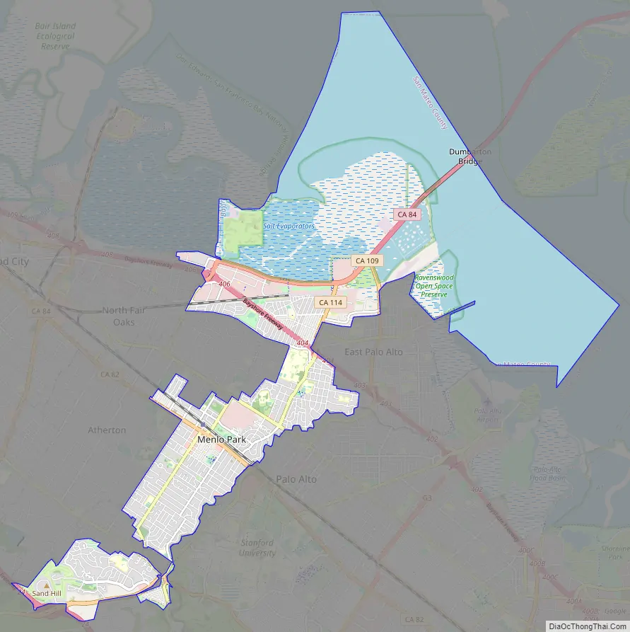
Menlo Park Road Map
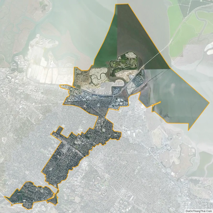
Menlo Park city Satellite Map
Geography
According to the United States Census Bureau, the city has a total area of 17.4 square miles (45 km), of which 9.8 square miles (25 km) are land and 7.6 square miles (20 km) are covered by water. Menlo Park is long and narrow on a northeast to southwest axis. The northeast portion borders the San Francisco Bay and includes the Dumbarton Bridge that connects Menlo Park to Fremont on the east side of the bay. The city shoreline includes the city’s largest park, Bedwell Bayfront Park (160 acres (65 ha)) and the Don Edwards San Francisco Bay National Wildlife Refuge. San Francisquito Creek marks much of the southeast border of the city. West Menlo Park (not part of the city despite its name) along Alameda de las Pulgas nearly separates the southwestern part of the city (known as Sharon Heights) from the rest. The extreme southwest is clipped by Interstate 280.
The Bayshore Freeway (part of U.S. Route 101) traverses Menlo Park northwest to southeast near the shoreline and somewhat parallel to the Bayshore Freeway to the southwest is El Camino Real. The intersection of El Camino Real and Santa Cruz Avenue is considered the heart of the city. Nearby, the Menlo Park Civic Center is bounded by Ravenswood Avenue, Alma Street, Laurel Street, and Burgess Drive. It contains the council offices, library, police station, and Burgess Park, which has various recreational facilities. Other major roads include Sand Hill Road in the Sharon Heights area.
The residential areas of Menlo Park can be unofficially divided into several neighborhoods. From “east” (northeast toward San Francisco Bay) to “west” (southwest toward the Pacific Coast), they are defined by the Palo Alto Weekly as: Belle Haven is the only neighborhood east of Route 101; much of the rest of that area is business or protected land. Between 101 and the roughly parallel Middlefield Road are the neighborhoods of the Willows, Suburban Park, Lorelei Manor, Flood Triangle, Vintage Oaks, and South of Seminary (the seminary being Saint Patrick’s Seminary). Between Middlefield and El Camino Real are the Caltrain track and Felton Gables, Linfield Oaks, and Park Forest. West of El Camino until the foothills of the Peninsula are the neighborhoods of Downtown Menlo Park, Central Menlo Park, and Allied Arts (sometimes also known as Stanford Park, it is named for the Allied Arts Guild in it). In the hills are Sharon Heights and Stanford Hills. Several other neighborhoods are closely associated with Menlo Park but are actually in unincorporated San Mateo county; these include Menlo Oaks and Fair Oaks (latter part of the North Fair Oaks census area) between Bayshore and Middlefield, University Heights (also known as West Menlo Park) between Sharon Heights and most of the rest of the city, and Stanford Weekend Acres, which is somewhat near Stanford Hills.
See also
Map of California State and its subdivision:- Alameda
- Alpine
- Amador
- Butte
- Calaveras
- Colusa
- Contra Costa
- Del Norte
- El Dorado
- Fresno
- Glenn
- Humboldt
- Imperial
- Inyo
- Kern
- Kings
- Lake
- Lassen
- Los Angeles
- Madera
- Marin
- Mariposa
- Mendocino
- Merced
- Modoc
- Mono
- Monterey
- Napa
- Nevada
- Orange
- Placer
- Plumas
- Riverside
- Sacramento
- San Benito
- San Bernardino
- San Diego
- San Francisco
- San Joaquin
- San Luis Obispo
- San Mateo
- Santa Barbara
- Santa Clara
- Santa Cruz
- Shasta
- Sierra
- Siskiyou
- Solano
- Sonoma
- Stanislaus
- Sutter
- Tehama
- Trinity
- Tulare
- Tuolumne
- Ventura
- Yolo
- Yuba
- Alabama
- Alaska
- Arizona
- Arkansas
- California
- Colorado
- Connecticut
- Delaware
- District of Columbia
- Florida
- Georgia
- Hawaii
- Idaho
- Illinois
- Indiana
- Iowa
- Kansas
- Kentucky
- Louisiana
- Maine
- Maryland
- Massachusetts
- Michigan
- Minnesota
- Mississippi
- Missouri
- Montana
- Nebraska
- Nevada
- New Hampshire
- New Jersey
- New Mexico
- New York
- North Carolina
- North Dakota
- Ohio
- Oklahoma
- Oregon
- Pennsylvania
- Rhode Island
- South Carolina
- South Dakota
- Tennessee
- Texas
- Utah
- Vermont
- Virginia
- Washington
- West Virginia
- Wisconsin
- Wyoming


