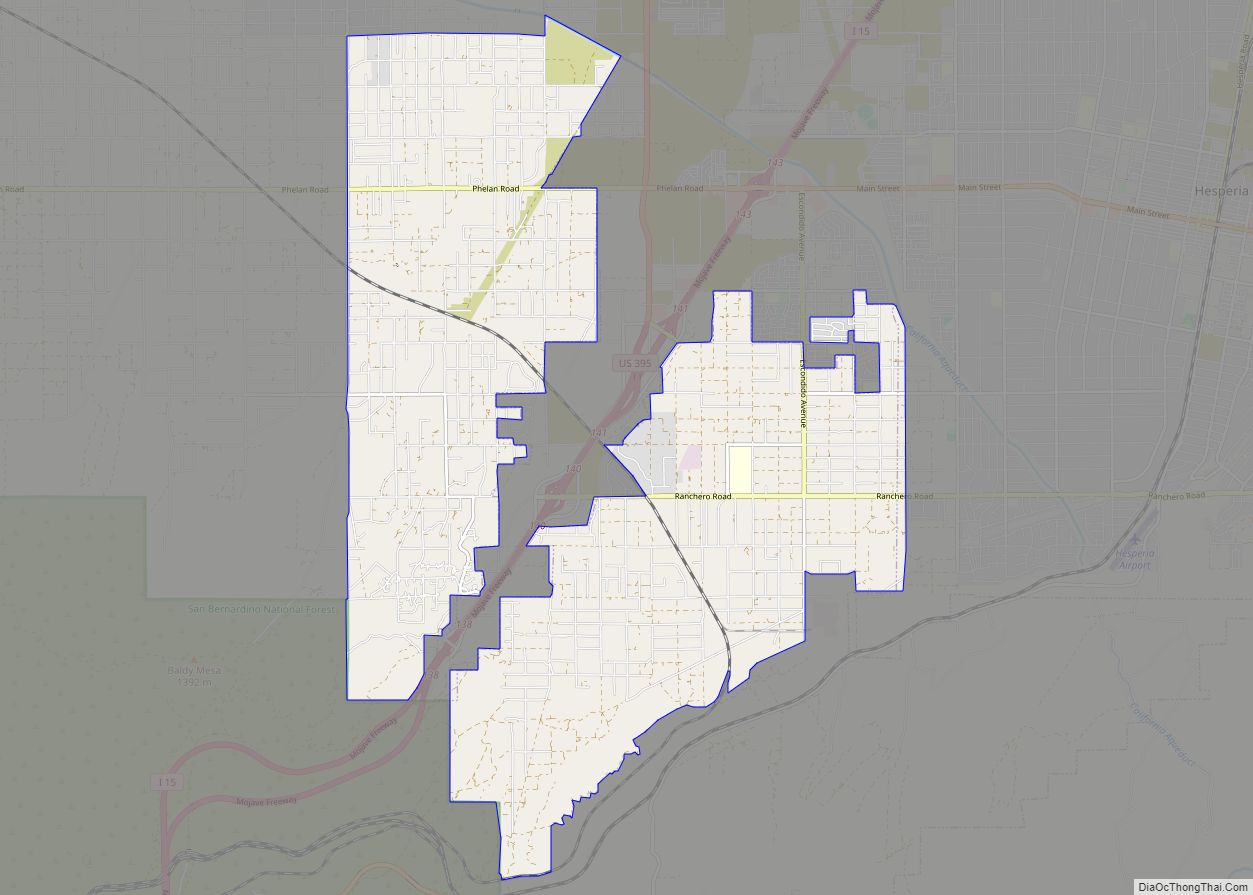
Map of Oak View CDP

Map of Oak View CDP

Oak View is an unincorporated community in Ventura County, California, United States. The community is located along the Ventura River in a narrow valley between the towns of Casitas Springs (south) and Mira Monte (north). Lake Casitas and the community of Ojai are also nearby. At the 2010 census, the population of Oak View was … Read more

Map of Oakhurst CDP

Map of Oakhurst CDP, California

Oakhurst (formerly Fresno Flats) is a census-designated place (CDP) in Madera County, California, United States, 14 miles (23 km) south of the entrance to Yosemite National Park, in the foothills of the Sierra Nevada. At the 2020 census, the population was 5,945, up from 2,829 at the 2010 census. It is part of the Madera metropolitan … Read more

Map of Oakdale city

Map of Oakdale city, California

Oakdale is a city in the San Joaquin Valley and Stanislaus County, California. It is part of the Modesto Metropolitan Statistical Area. Oakdale goes by the slogan “Cowboy Capital of the World.” The population was 23,181 at the 2020 census, up from 20,675 at the 2010 census and 15,503 at the 2000 census. Oakdale city … Read more

Map of Oasis CDP

Map of Oasis CDP, California

Oasis is a census-designated place in the California county of Riverside. Oasis sits at an elevation of 141 feet (43 m) below sea level. The 2020 United States census reported Oasis’s population was 4,468, down from 6,890 in 2010. Oasis CDP overview: Name: Oasis CDP LSAD Code: 57 LSAD Description: CDP (suffix) State: California County: Riverside … Read more

Map of Oakville CDP

Map of Oakville CDP, California

Oakville is a census-designated place (CDP) in the Napa Valley of Napa County, northern California. The population was 71 at the 2010 census. Oakville’s ZIP Code is 94562, and it is located in area code 707. The local economy is based on Napa Valley wine production, and Oakville was formally declared a distinct appellation within … Read more

Map of Oakley city

Map of Oakley city, California

Oakley is a city in Contra Costa County, California, United States. It is within the nine-county San Francisco Bay Area. The population at the 2020 United States census was 43,357. Oakley was incorporated in 1999, making it the newest incorporated city in Contra Costa County. Oakley city overview: Name: Oakley city LSAD Code: 25 LSAD … Read more

Map of Ocotillo CDP

Map of Ocotillo CDP

Ocotillo (American Spanish: [okoˈtiʝo]; Spanish for “Vine cactus”) is a census-designated place (CDP) in Imperial County, California. Ocotillo is located 26 miles (42 km) west of El Centro, The population was 215 at the 2020 census, down from 266 at the 2010 census and 296 at the 2000 census. It is part of the El Centro, California … Read more

Map of Oceano CDP

Map of Oceano CDP

Oceano (Spanish: Océano, meaning “Ocean”) is a census-designated place (CDP) in San Luis Obispo County, California, United States. The population was 7,286 at the 2010 census, up from 7,260 at the 2000 census. Oceano CDP overview: Name: Oceano CDP LSAD Code: 57 LSAD Description: CDP (suffix) State: California County: San Luis Obispo County Elevation: 30 ft … Read more

Map of Occidental CDP

Map of Occidental CDP

Occidental is a census-designated place (CDP) in Sonoma County, California, United States. The population was 1,115 at the 2010 census, down from 1,272 at the 2000 census. Occidental CDP overview: Name: Occidental CDP LSAD Code: 57 LSAD Description: CDP (suffix) State: California County: Sonoma County Elevation: 594 ft (181 m) Total Area: 4.966 sq mi (12.862 km²) Land Area: 4.966 sq mi … Read more

Map of Olancha CDP

Map of Olancha CDP

Olancha (Timbisha: Pakwa’ si) is a census designated place in Inyo County of the U.S. state of California. Olancha is located on U.S. Route 395 in California, 37 miles (60 km) south-southeast of Independence, at an elevation of 3658 feet (1115 m). As of the 2010 census, the population was 192, up from 134 at the … Read more

Map of Ojai city

Map of Ojai city

Ojai (/ˈoʊhaɪ/ (listen) OH-hy; Chumash: ’Awhaỳ) is a city in Ventura County, California. Located in the Ojai Valley, it is northwest of Los Angeles and east of Santa Barbara. The valley is part of the east–west trending Western Transverse Ranges and is about 10 miles (16 km) long by 3 miles (5 km) wide and divided into … Read more

Map of Oildale CDP

Map of Oildale CDP

Oildale is a census-designated place (CDP) in Kern County, California, United States. Oildale is located 3.5 miles (5.6 km) north-northwest of downtown Bakersfield, at an elevation of 469 feet (143 m). The population was 32,684 at the 2010 census, up from 27,885 at the 2000 census. It is an unincorporated suburban town just north of Bakersfield across … Read more