Ojai (/ˈoʊhaɪ/ (listen) OH-hy; Chumash: ’Awhaỳ) is a city in Ventura County, California. Located in the Ojai Valley, it is northwest of Los Angeles and east of Santa Barbara. The valley is part of the east–west trending Western Transverse Ranges and is about 10 miles (16 km) long by 3 miles (5 km) wide and divided into a lower and an upper valley, each of similar size, surrounded by hills and mountains. The population was 7,637 at the 2020 census, up from 7,461 at the 2010 census.
Ojai is a tourism destination known for its boutique hotels, recreation opportunities, hiking, and farmers’ market of local organic agriculture. It has small businesses specializing in local and ecologically friendly art, design, and home improvement. Chain stores are prohibited by city ordinance to encourage local small business development and keep the town unique.
The name Ojai is derived from the Mexican-era Rancho Ojai, which in turn took its name from the Ventureño Chumash word ‘Awha’y, meaning “Moon”. The city’s self-styled nickname is “Shangri-La” referencing the natural environment of this health and spirituality-focused region as well as the mystical sanctuary of the 1937 film adaptation of James Hilton’s novel Lost Horizon.
| Name: | Ojai city |
|---|---|
| LSAD Code: | 25 |
| LSAD Description: | city (suffix) |
| State: | California |
| County: | Ventura County |
| Incorporated: | August 5, 1921 |
| Elevation: | 745 ft (227 m) |
| Total Area: | 4.37 sq mi (11.32 km²) |
| Land Area: | 4.36 sq mi (11.28 km²) |
| Water Area: | 0.01 sq mi (0.04 km²) 0.35% |
| Total Population: | 7,637 |
| Population Density: | 1,700/sq mi (670/km²) |
| ZIP code: | 93023 & 93024 |
| Area code: | 805 |
| FIPS code: | 0653476 |
| Website: | ojaicity.org |
Online Interactive Map
Click on ![]() to view map in "full screen" mode.
to view map in "full screen" mode.
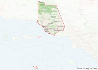
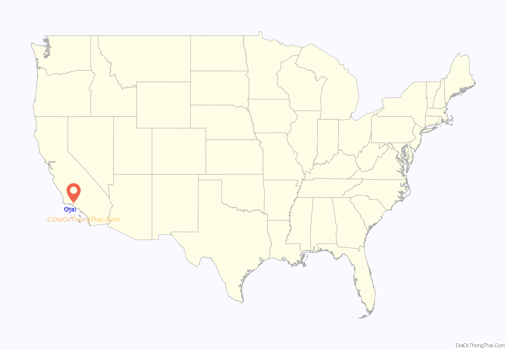
Ojai location map. Where is Ojai city?

History
Chumash
Ojai sits on the traditional territory of the Chumash, a Native American people who inhabited the central and southern coastal regions of California, in portions of what are Morro Bay in the north to Malibu in the south and the Channel Islands. Before the arrival of European settlers, at least 10,000 Chumash people lived in over 150 independent villages, speaking variations of the same language. Starting in 1769, Spanish soldiers and missionaries arrived to colonize the California coast, Christianize the native population, found military presidios and relocate Chumash people from their villages into Spanish missions.
Due to violence and imported disease, Chumash people died at devastating rates under Spanish rule. According to George Tinker, a Native Scholar, “The Native American population of coastal population was reduced by some 90 percent during seventy years under the sole proprietorship of Serra’s mission system.” Whether due to Spanish rule or as part of the California Genocide under the land’s eventual control by the United States, by 1900, the Chumash population had declined to just 200, while current estimates of Chumash people today range from 2,000 to 5,000.
The name Ojai is derived from the Ventureño Chumash word ʼawha’y meaning “moon.” A 1905 book on place names in the United States records the name Ojai as being derived from an Indigenous word meaning “nest”, though the specific Indigenous language is not identified.
Rancho Ojai
In 1837, Fernando Tico, a Santa Barbara businessman, received the 17,716-acre Rancho Ojai Mexican land grant, which included both the lower and upper Ojai valleys. Tico operated a cattle ranch on the land and moved his large family to an adobe in the lower valley. Tico sold the entire Rancho Ojai in 1853. The rancho changed hands several more times before it was purchased in 1864 by Thomas A. Scott, a Pennsylvania oil and railroad baron. The petroleum exploration of the Ojai Basin was the result of a report of oil seeps (oil springs) along the Sulphur Mountain area. In 1866, Scott’s nephew Thomas Bard used a steam-powered cable-tool drilling rig on the north side of Sulphur Mountain. On May 29, 1867, Ojai No. 6 produced an oil gusher, at a depth of 550 feet, and the Ojai Field eventually produced 10-20 barrels of oil a day. Also in 1866, Leland Stanford’s brother Josiah dug oil tunnels on the south side of Sulphur Mountain, producing 20 barrels a day for the Stanford Brothers refinery in San Francisco. For economic reasons, falling oil prices at the end of the Civil War and cheaper imports from the east, Scott and Stanford ceased oil exploration in the valley area. Thomas Bard then began selling the surface rights to parcels of Rancho Ojai in late 1867. As the president of Unocal, Bard would return in the 1890s to dig about 50 oil tunnels into Sulphur Mountain, which produced until 1998.
Nordhoff
The town was laid out in 1874 by San Buenaventura businessman R.G. Surdam and named Nordhoff in honor of the writer Charles Nordhoff who had written a book about California titled, California for Health, Pleasure and Residence: A Book for Travelers and Settlers. Most early settlers to the valley had one or more family members who were ill, particularly with respiratory illnesses, and the Ojai Valley developed a reputation for having healthy air quality. Many did get well after moving to the valley. Charles Nordhoff had not visited the Ojai Valley when his book came out in 1873, but made several visits to his namesake town in the early 1880s, and he mentioned the Ojai Valley in the revised 1882 version of his popular book. The discovery of hot springs in Matilija Canyon and subsequent development of hot springs resorts in the late 1800s contributed to the valley’s healing mystique.
The public high school in Ojai is Nordhoff High School. The public junior high school, named “Matilija”, formerly served as Nordhoff Union High School and still features large tiles with the initials “NUHS” on the steps of the athletic field.
Railroad
The Ventura and Ojai Valley Railroad connected Ojai to the national rail network near Ventura station in 1898. The Southern Pacific Railroad acquired all the capital stock in the Ventura and Ojai Valley Railroad in April 1898. A nine-day Pineapple Express with rainfall intensity reaching 6.2 inches (16 cm) per day caused floods destroying the rail line in January 1969. The former rail line was converted to the Ojai Valley Trail in 1989.
Libbey
Nordhoff became a popular wintering spot for wealthy Easterners and Midwesterners. The elite Foothills Hotel, which catered to them, was built on a mountain overlooking the town in 1903. Visitors enjoyed dining, music concerts, horseback riding, and hunting and fishing trips into the back country. Some of these businessmen built homes in the valley and contributed to the community’s development. Among these winter visitors were Edward Drummond Libbey and his wife Florence. Their first winter in Ojai was in 1907. Libbey was the owner of the Libbey Glass Company of Toledo, Ohio. He fell in love with the valley, bought property in the Foothills tract in 1909, and built a Craftsman-style house designed by Myron Hunt and Elmer Grey.
Steeped in City Beautiful ideals, Libbey began thinking about what could be done to beautify the existing rustic town. He bought up all the properties on the south side of Ojai Avenue (where Libbey Park is today) and most of the buildings there were demolished. In 1916, he hired the architectural firm of Frank Mead and Richard Requa of San Diego to transform Nordhoff into the Spanish-style town center seen today. The project included a Mission-style arcade along the main street, a bell-tower reminiscent of the famous campanile of the Cathedral of the Virgin Mary of the Immaculate Conception in Havana, Cuba (also known as the Havana Cathedral), and a pergola with two arches opposite the arcade.
In March 1917, just after completion of the renovation project, the name of the town was changed to Ojai. The valley had always been known as “The Ojai”. Leading up to and during World War I, American sentiment became increasingly anti-German. Across the United States, German and German-sounding place names were changed. Some Ojai writers in the past have speculated that anti-German sentiment contributed to the name change of Nordhoff to Ojai in 1917. There is no clear evidence that this was the case for the name change in Ojai.
To thank Libbey for his gifts to the town, the citizens proposed a celebration in the new Civic Center Park (later changed to Libbey Park) that they wished to call “Libbey Day,” but Libbey suggested “Ojai Day” instead. The first Ojai Day took place April 7, 1917. Ojai Day was celebrated each year until 1928. Local schoolteacher Craig Walker revived Ojai Day in 1991 and it has been celebrated since. The Ojai Day celebration takes place in October.
In 1917 two fires struck the community. The first started in Matilija Canyon on June 16 and burned 60 buildings in its path, including many homes and the Foothills Hotel. The newly Spanish-style structures in the downtown were not affected. On November 28, 1917, a fire started in a gasoline stove in a store in the Arcade and the stores in the western half of the Arcade burned down. Part of the Arcade suffered smoke damage but did not burn down. A new Spanish-style Foothills Hotel was built in 1919–1920 to replace the one that burned down.
Housing
The Taormina neighborhood was established as the first historic district in the city in 2016. The housing development was built in the style of French architecture of Normandy in the 1960s and 1970s by members of the Theosophy movement adjacent to the Krotona Institute of Theosophy. Taormina’s founder, theosophist Ruth Wilson, envisioned the development as a retirement community for fellow theosophists but in the early 1980s a court ruling required the community to be open to residents of all faiths and backgrounds. The majority of homes in the city were built between 1940 and 1980 with about a dozen mobile-home parks included in the housing stock. With rapid growth in the 1970s, a slow-growth ordinance was passed. From 2008 to 2018, there were no new multifamily developments with a single six residential unit apartment being built in 2019.
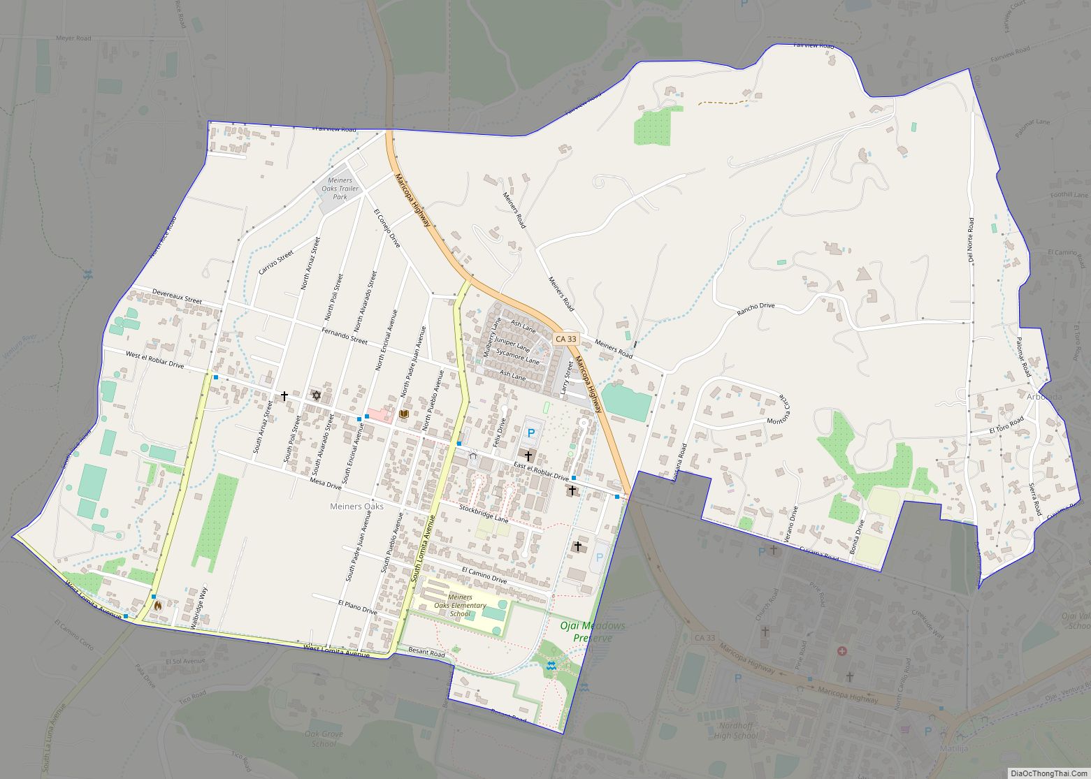
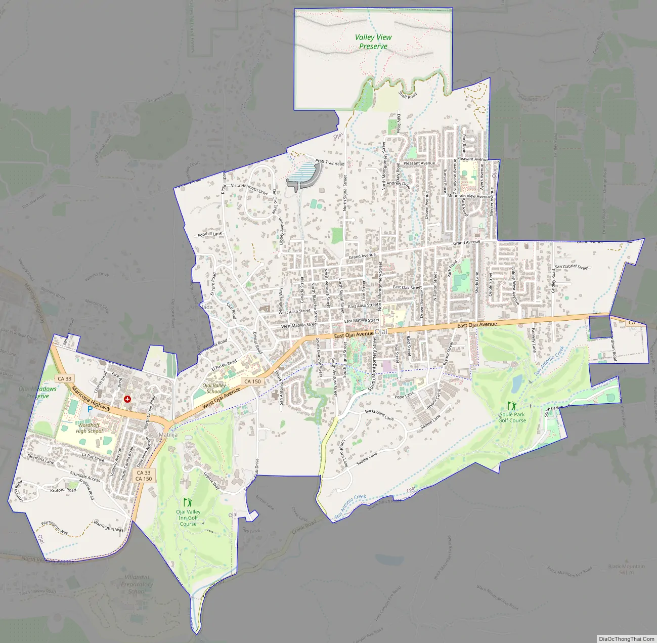
Ojai Road Map
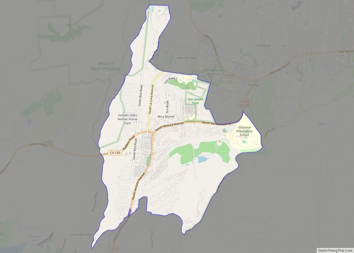
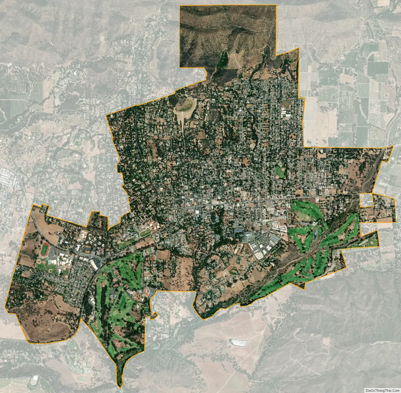
Ojai city Satellite Map
Geography
Ojai is situated in a small east–west eponymous valley, north of Ventura and east of Santa Barbara. The city is approximately 745 feet (227 m) above sea level and borders the Los Padres National Forest to the north. It is approximately 15 miles (24 km) inland from the Pacific Ocean. The Ojai Valley lies within the Topa Topa Mountains on the north and south and is actively shaped by a web of earthquake faults. The Santa Ynez Mountains lie to the north, while Sulphur Mountain and the lower Black Mountain lie to the south. The mountains to the west of the Ojai Valley are drained by the Coyote, Matilija and Santa Ana creeks. These empty into the Ventura River. The Matilija Dam, Casitas Dam and Lake Casitas Reservoir alter the historic drainage of these creeks and the river. The creeks that drain the mountains directly north of Ojai empty into San Antonio Creek, as does Lion Canyon Creek that lies between Black Mountain and Sulphur Mountain. San Antonio Creek drains into the Ventura River just north of Casitas Springs. The Ventura River flows through the Ventura River Valley and empties into the Pacific Ocean at the city of Ventura. The Ventura River was once known for its steelhead fishing before Matilija Dam and Lake Casitas were constructed, eliminating habitat for this trout species.
The eastern part of the Upper Ojai Valley is drained by the Sisar and Santa Paula creeks. These creeks flow into the Santa Clara River at Santa Paula. The high mountains above the Ojai Valley and further east are drained by Sespe Creek, which empties into the Santa Clara River at Fillmore. In 1991, 31.5 miles of the 55-mile-long Sespe Creek was given federal Wild & Scenic River status.
Nordhoff Ridge, the western extension of the Topatopa Mountains, towers over the north side of the valley at more than 5,000 feet (1,500 m). Sulphur Mountain creates the southern ranges bounding the Ojai Valley, a little under 3,000 feet (910 m) in elevation. The Sulphur and Topatopa mountains are part of the Transverse Ranges system. The Ojai Valley and the surrounding mountains are heavily wooded with oak trees.
Climate
The climate of Ojai is Mediterranean, characterized by hot, dry summers, at times exceeding 100 °F (37.8 °C), and mild, rainy winters, with lows at night falling below freezing at times. During dry spells with continental air, morning temperatures, due to Ojai’s valley location, can drop well below most of Southern California, with the record being 13 °F (−10.6 °C) on January 6–7, 1913. In contrast, Ojai is far enough from the sea to minimize marine cooling, and very hot days can occur during summer, with the record being 119 °F (48.3 °C) on June 16, 1917 – when it fell as low as 65 °F (18.3 °C) in the morning due to clear skies and dry air.
As is typical for much of coastal Southern California, most precipitation falls in the form of rain between the months of October and April, with intervening dry summers. As with all of Southern California, rain falls on few days, but when it does rain it is often extremely heavy: the record being 9.05 inches (229.9 mm) on February 24, 1913, followed by 8.15 inches (207.0 mm) on January 26, 1914. During the wettest month on record of January 1969, 25.76 inches (654.3 mm) fell, with a whopping 23.46 inches (595.9 mm) in eight days from January 19 to January 26. In contrast, the median annual rainfall for all years in Ojai is only around 18.1 inches (460 mm) and in the driest “rain year” from July 2006 to June 2007, just 6.87 inches (174.5 mm) fell in twelve months. The wettest “rain year” was from July 1997 to June 1998 with 48.29 inches (1,226.6 mm).
See also
Map of California State and its subdivision:- Alameda
- Alpine
- Amador
- Butte
- Calaveras
- Colusa
- Contra Costa
- Del Norte
- El Dorado
- Fresno
- Glenn
- Humboldt
- Imperial
- Inyo
- Kern
- Kings
- Lake
- Lassen
- Los Angeles
- Madera
- Marin
- Mariposa
- Mendocino
- Merced
- Modoc
- Mono
- Monterey
- Napa
- Nevada
- Orange
- Placer
- Plumas
- Riverside
- Sacramento
- San Benito
- San Bernardino
- San Diego
- San Francisco
- San Joaquin
- San Luis Obispo
- San Mateo
- Santa Barbara
- Santa Clara
- Santa Cruz
- Shasta
- Sierra
- Siskiyou
- Solano
- Sonoma
- Stanislaus
- Sutter
- Tehama
- Trinity
- Tulare
- Tuolumne
- Ventura
- Yolo
- Yuba
- Alabama
- Alaska
- Arizona
- Arkansas
- California
- Colorado
- Connecticut
- Delaware
- District of Columbia
- Florida
- Georgia
- Hawaii
- Idaho
- Illinois
- Indiana
- Iowa
- Kansas
- Kentucky
- Louisiana
- Maine
- Maryland
- Massachusetts
- Michigan
- Minnesota
- Mississippi
- Missouri
- Montana
- Nebraska
- Nevada
- New Hampshire
- New Jersey
- New Mexico
- New York
- North Carolina
- North Dakota
- Ohio
- Oklahoma
- Oregon
- Pennsylvania
- Rhode Island
- South Carolina
- South Dakota
- Tennessee
- Texas
- Utah
- Vermont
- Virginia
- Washington
- West Virginia
- Wisconsin
- Wyoming