Map of El Jebel CDP

Map of El Jebel CDP

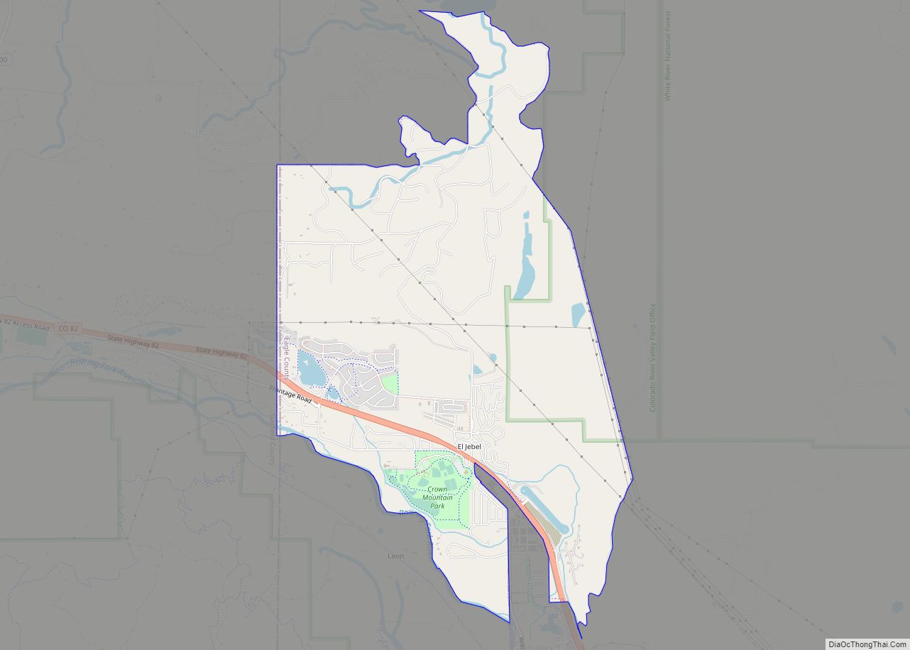
El Jebel is an unincorporated community and a census-designated place (CDP) located in and governed by Eagle County, Colorado, United States. The CDP is a part of the Edwards, CO Micropolitan Statistical Area. The population of the El Jebel CDP was 4,130 at the United States Census 2020. The Carbondale Post Office (ZIP Code 81623) … Read more

Map of Edwards CDP

Map of Edwards CDP, Colorado

Edwards is an unincorporated town, a post office, and a census-designated place (CDP) located in and governed by Eagle County, Colorado, United States. Edwards is the principal town of the Edwards, CO Micropolitan Statistical Area. The Edwards post office has the ZIP Code 81632. At the United States Census 2020, the population of the Edwards … Read more

Map of Eldorado Springs CDP

Map of Eldorado Springs CDP

Eldorado Springs is an unincorporated community, a census-designated place (CDP) and a post office located in and governed by Boulder County, Colorado, United States. The CDP is a part of the Boulder, CO Metropolitan Statistical Area. The Eldorado Springs post office has the ZIP code 80025 (post office boxes). At the 2020 United States census, … Read more

Map of Eldora CDP

Map of Eldora CDP, Colorado

Eldora (pronounced el-DOH-ruh), previously known as “Eldorado” then “El-Dora”, then Eldora or Camp Eldorado, and still called Happy Valley, is an unincorporated community and a census-designated place (CDP) located in and governed by Boulder County, Colorado, United States. The CDP is a part of the Boulder, CO Metropolitan Statistical Area. The population of the Eldora … Read more

Map of Elbert CDP

Map of Elbert CDP, Colorado

Elbert is an unincorporated town, a post office, and a census-designated place (CDP) located in and governed by Elbert County, Colorado, United States. The CDP is a part of the Denver–Aurora–Lakewood, CO Metropolitan Statistical Area. The Elbert post office has the ZIP Code 80106. At the United States Census 2020, the population of the Elbert … Read more

Map of Empire town, Colorado

Map of Empire town, Colorado

The historic Town of Empire is a Statutory Town located in Clear Creek County, Colorado, United States. The town population was 345 at the 2020 United States Census, a +22.34% increase since the 2010 United States Census. The town is a former mining settlement that flourished during the Colorado Silver Boom in the late 19th … Read more

Map of Ellicott CDP

Map of Ellicott CDP

Ellicott is an unincorporated community and a census-designated place (CDP) located in and governed by El Paso County, Colorado, United States. The CDP is a part of the Colorado Springs, CO Metropolitan Statistical Area. The population of the Ellicott CDP was 1,248 at the United States Census 2020. The Calhan post office (Zip Code 80808) … Read more

Map of Elizabeth city

Map of Elizabeth town, Colorado

Elizabeth is a Statutory Town that is the most populous municipality in Elbert County, Colorado, United States. The town population was 1,675 at the 2020 United States Census, a +23.34% increase since the 2010 United States Census. Elizabeth is a part of the Denver–Aurora–Lakewood, CO Metropolitan Statistical Area and the Front Range Urban Corridor. Elizabeth … Read more

Map of Estes Park town

Map of Estes Park town

Estes Park /ˈɛstɪs/ is a statutory town in Larimer County, Colorado, United States. The town population was 5,904 at the 2020 United States Census. Estes Park is a part of the Fort Collins, CO Metropolitan Statistical Area and the Front Range Urban Corridor. A popular summer resort and the location of the headquarters for Rocky … Read more

Map of Erie city

Map of Erie town, Colorado

The Town of Erie is a Statutory Town located in Weld and Boulder counties, Colorado, United States. The town population was 30,038 at the 2020 United States Census, a +65.64% increase since the 2010 United States Census. At the 2020 census, 17,387 (58%) Erie residents lived in Weld County and 12,651 (42%) lived in Boulder … Read more

Map of Englewood city

Map of Englewood city, Colorado

The City of Englewood is a home rule municipality located in Arapahoe County, Colorado, United States. The town population was 33,659 at the 2020 United States Census. Englewood is a part of the Denver–Aurora–Lakewood, CO Metropolitan Statistical Area and the Front Range Urban Corridor. Englewood is located immediately south of Denver in the South Platte … Read more

Map of Fairmount CDP

Map of Fairmount CDP, Colorado

Fairmount is an unincorporated community and a census-designated place (CDP) in Jefferson County, Colorado, United States. The CDP is a part of the Denver–Aurora–Lakewood, CO Metropolitan Statistical Area. The population of the Fairmount CDP was 9,324 at the United States Census 2010. ZIP code 80403 applies to addresses in Fairmount. Fairmount CDP overview: Name: Fairmount … Read more