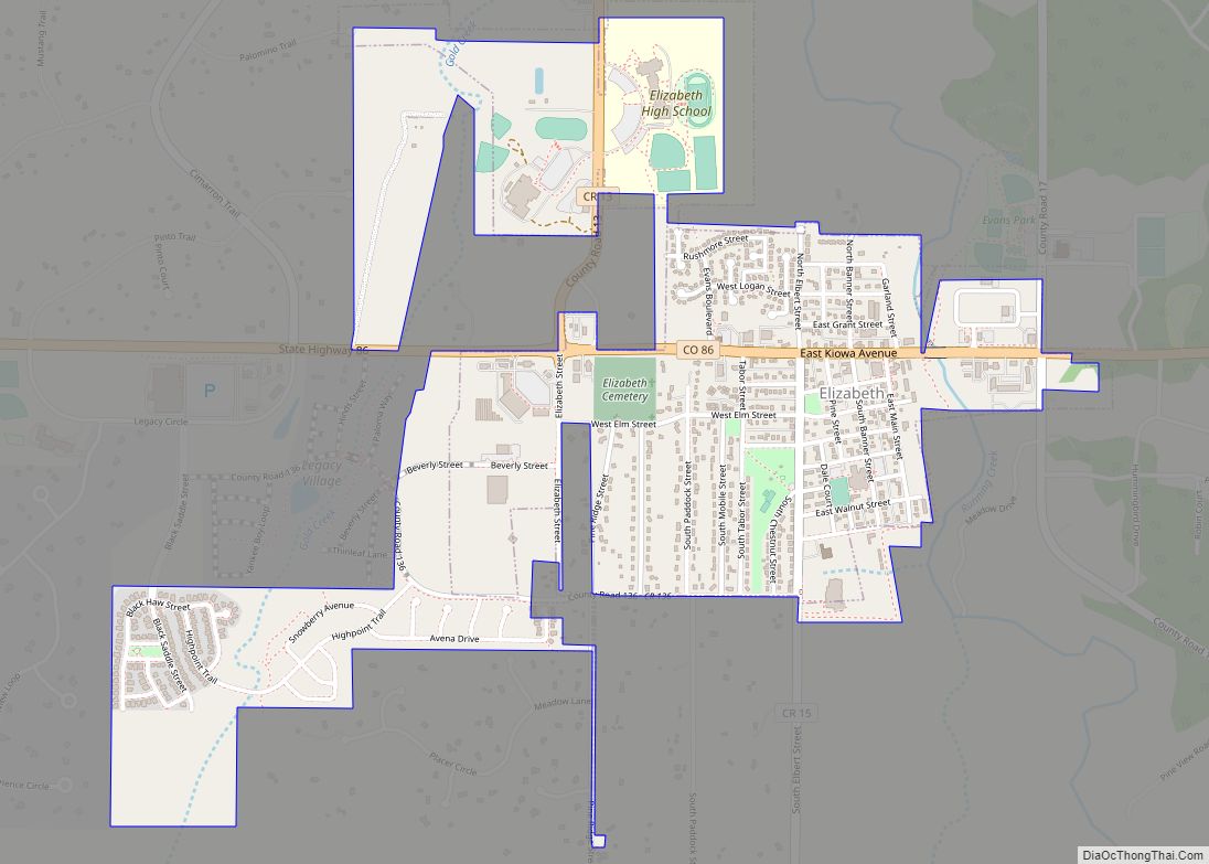
Elizabeth is a Statutory Town that is the most populous municipality in Elbert County, Colorado, United States. The town population was 1,675 at the 2020 United States Census, a +23.34% increase since the 2010 United States Census. Elizabeth is a part of the Denver–Aurora–Lakewood, CO Metropolitan Statistical Area and the Front Range Urban Corridor.
| Name: | Elizabeth town |
|---|---|
| LSAD Code: | 43 |
| LSAD Description: | town (suffix) |
| State: | Colorado |
| County: | Elbert County |
| Incorporated: | October 9, 1890 |
| Elevation: | 6,476 ft (1,974 m) |
| Total Area: | 1.999 sq mi (5.178 km²) |
| Land Area: | 1.999 sq mi (5.178 km²) |
| Water Area: | 0.000 sq mi (0.000 km²) |
| Total Population: | 1,675 |
| Population Density: | 838/sq mi (324/km²) |
| ZIP code: | 80107 |
| Area code: | 303 |
| FIPS code: | 0823740 |
| Website: | www.townofelizabeth.org |
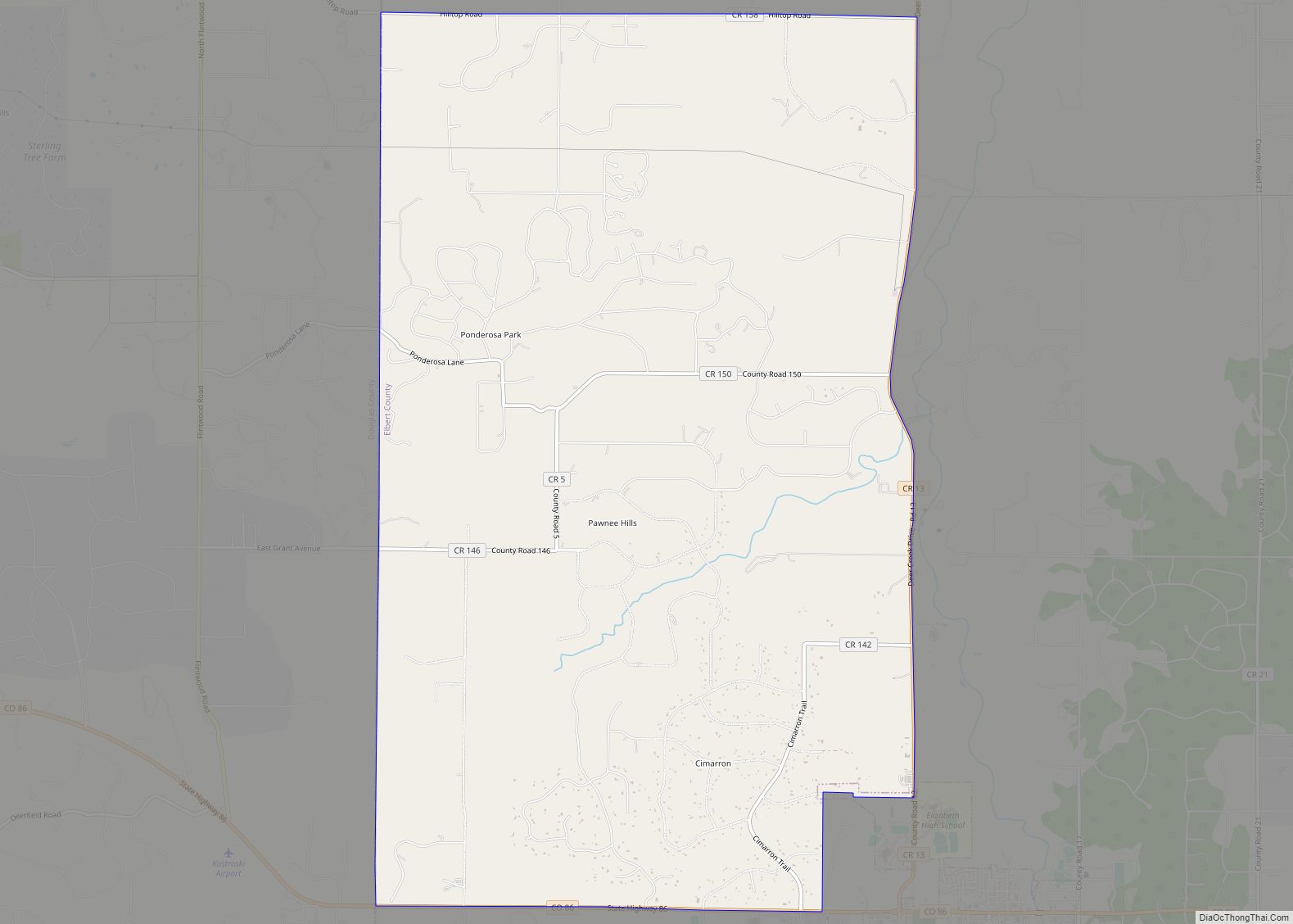
Online Interactive Map
Click on ![]() to view map in "full screen" mode.
to view map in "full screen" mode.
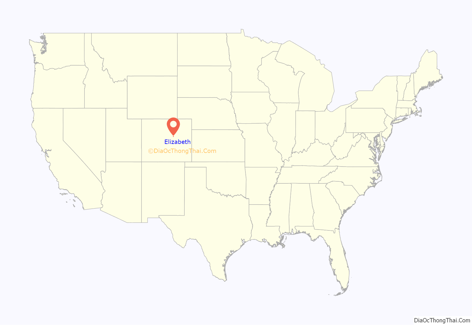
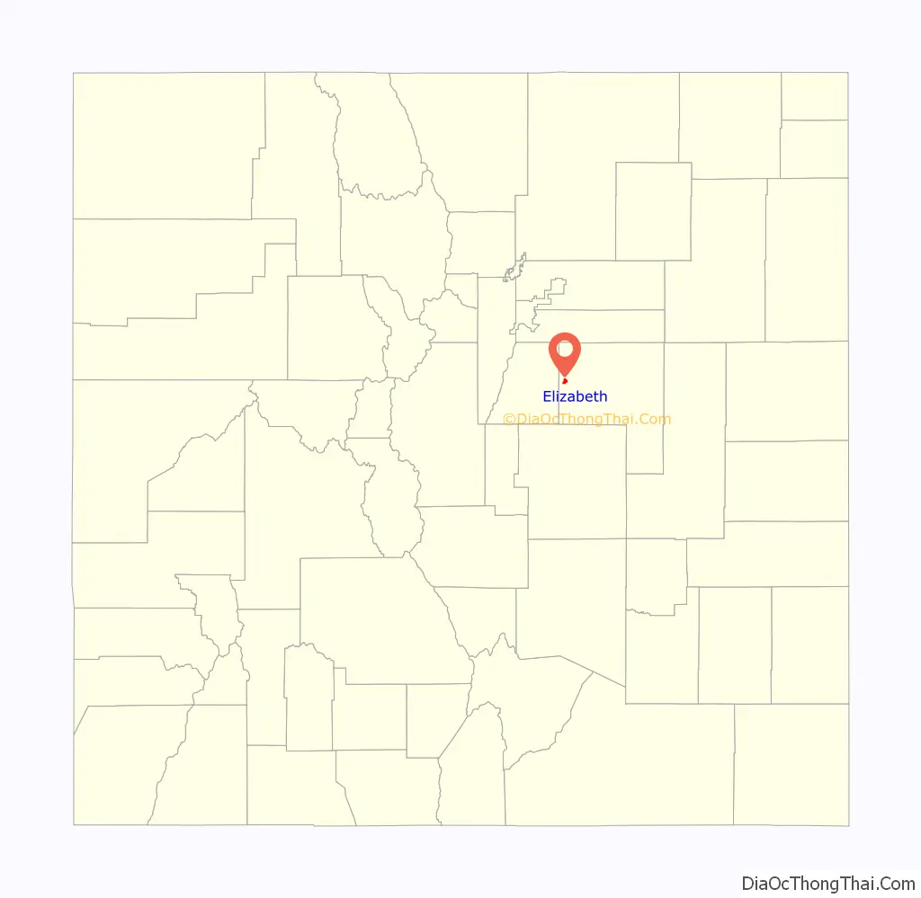
Elizabeth location map. Where is Elizabeth town?
History
Elizabeth was originally a saw mill camp. The town was later named after a family member of John Evans, a territorial governor.
The town has had a post office since 1882 and was incorporated in October 1890.
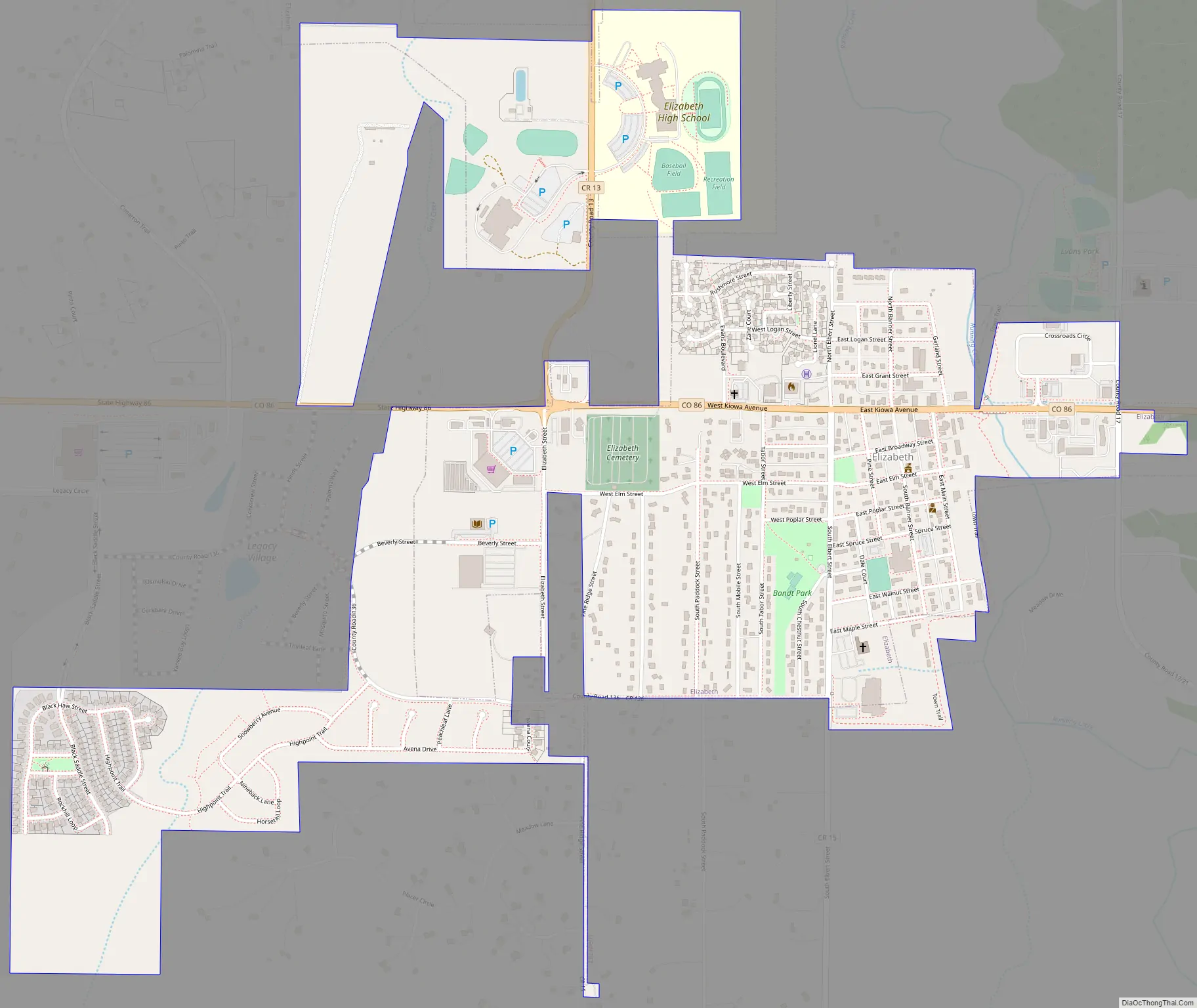
Elizabeth Road Map
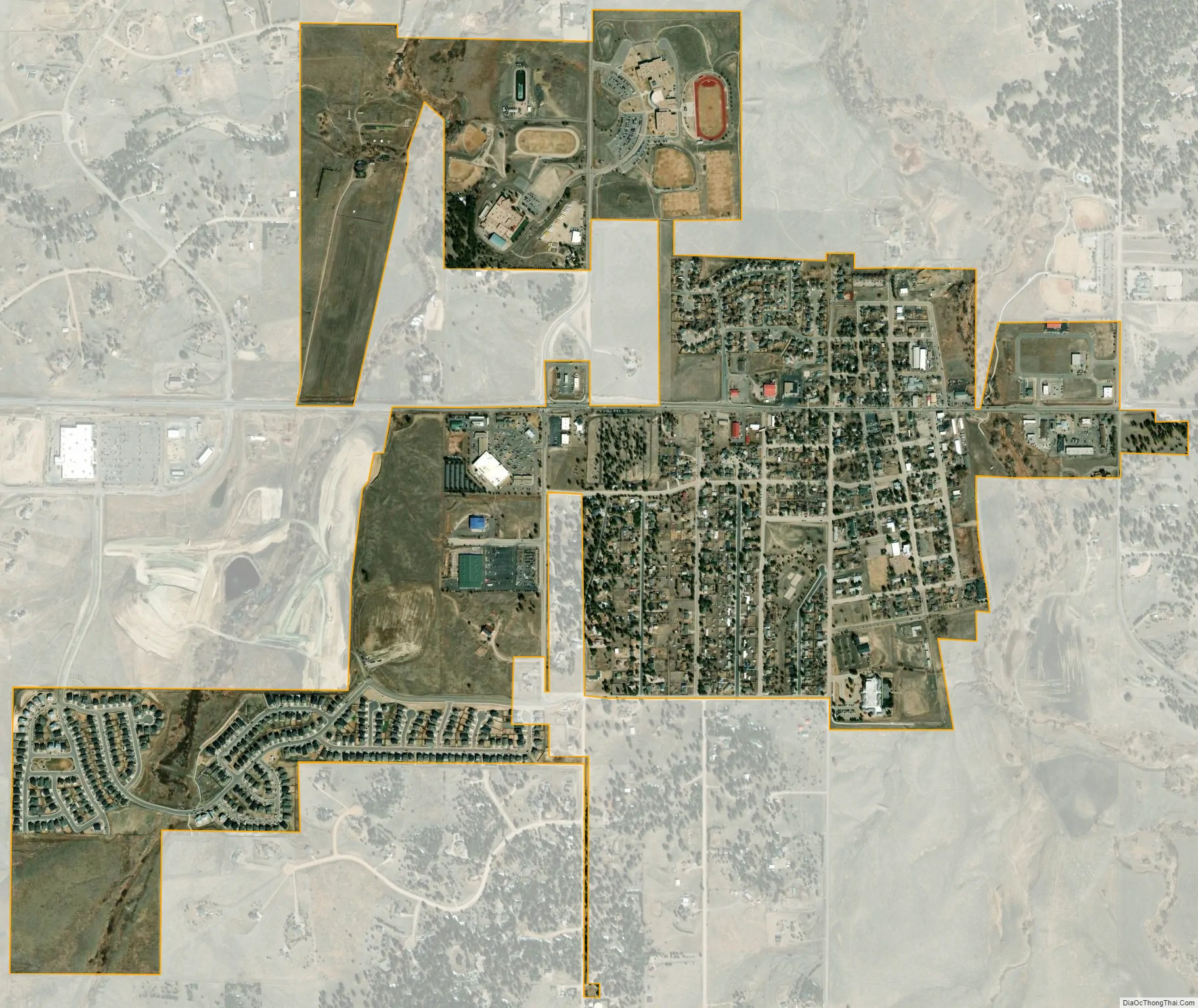
Elizabeth city Satellite Map
Geography
Elizabeth is located in western Elbert County at 39°21′36″N 104°36′0″W / 39.36000°N 104.60000°W / 39.36000; -104.60000 (39.359954, -104.600063). Colorado State Highway 86 passes through the town, leading east 7 miles (11 km) to Kiowa and west 15 miles (24 km) to Castle Rock. Denver is 40 miles (64 km) to the northwest via Franktown and Parker.
At the 2020 United States Census, the town had a total area of 1,280 acres (5.178 km), all of it land.
See also
Map of Colorado State and its subdivision:- Adams
- Alamosa
- Arapahoe
- Archuleta
- Baca
- Bent
- Boulder
- Broomfield
- Chaffee
- Cheyenne
- Clear Creek
- Conejos
- Costilla
- Crowley
- Custer
- Delta
- Denver
- Dolores
- Douglas
- Eagle
- El Paso
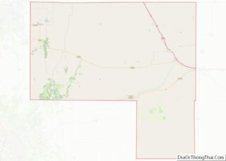
- Elbert
- Fremont
- Garfield
- Gilpin
- Grand
- Gunnison
- Hinsdale
- Huerfano
- Jackson
- Jefferson
- Kiowa
- Kit Carson
- La Plata
- Lake
- Larimer
- Las Animas
- Lincoln
- Logan
- Mesa
- Mineral
- Moffat
- Montezuma
- Montrose
- Morgan
- Otero
- Ouray
- Park
- Phillips
- Pitkin
- Prowers
- Pueblo
- Rio Blanco
- Rio Grande
- Routt
- Saguache
- San Juan
- San Miguel
- Sedgwick
- Summit
- Teller
- Washington
- Weld
- Yuma
- Alabama
- Alaska
- Arizona
- Arkansas
- California
- Colorado
- Connecticut
- Delaware
- District of Columbia
- Florida
- Georgia
- Hawaii
- Idaho
- Illinois
- Indiana
- Iowa
- Kansas
- Kentucky
- Louisiana
- Maine
- Maryland
- Massachusetts
- Michigan
- Minnesota
- Mississippi
- Missouri
- Montana
- Nebraska
- Nevada
- New Hampshire
- New Jersey
- New Mexico
- New York
- North Carolina
- North Dakota
- Ohio
- Oklahoma
- Oregon
- Pennsylvania
- Rhode Island
- South Carolina
- South Dakota
- Tennessee
- Texas
- Utah
- Vermont
- Virginia
- Washington
- West Virginia
- Wisconsin
- Wyoming