Map of Garden City town, Colorado

Map of Garden City town, Colorado

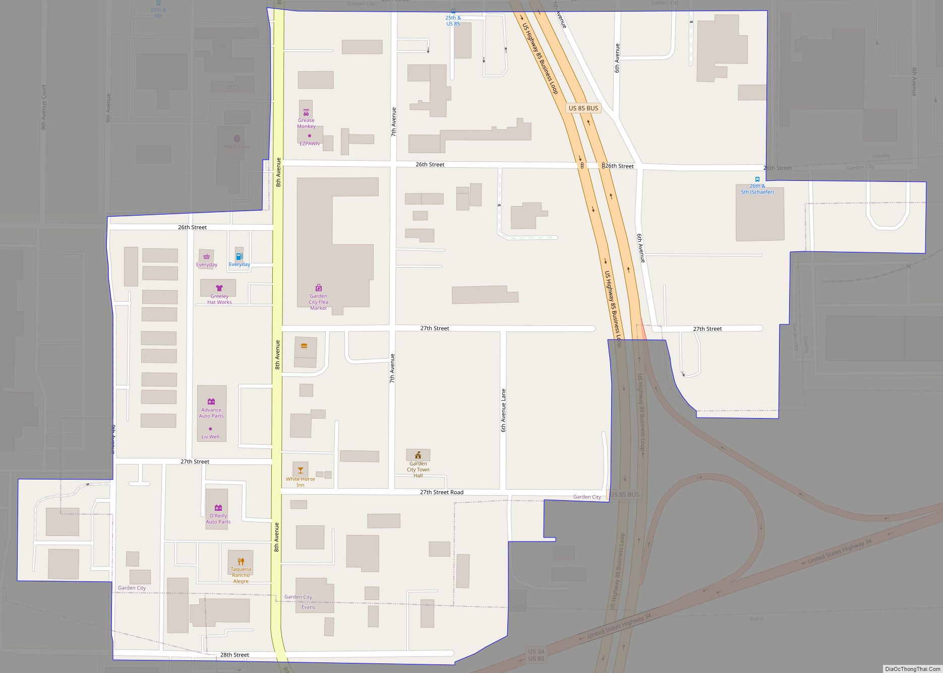
The Town of Garden City is a Statutory Town located in Weld County, Colorado, United States. The town population was 254 at the 2020 United States Census. Garden City is a part of the Greeley, CO Metropolitan Statistical Area and the Front Range Urban Corridor. It is surrounded by the cities of Greeley and Evans, … Read more

Map of Fulford CDP

Map of Fulford CDP

Fulford is an unincorporated community and a census-designated place (CDP) located in and governed by Eagle County, Colorado, United States. The CDP is a part of the Edwards, CO Micropolitan Statistical Area. The population of the Fulford CDP was 0 at the United States Census 2020. The Edwards post office (Zip Code 81632) serves the … Read more

Map of Georgetown town, Colorado

Map of Georgetown town, Colorado

The historic Town of Georgetown is the territorial charter municipality that is the county seat of Clear Creek County, Colorado, United States. The town population was 1,118 at the 2020 United States Census. The former silver mining camp along Clear Creek in the Front Range of the Rocky Mountains was established in 1859 during the … Read more

Map of Genoa town

Map of Genoa town, Colorado

Genoa is a statutory town located in Lincoln County, Colorado, United States. The town population was 153 at the 2020 United States Census. Genoa town overview: Name: Genoa town LSAD Code: 43 LSAD Description: town (suffix) State: Colorado County: Lincoln County Elevation: 5,604 ft (1,708 m) Total Area: 0.310 sq mi (0.804 km²) Land Area: 0.310 sq mi (0.804 km²) Water Area: 0.000 sq mi … Read more

Map of Genesee CDP

Map of Genesee CDP, Colorado

Genesee is an unincorporated community and a census-designated place (CDP) located in and governed by Jefferson County, Colorado, United States. The CDP is a part of the Denver–Aurora–Lakewood, CO Metropolitan Statistical Area. The population of the Genesee CDP was 3,610 at the United States Census 2020. The Golden post office (Zip code 80401) serves the … Read more

Map of Glendale CDP, Colorado

Map of Glendale CDP, Colorado

Glendale is an unincorporated community and a census-designated place (CDP) located in and governed by Boulder County, Colorado, United States. The CDP is a part of the Boulder, CO Metropolitan Statistical Area. The population of the Glendale CDP was 64 at the United States Census 2020. The Jamestown post office (Zip Code 80455) serves the … Read more

Map of Gilcrest town

Map of Gilcrest town

The Town of Gilcrest is a Statutory Town located in Weld County, Colorado, United States. The town population was 1,029 at the 2020 United States Census. Gilcrest is a part of the Greeley, CO Metropolitan Statistical Area and the Front Range Urban Corridor. Gilcrest town overview: Name: Gilcrest town LSAD Code: 43 LSAD Description: town … Read more

Map of Gerrard CDP

Map of Gerrard CDP

Gerrard is a census-designated place (CDP) in and governed by Rio Grande County, Colorado, United States. The population of the Gerrard CDP was 264 at the 2020 United States Census. The South Fork post office (Zip Code 81154) serves the area. Gerrard CDP overview: Name: Gerrard CDP LSAD Code: 57 LSAD Description: CDP (suffix) State: … Read more

Map of Gold Hill CDP

Map of Gold Hill CDP, Colorado

Gold Hill is an unincorporated community and a census-designated place (CDP) located in and governed by Boulder County, Colorado, United States. The CDP is a part of the Boulder, CO Metropolitan Statistical Area. The population of the Gold Hill CDP was 218 at the United States Census 2020. The Boulder post office (Zip Code 80302) … Read more

Map of Glenwood Springs city

Map of Glenwood Springs city

Glenwood Springs is a home rule municipality that is the county seat of Garfield County, Colorado, United States. The city population was 9,963 at the 2020 United States Census. Glenwood Springs is located at the confluence of the Roaring Fork River and the Colorado River, connecting the Roaring Fork Valley and a series of smaller … Read more

Map of Gleneagle CDP

Map of Gleneagle CDP

Gleneagle is an unincorporated community and a census-designated place (CDP) located in and governed by El Paso County, Colorado, United States. The CDP is a part of the Colorado Springs, CO Metropolitan Statistical Area. The population of the Gleneagle CDP was 6,649 at the United States Census 2020. The Colorado Springs post office (Zip Code … Read more

Map of Golden city

Map of Golden city, Colorado

Golden is a home rule city that is the county seat of Jefferson County, Colorado, United States. The city population was 20,399 at the 2020 United States Census. Golden lies along Clear Creek at the base of the Front Range of the Rocky Mountains. Founded during the Pike’s Peak Gold Rush on June 16, 1859, … Read more