Map of Upper Bear Creek CDP

Map of Upper Bear Creek CDP

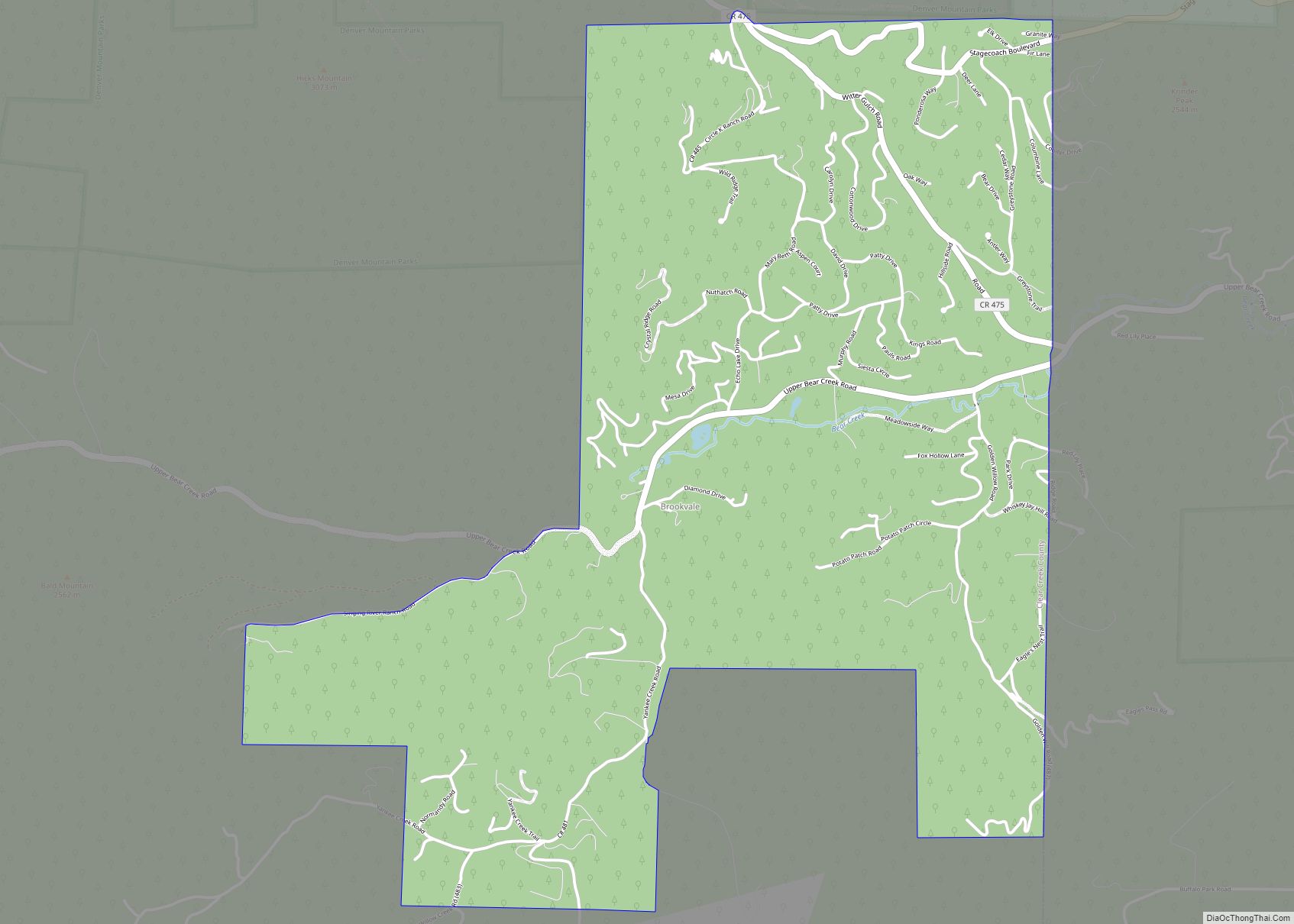
Upper Bear Creek is an unincorporated community and a census-designated place (CDP) located in and governed by Clear Creek County, Colorado, United States. The CDP is a part of the Denver–Aurora–Lakewood, CO Metropolitan Statistical Area. The population of the Upper Bear Creek CDP was 984 at the United States Census 2020. The Evergreen post office … Read more

Map of Two Buttes town

Map of Two Buttes town

The town of Two Buttes is a Statutory Town located in Baca County, Colorado, United States. The population was 34 at the 2020 census. Two Buttes town overview: Name: Two Buttes town LSAD Code: 43 LSAD Description: town (suffix) State: Colorado County: Baca County Incorporated: 1911-10-19 Elevation: 4,108 ft (1,252 m) Total Area: 0.25 sq mi (0.64 km²) Land Area: … Read more

Map of Vernon CDP, Colorado

Map of Vernon CDP, Colorado

Vernon is an unincorporated town, a post office, and a census-designated place (CDP) located in and governed by Yuma County, Colorado, United States. The Vernon post office has the ZIP Code 80755. At the United States Census 2020, the population of the Vernon CDP was 38. Vernon CDP overview: Name: Vernon CDP LSAD Code: 57 … Read more

Map of Valmont CDP

Map of Valmont CDP

Valmont is an unincorporated community and a census-designated place (CDP) located in and governed by Boulder County, Colorado, United States. The CDP is a part of the Boulder, CO Metropolitan Statistical Area. The population of the Valmont CDP was 64 at the United States Census 2020. The Boulder post office (Zip Code 80301) serves the … Read more

Map of Valdez CDP, Colorado

Map of Valdez CDP, Colorado

Valdez is an unincorporated community and a census-designated place (CDP) located in and governed by Las Animas County, Colorado, United States. From 1907 to 1960, to Valdez served as a company town for Colorado Fuel & Iron and its Frederick coal mine, the company’s most productive and second largest. The population of the Valdez CDP … Read more

Map of Vineland CDP

Map of Vineland CDP, Colorado

Vineland is a census-designated place (CDP) in and governed by Pueblo County, Colorado, United States. The CDP is a part of the Pueblo, CO Metropolitan Statistical Area. The population of the Vineland CDP was 269 at the United States Census 2020. The Pueblo post office (Zip Code 81006) serves the area. Vineland CDP overview: Name: … Read more

Map of Vilas town

Map of Vilas town, Colorado

The town of Vilas is a statutory town located in Baca County, Colorado, United States. The population was 98 at the 2020 census. A post office called Vilas has been in operation since 1887. The community was named after William Freeman Vilas, a United States Senator from Wisconsin. Vilas town overview: Name: Vilas town LSAD … Read more

Map of Victor city, Colorado

Map of Victor city, Colorado

The City of Victor is a Statutory City in Teller County, Colorado, United States. Gold was discovered in Victor in the late 19th century, an omen of the future of the town. With Cripple Creek, the mining district became the second largest gold mining district in the country and realized approximately $10 billion of mined … Read more

Map of Walsenburg city

Map of Walsenburg city

Walsenburg is the Statutory City that is the county seat and the most populous municipality of Huerfano County, Colorado, United States. The city population was 3,049 at the 2020 census, down from 3,068 in 2010. Walsenburg city overview: Name: Walsenburg city LSAD Code: 25 LSAD Description: city (suffix) State: Colorado County: Huerfano County Incorporated: June … Read more

Map of Walden town

Map of Walden town, Colorado

Walden is the Statutory Town that is the county seat, the most populous community, and the only incorporated municipality in Jackson County, Colorado, United States. It is situated in the center of a large open valley called North Park. People from Walden and the surrounding area refer to themselves as “North Parkers”. The town population … Read more

Map of Vona town

Map of Vona town

Vona is a statutory town in Kit Carson County, Colorado, United States. The population was 95 at the 2020 census. Vona town overview: Name: Vona town LSAD Code: 43 LSAD Description: town (suffix) State: Colorado County: Kit Carson County Incorporated: August 9, 1919 Elevation: 4,514 ft (1,376 m) Total Area: 0.22 sq mi (0.57 km²) Land Area: 0.22 sq mi (0.57 km²) Water … Read more

Map of Watkins CDP

Map of Watkins CDP, Colorado

Watkins (also called Box Elder) is an unincorporated town and a census-designated place (CDP) located in and governed by Arapahoe and Adams counties, Colorado, United States. The CDP is a part of the Denver–Aurora–Lakewood, CO Metropolitan Statistical Area. The town is surrounded by Aurora and its post office, which lies within the Aurora city limits, … Read more