Map of Cimarron Hills CDP

Map of Cimarron Hills CDP

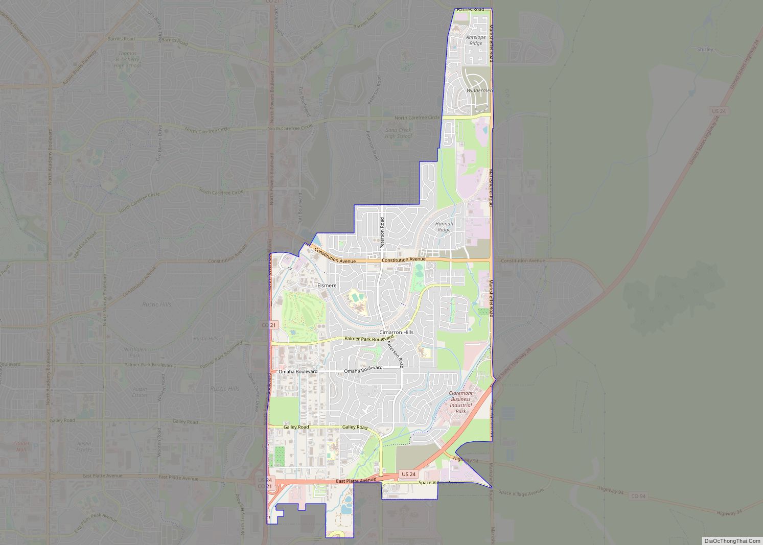
Cimarron Hills is an unincorporated community and a census-designated place (CDP) located in and governed by El Paso County, Colorado, United States. Cimarron Hills is an enclave of the City of Colorado Springs. The CDP is a part of the Colorado Springs, CO Metropolitan Statistical Area. The population of the Cimarron Hills CDP was 19,311 … Read more

Map of Cheyenne Wells town

Map of Cheyenne Wells town

Cheyenne Wells is the Statutory Town that is the county seat and the most populous municipality of Cheyenne County, Colorado, United States. The town population was 758 at the 2020 United States Census. Cheyenne Wells town overview: Name: Cheyenne Wells town LSAD Code: 43 LSAD Description: town (suffix) State: Colorado County: Cheyenne County Incorporated: May … Read more

Map of Coaldale CDP

Map of Coaldale CDP, Colorado

Coaldale is a census-designated place (CDP) and post office located in and governed by Fremont County, Colorado, United States. The CDP is a part of the Cañon City, CO Micropolitan Statistical Area. The Coaldale post office has the ZIP Code 81222. At the United States Census 2020, the population of the Coaldale CDP was 343. … Read more

Map of Coal Creek CDP

Map of Coal Creek CDP

Coal Creek, commonly known as Coal Creek Canyon, is a census-designated place (CDP) located in and governed by Jefferson, Boulder, and Gilpin counties in Colorado, United States, but primarily Jefferson County. The population of the Coal Creek CDP was 2,494 at the United States Census 2020. The Golden post office (Zip code 80403) serves the … Read more

Map of Clifton CDP, Colorado

Map of Clifton CDP, Colorado

Clifton is a census-designated place (CDP) and post office in and governed by Mesa County, Colorado, United States. It is part of the Grand Junction, CO Metropolitan Statistical Area. The Clifton post office has the ZIP Code 81520. As of the 2020 census, the population of the Clifton CDP was 20,413. Clifton CDP overview: Name: … Read more

Map of Colona CDP

Map of Colona CDP, Colorado

Colona is a census-designated place (CDP) located in and governed by Ouray County, Colorado, United States. The CDP is a part of the Montrose, CO Micropolitan Statistical Area. The population of the Colona CDP was 36 at the United States Census 2020. The Montrose post office (Zip Code 81401) serves the area. Colona CDP overview: … Read more

Map of Collbran town

Map of Collbran town

The Town of Collbran is a Statutory Town located in Mesa County, Colorado, United States. The town population was 369 at the 2020 United States Census. Collbran is a part of the Grand Junction, CO Metropolitan Statistical Area. Collbran town overview: Name: Collbran town LSAD Code: 43 LSAD Description: town (suffix) State: Colorado County: Mesa … Read more

Map of Cokedale town

Map of Cokedale town

The Town of Cokedale is a Statutory Town located in Las Animas County, Colorado, United States. The town population was 127 at the 2020 United States Census. Cokedale town overview: Name: Cokedale town LSAD Code: 43 LSAD Description: town (suffix) State: Colorado County: Las Animas County Incorporated: March 15, 1948 Elevation: 6,332 ft (1,930 m) Total Area: … Read more

Map of Columbine CDP

Map of Columbine CDP

Columbine is census-designated place (CDP) in and governed by Jefferson and Arapahoe counties in Colorado, United States. The CDP is a part of the Denver metropolitan area. Located primarily in Jefferson County, Columbine lies immediately south of Denver. The population of the Columbine CDP was 25,229 at the 2020 census. The community lies in ZIP … Read more

Map of Columbine Valley town

Map of Columbine Valley town

The Town of Columbine Valley is a Statutory Town located in western Arapahoe County, Colorado, United States. The town population was 1,502 at the 2020 United States Census, a +19.59% increase since the 2010 United States Census. Columbine Valley is a part of the Denver-Aurora-Lakewood, CO Metropolitan Statistical Area and the Front Range Urban Corridor. … Read more

Map of Colorado City CDP, Colorado

Map of Colorado City CDP, Colorado

Colorado City is a census-designated place (CDP) and post office in and governed by Pueblo County, Colorado, United States. The CDP is a part of the Pueblo, CO Metropolitan Statistical Area. The Colorado City post office has the ZIP Code 81019 (post office boxes). At the United States Census 2020, the population of the Colorado … Read more

Map of Conejos CDP

Map of Conejos CDP

Conejos is an unincorporated town, a post office, a census-designated place (CDP), and the county seat of Conejos County, Colorado, United States. The Conejos post office has the ZIP Code 81129. At the United States Census 2020, the population of the Conejos CDP was 46. Conejos is the only unincorporated county seat in the State … Read more